
Visscher, Nicholas I (sold)

Nicholas Visscher I (1618 - 1679) was a Dutch engraver, cartographer and publisher. The son of Claes Jansz Visscher (1587 - 1652), he was brought up in and carried on the family publishing firm after his father's death. During his tenurem, the firm produced an array of maps that introduced a new level of artistic flourish to the Dutch mapmaking trade: the 'Jansson-Visscher' map of the New Netherlands and New Engand provided the model map for that region for over a century, and his 1658 world map was hailed by Shirley as the 'master forerunner of a number of highly decorative Dutch world maps produced throughout the remainder of the century.' He received a privilege from Holland and West Friesland in 1677; after his death the firm was taken up by his son, Nicholas II (1649 - 1702). Upon the death of Nicholas Visscher II, the business was carried on by the widowed Elizabeth Verseyl Visscher (16?? - 1726). After her death, the firm and all of its plates was liquidated to Peter Schenk.
Classic Dutch Double Hemisphere World in Original Color.
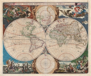
Orbis Terrarum Nova et Accuratissima Tabula. Auctore Nicolao Visscher.
sold
- Digital Map Information
- Suitable for large format printing
- Full resolution TIFF file
- ICC color profile embedded
- Delivered instantly via download link
This is Nicolas Visscher's classic 1658 double hemisphere map of the world, in beautiful original color. It epitomizes, both aesthetically and geographically, the Dutch World map of the second part of the 17th century. As such, according to Rodney Shirley, it is the 'master fore-runner' of the highly decorative style of Dutch world map that characterized the latter part of the Dutch Golden Age of Mapmaking. (more details)
Setting the stage for thirty years of war.
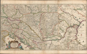
Totius Regni Hungariae, Maximaeque Partis Danubii Fluminis, una cum adjacentibus et finitimis Regionibus Novissima Delineatio, per Nicolaum Visscher.
sold
- Digital Map Information
- Suitable for large format printing
- DPI: 600
- File Size: 95.75 MB
- File Type: ZIP / TIFF
- ICC color profile embedded
- Delivered instantly via download link
This is a beautiful, contemporary-color example of Nicolas Visscher I's 1658 map of the course of the Danube, extending from Vienna to the Black Sea. The map encompasses much of what would soon become the seat of war between Christian European powers and the Turkish Empire. (more details)