
Vivien de Saint-Martin, Louis (sold)

Louis Vivien, called Vivien de Saint-Martin, (May 17, 1802 - December 26 1896) was a 19th-century French geographer. Prolific and long lived, he had at least a dozen major titles to his credit, including an 1841 history of the French Revolution, an 1844 history of Napoleon, an 1873 history of geography, and (in partnership with Franz Schrader) his Atlas universal de géographique. Nothing has come down to us of his early years, but he was hailed during his lifetime: he was Honorary President of the Société de Géographie de Paris, member of the Royal Academy of Sciences in Berlin, and honorary member of the Royal Academy of Madrid.
Keeping the Ship Afloat
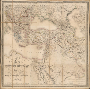
Carte de l'Empire Ottoman Comprenant les Possessions de la Porte en Europe, en Asie et en Afrique; avec les parties limitrophes de l'Arabie, de la Perse, de la Russie et de l'Empire d'Autriche.
sold
- Digital Map Information
- Suitable for large format printing
- Full resolution TIFF file
- ICC color profile embedded
- Delivered instantly via download link
This is an impressive, large-format 1864 folding map of the Ottoman Empire and environs, prepared by Louis Vivien de Saint-Martin and Joseph-Marin-Adolphe Noël des Vergers and published by J. Barthelemier. It presents the Empire in the aftermath of the Crimean War (1853 - 1856), when the Empire attempted to modernize and recover from the loss of territory earlier in the century. (more details)
The heavens, in vivid color.
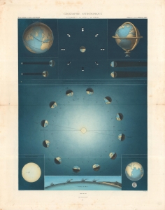
Géographie Astronomique, La Terre - La Lune - Le Soleil.
sold
- Digital Map Information
- Suitable for large format printing
- File Size: 28.12 MB
- File Type: ZIP / TIFF
- ICC color profile embedded
- Delivered instantly via download link
A gorgeous representation of the Earth, Moon, and Sun explaining the phases of the moon, the seasons, and more. This sheet appeared in Louis Vivien de Saint-Martin's 1878 Atlas Universel de Géographie… (more details)
Scarce, Large-format map of China.
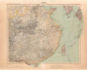
Chine / Asie en Dix Feuilles _ Feuille VIII.
sold
- Digital Map Information
- Suitable for large format printing
- File Size: 45.21 MB
- File Type: ZIP / TIFF
- ICC color profile embedded
- Delivered instantly via download link
This map of China was printed in 1911 as part of Schrader's ten sheet supplement on Asia, published by the French firm Hachette in the beginning of the 20th century to extend that firm's Atlas Universel originally under the direction of Louis Vivien de Saint - Martin. The other maps of the series are:
- 1. Asia Minor and the Caucasus
- 2. Turkestan
- 3. Mongolia
- 4. Japan, Korea and Manchuria
- 5. Arabia
- 6. Persia, Afghanistan and northwest India
- 7. Northeast India and Tibet
- 9. South India
- 10. India