
Zeno, Nicoló (sold) (Zeno the Younger)
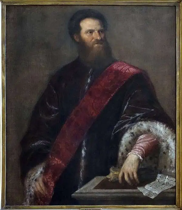
Nicolò Zeno the Younger (1515 - 1565) was a Venetian Senator and author. He was the son of a literary man and a family powerful in Venetian politics, and was reputedly educated in science and the humanities. He was a successful hydraulic engineer, a most important field in so inundated a city as Venice. Able though he may have been, his early entrance to politics at the age of 23 was made possible via payments of 100 ducats to the Council of Ten. Following Venice's disastrous 1537-1540 war with the Ottoman Empire, Zeno wrote and published an unpublished history of the conflict notable for its invective against proponents of the war. Zeno is mainly remembered for his 1558 publication of a map and series of letters which he claimed to have discovered in a storeroom of the family's home in Venice, purporting to describe a fourteenth century voyage by his ancestors, Nicolò and Antonio Zeno, to the north Atlantic and even to North America. Zeno's position as Senator would have discouraged question of his honesty in Venice, certainly, and the inclusion of his map in Ruscelli's successful 1561 edition of Ptolemy ensured the spread of his geographical ideas. And indeed, Zeno's map was widely accepted for over a century, influencing the maps of Ortelius, Mercator, Blaeu and others, until research (in particular that of Frederic W. Lucas, in 1898) identified both the cartographic and textual sources Zeno employed in concocting his report, demolishing its credibility.
AKA: Zeno the Younger
Greatest Phantom Island of the Old World.
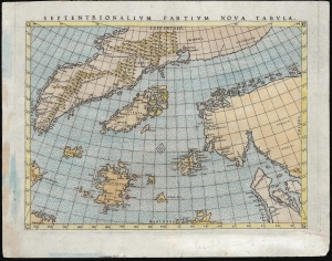
Septentrionalium Partium Nova Tabula.
sold
- Digital Map Information
- Suitable for large format printing
- Full resolution TIFF file
- ICC color profile embedded
- Delivered instantly via download link
This is Girolamo Ruscelli's 1562 edition of the 1558 Carta Da Navegar De Nicolo et Antonio Zeni Furono In Tramontana Lano MCCCLXXX by Nicoló Zeno the Younger, revealing the alleged 14th century voyages of his ancestors, Nicoló and Antonio Zeno. The fraud, seen largely as an attempt to co-opt the 1492 Columbian discovery of America, is responsible for the tenacity with which 16th and early 17th century geographers mapped the phantom islands Frisland, Icaria, Deogeo, and the coastline of Estotiland, which was taken to be the coast of Labrador. This first-plate example of Ruscelli's 1561 engraving, in its 1562 Latin text edition, which would have seen the greatest early dissemination of this image outside of Venice, and the biggest impact of its content on European geographical ideas. (more details)
Earliest acquirable state of the Zeno map.
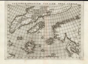
Septentrionalium Partium Nova Tabula.
sold
- Digital Map Information
- Suitable for large format printing
- Full resolution TIFF file
- ICC color profile embedded
- Delivered instantly via download link
This is the most important map of Girolamo Ruscelli's 1561 - 1562 edition Ptolemy: the earliest acquirable iteration of Nicoló Zeno's 1558 Carta Da Navegar De Nicolo et Antonio Zeni Furono In Tramontana Lano MCCCLXXX, revealing the alleged 14th-century voyages of Zeno's ancestors, Nicoló and Antonio. Zeno's fraud, intended to enhance his political power in Venice and later embraced as to co-opt the 1492 Columbia discovery of America, was responsible for the initial appearance and subsequent tenacity of the apocryphal islands Frisland, Icaria, Drogeo, and the coastline of Estotiland, which was taken by some of Europe's finest geographers to be the coast of Labrador. (more details)
First Double-Hemisphere World in a Printed Geography.
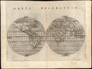
Orbis Descriptio.
sold
- Digital Map Information
- Suitable for large format printing
- Full resolution TIFF file
- ICC color profile embedded
- Delivered instantly via download link
This is the 1561 Girolamo Ruscelli map of the world, in the first state of the first plate. It is the earliest acquirable double hemisphere world map, and is the first such to appear in a printed geography. While many of its geographical details derived from Giacomo Gastaldi's 1548 Ptolemy, this map's incorporation of new information for the north Atlantic and its new projection transformed this map into a fully new composition. Amongst printed maps, the only earlier map using this projection is the unacquirable 1555 Georgio Sideri 'Calapoda' (fl. 1537 - 1565) map. (more details)
The Greatest Phantom Island of the Old World.
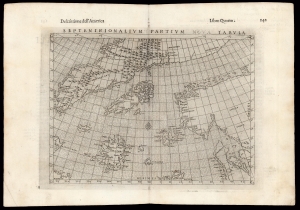
Septenirionalium Partium Nova Tabula.
sold
- Digital Map Information
- Suitable for large format printing
- DPI: 600
- File Size: 15.77 MB
- File Type: ZIP / TIFF
- ICC color profile embedded
- Delivered instantly via download link
This is Girolamo Ruscelli's 1599 edition of the 1558 Carta Da Navegar De Nicolo et Antonio Zeni Furono In Tramontana Lano MCCCLXXX by Nicoló Zeno the Younger, revealing the alleged 14th century voyages of his ancestors, Nicoló and Antonio Zeno. The fraud, largely an attempt to co-opt Columbus' 1492 discovery of America, is responsible for the tenacity with which sixteenth and early seventeenth century geographers mapped the phantom islands Frisland, Icaria, Deogeo, and the coastline of Estotiland, which was taken to be the coast of Labrador. (more details)
Mercator's Europe, Updated with Zeno's Revelations.
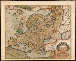
Europa, ad magnae Europae Gerardi Mercatoris P. imitationem, Rumoldi Mercatoris F. cura edita, servato tamen initio longitudinis ex ratione magnetis, quod Pater in magna sua universali posuit.
sold
- Digital Map Information
- Suitable for large format printing
- Full resolution TIFF file
- ICC color profile embedded
- Delivered instantly via download link
This is the 1595 first atlas edition of Gerard Mercator's map of Europe. It also Mercator's mapping of Muscovy, Tartary, and the distant north of Europe. The map reaches east beyond the River Ob and the Caspian Sea; it encompasses the Mediterranean Sea and reaches north to Mercator's theorized Arctic islands. (more details)
Mercator's Europe, Updated with Zeno's Revelations.
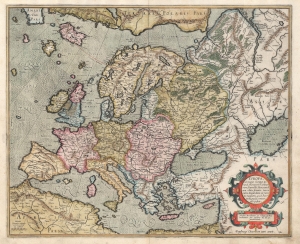
Europa, ad magnae Europae Gerardi Mercatoris P. imitationem, Rumoldi Mercatoris F. cura edita, servato tamen initio longitudinis ex ratione magnetis, quod Pater in magna sua universali posuit.
sold
- Digital Map Information
- Suitable for large format printing
- Full resolution TIFF file
- ICC color profile embedded
- Delivered instantly via download link
This is the 1595 first atlas edition of Gerard Mercator's map of Europe. It also Mercator's mapping of Muscovy, Tartary, and the distant north of Europe. The map reaches east beyond the River Ob and the Caspian Sea; it encompasses the Mediterranean Sea and reaches north to Mercator's theorized Arctic islands. (more details)
Discoveries of Frobisher, Davis, and... Zeno?
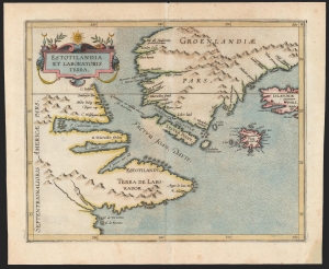
Estotilandia et Laboratoris Terra.
sold
- Digital Map Information
- Suitable for large format printing
- DPI: 600
- File Size: 17.46 MB
- File Type: ZIP / TIFF
- ICC color profile embedded
- Delivered instantly via download link
This is Cornelis Wytfliet's 1597 map of Labrador and Greenland, combining the most up-to-date discoveries in the North Atlantic with one of the most fascinating cartographic frauds committed to print. (more details)
Presenting the North Parts of the World.
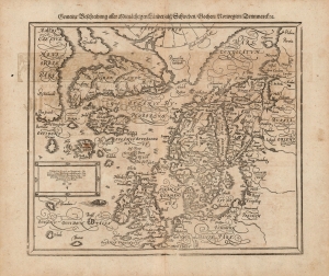
Gemeine Beschreibung Aller Mitnåchtigen Lander Alsz Schweden, Gothen, Norwegien, Denmarck etc.
sold
- Digital Map Information
- Suitable for large format printing
- DPI: 600
- File Size: 36.79 MB
- File Type: ZIP / TIFF
- ICC color profile embedded
- Delivered instantly via download link
This is an attractive woodcut map of Scandinavia and the north parts of the European world, added to Sebastian Münster's Cosmographia in 1588. It is one of the earliest maps to introduce Gerard Mercator's Arctic geography, as well as one of the most influential maps to adopt the Zeno 'Frisland' fraud. (more details)