
Late Glimpse of Pre-Earthquake San Francisco.
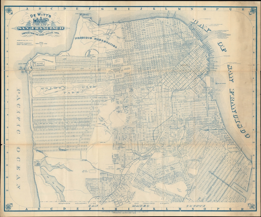
De Witt's indexed map of the city of San Francisco compiled from the latest official data.
sold
- Digital Map Information
- Suitable for large format printing
- File Size: 33.04 MB
- File Type: ZIP / TIFF
- ICC color profile embedded
- Delivered instantly via download link
An engaging 1904 folding map of the city of San Francisco prepared by Frederic M. De Witt. It depicts the city in a period of expansion and transformation, on the eve of the horrific destruction of the 1906 earthquake and fire. (more details)
Celebration of Champaign Urbana ... scathing criticism of society.

Champaign Urbana, the University of Illinois.
sold
A wonderfully composed 1980 Bob Waldmire illustration of the University of Illinois, Champaign, Urbana, combining aspects of a map, a diorama, a view, and a calendar. Waldmire's inimitable style celebrates Champaign, Urbana, the University of Illinois, and Illinois in general while simultaneously delivering a scathing criticism of society's abuse of the environment, Indigenous people, and ourselves. (more details)
Visit Acadia National Park!

Path and Road Map of the Eastern Part of Mount Desert Island Maine. Path and Road Map of the Western Part of Mount Desert Island Maine.
sold
This is a 1975 Augustus D. Phillips map of Acadia National Park, Mount Desert Island, Maine. Phillips was a local of Mount Desert Island, living most of his life in Northeast Harbor. His fun pictorial maps were popular with tourists and locals alike, enjoying a wide following. (more details)
Finally a slightly convenient way to visit Yosemite National Park.
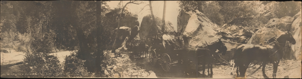
Arch Rock on Stage Road to Yosemite National Park Reached by Yosemite Valley Railroad.
$550.00
Acquire
- Digital Map Information
- Suitable for large format printing
- File Size: 9.94 MB
- File Type: ZIP / TIFF
- ICC color profile embedded
- Delivered instantly via download link
This is a 1907 Arthur C. Pillsbury photograph of horse-drawn coaches ferrying visitors from the Yosemite Valley Railroad station at El Portal to Yosemite National Park. The coaches pass through Arch Rock, the park entrance. This photo was taken within months of the Yosemite Valley Railroad's first passenger trip on May 15, 1907. Before the advent of the Yosemite Valley Railroad, visitors to Yosemite had to suffer through 2 days of grueling travel over rutted roads in a cramped stagecoach. The railroad cut the travel time to between 8 and 9 hours and provided relative comfort. (more details)
Orienting U.S. personnel to Seoul.
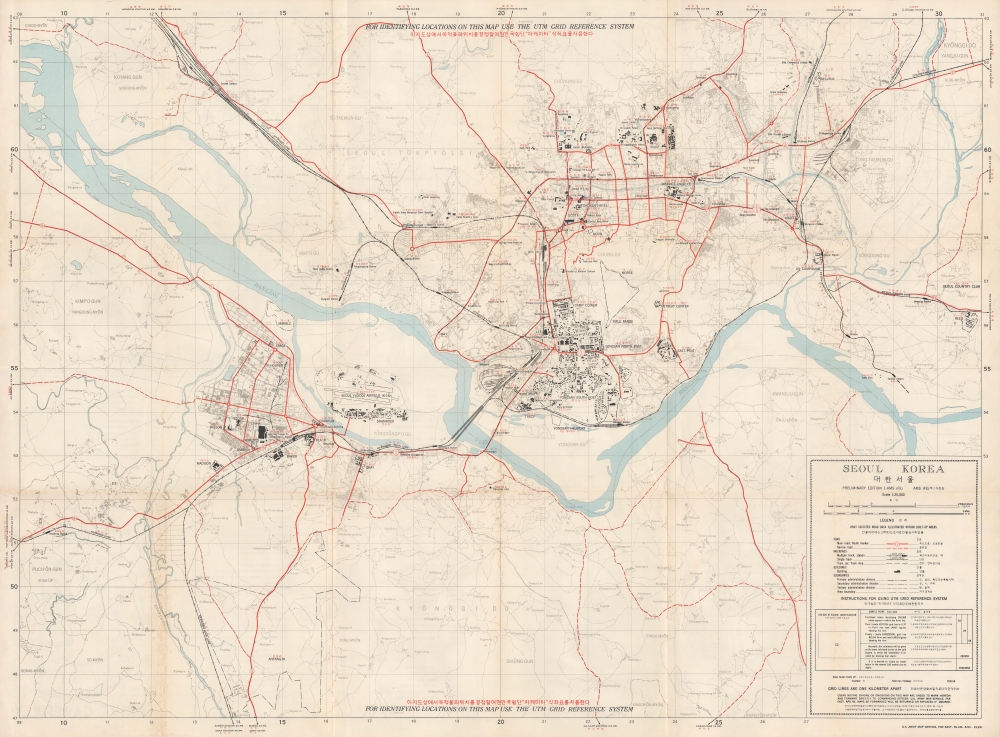
Seoul Korea.
sold
This is a 1959 U.S. Army Map Service Far East city map of Seoul, South Korea. Published 6 years after the Korean War (1950 - 1953), this map highlights the extensive and ongoing post-war U.S. military presence in Seoul. In so doing, it underscores the importance of the United States-South Korean Mutual Defense Treaty to the security of South Korea. (more details)
Sebastian Münster's Home City.
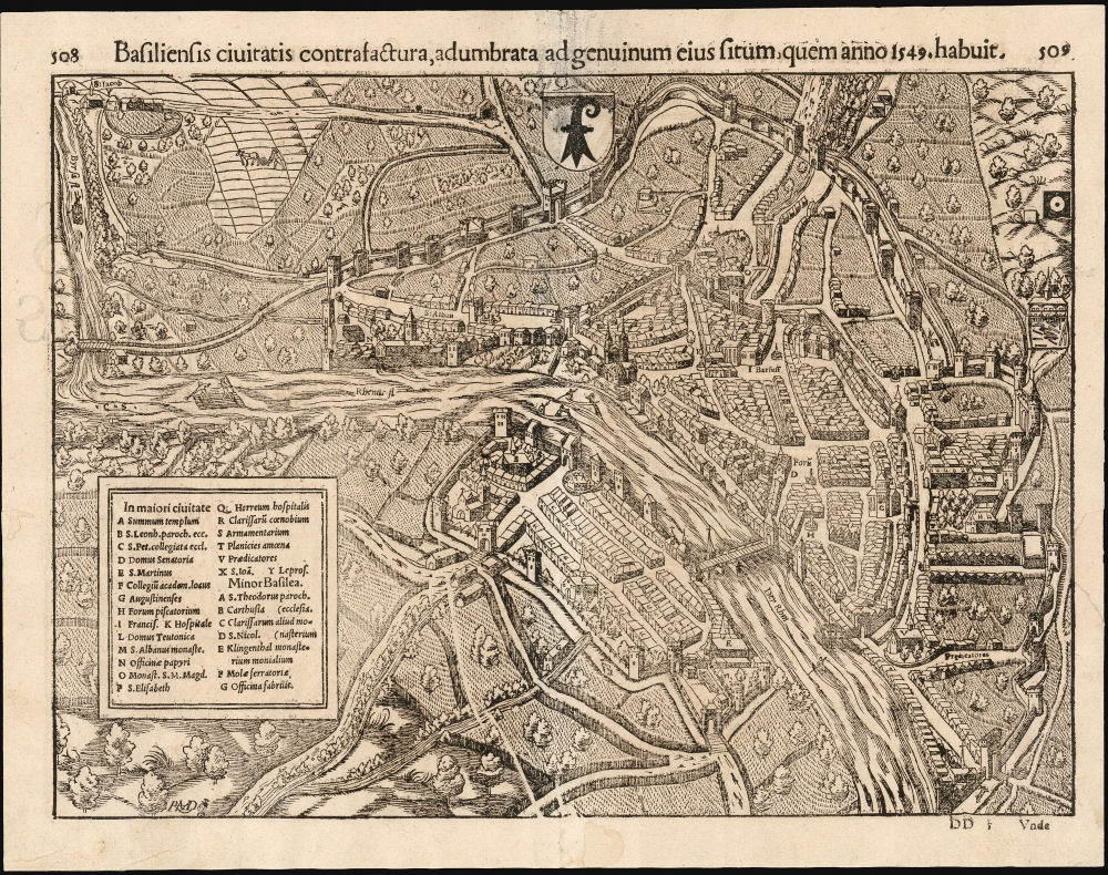
Basiliensis civitatis contrafactura, adumbrata ad genuinum eius situm, quem anno 1549, habuit.
sold
- Digital Map Information
- Suitable for large format printing
- Full resolution TIFF file
- ICC color profile embedded
- Delivered instantly via download link
Sebastian Münster's lively and remarkably accurate woodcut bird's-eye view of Basel, Switzerland's old town as it stood in 1549, is the earliest acquirable map of that city. It is preceded only by the view appearing in the 1493 Nuremberg Chronicle. Münster's work is particularly significant, as it is a representation of the mapmaker's home city. (more details)
Last plan of pre-Soviet Riga.
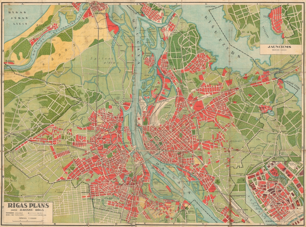
Rīgas Plāns.
sold
- Digital Map Information
- Suitable for large format printing
- Full resolution TIFF file
- ICC color profile embedded
- Delivered instantly via download link
This is an impressive large-scale c. 1940 map of Riga, Latvia, by Janis Roze. This is one of the last maps of independent Riga, issued in the same year it was taken over by the Soviets, and all businesses, including J. Roze, were nationalized. (more details)
Battleground of the French Wars of Religion.

Andegavensium Ditionis Vera et Integra Descriptio.
sold
- Digital Map Information
- Suitable for large format printing
- Full resolution TIFF file
- ICC color profile embedded
- Delivered instantly via download link
A beautiful example, in superb original color, of Abraham Ortelius' 1579 map of the Duchy of Anjou, now largely consistent with the Department of Maine-et-Loire. Ortelius sourced his map from a now-lost map produced in 1573 by Lezin Guyet (1515 - 1580,) who lived in Anjou and whose map was dedicated to the Duke of Anjou. At the time the map was produced, the Dukes of Anjou were embroiled in the French Wars of Religion. This part of the Loire valley is known as the source of the Vignobles d'Anjou et Saumur. (more details)
Heart of Screenland.

[Culver City] / Welcome to the Heart of Screenland Culver City California.
sold
- Digital Map Information
- Suitable for large format printing
- Full resolution TIFF file
- ICC color profile embedded
- Delivered instantly via download link
A rare 1927 view of Culver City, California, by artist Rays Burke, part of a local Chamber of Commerce brochure for the city, dubbed 'the heart of Screenland,' still the city's motto. (more details)
Selling furs and buying supplies.

Rendezvous Sites: 1825 - 1840.
sold
This is a c. 1975 Fred Gowans map of the Rocky Mountain Rendezvous sites in Idaho, Utah, and Wyoming. 'Rendezvous' were annual gatherings organized by fur trading companies where trappers could sell their furs and resupply without leaving the mountains. (more details)
Promoting Orlando during the Florida Land Boom.

Milage Map of the Best Roads of Florida.
sold
- Digital Map Information
- Suitable for large format printing
- Full resolution TIFF file
- ICC color profile embedded
- Delivered instantly via download link
This is the c. 1924 Clason folding road map of Florida. It corresponds with the 1920s Florida Land Boom and was issued to promote real estate development in the Orwin Manor neighborhood of Orlando and Winter Park. (more details)
Historical Justifications for Argentinian Territorial Claims in La Plata.
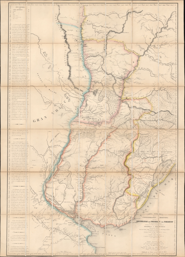
Carta esferica de la confederacion Argentina y de las republicas del Uruguay y del Paraguay.
sold
- Digital Map Information
- Suitable for large format printing
- File Size: 47.3 MB
- File Type: ZIP / TIFF
- ICC color profile embedded
- Delivered instantly via download link
This is the sole edition of Jose Maria Cabrer's 1826 map of the Argentine Confederation, Paraguay, and Uruguay, based on his surveys executed between 1777 and 1802. Despite its excellence, it was not published during the author's lifetime and did not appear in print before this Paris edition of 1853. The original manuscript has not survived. Cabrer, a Spanish military engineer, had been assigned to survey the borders of the Spanish and Portuguese empires in South America following the 1777 Treaty of Ildefonso; the present work encapsulates two decades of arduous, well-respected surveys, compiled 'unofficially' by Cabrer in 1802. (more details)
Japanese imperialistic Pan-Asianism.
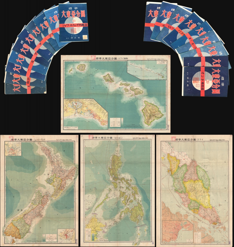
標準大東亞分圖 / Standard Map of the Great East Co-Prosperity Sphere.
sold
This is an important full set of 20 maps from the 1943 Showa 18 World War II (WWII) Greater East Asian Co-Prosperity Sphere series, by Seitosha (正統社). The maps cover from India to Hawaii and from Japan to Australia, reflecting the Japanese Imperial vision of Pan-Asianism. (more details)
Created for the French Navy during the American Revolutionary War.
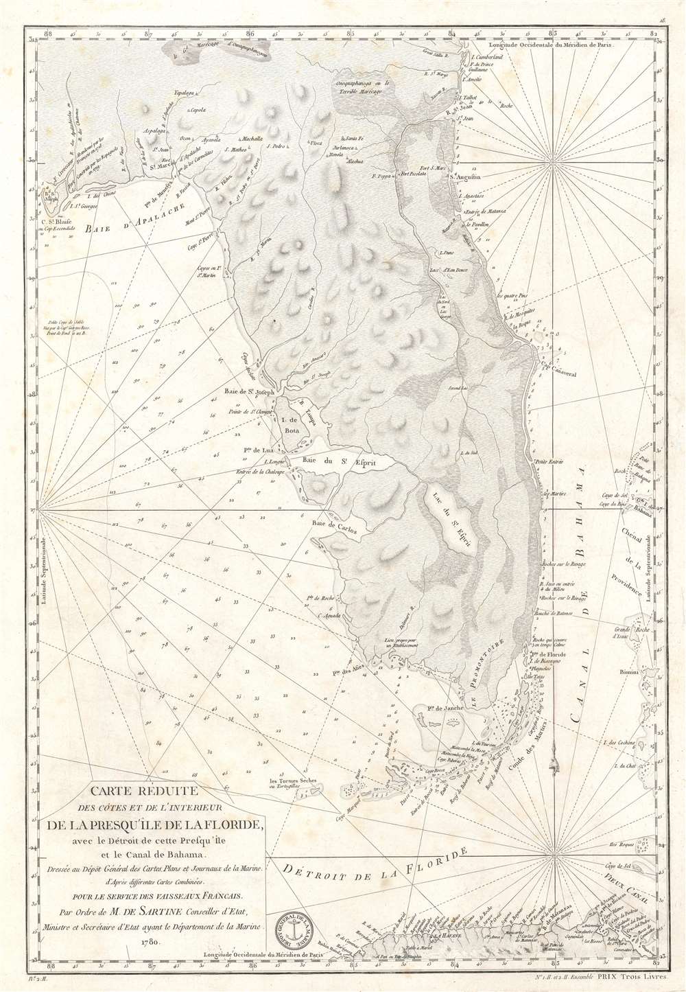
Carte Réduite des Côtes et de l'Interieur de la Presqu'île de la Floride, avec le Détroit de cette Presqu'Île et le Canal de Bahama.
sold
- Digital Map Information
- Suitable for large format printing
- DPI: 600
- File Size: 22.8 MB
- File Type: ZIP / TIFF
- ICC color profile embedded
- Delivered instantly via download link
This is a 1780 Antoine de Sartine nautical map of Florida, issued for French Naval use during the American Revolutionary War. (more details)
Thai map of World War II at the peak of Japanese aggression.

แผนที่แสดงผลของสงครามมหาเอเชียบูรพา. / Map showing the results of the Greater East Asia War.
sold
- Digital Map Information
- Suitable for large format printing
- Full resolution TIFF file
- ICC color profile embedded
- Delivered instantly via download link
The only known example of a 1942 Thai pictorial map illustrating the progress of the Pacific theater in World War II (1939 - 1945). The map captures the apex of Japanese expansion, just before the pivotal Battle of Midway, when the United States decisively defeated the Japanese Fleet, changing the course of the Pacific War. (more details)
Late Appearance of California as an Island.

Novus Orbis Sive America Meridionalis et Septentrionalis...
sold
- Digital Map Information
- Suitable for large format printing
- File Size: 27.44 MB
- File Type: ZIP / TIFF
- ICC color profile embedded
- Delivered instantly via download link
This is Johann Michael Probst's rare 1784 issue of Mattheus Seutter's map of the Americas. Among other features, it includes a very late representation of California as an island, a cartographic myth that had largely been dispelled decades earlier. (more details)
South Vietnamese Regional Forces.

[Village Manuscript Map.]
sold
This is a c. 1969 Vietnam War (1955 - 1975) Era South Vietnamese manuscript map of a Vietnamese village. Although the village is unknown, the map illustrates the activities of the South Vietnamese Regional Forces, an internal security force instrumental in opposing Viet Cong incursions into South Vietnam. (more details)
Pensacola Bay and its Anchorages.
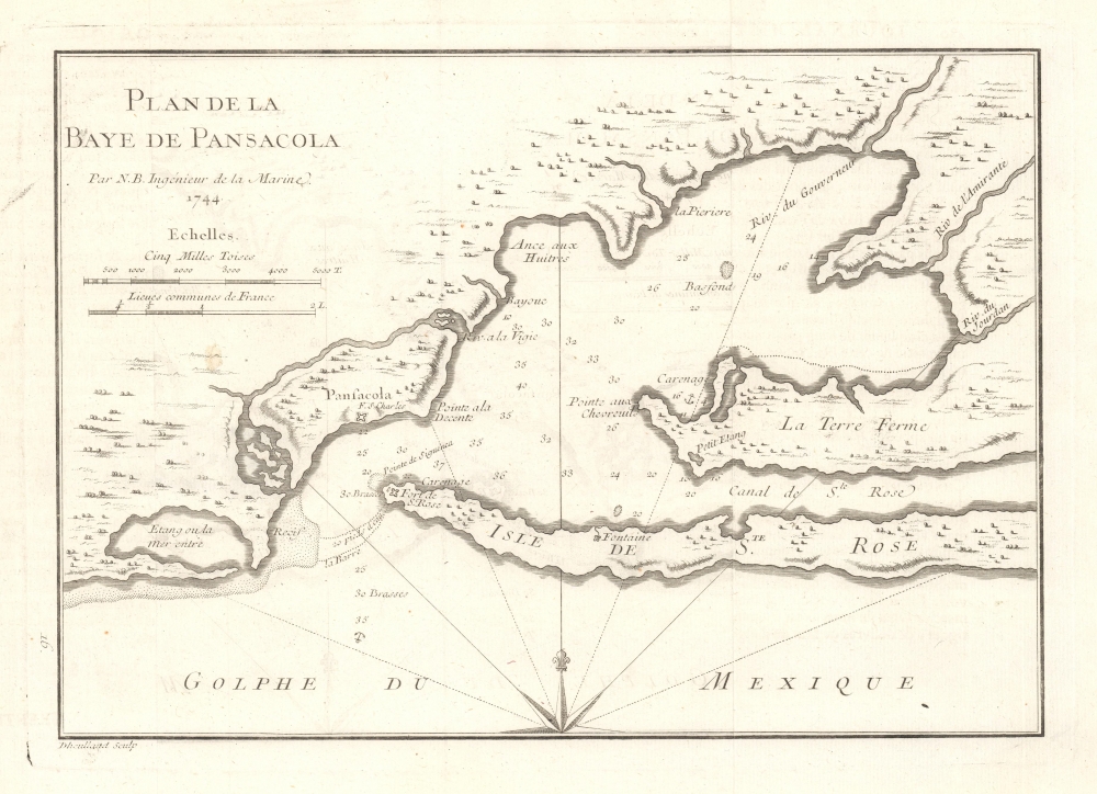
Plan de la Baye de Pensacola.
$450.00
Acquire
- Digital Map Information
- Suitable for large format printing
- File Size: 3.54 MB
- File Type: ZIP / TIFF
- ICC color profile embedded
- Delivered instantly via download link
This is an elegant 1744 chart of Pensacola Harbor in Florida by Jacques-Nicolas Bellin. It is among the earliest available charts of the bay and harbor and identifies the locations of Fort St. Charles and Fort St. Rose. Bellin also notes important coastal features, including reefs, soundings, and anchorages.
Bellin originally prepared this map to illustrate Pierre François Xavier de Charlevoix's Histoire et description generale de la Nouvelle France. It was engraved by Guillaume Dheulland. Charlevoix's history and this map, in particular, thus proved exceptionally influential as one of the most comprehensive works on North America predating the French and Indian War. Copies of the Histoire et description generale were found in the libraries of many 18th-century luminaries, including Voltaire, Franklin, and Jefferson. Jefferson especially admired Charlevoix's work, calling it 'a particularly useful species of reading' and no doubt influenced his decision to pursue the historic 1802 Louisiana Purchase, possibly the most significant event in the post-colonial history of North America. (more details)
Bellin originally prepared this map to illustrate Pierre François Xavier de Charlevoix's Histoire et description generale de la Nouvelle France. It was engraved by Guillaume Dheulland. Charlevoix's history and this map, in particular, thus proved exceptionally influential as one of the most comprehensive works on North America predating the French and Indian War. Copies of the Histoire et description generale were found in the libraries of many 18th-century luminaries, including Voltaire, Franklin, and Jefferson. Jefferson especially admired Charlevoix's work, calling it 'a particularly useful species of reading' and no doubt influenced his decision to pursue the historic 1802 Louisiana Purchase, possibly the most significant event in the post-colonial history of North America. (more details)
Visualizing L.A.'s Horrendous Traffic.
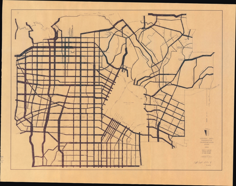
Traffic Flow Map Average Weekday 24 Hour Volumes. Preliminary Plate.
$350.00
Acquire
An intriguing infographic map of Los Angeles traffic flows prepared in 1970 by City Traffic Engineer S. S. Taylor. It introduces a novel technique to illustrate traffic density and demonstrates the difficulty of managing the immense number of vehicles transiting the city daily. (more details)
Before 'Sin City'.

Las Vegas Nevada Still a Frontier Town / Las Vegas and Boulder Dam Nevada.
sold
- Digital Map Information
- Suitable for large format printing
- Full resolution TIFF file
- ICC color profile embedded
- Delivered instantly via download link
A whimsical 1939 Raymond Winters pictorial view of Las Vegas, Nevada, and its environs, including Boulder (Hoover) Dam and Lake Mead. (more details)