
Ortelius, Abraham
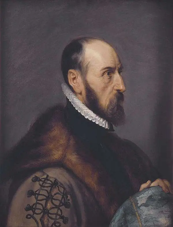
Abraham Ortelius (April 14, 1527 - June 28, 1598) also known as Ortels, was a cartographer, geographer, and cosmographer of Brabant, active in Antwerp. He was the creator of the first modern atlas, Theatrum Orbis Terrarum and is a seminal figure in the history of cartography. Along with Gerard Mercator and Gemma Frisius, he was a founder of the Netherlandish school of cartography. His connections with Spain - culminating in his 1575 appointment as Royal Cartographer to King Phillip II of Spain - gave him unmatched access to Spanish geographical knowledge during a crucial period of the Age of Discovery. Ortelius was born in 1527 in Antwerp. In 1547 he entered the Antwerp Guild of Saint Luke as an illuminator of maps. He began trading in books, prints, and maps, traveling regularly to the Frankfurt book and print fair, where in 1554 he met Mercator. He accompanied Mercator on journeys throughout France in 1560 and it was at this time, under Mercator's influence, that he appears to have chosen his career as a scientific geographer. His first published geographic work appeared in 1564, an eight-sheet cordiform world map. A handful of other maps preceded the 1570 publication of the first edition of the Theatrum Orbis Terrarum, which would prove to be his life work. Appearing with but 53 maps in its first edition, Ortelius' work expanded with new maps added regularly. By 1592, it had 134 maps. Many of Ortelius' maps remained the standard for nearly a century. He traveled extensively, but his genius was as a compiler, locating the best informed maps on which to base his own. His contacts throughout Europe and extending even (via the Portuguese) to the Far East were formidable. Moreover, many of his maps were based on his own scholarship, particularly his historical works. His theories of geography were particularly ahead of his time with respect to the notion of continental drift, the possibility of which he mused on as early as 1596, and which would be proven correct centuries later. In a sense his greatest achievement was his successful navigation of the religious and political violence endemic to his city throughout his adult life: The Dutch Revolt, or Eighty Years' War (1568 - 1648), fully embroiled Antwerp. Although outwardly and officially recognized as Catholic (Arias Montanus vouched for Ortelius' Catholic orthodoxy prior to his appointment as Royal Geographer), Ortelius was able to separate himself from the religious furor which characterized the war in the low countries. Ortelius showed a glimpse of himself in a letter to a friend, regarding humanist Justus Lipsius: 'I do not know whether he is an adherent of the Pope or a Calvinist, but if he has ears to hear, he will neither be one nor the other, for sins are committed on both sides'. Ortelius' own explorations of Biblical history in his maps, and the Christogram contained in his own motto, suggest him to be a religious man, but his abjuration of political religious authorities mark him as an individualist. His tombstone at St Michael's Præmonstratensian Abbey in Antwerp bears the inscription, Quietis cultor sine lite, uxore, prole. ('served quietly, without accusation, wife, and offspring.')
One of the first maps to show the Pacific Northwest.

Tartariae Sive Magni Chami Regni typus.
$2,000.00
Acquire
- Digital Map Information
- Suitable for large format printing
- Full resolution TIFF file
- ICC color profile embedded
- Delivered instantly via download link
This is Abraham Ortelius' seminal 1570 map of Tartary, one of the first maps to focus on the North Pacific coasts of America and Asia, in a sharp, early edition of 1573. While the map is intended to the Asian empire of the Great Khan, it is also notable for what it presents of America. The map includes what is now the west coast of the United States, northwestern Canada, and Alaska, a part of the world almost entirely unknown at that time. It is the earliest obtainable map to name California. It also one of the most definitive early maps to distinctly separate the continents of Asia and America (via the Strait of Anian) well before the explorers of the 18th century proved that separation to be fact. (more details)
One of the first maps to show the Pacific Northwest.
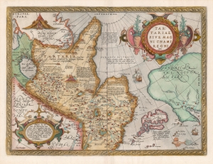
Tartariae Sive Magni Chami Regni typus.
$1,800.00
Acquire
- Digital Map Information
- Suitable for large format printing
- DPI: 600
- File Size: 46.45 MB
- File Type: ZIP / TIFF
- ICC color profile embedded
- Delivered instantly via download link
An example of Ortelius' seminal 1579 map of Tartary, one of the first maps to focus on the North Pacific. While the map is intended to detail Asia under the Great Khan, it is perhaps more notable for what it presents of America. The map includes what is now the west coast of the United States, northwestern Canada, and Alaska, lands then almost entirely unknown. It is the earliest obtainable map to name California. It also displays a strait separating Asia and America - the Strait of Anian - appearing long before Vitus Bering's exploration proved the existence of such. (more details)
Heart of the Dutch Revolt.
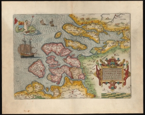
Zelandicarum Insularum Exactissima et Nova Descriptio, Auctore D. Iacobo A Daventria.
$850.00
Acquire
- Digital Map Information
- Suitable for large format printing
- Full resolution TIFF file
- ICC color profile embedded
- Delivered instantly via download link
This is a beautiful example of Abraham Ortelius' 1570 map of the Zeeland province of the Netherlands. The province was inclusive of Antwerp, where Ortelius lived and worked, thus presenting the mapmaker's homeland. It is, moreover, the best map of the lands at the heart of the Dutch Revolt and Eighty Years’ War (1568 - 1648). (more details)
First map of Russia based on actual exploration.
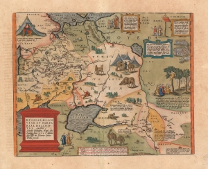
Russiae, Moscoviae et Tartariae Descriptio. Auctore Antonio Ienkensono Anglo, edita Londini Anno. 1562 et dedicata illustriss: D. Henrico Sÿdneo Wallie presidi.
$2,000.00
Acquire
- Digital Map Information
- Suitable for large format printing
- Full resolution TIFF file
- ICC color profile embedded
- Delivered instantly via download link
This is a 1601 example of Abraham Ortelius' 'Russia, Moscoviae et Tartariae', the first atlas map of Russia, and the first to be produced based on actual exploration. Its content is based on the travels of English merchant and diplomat Anthony Jenkinson, who visited Russia four times between 1557 and 1571. The map details the lands revealed by Jenkinson's first voyage which lasted from 1557 to 1560. His map, which was provided to Ortelius, was completed after that voyage, in 1562. (more details)
First Atlas Map of the North Parts of the World.
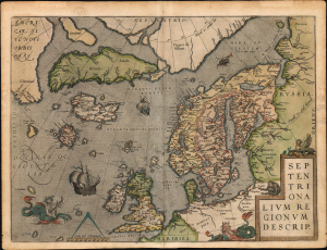
Septentrionalium Regionum Descrip.
$3,000.00
Acquire
- Digital Map Information
- Suitable for large format printing
- Full resolution TIFF file
- ICC color profile embedded
- Delivered instantly via download link
A beautiful example of one of Abraham Ortelius' most interesting maps, his 1570 map of Scandinavia and the Arctic. During the Age of Discovery, the Arctic was as remote and unfamiliar as the coasts of America, Africa, or Asia. This map played a role in propagating several cartographic fallacies, including the Zeno Fraud: Frisland, Estotiland, Drogeo. The present example, in a 1602 Vrients edition, features warm, original color. (more details)
First Modern Atlas Map of the British Isles.
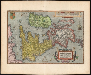
Angliae, Scotiae, et Hiberniae, Sive Britannicar: Insularum Descriptio.
$1,750.00
Acquire
- Digital Map Information
- Suitable for large format printing
- Full resolution TIFF file
- ICC color profile embedded
- Delivered instantly via download link
This is Abraham Ortelius' 1570 map of the British Isles, the first atlas map of the British Isles, in a beautiful example of the third state. (more details)
The First Atlas Map of France.
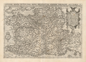
Galliae Regni Potentiss. Nova Descriptio.
$500.00
Acquire
- Digital Map Information
- Suitable for large format printing
- DPI: 600
- File Size: 51.37 MB
- File Type: ZIP / TIFF
- ICC color profile embedded
- Delivered instantly via download link
This is Abraham Ortelius' 1570 map of France, based on the now-lost 1560 Nouvelle Description des Gaules of French priest and cartographer Jean Jolivet. The map includes the areas that would become Switzerland and Savoy, as well as Italy's Piedmont and part of Lombardy. Franz Hogenberg's expert engraving includes the evocative, pictorial representation of the Alps and the Pyrenees mountain ranges, as well as forests throughout northern France. Descriptive notes in French appear throughout.
(more details)
The Danube below Vienna.
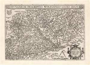
Hungariae Descriptio Wolfgango Lazio Auct.
$750.00
Acquire
- Digital Map Information
- Suitable for large format printing
- DPI: 600
- File Size: 62.82 MB
- File Type: ZIP / TIFF
- ICC color profile embedded
- Delivered instantly via download link
This is Abraham Ortelius' 1570 map of Hungary, the first acquirable, accurate map of that region, and the first atlas map of Hungary. The map includes parts of Austria, Slovakia and Romania, with parts of Croatia, Bosnia and Serbia in the south. The heart of the map is the River Danube, reaching from Vienna in the west to the Romanian river Olt (here in the German Alt and the Latin Aluta) Buda and Pest are shown. Belgrade appears at the confluence of the Sau and the Danube, with the antiquated German appellation Griechschweissenburg. (more details)
The Danube below Vienna.
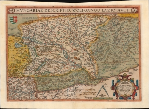
Hungariae Descriptio Wolfgango Lazio Auct.
$700.00
Acquire
- Digital Map Information
- Suitable for large format printing
- Full resolution TIFF file
- ICC color profile embedded
- Delivered instantly via download link
This is Abraham Ortelius' 1570 map of Hungary, the first acquirable, accurate map specifically of that region, and the first to appear in an atlas. (more details)
The 16th Century European Frontier.
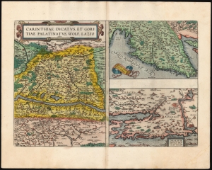
Carinthiae Ducatus, Et Goritiae Palatinus, Wolf. Lazio auctore./ Histriae tabula a Petro Coppo descr./ Zarae, et Sebenici Descriptio.
$550.00
Acquire
- Digital Map Information
- Suitable for large format printing
- Full resolution TIFF file
- ICC color profile embedded
- Delivered instantly via download link
This is Abraham Ortelius' 1573 engraving containing the maps of The Duchy of Carinthiae in Austria, Istria on the Adriatic coasts of Croatia and Slovenia, and the region around the Croatian ports of Zara and Srebrenica. Although the maps are not contiguous with one another, they all represent very contemporary maps of western strongholds near Europe's frontier with Habsburg Hungary and with the Ottoman Empire.
Ortelius was a keen compiler of sources: his map of the Duchy of Carinthia comes from the very current map of the Viennese Wolfgang Lazius; Carinthiae ducatus cum palatinate Goricia appeared in his 1561 atlas of Austria. Carinthia, the southernmost region of Austria, is now noted for the mountains of the Eastern Alps; the region on the map extends southwards beyond the Karawank Mountains into what is now northern Slovenia. The map is bisected by the Drava River running west to east. In addition to the mountains this region is also known for its lakes. The present map includes the Millstätter See, the Ossiacher See, and the Wörthersee. On the Slovenian side of the Karawank mountains near the city of Idria (Idrija) there is noted, Argenti viva fodine: a quicksilver, or mercury, mine. This is an accurate notation of keen interest: anyone seeking to purify mined silver or gold required quicksilver for the process; and the mine of Idrija had produced that rare metal going back to 1490.
The map of Istria - the Adriatic peninsula predominantly held by Croatia and Slovenia - Ortelius credited to its ultimate source, Pietro Coppo. The Venetian Coppo had lived in a town on the northwest coast of Istria for most of his life, and in about 1525 had produced a woodcut map of the area. Although in his text Ortelius also credits the scholar Leandro Alberti, Ortelius' map appears to be a closer to Bertelli's 1569 iteration of the Coppo.
The third map focuses on the region around the Croatian cities of Zadar (Zara) and Šibenik (Sebenici). Zadar is the oldest continuously inhabited city in Croatia and is a historical center of Dalmatia. The name 'Zara' began to be applied to the city when it was absorbed by the Republic of Venice in the 15th century. Šibenik is the third-largest city of Dalmatia, and like Zadar was held for a time by the Republic of Venice. Ortelius claimed his source to be anonymous; Meurer and Woodward have attributed the 1570 source map to Paolo Forlani. (more details)
Ortelius was a keen compiler of sources: his map of the Duchy of Carinthia comes from the very current map of the Viennese Wolfgang Lazius; Carinthiae ducatus cum palatinate Goricia appeared in his 1561 atlas of Austria. Carinthia, the southernmost region of Austria, is now noted for the mountains of the Eastern Alps; the region on the map extends southwards beyond the Karawank Mountains into what is now northern Slovenia. The map is bisected by the Drava River running west to east. In addition to the mountains this region is also known for its lakes. The present map includes the Millstätter See, the Ossiacher See, and the Wörthersee. On the Slovenian side of the Karawank mountains near the city of Idria (Idrija) there is noted, Argenti viva fodine: a quicksilver, or mercury, mine. This is an accurate notation of keen interest: anyone seeking to purify mined silver or gold required quicksilver for the process; and the mine of Idrija had produced that rare metal going back to 1490.
The map of Istria - the Adriatic peninsula predominantly held by Croatia and Slovenia - Ortelius credited to its ultimate source, Pietro Coppo. The Venetian Coppo had lived in a town on the northwest coast of Istria for most of his life, and in about 1525 had produced a woodcut map of the area. Although in his text Ortelius also credits the scholar Leandro Alberti, Ortelius' map appears to be a closer to Bertelli's 1569 iteration of the Coppo.
The third map focuses on the region around the Croatian cities of Zadar (Zara) and Šibenik (Sebenici). Zadar is the oldest continuously inhabited city in Croatia and is a historical center of Dalmatia. The name 'Zara' began to be applied to the city when it was absorbed by the Republic of Venice in the 15th century. Šibenik is the third-largest city of Dalmatia, and like Zadar was held for a time by the Republic of Venice. Ortelius claimed his source to be anonymous; Meurer and Woodward have attributed the 1570 source map to Paolo Forlani. (more details)
16th Century Italian Frontier.
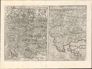
Rhetiae alpestris descriptio, in qua hodie Tirolis Comitatus. / Goritiae. Karstii, Chaczeolae, Carniolae, Histriae, et Windorum Marchae Descrip.
$450.00
Acquire
- Digital Map Information
- Suitable for large format printing
- Full resolution TIFF file
- ICC color profile embedded
- Delivered instantly via download link
This 1573 Abraham Ortelius engraving features two Wolfgang Lazius maps: Tyrol in southern Austria and northern Italy, and the modern-day border regions of Slovenia, Italy, and Croatia. Although the maps are not contiguous, they all represent contemporary maps of western strongholds at Italy's frontiers with Austria and Croatia. (more details)
Picardy Belongs to the Low Countries, Says Ortelius.
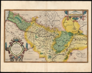
Picardiae Belgicae regionis descriptio.
$300.00
Acquire
- Digital Map Information
- Suitable for large format printing
- Full resolution TIFF file
- ICC color profile embedded
- Delivered instantly via download link
A beautiful example, in superb original color, of Abraham Ortelius' 1579 map of Picardy, the first map of that area in an atlas. The map focuses on the Somme River valley. Amiens, chief city of the region, St. Quentin and La Fere are given particular emphasis. Ortelius' cartouche and scales are embellished with elegant strapwork frames. This specific example is from a 1595 edition of the atlas, and is radiant with the hand color of that period. (more details)
First Atlas Map of the Caribbean in its First Printing
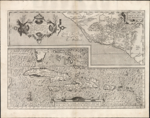
Culiacanae, America Regionis Descriptio./ Hispaniolae, Cubae, Aliarumque Insularum Circumiacentium, Delineatio./ Cum Imp. et Regio./ privilegio decennali 1579.
$2,000.00
Acquire
- Digital Map Information
- Suitable for large format printing
- Full resolution TIFF file
- ICC color profile embedded
- Delivered instantly via download link
This is a superb, first-edition example of Ortelius' 1579 map of Cuba and the Caribbean, combined with his map of the Viceroyalty of Culiacan in Northwestern Mexico. While Ortelius' Theatrum had been in print since 1570, it was not until 1579 that this map was added to the book. This example exhibits a bold, sharp strike resulting from the youth of its plate; it is consequently very desirable. (more details)
Dominant 16th century model for the mapping of Austria.
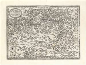
Austriae Ducatus Chorographia, Wolfgango Lazio Auctore.
$650.00
Acquire
- Digital Map Information
- Suitable for large format printing
- DPI: 600
- File Size: 57.8 MB
- File Type: ZIP / TIFF
- ICC color profile embedded
- Delivered instantly via download link
This is Abraham Ortelius' 1570 map of Austria. It depicts the lands lying between the Thaya River in the north and the Drava in the south. Between the two flows the Danube, from Waldkirchen am Wesen in the west to Bratislava in the east (here styled Bresburg). Vienna, of course, is prominently noted. (more details)
First atlas map of the Duchy of Milan.
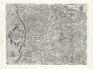
Ducatus Mediolanensis, Finitimarumque Regionū Descriptio,, Auctore Joanne Georgio Septala Mediolanense.
$450.00
Acquire
- Digital Map Information
- Suitable for large format printing
- DPI: 600
- File Size: 55.34 MB
- File Type: ZIP / TIFF
- ICC color profile embedded
- Delivered instantly via download link
This is Abraham Ortelius' 1570 map of the Duchy of Milan, in Italy. It was based the map of Giovanni Giorgio Settala (1520 - 1590) engraved by Hieronymus Cock, which exists in a sole copy in the British Library. Settala was Milanese, and although most of his life was spent building fortifications for Charles V in Spain, his map was drawn while he lived in Milan. (more details)
Transylvania, from the first modern atlas.
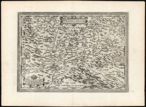
Transilvania / Hanc ultra Transilvaniam, quae et Panodacia, et Dacia Ripēsis, vulgo Sibemburgē Dicitur, edidit Viennae Ao. 1566 Nobiliss. atque Doctiss. Ioês Sâbucus Pannonius.
$750.00
Acquire
- Digital Map Information
- Suitable for large format printing
- DPI: 600
- File Size: 54.14 MB
- File Type: ZIP / TIFF
- ICC color profile embedded
- Delivered instantly via download link
This is Abraham Ortelius' 1575 map of Transylvania, from the first modern atlas, covering what is now central Romania. It is a superb engraving, dramatically presenting the mountains and forests of this frontier region of Europe and the Turkish Empire. (more details)
Ortelius' Map of Venice and Apulia.
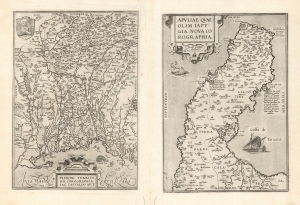
Patavini Territorii Corographia, Iac Castaldo Auct./ Apuliae Quae Olim Iapygia, Nova Corographia. Jacobo Castaldo Auctore.
$500.00
Acquire
- Digital Map Information
- Suitable for large format printing
- DPI: 600
- File Size: 40.49 MB
- File Type: ZIP / TIFF
- ICC color profile embedded
- Delivered instantly via download link
This is Abraham Ortelius' 1573 engraving containing maps of the Italian regions of Padua and Apulia: respectively, the immediate region inland of Venice and the bootheel of Italy. Both maps Ortelius credits to the 16th century Italian doyen of geography, Giocomo Gastaldi; the map illustrates the transmission to the Low Countries of both the traditional medium and the content of 16th century Italian geography. (more details)
First European Atlas map specifically of China.
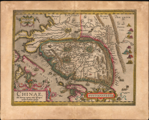
Chinae, olim Sinarum regionis, nova descriptio. auctore Ludovico Georgio.
$5,500.00
Acquire
- Digital Map Information
- Suitable for large format printing
- Full resolution TIFF file
- ICC color profile embedded
- Delivered instantly via download link
This is Abraham Ortelius' 1584 map of China, the first specific map of China, Southeast Asia, and the Philippines to appear in an atlas, here in an original-color example of a 1608 Vrients edition. This is the first printed European map of China and first atlas map to name the Philippines as an archipelago. This map remained definative regional map until superceded in 1655 maps of Martino Martini (卫匡国; 1614 - 1661). (more details)
First Specific Printed Maps of Florida and Peru.
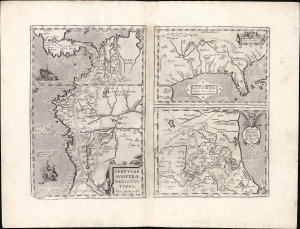
Peruviae Auriferae Regionis Typus./ La Florida./ Guastecan.
$1,250.00
Acquire
- Digital Map Information
- Suitable for large format printing
- Full resolution TIFF file
- ICC color profile embedded
- Delivered instantly via download link
This is an elegant example of Ortelius' 1584 engraving that includes the first specific map of Florida, the earliest specific map of Peru, and the first map focusing on the Guastecan province of Mexico. The map is a prime example of Ortelius' strength, not only as a mapmaker, but also as a compiler. All these maps combined here are relevant to each other in that they all derive from Spanish sources and reveal parts of the Spanish Empire in America, despite Spain forbidding the production and dissemination of such maps. Two of these maps credit specific Spanish sources, reflecting Ortelius' position as geographer to the king of Spain. Antwerp was part of the Spanish Empire at the time, and it is a testimony to Ortelius's far-reaching network of contacts throughout Europe that he was able to obtain maps such as these for publication. (more details)
From the First Modern Atlas.
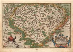
Regni Bohemiae Descriptio.
$750.00
Acquire
- Digital Map Information
- Suitable for large format printing
- Full resolution TIFF file
- ICC color profile embedded
- Delivered instantly via download link
This is Ortelius' 1570 map of Bohemia, in a beautiful, original-color example from the 1587 French edition of Theatrum Orbis Terrarum, the first modern atlas. It is derived from the unobtainable, Leipzig-published, 1568 Johann Criginger (1521 - 1571) map, which was to date the best map of Bohemia available. Like the Criginger, Ortelius' map is oriented to the north, showing the Kingdom of Bohemia surrounded by pictorially-represented forests and forbidding mountains. Cities and towns are pictorially shown to represent their respective sizes. Ortelius' map is embellished with two handsome, strapwork cartouches; the title cartouche is surmounted with the Bohemian coat-of-arms. (more details)
Striking Woodcut map of Greece.
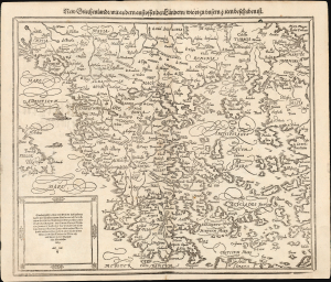
New Griechenlandt mit andern anstossenden Laendern wie es zu unsern zeiten beschriben ist.
$350.00
Acquire
- Digital Map Information
- Suitable for large format printing
- Full resolution TIFF file
- ICC color profile embedded
- Delivered instantly via download link
This evocative map of Greece and the Greek Islands was added to Münster's Cosmographia in 1588 as part of Sebastian Petri's extensive update of the work, presenting a state-of-the-art mapping of the region. (more details)
First separate map of the Pacific - in an exceptional old color example.
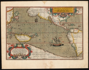
Maris Pacifici (quod vulgo Mar del Zur).
$17,500.00
Acquire
- Digital Map Information
- Suitable for large format printing
- Full resolution TIFF file
- ICC color profile embedded
- Delivered instantly via download link
This is Abraham Ortelius' 1589 map of the Pacific; here is the best example to appear on the market in recent years, with a strong strike and fine original color. Abraham Ortelius' map is as important as it is beautiful - Burden hailed it as 'one of the most important maps that appeared in the Ortelius atlases' and 'one of Ortelius' most desirable maps'. The map is not only the first to focus on the Pacific Ocean, but it is also the first acquirable map to separately identify North and South America. (more details)
Ground Zero of the Thirty Years' War.
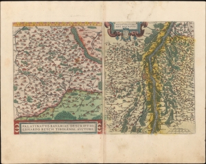
Palatinus Bavariae Descriptio / Argentoratensis Agri Descriptio.
$250.00
Acquire
- Digital Map Information
- Suitable for large format printing
- Full resolution TIFF file
- ICC color profile embedded
- Delivered instantly via download link
A fine example in stunning original color of Abraham Ortelius' maps of the Upper Palatinate region of Bavaria, and a portion of the Rhine River to the west, including Strasbourg. Presenting two maps on one sheet, this page appeared in the 1595 edition of the Theatrum Orbis Terrarum. (more details)
Between the Loire and Massif Central.
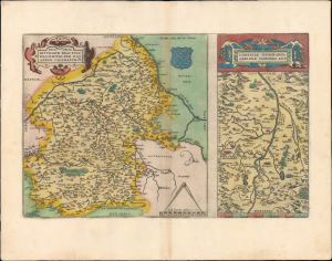
Regionis Biturgium... / Limaniae Topographia...
$200.00
Acquire
- Digital Map Information
- Suitable for large format printing
- Full resolution TIFF file
- ICC color profile embedded
- Delivered instantly via download link
This is a lovely, old-color 1595 Abraham Ortelius map of the historic regions of Berry and Limagne (in Auvergne) in central France. Around the time this map was produced, these regions, like much of Europe, were caught between opposing forces in the Wars of Religion. (more details)
Ortelius' Map of His Home Region.
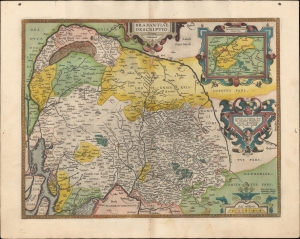
Brabantiae Descriptio.
$800.00
Acquire
- Digital Map Information
- Suitable for large format printing
- Full resolution TIFF file
- ICC color profile embedded
- Delivered instantly via download link
A beautiful original color example of Abraham Ortelius' 1595 map of Brabant, his home region, which contains the cities of Brussels and Antwerp. It appeared in his magisterial Theatrum Orbis Terrarum, the first modern atlas, first printed in Antwerp 1570. (more details)
Era of Declining Fortunes.
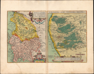
Braunsuicensis et Luneburgensis Ducatuum Vera Delineat. / Norimberg. Agri, Fidissima Descrip.
$300.00
Acquire
- Digital Map Information
- Suitable for large format printing
- Full resolution TIFF file
- ICC color profile embedded
- Delivered instantly via download link
This is a striking old-color example of Abraham Ortelius' 1595 maps of the Duchy of Braunschweig and Lüneburg, along with the city of Nürnberg and its environs. Both areas are captured near the height of their economic and cultural influence, but on the cusp of a rapid decline brought about by warfare and economic changes. (more details)
Between the great powers.
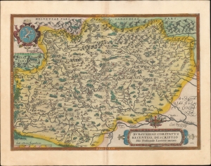
Burgundiae Comitatus Recentiss Descriptio Dño Ferdinando Lannoyo auctore.
$500.00
Acquire
- Digital Map Information
- Suitable for large format printing
- Full resolution TIFF file
- ICC color profile embedded
- Delivered instantly via download link
A beautiful example, in superb original color, of Abraham Ortelius' 1579 map of Burgundy. It conforms to the eastern part of modern-day Bourgogne-Franche-Comté. It is the first of four maps Ortelius produced of Burgundy, one of the world's most famous wine-producing regions. (more details)
Birthplace of the the Reformation.
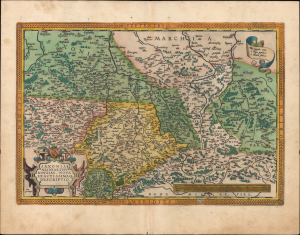
Saxoniae, Misniae, Thuringiae, Nova Exactissimaque Descriptio.
$300.00
Acquire
- Digital Map Information
- Suitable for large format printing
- Full resolution TIFF file
- ICC color profile embedded
- Delivered instantly via download link
This is an old-color 1595 map of large portions of what is now central Germany and Czechia, including Saxony, Thuringia, and Brandenburg, that appeared in Abraham Ortelius' Theatrum Orbis Terrarum. This region was the birthplace of Lutheranism and, by extension, the Protestant Reformation, being the stage upon which many of the key early events of the Reformation took place. (more details)
Germany's Outlet to the North Sea.
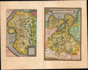
Thietmarsiae, Holsaticae Regionis Partis Typus. / Oldenburg Comit.
$350.00
Acquire
- Digital Map Information
- Suitable for large format printing
- Full resolution TIFF file
- ICC color profile embedded
- Delivered instantly via download link
This is an old-color sheet containing maps of Dithmarschen and Oldenburg, in today's Germany, that appeared in the 1595 edition of Abraham Ortelius' Theatrum Orbis Terrarum. These regions were geographically close but culturally and politically distinct, with Dithmarschen having been recently conquered after generations of autonomy as a peasant republic, while Oldenburg was deeply embroiled in the complex political and military machinations of the Holy Roman Empire. (more details)
One of Medieval Europe's Great Knowledge Centers.
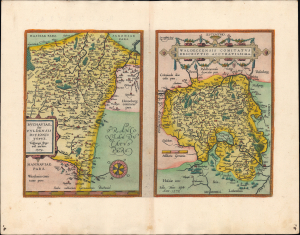
Buchaviae, sive Fuldensis Ditionis Typus / Waldeccensis Comitatus Descriptio Accuratissima.
$275.00
Acquire
- Digital Map Information
- Suitable for large format printing
- Full resolution TIFF file
- ICC color profile embedded
- Delivered instantly via download link
This is a striking old-color example of Abraham Ortelius' 1595 maps of Fulda (or Buchavia) and Waldeck, central Germany. These regions, known today for their picturesque spa towns, were an important center for the Church in the Middle Ages and later an early bastion for Lutheranism during the early Reformation. (more details)
Ons Gelderland.
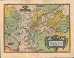
Gelriae, Cliviae, Finitimorumque Locorum Verissima Descriptio.
$450.00
Acquire
- Digital Map Information
- Suitable for large format printing
- Full resolution TIFF file
- ICC color profile embedded
- Delivered instantly via download link
A very fine old color example of Abraham Ortelius' 1595 map of Gelderland (also known as Geulders, or as Geldria or Gelriae in Latin) in the central part of the Netherlands. (more details)
Catholic Stronghold of the Netherlands.
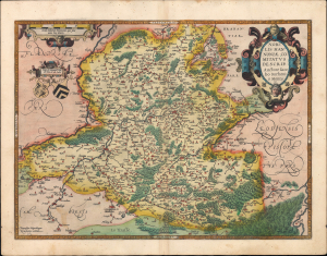
Nobilis Hannoniae Comitatus Descrip.
$275.00
Acquire
- Digital Map Information
- Suitable for large format printing
- Full resolution TIFF file
- ICC color profile embedded
- Delivered instantly via download link
This is a striking old-color example of Abraham Ortelius' 1595 map of the County of Hainaut, the westernmost part of Wallonia in today's Belgium and the eastern part of the present-day French département du Nord. Although exasperated by the tactics employed by the Habsburgs (joining the 1576 Pacification of Ghent, for instance), Hainaut was among the most faithfully Catholic parts of the Netherlands and became a stronghold for the Habsburgs during the Eighty Years' War. (more details)
Historically contested Lorraine.
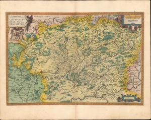
Lorraine Lotharingiae Nova Descriptio.
$350.00
Acquire
- Digital Map Information
- Suitable for large format printing
- Full resolution TIFF file
- ICC color profile embedded
- Delivered instantly via download link
This is a beautiful, original-color example of Abraham Ortelius' 1595 map of the Lorraine region from his Theatrum Orbis Terrarum. (more details)
Divergent Experiences of the 16th Century.
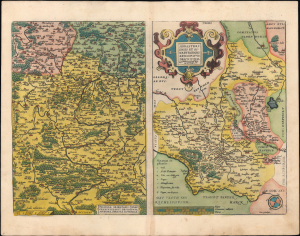
Franciae Orientalis (Vulgo Frankenlant) Descriptio. / Monasteriensis et Osnaburgensis Episcopatus Descriptio.
$250.00
Acquire
- Digital Map Information
- Suitable for large format printing
- Full resolution TIFF file
- ICC color profile embedded
- Delivered instantly via download link
This sheet from the 1595 edition of Abraham Ortelius' Theatrum Orbis Terrarum contains two old-color maps of areas in today's western Germany: the Main River Valley in Bavaria and the historic episcopates of Münster and Osnabrück in Westphalia. Though both in western Germany today, the two regions experienced the turbulent wars and religious struggles of the era very differently. (more details)
Stronghold of Lutheranism.
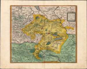
Mansfeldiae Comitatus Descriptio.
$250.00
Acquire
- Digital Map Information
- Suitable for large format printing
- Full resolution TIFF file
- ICC color profile embedded
- Delivered instantly via download link
This is an old-color 1595 map of the town of Mansfeld in central Germany and its environs, published in Abraham Ortelius' Theatrum Orbis Terrarum. It depicts the region after the early decades of the Protestant Reformation and the establishment of Lutheranism, whose founding figure was born and raised here. (more details)
Vivid Maps of the Veneto.
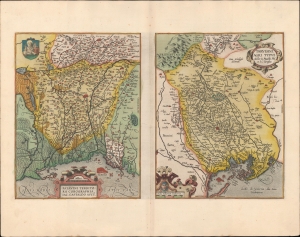
Patavini Territoriorii... / Tarvisini Agri Typus...
$350.00
Acquire
- Digital Map Information
- Suitable for large format printing
- Full resolution TIFF file
- ICC color profile embedded
- Delivered instantly via download link
A very fine original color example of Abraham Ortelius' 1595 maps of Padua (Padova) and Treviso, both part of the Republic of Venice at the time, which appeared in the Latin edition of his Theatrum Orbis Terrarum, the first modern atlas. (more details)
Riviera di Genoa.
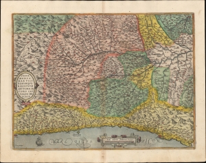
Pedemonta nae Vici Norumque Regionum Auctore Iacabo Castaldo descrip.
$500.00
Acquire
- Digital Map Information
- Suitable for large format printing
- Full resolution TIFF file
- ICC color profile embedded
- Delivered instantly via download link
A beautiful example, in superb original color, of Abraham Ortelius' 1581 map of Piedmont, Italy. Today, this corresponds to the Italian Riviera ('Riviera di Genoa'): Monaco, parts of France, coastal Liguria, and Piedmont. Based on the 1556 cartography of Giacomo Gastaldi, it is considered among the most geographically accurate of Ortelius's regional maps. (more details)
Troublemakers to the Holy Roman Emperors.
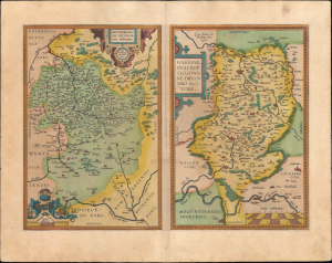
Hennebergensis Ditionis vera delineatio / Hassiae Descriptio.
$250.00
Acquire
- Digital Map Information
- Suitable for large format printing
- Full resolution TIFF file
- ICC color profile embedded
- Delivered instantly via download link
This is a fine old-color example of Abraham Ortelius' 1595 maps of the German regions of Henneberg and environs in Thuringia and Hesse that appeared in his Theatrum Orbis Terrarum. The maps capture these regions in the aftermath of a series of religious and military conflicts that defined the course of the Holy Roman Empire, resulting eventually in a grudging religious toleration between Catholics and Protestants. (more details)
Hotbed of Religious Radicalism.
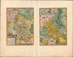
Turingiae Noviss. Descript. / Misniae et Lustaiae Tabula.
$200.00
Acquire
- Digital Map Information
- Suitable for large format printing
- Full resolution TIFF file
- ICC color profile embedded
- Delivered instantly via download link
This is a fine example of Abraham Ortelius' 1595 two-map sheet covering Thuringia and the historical regions of Misniae, centered on Meissen and Leipzig, that appeared in his Theatrum Orbis Terrarum. At this time, these regions were best known for their mines, universities, and importance for the emergence of Lutheranism and even more radical branches of Protestantism. (more details)
Borderlands of Italy, Austria, Croatia, and Slovenia.
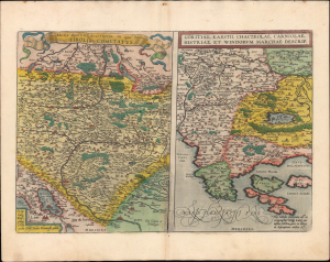
Rhetiae alpestris descriptio, in qua hodie Tirolis Comitatus. / Goritiae. Karstii, Chaczeolae, Carniolae, Histriae, et Windorum Marchae Descrip.
$275.00
Acquire
- Digital Map Information
- Suitable for large format printing
- Full resolution TIFF file
- ICC color profile embedded
- Delivered instantly via download link
This is an old-color 1595 Abraham Ortelius engraving from the Theatrum Orbis Terrarum featuring two Wolfgang Lazius maps: Tyrol in southern Austria and northern Italy, and the modern-day border regions of Slovenia, Italy, and Croatia. Although the maps are not contiguous, they all represent contemporary maps of western strongholds at Italy's frontiers with Austria and Croatia. (more details)
War Zone of the Holy Roman Empire.
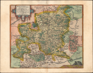
Wirtenberg Ducatus.
$325.00
Acquire
- Digital Map Information
- Suitable for large format printing
- Full resolution TIFF file
- ICC color profile embedded
- Delivered instantly via download link
This is an old color example of Abraham Ortelius' map of the Duchy of Württemberg, which appeared in the 1595 Latin edition of his Theatrum Orbis Terrarum. At this time, Württemberg was in the midst of decades of warfare, which predated but were exacerbated by the Wars of Religion. (more details)
Elegant Woodcut Map of Africa.
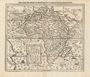
Affricae Tabula Nova. / Africa, Lybia, Morenlandt, mit allen Koenigreichen, so jetziger zeit darumb gefunden werden.
$950.00
Acquire
- Digital Map Information
- Suitable for large format printing
- DPI: 600
- File Size: 31.5 MB
- File Type: ZIP / TIFF
- ICC color profile embedded
- Delivered instantly via download link
This is the second map of Africa to appear in Sebastian Münster's Cosmographia, added to the work in 1588. This beautiful woodcut is cartographically derived from Abraham Ortelius' 1570 map of the continent, the best and most widespread general map of Africa of the 16th century. (more details)
Crete and the Greek Islands, as known to the Ancients.
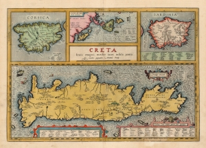
Creta Jovis magni medio iacet insula ponto.
$1,200.00
Acquire
- Digital Map Information
- Suitable for large format printing
- Full resolution TIFF file
- ICC color profile embedded
- Delivered instantly via download link
This is Abraham Ortelius' 1603 map of Crete and other Mediterranean islands as they were understood in antiquity and Greek mythology. The engraving is comprised of four separate maps of Corsica, Sardinia, the Ionian Islands, with Crete dominating all. The present example was published by Vrients, Ortelius' executor. The coloration of the atlases published by Vrients was unusually fine, so original color examples of Ortelius' maps of these editions are particularly desirable. (more details)
First Atlas Map specifically of Cyprus.
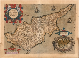
Cypri Insulae Nova Descript. 1573.
$900.00
Acquire
- Digital Map Information
- Suitable for large format printing
- Full resolution TIFF file
- ICC color profile embedded
- Delivered instantly via download link
This is a beautiful, original color example of Ortelius' 1573 map of Cyprus, combined with an inset map of Lemnos. Moreover, this is a Vrients edition of the map: maps from these editions typically exhibit finer quality color than those printed during Ortelius' lifetime and are consequently very desirable. (more details)
First Hondius Edition.
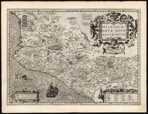
Hispaniae Novae Nova Descriptio.
$750.00
Acquire
- Digital Map Information
- Suitable for large format printing
- DPI: 600
- File Size: 54.48 MB
- File Type: ZIP / TIFF
- ICC color profile embedded
- Delivered instantly via download link
This is a superb, 1606 first edition example of Jodocus Hondius' map of New Spain. It was among the first maps Hondius produced to add to Gerard Mercator's Atlas, which Hondius acquired and contined to publish. Hondius' map is a faithful copy of the 1579 Ortelius map, which was authoritative enough to dominate the mapping of Mexico for more than a century. Hondius' strapwork cartouches reflect the Ortelius as well, but his engraving overall is superior, particularly his characteristic and evocative execution of water areas. Hondius' lettering, too, is more orderly and legible than was Ortelius'. (more details)
The Mythical Kingdom of Prester John, in a Superb Example with a Bold Strike.
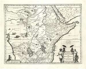
Aethiopia Superior vel Interior vulgo Abissinorum sive Presbiteri Joannis Imperium.
$950.00
Acquire
- Digital Map Information
- Suitable for large format printing
- DPI: 600
- File Size: 21.51 MB
- File Type: ZIP / TIFF
- ICC color profile embedded
- Delivered instantly via download link
This is the map of the mythical Kingdom of Prester John in eastern Africa, issued by Willem Blaeu in 1635, in a beautiful example. The map covers from the Bight of Benin to the Indian Ocean and from Arabia and the Red Sea to Mozambique. It includes two decorative cartouches, as well as stylized images of African fauna, including elephants, monkeys, and ostriches. While the African coast exhibits considerable advances over earlier maps of the region, the interior of Africa exhibits a cartography primarily based on the literature of antiquity and little changed from the days of Ptolemy, and its primary subject matter is that of legend. (more details)
Classic Dutch Map of Prussia.
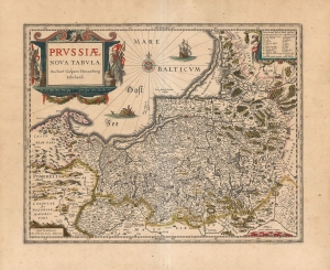
Prussiae Nova Tabula Auctore Gasparo Henneberg Erlichensi.
$650.00
Acquire
- Digital Map Information
- Suitable for large format printing
- DPI: 600
- File Size: 63.08 MB
- File Type: ZIP / TIFF
- ICC color profile embedded
- Delivered instantly via download link
A beautiful, original-color example of Willem Blaeu's map of Prussia, among the maps first added to the Appendix in 1630. It depicts the region now comprised of northern Poland (as far south as Toruń on the Vistula River), the Russian province of Kaliningrad, and western Lithuania. Detail spans from just west of Gdansk to Augustów in the east. The northeast limits of the map are marked with the region of Samogitia, and the Lithuanian coastal town of Palanga. (more details)
Humorous yet puzzling cartouche.
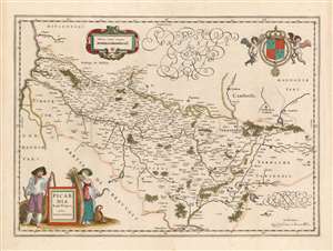
Picardia Regio Belgica, Auctore Ioanne Surhonio.
$300.00
Acquire
- Digital Map Information
- Suitable for large format printing
- DPI: 600
- File Size: 20.02 MB
- File Type: ZIP / TIFF
- ICC color profile embedded
- Delivered instantly via download link
This is Willem Blaeu's map of Picardy, easily the most entertaining map ever produced of this region of northern France. The map focuses on the Somme River valley. Amiens, St. Quentin, and La Fere are given particular emphasis. Putti bear a superb coat of arms with Fleurs-de-lis aloft in the upper right, and the scales are presented in a strapwork frame. (more details)
France during the Roman Era.
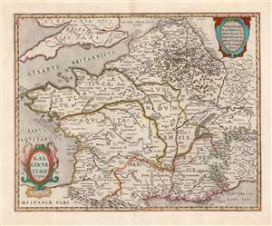
Galliae Veteris Typus.
$650.00
Acquire
- Digital Map Information
- Suitable for large format printing
- Full resolution TIFF file
- ICC color profile embedded
- Delivered instantly via download link
This is a beautiful example of Jan Jansson's map of France, known as Gaul during the Roman era. It is derived from Abraham Ortelius' map of the same title. The map thus combines the late sixteenth century mapping of France's physical geography with classical toponymy, drawn from the first century writing of the historian Strabo, supplemented by the work of Pliny, Virgil, Caesar, and others. Ortelius, a historian as well as a mapmaker, had included the map in his Parergon, the historical supplement to his Theatrum Orbis Terrarum. Jansson, with an eye for quality, was faithful to his source, including not only the place names but Ortelius' copious historical notations. (more details)
Scarce Miniature Africa.
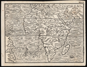
[Untitled map of Africa].
$500.00
Acquire
- Digital Map Information
- Suitable for large format printing
- DPI: 600
- File Size: 6.22 MB
- File Type: ZIP / TIFF
- ICC color profile embedded
- Delivered instantly via download link
This attractive woodcut map of Africa was executed by Giuseppe Moretti for inclusion in the 1688 edition of Giuseppe Rosaccio's Teatro del Mondo. It is an entertaining composition, embellished with a sea monster in the Atlantic and a sailing ship entering the Indian Ocean. The appearance of a woodcut map in this period is itself unusual, especially coming from Italy. Venetian and Roman mapmakers had been working on copperplate well before that technology had passed to Antwerp and Amsterdam. (more details)