
Rare triangulation chart of Southern Florida and the Keys.

Sketch F Showing the Progress of the Survey in Section No. VI (Lower Sheet) From Cape Florida to Tortugas Islands from 1845 to 1860.
sold
- Digital Map Information
- Suitable for large format printing
- File Size: 10.61 MB
- File Type: ZIP / TIFF
- ICC color profile embedded
- Delivered instantly via download link
A very attractive example of the 1860 U.S. Coast Survey triangulation chart or map of southern Florida and the Florida Keys. Covers from Key Biscayne Bay south along the Keys, past Key West, as far as the Marquesas Keys. Countless triangulation points are noted ... (more details)
Beautifully detailed chart showing the triangulation of the coast of Georgia and South Carolina.

Sketch E Showing the Progress of the Survey in Section No. V from 1847 to 1860.
sold
- Digital Map Information
- Suitable for large format printing
- File Size: 17.88 MB
- File Type: ZIP / TIFF
- ICC color profile embedded
- Delivered instantly via download link
This is an appealing 1860 U.S. Coast Survey triangulation chart or map of the Georgia and South Carolina coastline from Cumberland Island to Bald Head Island in North Carolina. E essentially three maps on a single sheet, the top map features a triangulation of ... (more details)
Nautical Chart of Martha's Vineyard, Massachusetts.
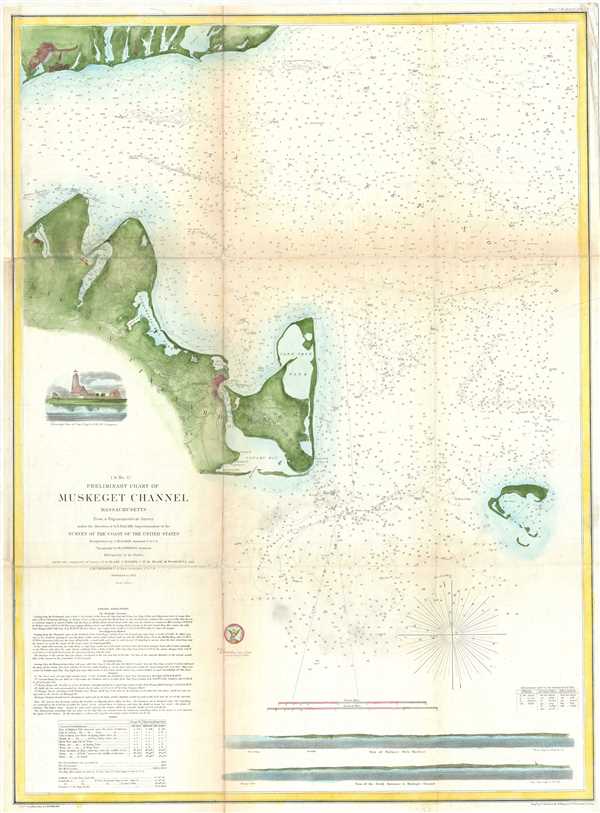
(A No. 5) Preliminary Chart of Muskeget Channel Massachusetts.
sold
- Digital Map Information
- Suitable for large format printing
- File Size: 11.95 MB
- File Type: ZIP / TIFF
- ICC color profile embedded
- Delivered instantly via download link
One of the better mid 19th century large format maps of Martha's Vineyard by the U.S. Coast Survey. This rare map depicts most of the island of Martha’s Vineyard though does cut out its southwestern portion. The western extension of Nantucket appears in the ... (more details)
Coast Survey chart of Florida's Cedar Keys following the Seminole Wars.

Cedar Keys Florida.
sold
- Digital Map Information
- Suitable for large format printing
- File Size: 12.76 MB
- File Type: ZIP / TIFF
- ICC color profile embedded
- Delivered instantly via download link
This is an important 1861 U.S. Coast Survey mapping of the Cedar Keys, Florida. The map includes numerous depth soundings, coastal features and beautiful inland topography. The chart also includes information on light stations, tides, soundings, sailing ... (more details)
Triangulation chart of the North Carolina and Virginia coastline.

Sketch D Showing the progress of Section IV 1845 to 1851.
sold
- Digital Map Information
- Suitable for large format printing
- DPI: 300
- File Size: 10.86 MB
- File Type: ZIP / TIFF
- ICC color profile embedded
- Delivered instantly via download link
This is an exceptional example of the 1851 U.S. Coast Survey's progress chart for the coasts of Virginia and North Carolina. Covers from Cape Henry, Virginia, south past the Pamlico Sound and Cape Hatteras, to Cape Fear. It was here, looking over the ... (more details)
Coast Survey chart of Ponce de Leon Inlet in Florida - formerly known as Mosquito Inlet.

Sketch F. No. 3 Reconnoissance of Mosquito Inlet Coast of Florida.
sold
- Digital Map Information
- Suitable for large format printing
- DPI: 300
- File Size: 1.38 MB
- File Type: ZIP / TIFF
- ICC color profile embedded
- Delivered instantly via download link
This is a beautiful example of the 1851 U.S. Coast Survey chart of the Mosquito Bay or Ponce de Leon, Florida. It covers the Ponce de Leon Inlet, a natural opening in central Florida connecting the south end of the Halifax River and the northern end ... (more details)
Coast Survey chart of Florida's Cedar Keys following the Seminole Wars.

Sketch F. No. 4 Reconnoissance of Vicinity of Cedar Keys Coast of Florida.
sold
- Digital Map Information
- Suitable for large format printing
- DPI: 300
- File Size: 1.43 MB
- File Type: ZIP / TIFF
- ICC color profile embedded
- Delivered instantly via download link
This is an important 1851 U.S. Coast Survey mapping of Cedar Keys and vicinity, Florida. The map extends from Suwannee Bay south to St. Martin’s Keys and includes numerous depth soundings, coastal features as well as several triangulation points. ... (more details)
Beautiful nautical chart detailing part of the San Francisco Bay Area.

Sketch J No. 2 Mare Island Strait California.
sold
- Digital Map Information
- Suitable for large format printing
- DPI: 300
- File Size: 2.39 MB
- File Type: ZIP / TIFF
- ICC color profile embedded
- Delivered instantly via download link
This is a lovely example of the 1851 U.S. Coast Survey chart or map of the Mare Island Straits, California. The map covers part of the San Francisco Bay area including Mare Island, Straits of Karquines and parts of Vallejo. Vallejo, which served ... (more details)
Chart noting the proposed site of the Point Conception Light on the southwestern coast near Santa Barbara, California.

Sketch J No. 3 Point Conception Coast of California.
sold
- Digital Map Information
- Suitable for large format printing
- DPI: 300
- File Size: 1.76 MB
- File Type: ZIP / TIFF
- ICC color profile embedded
- Delivered instantly via download link
This is a nice example of the 1851 U.S. Coast Survey chart or map of Point Conception on the California Coast, where the Santa Barbara Channel meets the Pacific Ocean. The map is beautifully detailed some inland features noted, including the ... (more details)
Coast Survey chart indicating the site for the famous Point Pinos Light - oldest continuously operating lighthouse on the West Coast of the United States.

Sketch J. NO. 4 Indicating proposed Sites for a Light-House on Point Pinos Bay of Monterey.
sold
- Digital Map Information
- Suitable for large format printing
- DPI: 300
- File Size: 1.42 MB
- File Type: ZIP / TIFF
- ICC color profile embedded
- Delivered instantly via download link
This is a beautiful 1851 U.S. Coast Survey map or chart of Monterey Bay and Point Pinos in California. Essentially two maps on a single page, the right hand side map was created from surveys made in 1847 and depicts Monterey Bay from Pt. ... (more details)
Coast Survey chart of Trinidad Bay, gateway to the California Coastal National Monument.

J. No. 5 Reconnaissance of Trinidad Bay California.
sold
- Digital Map Information
- Suitable for large format printing
- DPI: 300
- File Size: 2.3 MB
- File Type: ZIP / TIFF
- ICC color profile embedded
- Delivered instantly via download link
This is a nice example of the 1851 U.S. Coast Survey chart or map of Trinidad Bay, California. Centers on Trinidad Head and includes details noting Trinidad City, including a street grid. A beautiful elevation profile and view of Trinidad ... (more details)
Chart showing the coastal survey of Savannah River, Georgia.

Sketch E No. 4 Savannah River Reconnaissance of the Approaches to the City of Savannah Including Front and Back Rivers.
sold
- Digital Map Information
- Suitable for large format printing
- DPI: 300
- File Size: 3.47 MB
- File Type: ZIP / TIFF
- ICC color profile embedded
- Delivered instantly via download link
This is a beautiful example of the 1851 U.S. Coast Survey chart or map of the Savannah River, Georgia. Centered on Hutchinson’s Island and the city of Savannah, this map follows the course river from Argyle Island to Elba Island. The ... (more details)
Triangulation chart of part of South Carolina's coast.
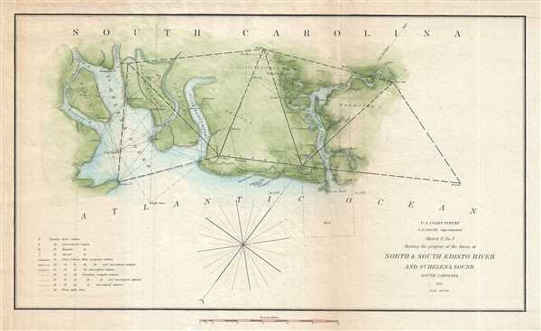
Sketch E No. 3 North and South Edisto River and St. Helena Sound South Carolina.
sold
- Digital Map Information
- Suitable for large format printing
- DPI: 300
- File Size: 2.47 MB
- File Type: ZIP / TIFF
- ICC color profile embedded
- Delivered instantly via download link
This is an attractive 1851 U.S. Coast Survey triangulation chart of the Coast of South Carolina between St. Helena's Sound and North Edisto River. Focuses on the inlets and waterways on Morgan’s Island, Hutchinson’s Island, ... (more details)
Nautical chart depicting the entrance of the Savannah River, Georgia.
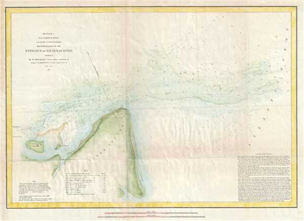
Sketch E No. 5 Reconnaissance of the Entrance of Savannah River Georgia.
sold
- Digital Map Information
- Suitable for large format printing
- DPI: 300
- File Size: 4.48 MB
- File Type: ZIP / TIFF
- ICC color profile embedded
- Delivered instantly via download link
This is a lovely 1851 U.S. Coast Survey map or nautical chart of the entrance of Savannah River in Georgia. Includes Cockspur Island and Tybee Island. Fort Pulaski, Tybee Beacon and the Tybee Lighthouse are identified. The ... (more details)
Nautical chart of the Mississippi River Delta.
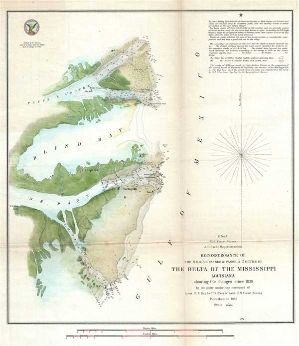
H No. 8 Reconnoissance of the N.E. and S.E. Passes and Passe A l'Outre of The Delta of the Mississippi Louisiana.
sold
- Digital Map Information
- Suitable for large format printing
- DPI: 300
- File Size: 4.29 MB
- File Type: ZIP / TIFF
- ICC color profile embedded
- Delivered instantly via download link
An attractive hand colored 1851 U.S. Coast Survey nautical chart or map of the Mississippi Delta. The map shows Passe A L’Outre, Blind Pay and North East Pass. Shows the locations of lighthouses, shoals, Drift Trees, ... (more details)
Beautiful nautical chart of Humboldt Bay on the northern coast of California.
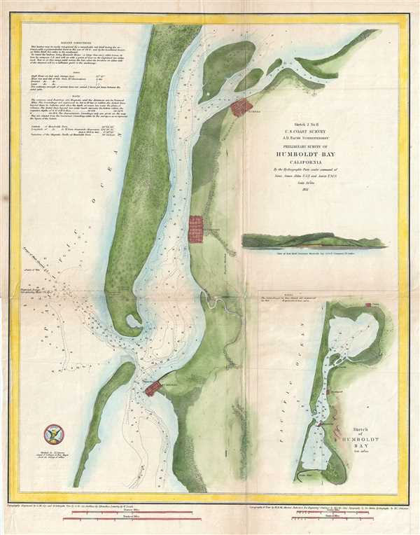
Sketch J No. 8 Preliminary Survey of Humboldt Bay California.
sold
- Digital Map Information
- Suitable for large format printing
- DPI: 300
- File Size: 6.34 MB
- File Type: ZIP / TIFF
- ICC color profile embedded
- Delivered instantly via download link
This is an attractive 1851 coastal map or nautical chart of Humboldt Bay, California by the U.S. Coast Survey. It covers from Indian Island and Samoa south to Fields Landing. The cities of Eureka, Humboldt and Bucksport ... (more details)
Early Coast Survey chart of San Diego Bay.

J No. 7 San Diego Entrance and Approaches California. General Sketch of San Diego Bay and Los Coronados.
sold
- Digital Map Information
- Suitable for large format printing
- DPI: 300
- File Size: 3.69 MB
- File Type: ZIP / TIFF
- ICC color profile embedded
- Delivered instantly via download link
This is a lovely 1851 U.S. Coast Survey chart or map of San Diego Bay. It features essentially two maps in one chart separated by a compass rose. The first map shows San Diego bay and Harbor just south of the city of ... (more details)
Coast Survey chart of the Florida Peninsula.

Sketch F Showing the Progress of the Survey in Section VI. With a General Reconnaissance of the Western Coast of Florida 1848-51.
sold
- Digital Map Information
- Suitable for large format printing
- DPI: 300
- File Size: 6.76 MB
- File Type: ZIP / TIFF
- ICC color profile embedded
- Delivered instantly via download link
A beautiful costal chart of Florida by the U. S. Coast Survey, 1851. Depicts the whole of the Florida peninsula, but specifically details the western coastline, showing all bays and harbors, as well as an accurate ... (more details)
Triangulation chart of Florida's northwest coast.
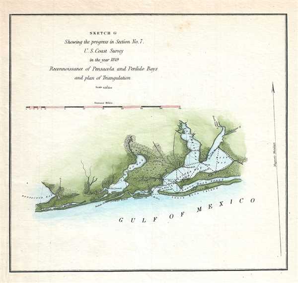
Sketch C Showing the progress in Section No. 7. Reconnoissance of Pensacola and Perdido Bays and plan of Triangulation.
sold
- Digital Map Information
- Suitable for large format printing
- DPI: 300
- File Size: 1.14 MB
- File Type: ZIP / TIFF
- ICC color profile embedded
- Delivered instantly via download link
A lovely example of the 1849 U.S. Coast Survey progress and triangulation chart or map of the Gulf Coast of northwest Florida from Pensacola Bay and Santa Rosa Sound west to Bon Secour Bay in Alabama. Includes ... (more details)
One of the finest large format American maps of Ohio obtainable.

Map of the State of Ohio Drawn by A. Bourne. Including the Indian Reservation, Purchased and laid out Counties and Townships in 1820.
sold
- Digital Map Information
- Suitable for large format printing
- Full resolution TIFF file
- ICC color profile embedded
- Delivered instantly via download link
One of the earliest obtainable specific large format maps of Ohio from the early part of the 19th century. This 1820 map of Ohio was engraved by Abner Reed and published by Caleb Atwater in his Description of ... (more details)