
Ming cartographic heritage.

大明一統二京十三省図 / Great Ming Unification Two Capitals and Thirteen Provinces Map / Da Ming Yi Yong Er Jing Shi San Shen Tu
sold
- Digital Map Information
- Suitable for large format printing
- Full resolution TIFF file
- ICC color profile embedded
- Delivered instantly via download link
This previously unknown 1769 Chinese-language manuscript map of Ming China and Korea is among the most important East Asian cartographic discoveries to emerge in recent years. Monumental in scale and exceptionally detailed, it preserves official Ming Dynasty geographic knowledge long thought lost, likely produced in Tokugawa Japan by descendants of Chinese scholars who fled the fall of the Ming Dynasty in 1644. Rich with elegant calligraphy, extensive topographical and political detail, and numerous textual annotations, the map offers an unparalleled window into the geography, historical memory, and intellectual traditions of the Ming loyalist diaspora. As a unique manuscript with no known counterpart, it represents a once-in-a-lifetime opportunity to acquire an extraordinary artifact of Chinese cartography, Sino-Japanese cultural exchange, and the enduring legacy of the Great Ming. (more details)

Boston.
sold
- Digital Map Information
- Suitable for large format printing
- DPI: 300
- File Size: 3.41 MB
- File Type: ZIP / TIFF
- ICC color profile embedded
- Delivered instantly via download link
A beautiful example of John Tallis and John Rapkin's 1851 decorative map of Boston, Massachusetts. The map covers downtown Boston prior to the Back Bay landfill projects, extending from Dover Street to the Charles River. Parts of adjacent South Boston, Cambridge, ... (more details)
World War II battle plan with Japanese annotations relating to the December 1941 Invasion of the Philippines.

ィフッリピン諸島 / Philippine Islands / Firipin shotō.
sold
- Digital Map Information
- Suitable for large format printing
- File Size: 10.91 MB
- File Type: ZIP / TIFF
- ICC color profile embedded
- Delivered instantly via download link
A remarkable discovery, this is an original 1941 World War II (WWII) Japanese battle plan, with original manuscript annotations, relating to the December 1941 invasion of the Philippines. The map describes the strategy for capturing the Philippine Islands as ... (more details)
Uncommmon World War II Pictorial Map of Singapore Island.
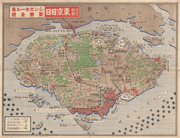
写真特報, 東京日日, シンガポール島, 要塞全貌 / Tokyo Daily Photo Dispatch - Singapore Island Fortress, Full Picture / Shashin tokuhō, Tōkyō nichinichi, shingapōru shima, yōsai zenbō.
sold
- Digital Map Information
- Suitable for large format printing
- File Size: 27.26 MB
- File Type: ZIP / TIFF
- ICC color profile embedded
- Delivered instantly via download link
A remarkable 1942 World War II (WWII) era map of Singapore Island issued by the Japanese newspaper Tokyo Nichi Nichi Shimbun . The map details the island of Singapore with a focus on resources and fortifications. Airfields, naval bases, artillery ... (more details)
Highly decorative pictorial map of the United States.
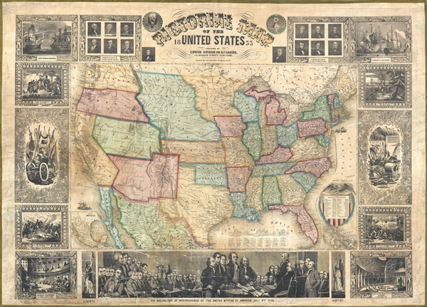
Pictorial Map of the United States.
sold
- Digital Map Information
- Suitable for large format printing
- Full resolution TIFF file
- ICC color profile embedded
- Delivered instantly via download link
An appealing and decorative 1855 wall map of the United States. Issued by ensign, Bridgman & Fanning, this map was drawn and engraved by J.M. Atwood and covers the entire United States from Atlantic to Pacific and from Canada to the Gulf of ... (more details)
Johnson's map of Washington and Oregon predating the formation of the Idaho Territory.

Johnson's Washington and Oregon.
sold
- Digital Map Information
- Suitable for large format printing
- File Size: 7.92 MB
- File Type: ZIP / TIFF
- ICC color profile embedded
- Delivered instantly via download link
A beautiful example of Johnson and Ward's 1863 map of Washington and Oregon. This rare map offers a fascinating snapshot of this region shortly following the outbreak of the American Civil War. Shows the state of Oregon with much of its eastern ... (more details)
Johnson and Ward's beautiful map of Mexico and parts of Texas.

Johnson's Mexico.
sold
- Digital Map Information
- Suitable for large format printing
- File Size: 8.42 MB
- File Type: ZIP / TIFF
- ICC color profile embedded
- Delivered instantly via download link
An excellent 1863 example of Johnson and Ward's map of Mexico and Texas. Like most of Johnson's maps, this map was derived from an earlier map by J. H. Colton issued in 1855. Covers all of modern day Mexico as well as most of Texas, Guatemala, ... (more details)
Beautiful map of Cuba from the mid-19th century.

Johnson's Cuba Jamaica and Porto Rico.
sold
- Digital Map Information
- Suitable for large format printing
- File Size: 8.75 MB
- File Type: ZIP / TIFF
- ICC color profile embedded
- Delivered instantly via download link
This is a beautiful example of Johnson and Ward's 1863 map of Cuba, Jamaica, the Bahamas and Puerto Rico. Also shows part of the Florida Keys. The map offers superb detail of the entire region including roadways, cities, provinces, and ... (more details)
Johnson's map predating the Italian solidarity movement..
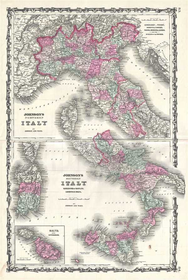
Johnson's Northern Italy. Johnson's Southern Italy Kingdom of Naples, I. Sardinia and Malta.
sold
- Digital Map Information
- Suitable for large format printing
- File Size: 15.81 MB
- File Type: ZIP / TIFF
- ICC color profile embedded
- Delivered instantly via download link
This is a marvelous 1863 map of Italy by the American cartographic publisher A. J. Johnson. It divides the region into Northern and Southern parts according to the geographical and political distinctions in 1863, when the Italian ... (more details)
Johnson's early edition map of Africa.

Johnson's Africa.
sold
- Digital Map Information
- Suitable for large format printing
- File Size: 15.55 MB
- File Type: ZIP / TIFF
- ICC color profile embedded
- Delivered instantly via download link
An extraordinary and attractive example of Johnson's 1863 map of Africa. This rare map appeared only in the earliest editions of Johnson's Atlas. Includes all of Africa as well as adjacent parts of Europe and Asia. This ... (more details)
Beautiful map of Russia.

Russia.
sold
- Digital Map Information
- Suitable for large format printing
- File Size: 8.85 MB
- File Type: ZIP / TIFF
- ICC color profile embedded
- Delivered instantly via download link
An excellent 1855 first edition example of Colton's map of Russia. Like most of Colton's Russia maps, this map was derived from an earlier wall map of the world produced by Colton and D. Griffing Johnson. Depicts the ... (more details)
Map of the Roman Empire with ancient place names.

Johnson's Roman Empire, Imperium Romanorum Latissime Patens.
sold
- Digital Map Information
- Suitable for large format printing
- File Size: 12.39 MB
- File Type: ZIP / TIFF
- ICC color profile embedded
- Delivered instantly via download link
This is Johnson and Ward's 1863 map of the Roman Empire. The map shows the extent of the Empire at its height, and covers most of Europe, the Middle East, Persia and parts of North Africa. The Roman Empire was ... (more details)
Map of Scandinavia and Prussia with view of Stockholm.

Johnson's Prussia Norway Sweden and Denmark.
sold
- Digital Map Information
- Suitable for large format printing
- File Size: 21.23 MB
- File Type: ZIP / TIFF
- ICC color profile embedded
- Delivered instantly via download link
This is a beautiful example of Johnson and Ward’s 1865 map of Scandinavia and Prussia. It depicts all of Sweden, Norway, Finland, Denmark and Prussia, as well as parts of Estonia, Latvia and Lithuania. There ... (more details)
Johnson's large folio map of Ohio.

Johnson's Ohio.
sold
- Digital Map Information
- Suitable for large format printing
- File Size: 17.67 MB
- File Type: ZIP / TIFF
- ICC color profile embedded
- Delivered instantly via download link
This is A. J. Johnson's beautifully hand colored first edition 1866 map of Ohio. This map shows cities, topographical features, railways, ferries and roads with color-coding at the county level. Johnson ... (more details)
Johnson's depiction of the worlds time zones.

A Diagram Exhibiting the difference of time between the places shown and Washington.
sold
- Digital Map Information
- Suitable for large format printing
- File Size: 8.08 MB
- File Type: ZIP / TIFF
- ICC color profile embedded
- Delivered instantly via download link
A very attractive example of Johnson's 1866 diagram of the world's time zones. Consists of a circular engraving in which numerous clocks are drawn, each representing a major world city. At the center is ... (more details)
Johnson's chart showing the flags of various countries.

Johnson's New Chart of National Emblems.
sold
- Digital Map Information
- Suitable for large format printing
- File Size: 14.93 MB
- File Type: ZIP / TIFF
- ICC color profile embedded
- Delivered instantly via download link
This is a beautiful example of Johnson and Ward's highly decorative 1864 chart of the world's flags and national emblems. Johnson first introduced this chart in 1863 edition of his atlas. Though common ... (more details)
Lovely depiction of the states of Iowa and Nebraska by Johnson.
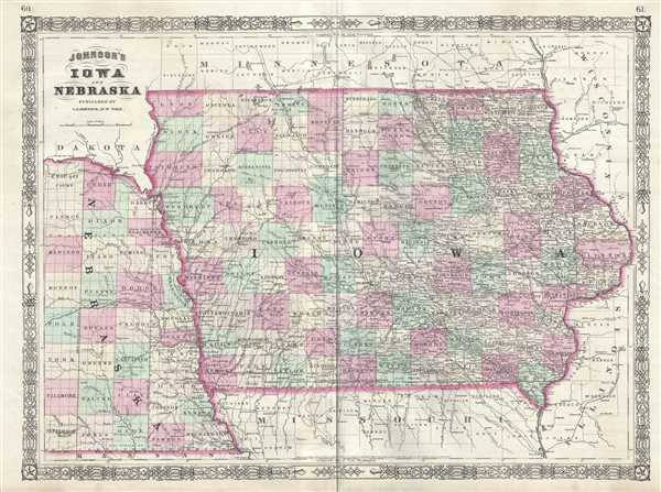
Johnson's Iowa and Nebraska.
sold
- Digital Map Information
- Suitable for large format printing
- File Size: 15.98 MB
- File Type: ZIP / TIFF
- ICC color profile embedded
- Delivered instantly via download link
This is A. J. Johnson's 1865 map of Iowa and Nebraska. The map covers the entire state of Iowa as well as the eastern portions of Nebraska. Offers color-coding according to county and notations for ... (more details)
Johnson's depiction of the German Confederation.

Johnson's Germany.
sold
- Digital Map Information
- Suitable for large format printing
- File Size: 19.08 MB
- File Type: ZIP / TIFF
- ICC color profile embedded
- Delivered instantly via download link
This is a beautiful example of Johnson and Ward's 1866 map of Germany. It covers Germany from Baltic Sea to the Adriatic Sea. The lower right quadrant features a list of the Constituent States. The ... (more details)
Johnson's map of India and Southeast Asia.

Johnson's Hindostan or British India.
sold
- Digital Map Information
- Suitable for large format printing
- File Size: 2.2 MB
- File Type: ZIP / TIFF
- ICC color profile embedded
- Delivered instantly via download link
This is a nice example of Johnson and Ward’s 1866 map of India and Southeast Asia. It covers from the Indus River eastward to include all of India, Burma (Myanmar), Siam (Thailand), Laos, ... (more details)
Colton's representation of the city of London, England.

The Environs of London.
sold
- Digital Map Information
- Suitable for large format printing
- File Size: 10.61 MB
- File Type: ZIP / TIFF
- ICC color profile embedded
- Delivered instantly via download link
An excellent 1856 example of Colton's map of London and the immediate vicinity. Includes parts of Surrey, Kent, Middlesex and Essex. Extends north to Southgate, east to Chadwell Heath, ... (more details)