

La Judee ou Terre Sainte, divisee en ses douze Tribus.
sold
- Digital Map Information
- Suitable for large format printing
- Full resolution TIFF file
- ICC color profile embedded
- Delivered instantly via download link
This is a beautiful 1750 map of Israel, Palestine or the Holy Land by Robert de Vaugondy. It extends from Sidon to Gaza and Covers the region as it existed in Biblical times with divisions for each of the Twelve Tribes of Israel. A large inset in the top left ... (more details)

Royaume d'Irlande divise en ses quatre Provinces, et subdivise en Comtes.
sold
- Digital Map Information
- Suitable for large format printing
- Full resolution TIFF file
- ICC color profile embedded
- Delivered instantly via download link
This is a beautiful 1750 map of Ireland by the French cartographer Robert de Vaugondy. It depicts the entire island with county and regional subdivisions defined. It offers excellent detail throughout showing mountains, rivers, forests, swamps, cities and a ... (more details)

L'Empire de la Chine dresse d'apres les Cartes de l'Atlas Chinois.
sold
- Digital Map Information
- Suitable for large format printing
- Full resolution TIFF file
- ICC color profile embedded
- Delivered instantly via download link
This is an attractive 1751 map of China, Korea and Taiwan by Robert de Vaugondy. It extends from Tartary east to include Korea or Corea and south including Hainan and Taiwan or Formosa. China is divided into various provinces with major cities, lakes, and ... (more details)

Etats du Grand-Seigneur en Asie, Empire de Perse, Pays des Usbecs, Arabie et Egypte.
sold
- Digital Map Information
- Suitable for large format printing
- Full resolution TIFF file
- ICC color profile embedded
- Delivered instantly via download link
This is Robert de Vaugondy's spectacular 1753 map of the Persia, Arabia and Turkey or the Ottoman Empire. Vaugondy maps the Empire at its height, with territory spanning from the Black Sea to the southernmost extension of Arabia and west, inclusive of ... (more details)
Identifies the Sea of Korea.
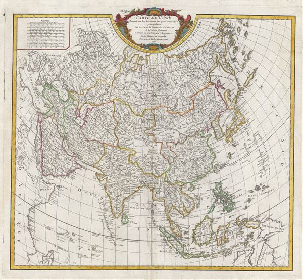
Carte de l'Asie dressee sur les Relations les plus nouvelles, principalement fur les Cartes de Russie, de la Chine, et de la Tatarie Chinoise; et divisee en ses Empires et Royaumes.
sold
- Digital Map Information
- Suitable for large format printing
- DPI: 300
- File Size: 15.88 MB
- File Type: ZIP / TIFF
- ICC color profile embedded
- Delivered instantly via download link
This is a rare and attractive 1775 map of Asia by Robert de Vaugondy. Vaugondy's map covers the entire continent from Africa and the Mediterranean east to the Bering Sea and south as far as Java and New Guinea. This map is most interesting in its ... (more details)

Palaestinae Sive Totius Terrae Promissionis Nova Descriptio Auctore Telemanno Stella Signensi.
sold
- Digital Map Information
- Suitable for large format printing
- DPI: 300
- File Size: 11.9 MB
- File Type: ZIP / TIFF
- ICC color profile embedded
- Delivered instantly via download link
This is a scarce and beautiful 1584 map of Palestine, Israel or the Holy Land by Abraham Orteilus. It extends from Beirut (Berytus) to Egypt and the Nile Delta and south as far as the Red Sea. This map shows the course of the Israelites as they ... (more details)

Carte de l'Italie dans laquelle sont tracees les Routes des Postes.
sold
- Digital Map Information
- Suitable for large format printing
- Full resolution TIFF file
- ICC color profile embedded
- Delivered instantly via download link
This is a scarce 1756 map of Italy by Robert de Vaugondy. It covers from Switzerland south to include all of Sicily. Sardinia and Corsica are also included. The map renders the entire region in extraordinary detail offering both topographical ... (more details)
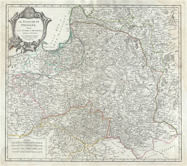
Le Royaume de Pologne, divise en ses duches et Provinces, et subdivise en Palatinats.
sold
- Digital Map Information
- Suitable for large format printing
- Full resolution TIFF file
- ICC color profile embedded
- Delivered instantly via download link
This is a fine 1752 map of the Kingdom of Poland by Robert de Vaugondy. It depicts the different Palantinates or administrative division of Poland and Lithuania as well as parts of the Russian Empire, Transylvania and Latvia. The map renders ... (more details)
Covers the Burgundy Wine Regions.

Partie Meridionale du Comte de Bourgogne ou Franche-Comte, ou sont les Bailliages de Orgelet, Lons-le-Saunier, Poligny, Arbois, Salins, Pontarlier, les Terres de St. Claude, et partie des Bailliages de Dole et Dornans.
sold
- Digital Map Information
- Suitable for large format printing
- Full resolution TIFF file
- ICC color profile embedded
- Delivered instantly via download link
This is a beautiful 1749 map of the important Burgundy (Bourgogne) and southern Franche-Comte region of eastern France by Robert de Vaugondy. It covers part of the southern Franche-Comte region including the whole or part of the modern day ... (more details)
Covers the Burgundy Wine Regions.

Partie Septentrionale du Comte de Bourgogne ou Franche-Comte, ou sont les Bailliages de Vesoul, Gray, Besancon, Baume, le Comte de Montbelliard, et partie des Bailliages de Dole, Quingey, et Ornans.
sold
- Digital Map Information
- Suitable for large format printing
- Full resolution TIFF file
- ICC color profile embedded
- Delivered instantly via download link
This is a beautiful 1749 map of the important Burgundy (Bourgogne) and northern Franche-Comte region of eastern France by Robert de Vaugondy. It covers the northern Franche-Comte region including the whole or part of the modern day ... (more details)
Covers the Burgundy Wine Regions.

Partie Meridionale du Gouvernement Genl. de Bourgogne ou se trouvent les Bailliages d'Autun, et de Challon, le Maconois, la Bresse et le Bugey divises en leurs Mandemens. Gouvernement General du Lyonois divise en Lyonois, Forez et Beaujolois.
sold
- Digital Map Information
- Suitable for large format printing
- Full resolution TIFF file
- ICC color profile embedded
- Delivered instantly via download link
This is a beautiful 1752 map of the southern Burgundy (Bourgogne) region of France by Robert de Vaugondy. It covers part of the Burgundy and Rhone-Alpes regions of France including the whole or parts of the modern day departments ... (more details)
Home of the finest Pinot noir and Chardonnay wines.
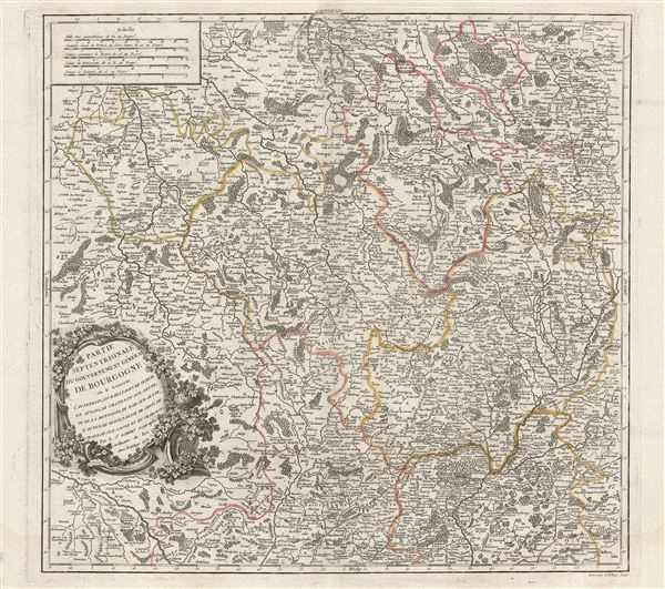
Partie Septentrionale du Gouvernement General de Bourgogne ou se trouvent l'Auxerrois, les Bailliages de Semur en Auxois, de Chatillon-sur-Seyne, ou de la Montagne, de Bar-sur-Seyne, d'Autun, de Dijon, partie de Celui de Challon-sur-Saone et du Charolois.
sold
- Digital Map Information
- Suitable for large format printing
- DPI: 300
- File Size: 19.02 MB
- File Type: ZIP / TIFF
- ICC color profile embedded
- Delivered instantly via download link
This is an attractive 1752 map the northern Burgundy (Bourgogne) region of France by Robert de Vaugondy. It covers the region from Chaumont south to Louhans and from Dornes east as far as Dole and includes the whole or parts of ... (more details)
Home of the some of the finest wines and cognacs.

Gouvernemens Generaux du Poitou, du Pays d'Aunis, et de Saintonge-Angoumois.
sold
- Digital Map Information
- Suitable for large format printing
- File Size: 24.07 MB
- File Type: ZIP / TIFF
- ICC color profile embedded
- Delivered instantly via download link
This is an attractive 1753 map of the Poitou-Charentes region of France by Robert de Vaugondy. It covers the region of Poitou-Charentes and part of the Pays-de-la-Loire region from Machecoul south to Royan and inland as far as ... (more details)
Home of fine Alsacian wines.

l'Alsace divisee en Haute et Basse et le Sundgau.
sold
- Digital Map Information
- Suitable for large format printing
- Full resolution TIFF file
- ICC color profile embedded
- Delivered instantly via download link
This is a scarce and beautiful 1754 map of the Alsace region of France by Robert de Vaugondy. Divided into two parts, the left section of the map features the department of Bas-Rhin and extends from Lauterbourg south to ... (more details)
Home of the fine Champagne wines.

Partie Meridionale du Gouvernemt. General de Champagne qui comprend la Champagne propre, le Vallage, le Bassigny, le Senonois, et une partie de la Brie et du Perthois.
sold
- Digital Map Information
- Suitable for large format printing
- Full resolution TIFF file
- ICC color profile embedded
- Delivered instantly via download link
This is a beautiful 1752 map of the southern Champagne region of France by Robert de Vaugondy. It covers part of the Champagne-Ardenne and Burgundy regions of northern France from Bar-le-Duc south to Montbard and from ... (more details)
Home of the fine Champagne wines.
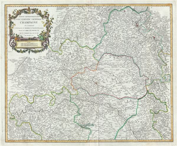
Partie Septentrionale du Governem? General de Champagne ou se trouvent le Retelois, le Rhemois, la Champagne propre, Partie de la Brie et du Pertois, etc.
sold
- Digital Map Information
- Suitable for large format printing
- Full resolution TIFF file
- ICC color profile embedded
- Delivered instantly via download link
This is a beautiful 1752 map of the northern Champagne region of France by Robert de Vaugondy. Centered on Reims, it covers part of the Champagne-Ardenne and Picardy regions of northeast France from Meaux east as far ... (more details)

Environs de Paris.
sold
- Digital Map Information
- Suitable for large format printing
- Full resolution TIFF file
- ICC color profile embedded
- Delivered instantly via download link
This is a beautiful 1753 map of Paris and its vicinity, France, by Robert de Vaugondy. Centered on Paris, it covers from the province of Vexin de Francois south to Beauce. This extremely detailed map notes important ... (more details)

Partie Meridionale de la Russie Europeenne ou sont distinguees exactement toutes les Provinces.
sold
- Digital Map Information
- Suitable for large format printing
- Full resolution TIFF file
- ICC color profile embedded
- Delivered instantly via download link
This is a fine 1752 map of the southern part of European Russia by Robert de Vaugondy. It covers from Moscow south to Georgia and from Poland east to the Volga River, including Crimea and Ukraine. An inset of Serbia ... (more details)

Les Royaumes de Suede et de Norwege, divises en leurs Provinces ou Gouvernemens.
sold
- Digital Map Information
- Suitable for large format printing
- Full resolution TIFF file
- ICC color profile embedded
- Delivered instantly via download link
This is a beautiful 1756 map of Scandinavia by Robert de Vaugondy. It covers Sweden, Norway and Finland along with parts of Denmark and Russia. An inset of Iceland is included in the top left quadrant. This ... (more details)

Royaume de Danemarck, qui comprend le Nort-Jutland divise en ses quatre Dioceses, le Sud-Jutland divise en ses deux Duches, de Sleswick et de Holstein, et les Isles de Fionie, Selande, Laland, etc.
sold
- Digital Map Information
- Suitable for large format printing
- Full resolution TIFF file
- ICC color profile embedded
- Delivered instantly via download link
This is a scarce 1750 map of Denmark by Robert de Vaugondy. It covers all of Jutland and the islands of Zealand, Funen and Lolland. Parts of Sweden and Germany are also included. This extremely detailed map ... (more details)