

North America Sheet XII. Georgia, with Parts of North and South Carolina, Tennessee, Alabama and Florida.
sold
- Digital Map Information
- Suitable for large format printing
- DPI: 300
- File Size: 7.63 MB
- File Type: ZIP / TIFF
- ICC color profile embedded
- Delivered instantly via download link
This is an uncommon 1833 map of Tennessee, Georgia and parts of Alabama, North Carolina and South Carolina issued by the Society for the Diffusion of Useful Knowledge or S.D.U.K. It covers the states of Tennessee and Georgia in their entirety while only part of ... (more details)
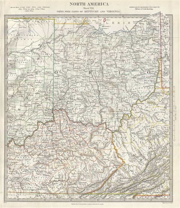
North America Sheet VIII Ohio, With parts of Kentucky and Virginia.
sold
- Digital Map Information
- Suitable for large format printing
- DPI: 300
- File Size: 7.28 MB
- File Type: ZIP / TIFF
- ICC color profile embedded
- Delivered instantly via download link
This is an attractive 1833 edition of the Society for the Diffusion of Useful Knowledge or S.D.U.K. map of Ohio, Kentucky, Indiana and Virginia. It covers the state of Ohio in its entirety along with parts of neighboring Indiana, Kentucky and Virginia. Offers ... (more details)
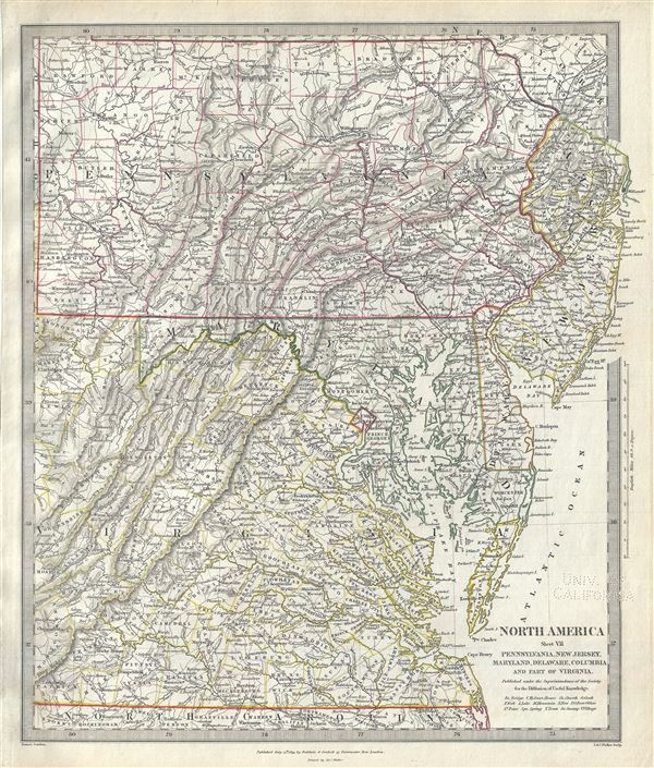
North America Sheet VII Pennsylvania, New Jersey, Maryland, Delaware, Columbia and Part of Virginia.
sold
- Digital Map Information
- Suitable for large format printing
- DPI: 300
- File Size: 9.53 MB
- File Type: ZIP / TIFF
- ICC color profile embedded
- Delivered instantly via download link
This is a lovely 1833 map of Pennsylvania, New Jersey, Maryland, Delaware and Virginia issued by the Society for the Diffusion of Useful Knowledge or S.D.U.K. The map covers the states of Pennsylvania, New Jersey, Maryland and Delaware in full with parts of ... (more details)

North America Sheet X Parts of Missouri, Illinois, Kentucky, Tennessee, Alabama, Mississippi and Arkansas.
sold
- Digital Map Information
- Suitable for large format printing
- DPI: 300
- File Size: 6.97 MB
- File Type: ZIP / TIFF
- ICC color profile embedded
- Delivered instantly via download link
An attractive 1833 example of the Society for the Diffusion of Useful Knowledge or S.D.U.K. map of Arkansas, Missouri, Mississippi, Kentucky, Tennessee, Alabama and Illinois. The map covers from St. Clair in Missouri to Hempstead in Arkansas and east as far ... (more details)

North America Sheet VI New-York, Vermont, Maine, New-Hampshire, Massachusetts, Connecticut, Rhode-Island, and New-Jersey.
sold
- Digital Map Information
- Suitable for large format printing
- DPI: 300
- File Size: 6.57 MB
- File Type: ZIP / TIFF
- ICC color profile embedded
- Delivered instantly via download link
This is a fine 1832 map of New England, New York and New Jersey issued by the Society for the Diffusion of Useful Knowledge or S.D.U.K. It covers from Waldo County in Maine south as far as the tip of New Jersey and west as far as St. Lawrence County in New ... (more details)

North America Sheet IX of Missouri, Illinois and Indiana.
sold
- Digital Map Information
- Suitable for large format printing
- DPI: 300
- File Size: 5.97 MB
- File Type: ZIP / TIFF
- ICC color profile embedded
- Delivered instantly via download link
This is a beautiful 1833 map of Illinois, Missouri, Iowa and Indiana issued by the Society for the Diffusion of Useful Knowledge or S.D.U.K. The map covers parts of modern day Iowa, Illinois, Missouri and Indiana from the Sioux Territory south as far as ... (more details)

North America Index Map of Canada and the United States.
sold
- Digital Map Information
- Suitable for large format printing
- DPI: 300
- File Size: 7.48 MB
- File Type: ZIP / TIFF
- ICC color profile embedded
- Delivered instantly via download link
An uncommon 1834 map of the United States issued by the Society for the Diffusion of Useful Knowledge or S.D.U.K. Parts of Canada are also included. The map covers the United States east of the Mississippi as well as the Trans-Mississippi territories ... (more details)

British North America.
sold
- Digital Map Information
- Suitable for large format printing
- DPI: 300
- File Size: 7.27 MB
- File Type: ZIP / TIFF
- ICC color profile embedded
- Delivered instantly via download link
An uncommon 1834 edition of the Society for the Diffusion of Useful Knowledge or S.D.U.K. map of British North America or Canada. It depicts the British and Russian holdings in North America. Centered on the Hudson Bay, the map covers from modern day ... (more details)

North America Sheet V The North West and Michigan Territories.
sold
- Digital Map Information
- Suitable for large format printing
- DPI: 300
- File Size: 5.86 MB
- File Type: ZIP / TIFF
- ICC color profile embedded
- Delivered instantly via download link
This is a scarce and important map issued by the Society for the Diffusion of Useful Knowledge, or S.D.U.K. in 1833, depicting Lake Michigan, the second largest of the five Great Lakes, and the only one that lies entirely within the United States. ... (more details)

North America Sheet IV Lake Superior.
sold
- Digital Map Information
- Suitable for large format printing
- DPI: 300
- File Size: 4.55 MB
- File Type: ZIP / TIFF
- ICC color profile embedded
- Delivered instantly via download link
A scarce and beautiful 1832 Society for the Diffusion of Useful Knowledge, or S.D.U.K. map of Lake Superior, the largest of the five Great Lakes. Centered on Lake Superior, the map coves the modern day regions of southern Ontario, northern ... (more details)

North America Sheet XI North and South Carolina.
sold
- Digital Map Information
- Suitable for large format printing
- DPI: 300
- File Size: 6.15 MB
- File Type: ZIP / TIFF
- ICC color profile embedded
- Delivered instantly via download link
This is a fine 1833 map of North Carolina and South Carolina by the Society for the Diffusion of Useful Knowledge, or S.D.U.K. The map covers part of North and South Carolina from Ashe County in North Carolina to the Atlantic Ocean. It ... (more details)

North America Sheet I Nova-Scotia with Part of New Brunswick and Lower Canada.
sold
- Digital Map Information
- Suitable for large format printing
- DPI: 300
- File Size: 5.7 MB
- File Type: ZIP / TIFF
- ICC color profile embedded
- Delivered instantly via download link
This is a fine 1832 map of Nova Scotia issued by the Society for the Diffusion of Useful Knowledge, or S.D.U.K. It covers the maritime provinces of Canada including the Prince Edward Island and part of New Brunswick and Quebec. Canadian ... (more details)
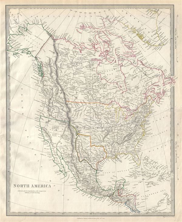
North America.
sold
- Digital Map Information
- Suitable for large format printing
- DPI: 300
- File Size: 6.76 MB
- File Type: ZIP / TIFF
- ICC color profile embedded
- Delivered instantly via download link
This is a scarce and interesting 1843 map of North America issued by the Society for the Diffusion of Useful Knowledge, or S.D.U.K. The map covers all of the United States, Canada, Russian America (Alaska) and Mexico predating the ... (more details)

North America Sheet III Upper Canada with Parts of New York, Pennsylvania and Michigan.
sold
- Digital Map Information
- Suitable for large format printing
- DPI: 300
- File Size: 8.76 MB
- File Type: ZIP / TIFF
- ICC color profile embedded
- Delivered instantly via download link
This is an attractive 1832 map of Upper Canada or Ontario issued by the Society for the Diffusion of Useful Knowledge, or S.D.U.K. Centered on Lake Ontario, the map covers from Drummond Island in the United States to Vaudreuil. ... (more details)

North America XIV Florida.
sold
- Digital Map Information
- Suitable for large format printing
- DPI: 300
- File Size: 4.98 MB
- File Type: ZIP / TIFF
- ICC color profile embedded
- Delivered instantly via download link
This is an uncommon 1834 map of Florida issued by the Society for the Diffusion of Useful Knowledge, or S.D.U.K. It covers the state of Florida in its entirety with its westernmost portion depicted in an inset in the bottom left ... (more details)

Rand McNally Standard Map of Florida.
sold
- Digital Map Information
- Suitable for large format printing
- Full resolution TIFF file
- ICC color profile embedded
- Delivered instantly via download link
This is a scarce 1925 map of Florida by Rand McNally and Company. The state of Florida is presented with extraordinary detail throughout noting towns, cities, rivers, electric lines, railways, coastal details and a host of ... (more details)
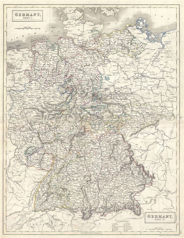
Germany, Part 1. Germany, Part 2.
sold
- Digital Map Information
- Suitable for large format printing
- Full resolution TIFF file
- ICC color profile embedded
- Delivered instantly via download link
This is a fine example of Adam and Charles Black's 1851 map of Germany in two parts. The map covers all of Germany from Denmark to Switzerland and depicts individual German states. The map also notes the 'Divisions of the ... (more details)
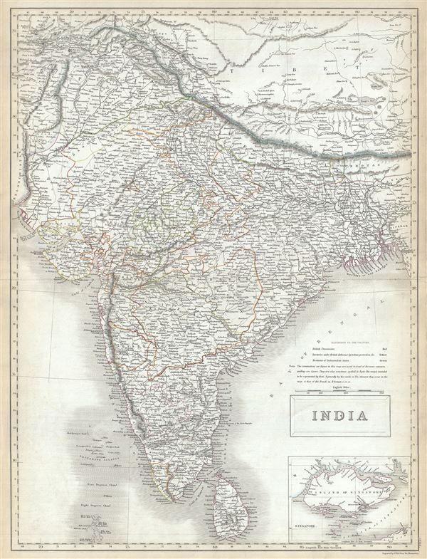
India.
sold
- Digital Map Information
- Suitable for large format printing
- Full resolution TIFF file
- ICC color profile embedded
- Delivered instantly via download link
This is a fine example of the Adam and Charles Black's 1844 map of India. It covers the Indian subcontinent from the Indian Caucasus Mountains to the Indian Ocean and includes Ceylon or Sri Lanka and part of Kabul in ... (more details)
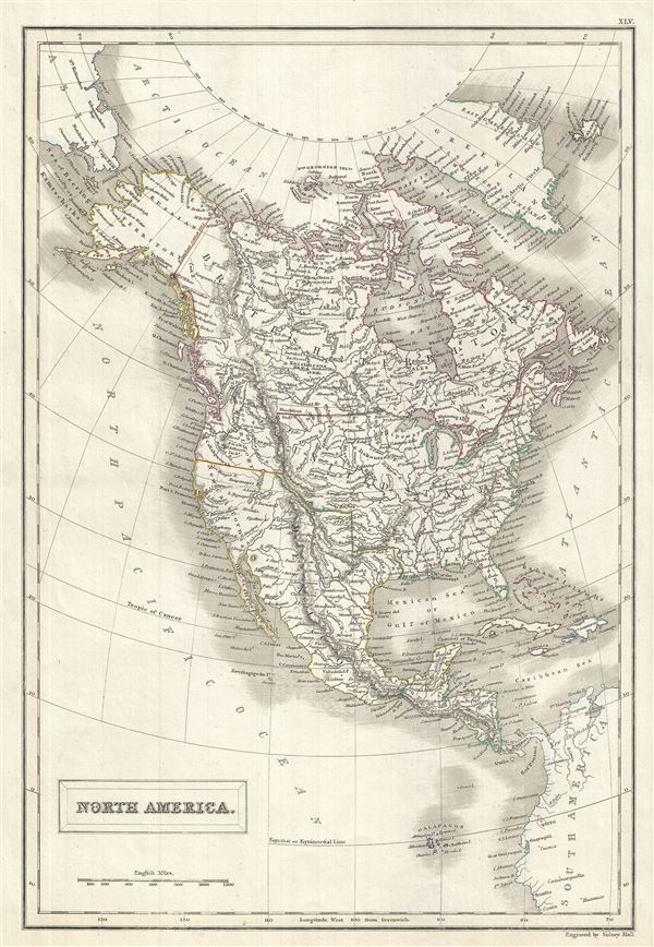
North America.
sold
- Digital Map Information
- Suitable for large format printing
- Full resolution TIFF file
- ICC color profile embedded
- Delivered instantly via download link
A fine example of Adam and Charles Black's 1844 map of North America. The map covers the continent from the North Georgian Islands in the Arctic Ocean to the Galapagos Islands in the North Pacific Ocean. Also covers ... (more details)
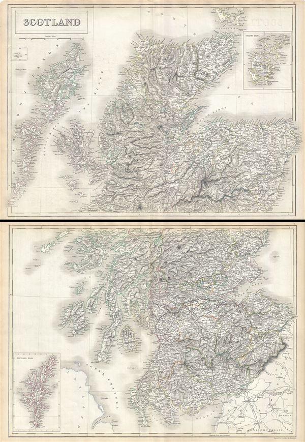
Scotland.
sold
- Digital Map Information
- Suitable for large format printing
- Full resolution TIFF file
- ICC color profile embedded
- Delivered instantly via download link
This is a fine example of Adam and Charles Black's 1844 map of Scotland. Divided into two separate maps, the upper map depicts northern Scotland from Blair Athol to the Island of Hoy (part of the Orkney Islands) in ... (more details)