
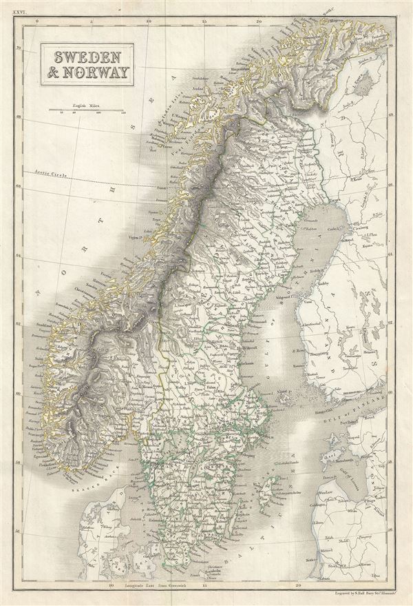
Sweden and Norway.
sold
- Digital Map Information
- Suitable for large format printing
- Full resolution TIFF file
- ICC color profile embedded
- Delivered instantly via download link
This is a lovely example of Adam and Charles Black's 1844 map of Scandinavia, including Norway and Sweden. It covers from the Arctic south to the Baltic Sea and east as far as the Gulf of Finland. Throughout, the map identifies various cities, towns, rivers and ... (more details)

Denmark.
sold
- Digital Map Information
- Suitable for large format printing
- Full resolution TIFF file
- ICC color profile embedded
- Delivered instantly via download link
This is an attractive example of Adam and Charles Black's 1844 map of Denmark. It covers all of Denmark inclusive of the Duchy of Holstein. Various towns, rivers, cities and several other topographical details are noted. The Kattegat (Cattegat) is also ... (more details)
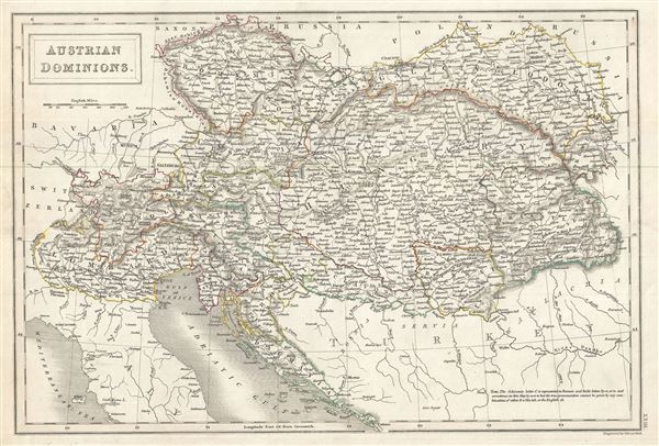
Austrian Dominions.
sold
- Digital Map Information
- Suitable for large format printing
- Full resolution TIFF file
- ICC color profile embedded
- Delivered instantly via download link
This is a fine example of Adam and Charles Black's 1844 map of the Austrian Empire. The map covers the territories claimed by the once vast Austrian Empire, including in whole or part the modern day nations of Austria, Hungary, Germany, Italy, Albania, ... (more details)

Hellas or Greece.
sold
- Digital Map Information
- Suitable for large format printing
- Full resolution TIFF file
- ICC color profile embedded
- Delivered instantly via download link
This is a fine example of Adam and Charles Black's 1844 map of Greece. It covers Greece from the Pagasetic Gulf to Cythera and includes the Cyclades as far east as Naxos. An inset in the lower left quadrant details the island of Corfu. Includes both ... (more details)
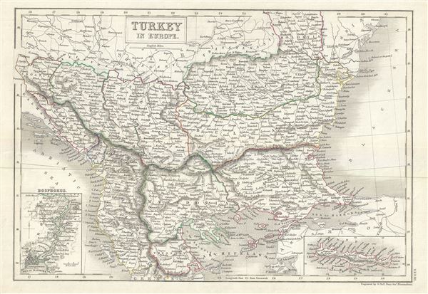
Turkey in Europe.
sold
- Digital Map Information
- Suitable for large format printing
- Full resolution TIFF file
- ICC color profile embedded
- Delivered instantly via download link
A fine example of Adam and Charles Black's 1844 map of the European parts of Turkey. Centered on the Aegean Sea, this map covers from Moldova to Thessaly and from the Adriatic to the Black Sea. Drawn when the Ottoman Empire controlled much of the ... (more details)

Persia.
sold
- Digital Map Information
- Suitable for large format printing
- Full resolution TIFF file
- ICC color profile embedded
- Delivered instantly via download link
This is a fine example of the Adam and Charles Black's 1844 map of Persia and Afghanistan. Centered on Yazd (Yezd) in modern day Iran, the map covers Iran, Afghanistan and parts of Pakistan, Iraq, India and Turkmenistan. It is curious to note ... (more details)
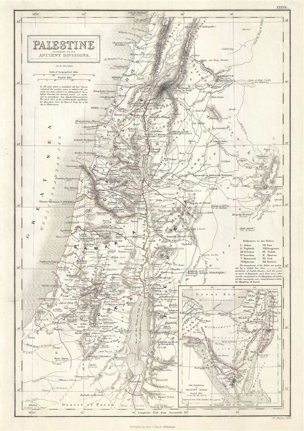
Palestine according to its Ancient Divisions.
sold
- Digital Map Information
- Suitable for large format printing
- Full resolution TIFF file
- ICC color profile embedded
- Delivered instantly via download link
This is a scarce 1844 Adam and Charles Black map of Ancient Palestine, Israel or the Holy Land. It covers the region as it existed in Biblical times with divisions for each of the Twelve Tribes of Israel and includes the modern day nations of ... (more details)
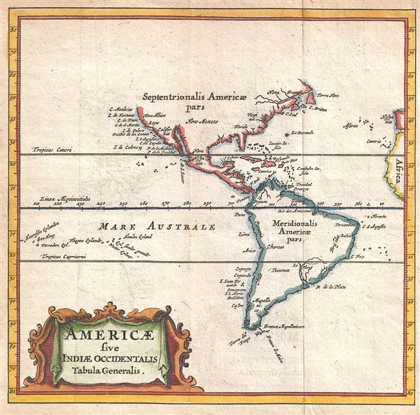
Americae sive Indiae Occidentalis Tabula Generalis.
sold
- Digital Map Information
- Suitable for large format printing
- DPI: 300
- File Size: 0.75 MB
- File Type: ZIP / TIFF
- ICC color profile embedded
- Delivered instantly via download link
A scarce and attractive 1661 miniature map of the the Americas by Philipp Cluver. A reduced version of the 1630 De Laet map, Cluver's map presents the Americas according to the geographical conventions of the time. The map offers primarily ... (more details)
Korea and California as Islands.
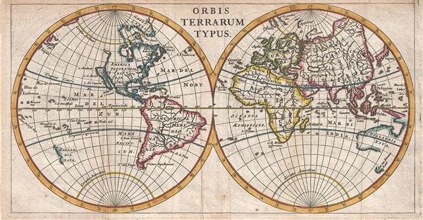
Orbis Terrarum Typus.
sold
- Digital Map Information
- Suitable for large format printing
- DPI: 300
- File Size: 1.76 MB
- File Type: ZIP / TIFF
- ICC color profile embedded
- Delivered instantly via download link
A scarce and attractive 1661 miniature map of the world by Philipp Cluver. Cluver presented the world according to the geographical conventions of the time with California and Korea appearing in insular form. In South America, Lake Parima, ... (more details)

Turkey in Asia.
sold
- Digital Map Information
- Suitable for large format printing
- Full resolution TIFF file
- ICC color profile embedded
- Delivered instantly via download link
This is a beautiful Adam and Charles Black's 1844 map of Turkey in Asia. Centered on the Holy land (Palestine / Israel), the map covers the modern day countries of Turkey, Cyprus, Iraq, Israel, Palestine, Jordan, Lebanon, and Syria. ... (more details)
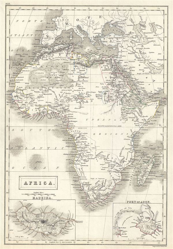
Africa.
sold
- Digital Map Information
- Suitable for large format printing
- Full resolution TIFF file
- ICC color profile embedded
- Delivered instantly via download link
This is a lovely example of the Adam and Charles Black's 1844 map of Africa. It covers the entire continent from the Mediterranean Sea to the Indian Ocean and the South Atlantic, including the island of Madagascar. An inset map in ... (more details)

Eastern Islands Birmah etc.
sold
- Digital Map Information
- Suitable for large format printing
- Full resolution TIFF file
- ICC color profile embedded
- Delivered instantly via download link
This is a fine example of Adam and Charles Black's 1844 map of the East Indies, Southeast Asia, and the Philippines. Includes modern day nations of Singapore, Myanmar (Burma), Laos, Vietnam, Cambodia, Thailand, Malaysia, Indonesia, ... (more details)
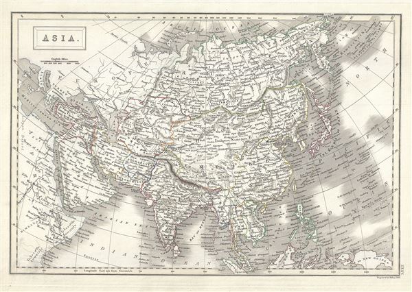
Asia.
$150.00
Acquire
- Digital Map Information
- Suitable for large format printing
- Full resolution TIFF file
- ICC color profile embedded
- Delivered instantly via download link
This is a beautiful example of Adam and Charles Black's 1844 map of Asia. The map covers the entire Asian continent from the Arctic Ocean to the Indian Ocean and from the Mediterranean Sea to the North Pacific Ocean. It shows ... (more details)
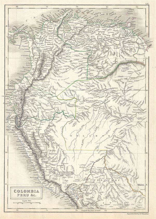
Colombia Peru etc.
sold
- Digital Map Information
- Suitable for large format printing
- Full resolution TIFF file
- ICC color profile embedded
- Delivered instantly via download link
A fine example of Adam and Charles Black's 1844 map of Colombia, Ecuador, Peru, Brazil and British Guyana. This map depicts Gran Colombia or Great Colombia, which included territories of modern day Colombia, Venezuela, Ecuador, ... (more details)
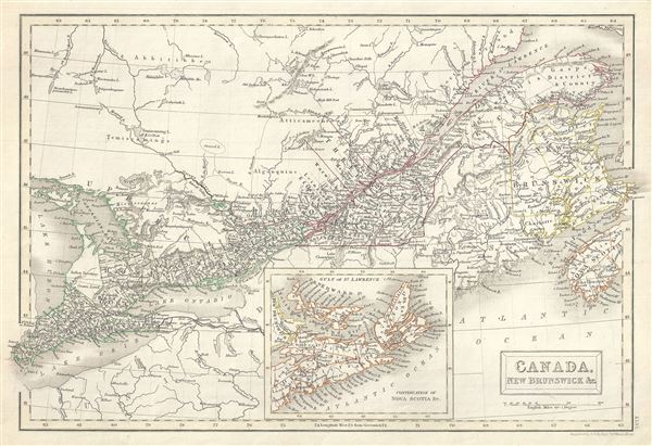
Canada, New Brunswick etc.
sold
- Digital Map Information
- Suitable for large format printing
- Full resolution TIFF file
- ICC color profile embedded
- Delivered instantly via download link
This is a fine example of Adam and Charles Black's 1844 map of Quebec (Canada East or Lower Canada) and New Brunswick. The map covers from Essex to Cape Breton Island in Nova Scotia (shown via inset at bottom center). It ... (more details)
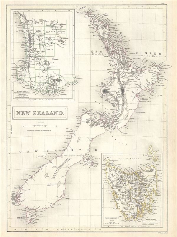
New Zealand.
sold
- Digital Map Information
- Suitable for large format printing
- Full resolution TIFF file
- ICC color profile embedded
- Delivered instantly via download link
This is a beautiful 1844 map of New Zealand by Adam and Charles Black. It covers the entire island country from Cape Reinga (C. Maria Van Diemen) to Stewart Island. An inset in the top left quadrant features the settled ... (more details)
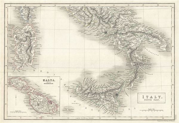
Italy, South Part.
sold
- Digital Map Information
- Suitable for large format printing
- Full resolution TIFF file
- ICC color profile embedded
- Delivered instantly via download link
A fine example of Adam and Charles Black's 1844 map of southern Italy. The map covers the Kingdom of Naples (a common reference for the 'Kingdom of the Two Sicilies'), which extended from the Papal States south to ... (more details)

West Indies.
sold
- Digital Map Information
- Suitable for large format printing
- Full resolution TIFF file
- ICC color profile embedded
- Delivered instantly via download link
This is a fine example of Adam and Charles Black's 1844 map of West Indies. Centered on Haiti or Santo Domingo, it covers the Caribbean from Florida to the Gulf of Panama and from Yucatan to the Lesser Antilles ... (more details)
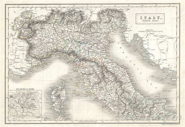
Italy, North Part.
sold
- Digital Map Information
- Suitable for large format printing
- Full resolution TIFF file
- ICC color profile embedded
- Delivered instantly via download link
This is a fine example of Adam and Charles Black's 1844 map of northern Italy. The map covers the island of Corsica and Northern Italy, including the regions of Tuscany, Modena, Parma, the Sardinian States, ... (more details)
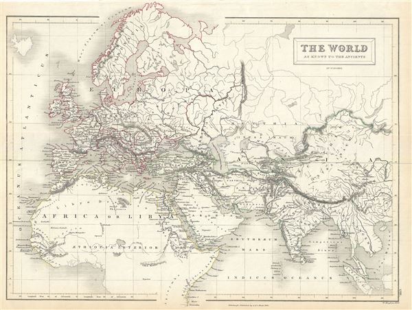
The World as known to the Ancients.
sold
- Digital Map Information
- Suitable for large format printing
- Full resolution TIFF file
- ICC color profile embedded
- Delivered instantly via download link
This is a fine example of Adam and Charles Black's 1844 map of the world of the Roman Empire. The map covers the span of world as known to the ancient Romans, from the Scandinavia south, as far as Sumatra. ... (more details)