
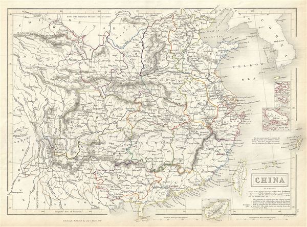
China.
sold
- Digital Map Information
- Suitable for large format printing
- Full resolution TIFF file
- ICC color profile embedded
- Delivered instantly via download link
This is a fine example of Adam and Charles Black's 1844 map of China. The map covers China from the Chinese Tartary to Hainan and from Assam in India to Korea (Corea), inclusive of Formosa or Taiwan. Four inset maps detail Amoy, Hong Kong, Zhoushan and Hainan. ... (more details)

Beautiful Napa County.
sold
- Digital Map Information
- Suitable for large format printing
- File Size: 13.07 MB
- File Type: ZIP / TIFF
- ICC color profile embedded
- Delivered instantly via download link
This is a beautiful 1963 pictorial map of Napa County by Weld Wilkie. It covers Napa County, one of the world's premier wine regions in beautiful detail, noting several landmarks and places of interest including The Old Bale Mill, Breathing Ceysers, Robert ... (more details)
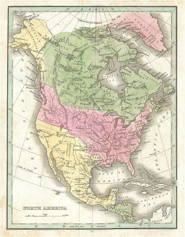
North America.
sold
- Digital Map Information
- Suitable for large format printing
- Full resolution TIFF file
- ICC color profile embedded
- Delivered instantly via download link
This is a beautiful example of the 1835 map of North America by the important American mapmaker T. G. Bradford. Bradford's map covers the entire North American continent from the Arctic Circle to the Isthmus of Panama, embracing all of Central America, ... (more details)
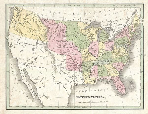
United States.
sold
- Digital Map Information
- Suitable for large format printing
- Full resolution TIFF file
- ICC color profile embedded
- Delivered instantly via download link
This is a beautiful example of the 1835 map of the United States by the important American mapmaker T. G. Bradford. It covers all of the territory claimed by the United States from Atlantic to Pacific and from British America (Canada) to the pre-1849 ... (more details)

United States, Exhibiting the Railroads and Canals.
sold
- Digital Map Information
- Suitable for large format printing
- Full resolution TIFF file
- ICC color profile embedded
- Delivered instantly via download link
This is a fine 1835 map of the United States exhibiting the railroads and canals by the important American mapmaker T. G. Bradford. It depicts the most inhabited parts of the United from the Great Lakes south to the Gulf of Mexico, and from Louisiana ... (more details)

Michigan and the Great Lakes.
sold
- Digital Map Information
- Suitable for large format printing
- Full resolution TIFF file
- ICC color profile embedded
- Delivered instantly via download link
This is a scarce 1835 map of Michigan, Wisconsin and the Great Lakes by the important American mapmaker T. G. Bradford. It covers from Lake Superior south as far Sandusky Bay in Ohio and includes the Great Lakes: Huron, Michigan, Eire, Superior and ... (more details)
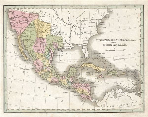
Mexico, Guatemala and the West Indies.
sold
- Digital Map Information
- Suitable for large format printing
- Full resolution TIFF file
- ICC color profile embedded
- Delivered instantly via download link
This beautiful map of Mexico, Guatemala and the West Indies was printed in 1835 by the important American mapmaker T. G. Bradford. It covers from Upper California and New Albion south to Panama, including the modern day regions of California, New ... (more details)

East Indies.
sold
- Digital Map Information
- Suitable for large format printing
- File Size: 8.23 MB
- File Type: ZIP / TIFF
- ICC color profile embedded
- Delivered instantly via download link
This is a beautiful and uncommon 1857 edition example of Colton's map of the East Indies. Like most of Colton's Asia maps, this map was derived from an earlier wall map of the world produced by Colton and D. Griffing Johnson. It covers from ... (more details)
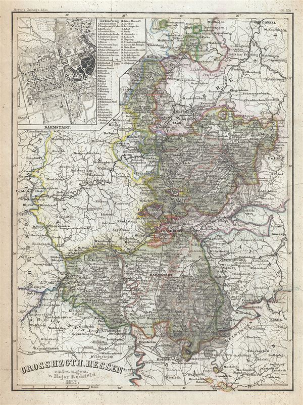
Grosshzgth. Hessen.
sold
This is a scarce 1853 map of the Grand Duchy of Hesse by Joseph Meyer. Centered on Frankfurt, it covers part of the modern day German State of Hesse from Heidelberg north to Kassel and from Cologne east as far as Fulda. An inset plan of the ... (more details)

Die Furstentumer: Waldeck, Lippe-Detmold und Schauenburg-Lippe.
sold
- Digital Map Information
- Suitable for large format printing
- Full resolution TIFF file
- ICC color profile embedded
- Delivered instantly via download link
This is a fine example of the 1850 map by Joseph Meyer depicting the Principalities of Waldeck, Lippe-Detmold and Schaumburg-Lippe, Germany. It covers the historic region from Hanover and Steinhuder Meer south to Borken and west as far as ... (more details)
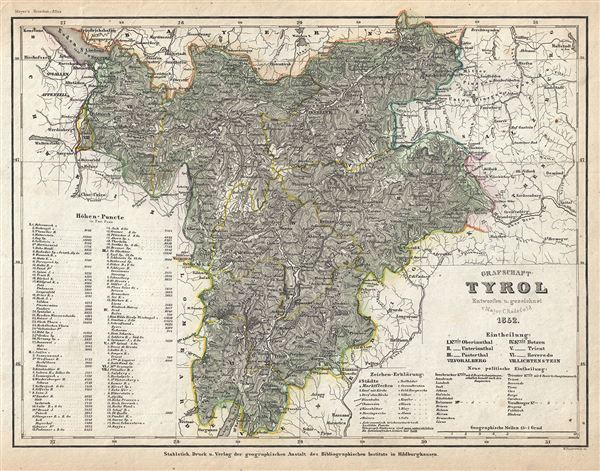
Grafschaft Tyrol.
sold
- Digital Map Information
- Suitable for large format printing
- Full resolution TIFF file
- ICC color profile embedded
- Delivered instantly via download link
This is a scarce 1852 map of the County of Tyrol by Joseph Meyer. It covers this historic region from Lake Constance (Bodensee) south to Lake Garda and east as far as Lienz. It includes the modern day countries of Austria, Italy and ... (more details)
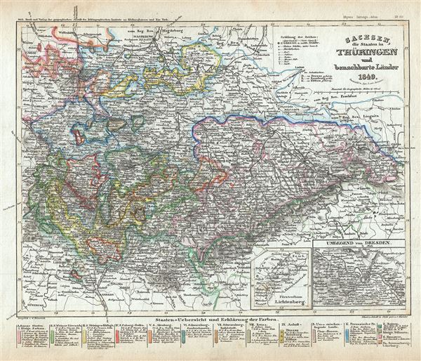
Sachsen, die Staaten in Thuringen und benachbarte Lander.
sold
- Digital Map Information
- Suitable for large format printing
- Full resolution TIFF file
- ICC color profile embedded
- Delivered instantly via download link
This is a scarce 1849 map of Saxony, the States of Thuringia and neighboring countries by Joseph Meyer. It covers the region from Magdeburg south to Bamberg and from Gottingen east as far as Gorlitz. Throughout the map identifies ... (more details)

Herzogthum Nassau.
sold
- Digital Map Information
- Suitable for large format printing
- Full resolution TIFF file
- ICC color profile embedded
- Delivered instantly via download link
This is an attractive 1849 map of the Duchy of Nassau by Joseph Meyer. It covers from Bad Berleburg south to Mainz and from Koblenz east as far as Hanau. An inset of the Rhine River in included in the top right quadrant while ... (more details)

Osterreich: Lombardisch-Venetianisches Konigreich.
sold
- Digital Map Information
- Suitable for large format printing
- Full resolution TIFF file
- ICC color profile embedded
- Delivered instantly via download link
This is a fine 1849 map by Joseph Meyer depicting the Kingdom of Lombardy-Venetia. It covers the north Italian territories of Lombardy and Venetia, merged together and ruled by the House of Habsburg-Lorraine, from Lake ... (more details)

Kurfurstentum Hessen.
sold
- Digital Map Information
- Suitable for large format printing
- Full resolution TIFF file
- ICC color profile embedded
- Delivered instantly via download link
This is a scarce 1849 map of the Electorate of Hesse or Hesse-Kassel, by Joseph Meyer. It covers the modern day German state of Hesse and vicinity from Einbeck south to Frankfurt and east as far as Gotha. Throughout ... (more details)
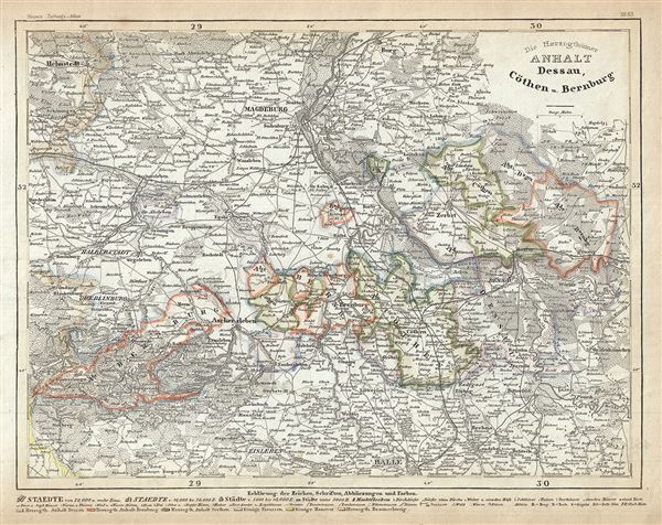
Die Herzogthumer Anhalt Dessau, Cothen u. Bernburg.
sold
- Digital Map Information
- Suitable for large format printing
- Full resolution TIFF file
- ICC color profile embedded
- Delivered instantly via download link
This is a fine 1852 map of the Duchies of Anhalt-Dessau, Anhalt-Kothen and Anhalt-Bernburg, Germany. It covers the former duchies and vicinity from Helmstedt to Halle and from Guntersberge east as far as ... (more details)

Mecklenburg Schwerin und Strelitz.
sold
- Digital Map Information
- Suitable for large format printing
- File Size: 8.08 MB
- File Type: ZIP / TIFF
- ICC color profile embedded
- Delivered instantly via download link
This is a scarce 1849 map of the Grand Duchy of Mecklenburg-Strelitz and the Grand Duchy of Mecklenburg-Schwerin by Joseph Meyer. It covers the two territories of the House of Mecklenburg from the Baltic ... (more details)

Herzogthum Braunschweig.
sold
- Digital Map Information
- Suitable for large format printing
- Full resolution TIFF file
- ICC color profile embedded
- Delivered instantly via download link
This is a fine 1849 example of Joseph Meyer's map of the Duchy of Brunswick, Germany. It covers the historic German state from Gardelegen to Blomberg and south as far as Nordhausen. Throughout the map ... (more details)

Map of the Hudson River.
sold
- Digital Map Information
- Suitable for large format printing
- Full resolution TIFF file
- ICC color profile embedded
- Delivered instantly via download link
This is a scarce 1866 map of the Hudson River, New York by James Miller. It covers the course of the Hudson River from Lake Luzerne south as it empties into the Upper New York Bay. It also covers the ... (more details)

Konigreich Hannover.
sold
- Digital Map Information
- Suitable for large format printing
- Full resolution TIFF file
- ICC color profile embedded
- Delivered instantly via download link
This is a fine 1852 map of the Kingdom of Hanover by Joseph Meyer. It depicts Kingdom of Hanover from Cuxhaven south as far as Kassel and from Meppen east as far as Hansestadt Salzwedel, covering most ... (more details)