

South America.
sold
- Digital Map Information
- Suitable for large format printing
- DPI: 300
- File Size: 2.37 MB
- File Type: ZIP / TIFF
- ICC color profile embedded
- Delivered instantly via download link
This is a desirable 1835 map of South America by T. G> Bradford. It covers the entire continent from the Caribbean to Tierra del Fuego, including the Falkland Islands. It includes the modern day nations of Colombia, Venezuela, Ecuador, Uruguay, French Guiana, ... (more details)
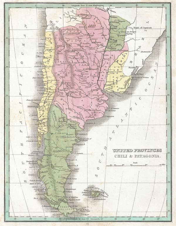
United Provinces Chili and Patagonia.
sold
- Digital Map Information
- Suitable for large format printing
- DPI: 300
- File Size: 2.51 MB
- File Type: ZIP / TIFF
- ICC color profile embedded
- Delivered instantly via download link
This is a beautiful 1835 map of the United Provinces of La Plata, Chile and Patagonia by the important American mapmaker T. G. Bradford. The map covers modern day Chile, Argentina, Paraguay and Uruguay. It also includes the Falkland Islands. Modern day ... (more details)

Colombia and Guiana.
sold
- Digital Map Information
- Suitable for large format printing
- DPI: 300
- File Size: 2.35 MB
- File Type: ZIP / TIFF
- ICC color profile embedded
- Delivered instantly via download link
This is an excellent example of T. G. Bradford's 1835 map of Colombia (New Granada), Venezuela, Ecuador and Guyana. This map covers French Dutch and British Guiana as well as Gran Colombia or Great Colombia, which included territories of modern day ... (more details)

Upper and Lower Canada.
sold
- Digital Map Information
- Suitable for large format printing
- DPI: 300
- File Size: 2.62 MB
- File Type: ZIP / TIFF
- ICC color profile embedded
- Delivered instantly via download link
This desirable map of Upper Canada (Ontario) and Lower Canada (Quebec) was printed by the important American mapmaker T. G. Bradford in 1835. It covers Upper Canada (Ontario), Lower Canada (Quebec), Nova Scotia and New Brunswick along with part of ... (more details)

Portland and Vicinity. Boston and Vicinity. Providence and Vicinity. New York and Vicinity. Albany and Vicinity. Baltimore and Vicinity. Philadelphia and Vicinity. Charleston and Vicinity. Savannah and Vicinity. New Orleans and Vicinity. St. Louis and Vicinity. Louisville and Vicinity. City of Nashville. Niagara Falls and Vicinity. Cincinnati and Vicinity.
sold
- Digital Map Information
- Suitable for large format printing
- DPI: 300
- File Size: 3.34 MB
- File Type: ZIP / TIFF
- ICC color profile embedded
- Delivered instantly via download link
This is a fine 1835 map or plan depicting the principal cities in the United States by the important American mapmaker T. G. Bradford. Essentially fifteen plans on a single sheet, it covers the cities of Portland (Maine), Boston (Massachusetts), ... (more details)

Indiana and Ohio.
sold
- Digital Map Information
- Suitable for large format printing
- DPI: 300
- File Size: 3.43 MB
- File Type: ZIP / TIFF
- ICC color profile embedded
- Delivered instantly via download link
This is a fine map of Indiana and Ohio printed by the important American mapmaker T. G. Bradford in 1835. It covers the two states of Indiana and Ohio in detail, noting rivers, towns, cities, railways, canals, and a host of other topographical ... (more details)
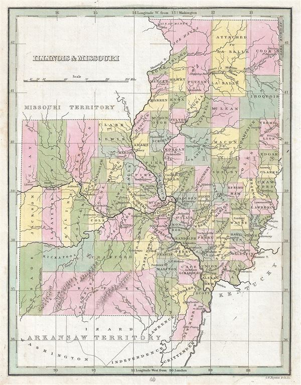
Illinois and Missouri.
sold
- Digital Map Information
- Suitable for large format printing
- DPI: 300
- File Size: 3.01 MB
- File Type: ZIP / TIFF
- ICC color profile embedded
- Delivered instantly via download link
This is a scarce map of Illinois and Missouri printed by the important American mapmaker T. G. Bradford in 1835. It covers the two states of Missouri and Illinois and includes parts of the Missouri Territory and Arkansas Territory (spelled ... (more details)

Kentucky.
sold
- Digital Map Information
- Suitable for large format printing
- DPI: 300
- File Size: 2.88 MB
- File Type: ZIP / TIFF
- ICC color profile embedded
- Delivered instantly via download link
This is a beautiful example of T.G. Bradford's 1835 map of Kentucky. It covers the state of Kentucky as well as parts of adjoining Tennessee, Illinois, Indiana and Ohio. It shows the region in detail, noting rivers, cities, towns, and ... (more details)

Tennessee.
sold
- Digital Map Information
- Suitable for large format printing
- DPI: 300
- File Size: 2.7 MB
- File Type: ZIP / TIFF
- ICC color profile embedded
- Delivered instantly via download link
This fine map of Tennessee was printed in 1835 by the important American mapmaker T. G. Bradford. It depicts the state of Tennessee as well as parts of the neighboring states of Alabama, Mississippi, Virginia and Kentucky. Offers fine ... (more details)
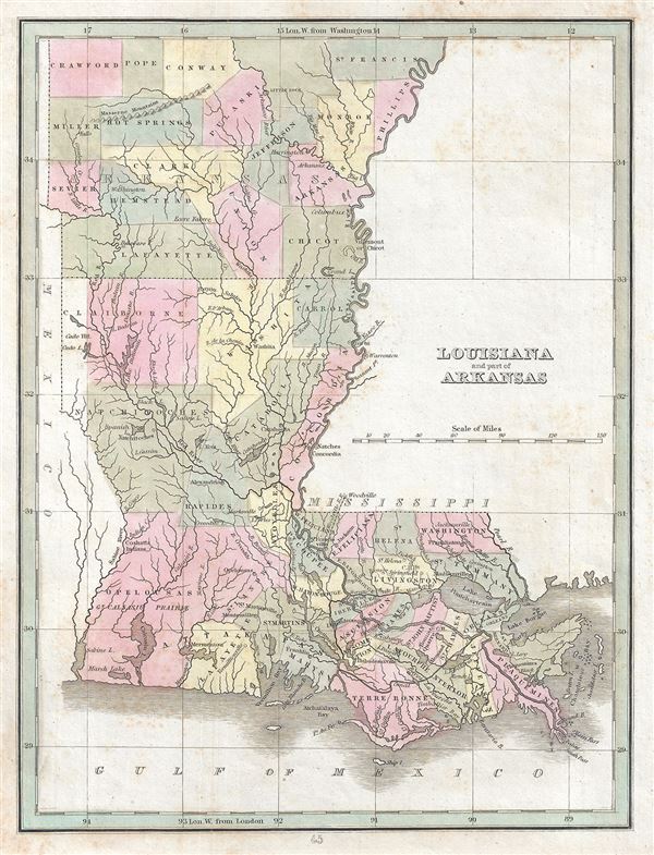
Louisiana and part of Arkansas.
sold
- Digital Map Information
- Suitable for large format printing
- DPI: 300
- File Size: 2.95 MB
- File Type: ZIP / TIFF
- ICC color profile embedded
- Delivered instantly via download link
This is a fine example of T. G. Bradford's map of Louisiana and part of Arkansas. It covers the state of Louisiana in its entirety as well as part of the state of Arkansas north as far as Crawford County. The map depicts the region in ... (more details)

Mississippi.
sold
- Digital Map Information
- Suitable for large format printing
- DPI: 300
- File Size: 2.99 MB
- File Type: ZIP / TIFF
- ICC color profile embedded
- Delivered instantly via download link
This fine map of Mississippi was printed in 1835 by the important American mapmaker T. G. Bradford. It depicts the state of Mississippi as well as parts of neighboring Alabama, Louisiana and Arkansas. The map shows fine detail, noting ... (more details)
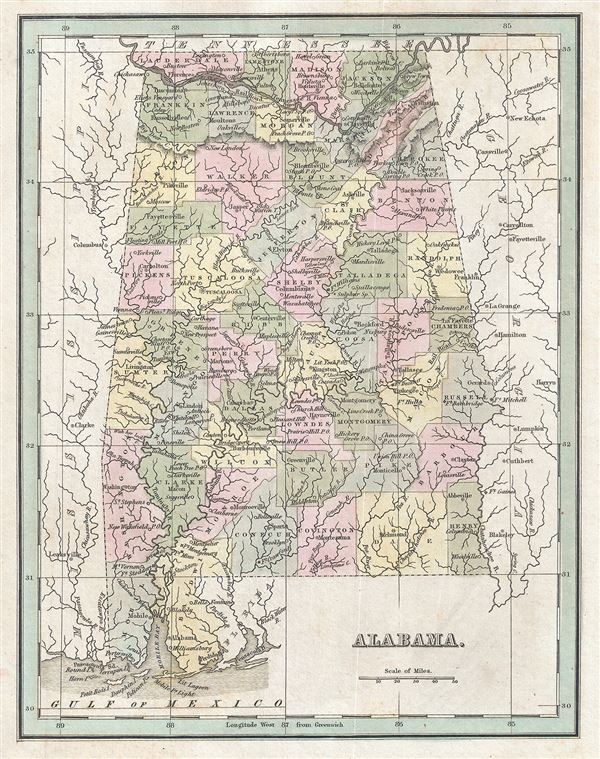
Alabama.
sold
- Digital Map Information
- Suitable for large format printing
- DPI: 300
- File Size: 3.14 MB
- File Type: ZIP / TIFF
- ICC color profile embedded
- Delivered instantly via download link
This is a fine 1835 map of Alabama by the important American mapmaker T. G. Bradford. It covers the state of Alabama as well as parts of neighboring Mississippi and Georgia. The map shows fine detail, noting rivers, lakes, towns, ... (more details)

Georgia.
sold
- Digital Map Information
- Suitable for large format printing
- DPI: 300
- File Size: 3.17 MB
- File Type: ZIP / TIFF
- ICC color profile embedded
- Delivered instantly via download link
This fine map of Georgia was printed in 1835 by the important American mapmaker T. G. Bradford. It depicts the state in detail, noting roads, rivers, lakes, proposed and finished canals, and a host of other topographical features, ... (more details)
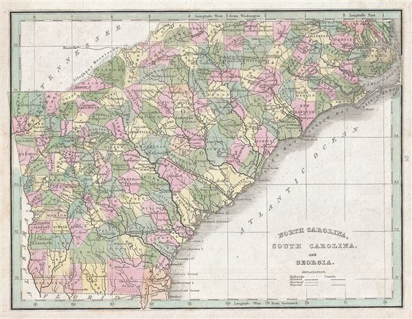
North Carolina, South Carolina and Georgia.
sold
- Digital Map Information
- Suitable for large format printing
- DPI: 300
- File Size: 4.01 MB
- File Type: ZIP / TIFF
- ICC color profile embedded
- Delivered instantly via download link
This is a scarce 1835 map of North Carolina, South Carolina and Georgia by the important American mapmaker T. G. Bradford. It depicts the three states in detail, noting roads, rivers, islands, capes, swamps, sounds, canals, ... (more details)

North Carolina.
sold
- Digital Map Information
- Suitable for large format printing
- DPI: 300
- File Size: 3.51 MB
- File Type: ZIP / TIFF
- ICC color profile embedded
- Delivered instantly via download link
This beautiful map of North Carolina was printed in 1835 by the important American mapmaker T. G. Bradford. This rare map plate configuration depicts the state individually rather than bundled with South Carolina - as is ... (more details)

Virginia, Maryland and Delaware.
sold
- Digital Map Information
- Suitable for large format printing
- DPI: 300
- File Size: 3.28 MB
- File Type: ZIP / TIFF
- ICC color profile embedded
- Delivered instantly via download link
This is a scarce 1835 map of Virginia, Maryland and Delaware by the important American mapmaker T. G. Bradford. It covers what is today Virginia, West Virginia, Delaware and Maryland. Includes Chesapeake Bay and ... (more details)

Pennsylvania and New Jersey.
sold
- Digital Map Information
- Suitable for large format printing
- DPI: 300
- File Size: 3.47 MB
- File Type: ZIP / TIFF
- ICC color profile embedded
- Delivered instantly via download link
This rare map of Pennsylvania and New Jersey was printed in 1835 by the important American mapmaker T. G. Bradford. It covers the two states in detail, noting rivers, proposed and completed railways and canals, ... (more details)
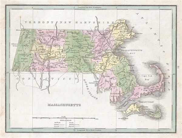
Massachusetts.
sold
- Digital Map Information
- Suitable for large format printing
- DPI: 300
- File Size: 2.81 MB
- File Type: ZIP / TIFF
- ICC color profile embedded
- Delivered instantly via download link
A scarce 1835 map of Massachusetts by T. G. Bradford. It covers the entire state as well as parts of the neighboring states of Connecticut, Vermont and New Hampshire. Martha's Vineyard (Dukes Island) and ... (more details)
The first Japanese map of the world from a Buddhist cosmographical perspective - a seminal map.

Nansenbushu Bankoku Shoka No Zu (Outline Map of All Countries of the Universe)
sold
- Digital Map Information
- Suitable for large format printing
- DPI: 300
- File Size: 91.94 MB
- File Type: ZIP / TIFF
- ICC color profile embedded
- Delivered instantly via download link
A seminal map of extreme significance. This is the first Japanese printed map to depict the world, including Europe and America, from a Buddhist cosmographical perspective. Printed by woodblock in 1710 ... (more details)
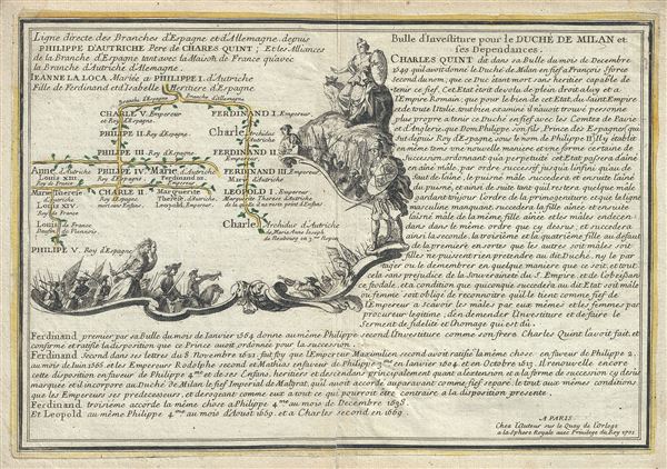
Ligne directe des branches d'Espagne et d'Allemagne depuis Philippe d'Autriche Pere de Charles Quint; Et les Alliances de la Branche d'Espagne tant avec la Maison de France qu'avec la Branche d'Autriche d'Alemagne.
sold
- Digital Map Information
- Suitable for large format printing
- Full resolution TIFF file
- ICC color profile embedded
- Delivered instantly via download link
This is a fine 1701 map of the lineage of Philip I of Castile. It notes spouses, and children, and succession as well as title and alliances mapping their rule in Spain, France and Austria. The two ... (more details)