

Johnson's Roman Empire, Imperium Romanorum Latissime Patens.
sold
- Digital Map Information
- Suitable for large format printing
- File Size: 13.05 MB
- File Type: ZIP / TIFF
- ICC color profile embedded
- Delivered instantly via download link
This is a beautiful example of Johnson and Ward's 1865 map the Roman empire. The map shows the extent of the Roman empire at its height, and covers most of europe, the Middle east, Persia and parts of North Africa. The empire was established in 27 BC after Gaius ... (more details)

Johnson's New Map of the State of Texas.
sold
- Digital Map Information
- Suitable for large format printing
- File Size: 20.75 MB
- File Type: ZIP / TIFF
- ICC color profile embedded
- Delivered instantly via download link
This is an exceptional example of Johnson and Ward's highly desirable 1865 map of Texas. Created during the American Civil War, this extraordinary folio map details the state of Texas in full. Identifies the elevated Table Lands, el Llando estadado (the Staked ... (more details)

Johnson's Illinois.
sold
- Digital Map Information
- Suitable for large format printing
- File Size: 18.47 MB
- File Type: ZIP / TIFF
- ICC color profile embedded
- Delivered instantly via download link
This is a beautiful example of Johnson and Ward's 1864 map of Illinois. The map covers the entire state along with portions of the adjacent states. Johnson introduced this large folio map in the 1864 edition of his atlas, replacing the single page Illinois map ... (more details)

Johnson's Palestine.
sold
- Digital Map Information
- Suitable for large format printing
- File Size: 9.66 MB
- File Type: ZIP / TIFF
- ICC color profile embedded
- Delivered instantly via download link
This is a beautiful example of Johnson and Ward's 1865 map of Israel, Palestine, or the Holy Land. The map includes the modern day nations of Israel, Palestine and Lebanon with parts of adjacent Syria and Jordan. Both ancient and contemporary place names as ... (more details)
Scarce American Civil War map illustrating the Southern or Confederate States.
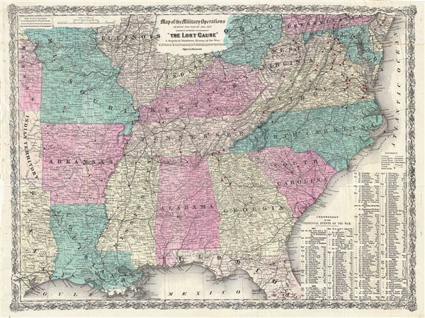
Map of the Military Operations During the War of 1861-1865 designed expressly to accompany 'The Lost Casue' A Standard Southern History of the War.
sold
- Digital Map Information
- Suitable for large format printing
- File Size: 24.31 MB
- File Type: ZIP / TIFF
- ICC color profile embedded
- Delivered instantly via download link
An interesting and exceptionally influential 1867 post Civil War movement map of the Southern States drawn for edward A. Pollard's book The Lost Cause . The map covers from Ohio and Pennsylvania to central Florida and the Gulf of Mexico and from Texas and ... (more details)

Monde Connu des Anciens.
sold
- Digital Map Information
- Suitable for large format printing
- DPI: 300
- File Size: 5.12 MB
- File Type: ZIP / TIFF
- ICC color profile embedded
- Delivered instantly via download link
This is an uncommon and attractive 1852 map of the Ancient World, including Asia, europe and Africa. The map shows the Ancient World during the time of the Ancient Roman empire from the Atlantic Ocean to Burma in Asia and from the Indian Ocean to the North ... (more details)

Johnson's Kentucky and Tennessee.
sold
- Digital Map Information
- Suitable for large format printing
- File Size: 23.97 MB
- File Type: ZIP / TIFF
- ICC color profile embedded
- Delivered instantly via download link
This is a beautiful example of Johnson and Ward's 1865 map of Kentucky and Tennessee. The map covers both states in its entirety along with parts of adjacent states. This rare map offers a fascinating snapshot of these secessionist states shortly ... (more details)

Johnson's Massachusetts, Connecticut and Rhode Island.
sold
- Digital Map Information
- Suitable for large format printing
- File Size: 19.02 MB
- File Type: ZIP / TIFF
- ICC color profile embedded
- Delivered instantly via download link
This is Johnson and Ward's 1864 map of Massachusetts, Connecticut and Rhode Island. It covers the three states as well as Long Island. Various towns, rivers, railways, roads, islands and several other topographical features are noted with relief ... (more details)
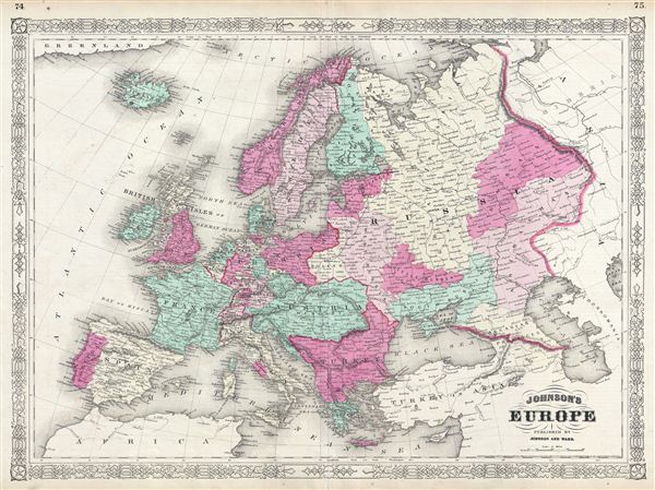
Johnsons's Europe.
sold
- Digital Map Information
- Suitable for large format printing
- File Size: 17.46 MB
- File Type: ZIP / TIFF
- ICC color profile embedded
- Delivered instantly via download link
This is a beautiful example of Johnson and Ward's 1864 map of europe. The map covers the continent in its entirety from the Atlantic to the Caspian Sea and from the Arctic Ocean to the Mediterranean Sea. It also details Iceland and parts of ... (more details)
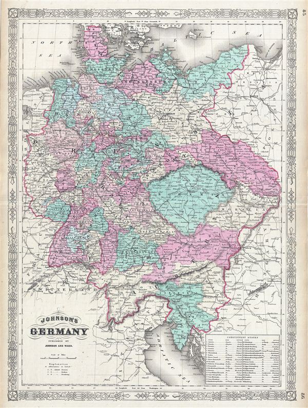
Johnson's Germany.
sold
- Digital Map Information
- Suitable for large format printing
- File Size: 20.32 MB
- File Type: ZIP / TIFF
- ICC color profile embedded
- Delivered instantly via download link
This is a beautiful example of Johnson and Ward's 1865 map of Germany. It covers Germany from Baltic Sea to the Adriatic Sea. The lower right quadrant features a list of the Constituent States. The German Confederation, created in 1814, ... (more details)

Johnson's Ireland. Johnson's Scotland.
sold
- Digital Map Information
- Suitable for large format printing
- File Size: 19.08 MB
- File Type: ZIP / TIFF
- ICC color profile embedded
- Delivered instantly via download link
This is a beautiful example of Johnson and Ward's 1865 map of Scotland and Ireland. It contains two separate maps within the same border. The left hand map features Ireland and covers the entire emerald Isle in full from Donegal to Cork. ... (more details)

Johnson's England and Wales.
sold
- Digital Map Information
- Suitable for large format printing
- File Size: 20.17 MB
- File Type: ZIP / TIFF
- ICC color profile embedded
- Delivered instantly via download link
This is Johnson and Ward's 1864 map of england and Wales. The map covers both england and Wales in full from Scotland south to the english Channel and The Channel Islands, and from St. George's Channel to the mouth of the Thames River, ... (more details)
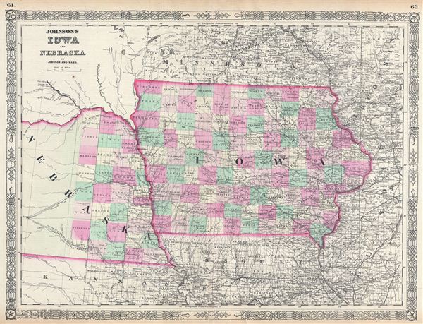
Johnson's Iowa and Nebraska.
sold
- Digital Map Information
- Suitable for large format printing
- File Size: 17.37 MB
- File Type: ZIP / TIFF
- ICC color profile embedded
- Delivered instantly via download link
This is Johnson and Ward's 1864 map of Iowa and Nebraska. It covers the states of Iowa and Nebraska as well as parts of the adjacent states. Various towns, rivers, Indian reservations, railways, roads, and several other topographical ... (more details)

Johnson's Indiana.
sold
- Digital Map Information
- Suitable for large format printing
- File Size: 20.09 MB
- File Type: ZIP / TIFF
- ICC color profile embedded
- Delivered instantly via download link
This is Johnson and Ward's 1864 map of Indiana. It covers Indiana in full as well as parts of the adjacent states. Various towns, cities, rivers and several other topographical features are noted with relief shown by hachure. It ... (more details)

Johnson's Roman Empire, Imperium Romanorum Latissime Patens.
sold
- Digital Map Information
- Suitable for large format printing
- File Size: 13.17 MB
- File Type: ZIP / TIFF
- ICC color profile embedded
- Delivered instantly via download link
This is Johnson and Ward's 1864 map of the Roman empire. The map shows the extent of the Roman empire at its height, and covers most of europe, the Middle east, Persia and parts of North Africa. The empire was established in 27 ... (more details)

Johnson's Japan, Nippon, Kiusiu, Sikok, Yesso and the Japanese Kuriles.
sold
- Digital Map Information
- Suitable for large format printing
- File Size: 9.37 MB
- File Type: ZIP / TIFF
- ICC color profile embedded
- Delivered instantly via download link
This is Johnson and Ward's 1864 map of Japan. Compiled by A. J. Johnson from the map of Siebold with additions from the surveys and reconnaissance of the U.S. Japan expedition, this map covers the Japanese Islands from Kiusiu ... (more details)
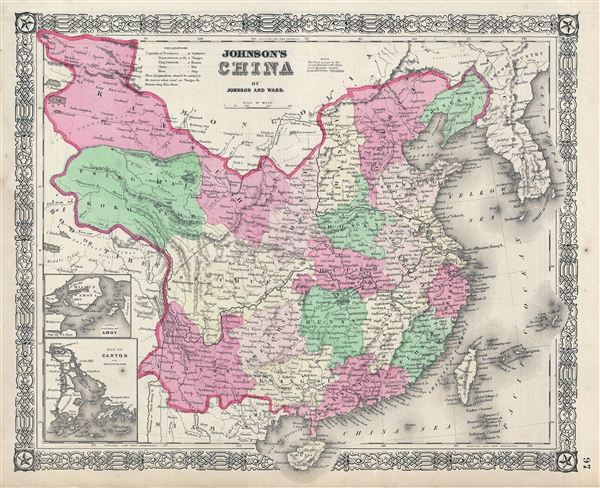
Johnson's China.
sold
- Digital Map Information
- Suitable for large format printing
- File Size: 9.9 MB
- File Type: ZIP / TIFF
- ICC color profile embedded
- Delivered instantly via download link
This is Johnson and Ward's 1864 map of China, covering from Mongolia to Hainan and from Tibet to Korea. The map identifies both the Great Wall and the Grand Canal. It depicts the region with particular attention to cities and ... (more details)
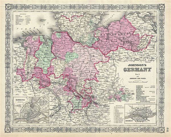
Johnson's Germany No. 1.
sold
- Digital Map Information
- Suitable for large format printing
- File Size: 10.1 MB
- File Type: ZIP / TIFF
- ICC color profile embedded
- Delivered instantly via download link
This is a beautiful example of the northern sheet from Johnson and Ward's 1864 Germany series. Details Hanover, Mecklenburg Schwerin, Holstein and Oldenburg. Insets detail the city of Hamburg and the city of Bremen. The map ... (more details)

Johnson's Austria Turkey In Europe And Greece.
sold
- Digital Map Information
- Suitable for large format printing
- File Size: 21.21 MB
- File Type: ZIP / TIFF
- ICC color profile embedded
- Delivered instantly via download link
This is a beautiful example of A. J. Johnson and R. Browning's 1861 map of Austria, Turkey in europe and Greece. It covers from Italy eastward to include all of Austria, Hungary, the Balkans (Bosnia, Serbia, Albania, Croatia, ... (more details)

Map of The World showing the Geographical Distribution & Range of The Principal Members of The Animal Kingdom. Map of The World illustrating the Productive Industry Of Various Countries, & exhibiting the principal features of Commerce And Navigation.
sold
- Digital Map Information
- Suitable for large format printing
- File Size: 6.27 MB
- File Type: ZIP / TIFF
- ICC color profile embedded
- Delivered instantly via download link
This is a beautiful example of A. J. Johnson and R. Browning's 1861 map of the World's animal kingdom and the productive industries of various countries. The map is divided into two parts. The upper map shows the ... (more details)