

Austrian Dominions
sold
- Digital Map Information
- Suitable for large format printing
- DPI: 300
- File Size: 6.72 MB
- File Type: ZIP / TIFF
- ICC color profile embedded
- Delivered instantly via download link
This is a fine example of Adam and Charles Black's 1851 map of the Austrian empire. The map covers the territories claimed by the once vast Austrian empire, including in whole or part the modern day nations of Austria, Hungary, Germany, Italy, Albania, Croatia, ... (more details)
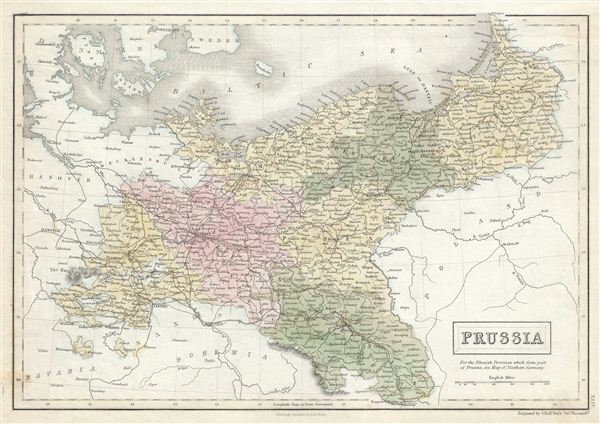
Prussia.
sold
- Digital Map Information
- Suitable for large format printing
- DPI: 300
- File Size: 5.97 MB
- File Type: ZIP / TIFF
- ICC color profile embedded
- Delivered instantly via download link
This is a fine example of Adam and Charles Black's 1851 map of Prussia, Germany. Prussia stretches across the map from the Harz moving eastward, including Brandenburg and Saxony, to east Prussia and covers what is today northeastern Germany and Poland. Prussia ... (more details)

Denmark.
sold
- Digital Map Information
- Suitable for large format printing
- DPI: 300
- File Size: 6.71 MB
- File Type: ZIP / TIFF
- ICC color profile embedded
- Delivered instantly via download link
This is a fine example of Adam and Charles Black's 1851 map of Denmark. It covers all of Denmark inclusive of the Duchy of Holstein. At this time in history, Denmark was in the midst of a prolonged period of peace and prosperity that led to a cultural and ... (more details)

Russia in Europe.
sold
- Digital Map Information
- Suitable for large format printing
- DPI: 300
- File Size: 12.91 MB
- File Type: ZIP / TIFF
- ICC color profile embedded
- Delivered instantly via download link
This is a fine example of Adam and Charles Black's 1851 map of european Russia. The map depicts the european portions of Russia from the Arctic Sea south to the Black Sea and Caspian Sea, and extending west as far as Poland and east as far as Orenburg and ... (more details)

West Indies.
sold
- Digital Map Information
- Suitable for large format printing
- DPI: 300
- File Size: 7.53 MB
- File Type: ZIP / TIFF
- ICC color profile embedded
- Delivered instantly via download link
This is a fine example of Adam and Charles Black's 1851 map of West Indies. Centered on Haiti or Santo Domingo, it covers the Caribbean from Florida to the Gulf of Panama and from Yucatan to the Lesser Antilles and Barbados. It includes the Bahamans, ... (more details)
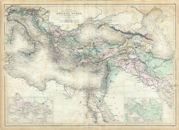
Map of the Principal Countries of the Ancient World extending from The Alps to the Southern Frontier of Egypt and from Carthage to Persepolis.
sold
- Digital Map Information
- Suitable for large format printing
- DPI: 300
- File Size: 19.52 MB
- File Type: ZIP / TIFF
- ICC color profile embedded
- Delivered instantly via download link
This is a fine example of Adam and Charles Black's 1851 map of the principal counties of the Ancient World. The map depicts part of the empire of Alexander the Great and covers from modern day Italy south as far as egypt and from Corsica to Caspian ... (more details)

Brazil.
sold
- Digital Map Information
- Suitable for large format printing
- DPI: 300
- File Size: 6.64 MB
- File Type: ZIP / TIFF
- ICC color profile embedded
- Delivered instantly via download link
This is a fine example of Adam and Charles Black's 1851 map of Brazil. It covers the South American countries of Brazil, Uruguay, Paraguay and Guyana. Under emperor Dom Pedro I Brazil had declared itself indecent of Portugal roughly 29 turbulent ... (more details)
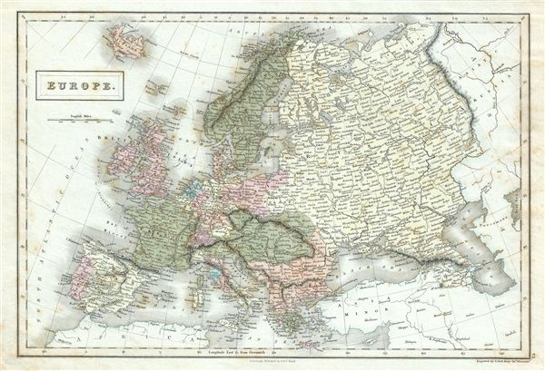
Europe.
sold
- Digital Map Information
- Suitable for large format printing
- DPI: 300
- File Size: 6.32 MB
- File Type: ZIP / TIFF
- ICC color profile embedded
- Delivered instantly via download link
This is a fine example of Adam and Charles Black's 1851 map of europe. The map covers the continent in its entirety from the North Atlantic Ocean to the Caspian Sea and from the Arctic Sea to the Mediterranean Sea, including Iceland. It shows ... (more details)

Konigreich Italien.
sold
- Digital Map Information
- Suitable for large format printing
- File Size: 37.2 MB
- File Type: ZIP / TIFF
- ICC color profile embedded
- Delivered instantly via download link
An appealing c. 1890 large format map of Italy issued by Carl Flemming and Friedrich Handtke. The map covers the Italian peninsula in full from the Alps to Sicily, including Malta, Sardinia, Pantelleria, and Corsica. An inset map in the lower ... (more details)
Early 18th century birds-eye view of Malta.

D'Oude Schets Van Het Eyland Malta, alwaer, Paulus Na Zyn Schipbreuk Aenlandde . Act. XXVII.1.
sold
- Digital Map Information
- Suitable for large format printing
- DPI: 300
- File Size: 10.58 MB
- File Type: ZIP / TIFF
- ICC color profile embedded
- Delivered instantly via download link
A scarce and visually stunning Augustin Calmet 1729 topographical map and view of Malta. The map / view is oriented to the southwest and illustrates the island from a bird's-eye perspective, with mountains, buildings, trees, and fortifications rendered in profile. The fortifications of Valletta are clearly visible as are various small towns, fortifications, and lookout towers. A key in the upper right quadrant corresponds to numerical references found throughout the map. (more details)
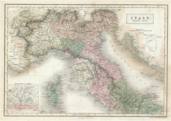
Italy, North part.
sold
- Digital Map Information
- Suitable for large format printing
- DPI: 300
- File Size: 6.54 MB
- File Type: ZIP / TIFF
- ICC color profile embedded
- Delivered instantly via download link
This is a fine example of Adam and Charles Black's 1851 map of northern Italy. The map covers the island of Corsica and Northern Italy, including the regions of Tuscany, Modena, Parma, the Sardinian States, Austrian Lombardy and the State of ... (more details)

Hellas or Greece.
sold
- Digital Map Information
- Suitable for large format printing
- DPI: 300
- File Size: 7.48 MB
- File Type: ZIP / TIFF
- ICC color profile embedded
- Delivered instantly via download link
This is a fine example of Adam and Charles Black's 1851 map of Greece. It covers Greece from the Pagasetic Gulf to Cythera and includes the Cyclades as far east as Naxos. An inset in the lower left quadrant details the island of Corfu. ... (more details)
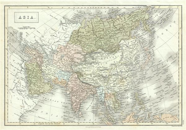
Asia.
sold
- Digital Map Information
- Suitable for large format printing
- DPI: 300
- File Size: 6.98 MB
- File Type: ZIP / TIFF
- ICC color profile embedded
- Delivered instantly via download link
This is a fine example of Adam and Charles Black's 1851 map of Asia. The map covers the entire Asian continent from the Arctic Ocean to the Indian Ocean and from the Mediterranean Sea to the North Pacific Ocean. The map covers Turkey, ... (more details)
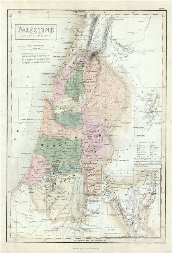
Palestine according to its Ancient Divisions.
sold
- Digital Map Information
- Suitable for large format printing
- DPI: 300
- File Size: 5.79 MB
- File Type: ZIP / TIFF
- ICC color profile embedded
- Delivered instantly via download link
This is a fine example of the Adam and Charles Black's 1851 map of Ancient Palestine, Israel or the Holy Land. It covers the region as it existed in Biblical times with divisions for each of the Twelve Tribes of Israel and includes the ... (more details)

Persia and Afghanistan.
sold
- Digital Map Information
- Suitable for large format printing
- DPI: 300
- File Size: 6.16 MB
- File Type: ZIP / TIFF
- ICC color profile embedded
- Delivered instantly via download link
This is a fine example of the Adam and Charles Black's 1851 map of Persia and Afghanistan. Centered on Yazd (Yezd) in modern day Iran, the map covers Iran, Afghanistan and parts of Pakistan, Iraq, India and Turkmenistan. It is curious ... (more details)
Includes an early map of Singapore Island and city as an inset.
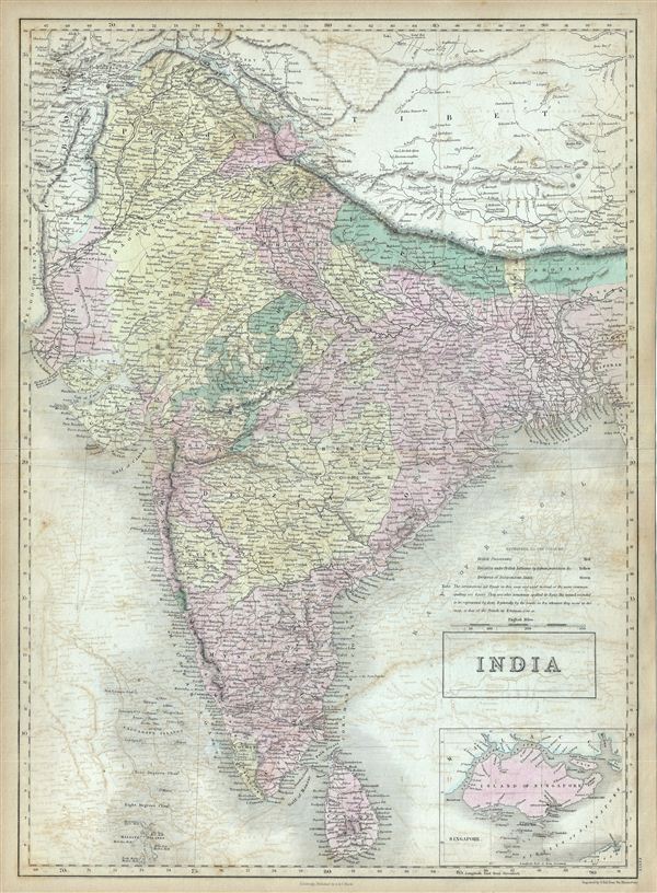
India.
sold
- Digital Map Information
- Suitable for large format printing
- DPI: 300
- File Size: 19.01 MB
- File Type: ZIP / TIFF
- ICC color profile embedded
- Delivered instantly via download link
This is a fine example of the Adam and Charles Black's 1851 map of India. It covers the Indian subcontinent from the Indian Caucasus Mountains to the Indian Ocean and includes Ceylon or Sri Lanka and part of Kabul in Afghanistan. The ... (more details)
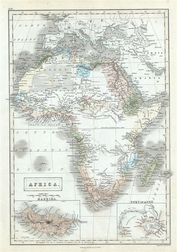
Africa.
sold
- Digital Map Information
- Suitable for large format printing
- DPI: 300
- File Size: 6.44 MB
- File Type: ZIP / TIFF
- ICC color profile embedded
- Delivered instantly via download link
This is a fine example of the Adam and Charles Black's 1851 map of Africa. It covers the entire continent from the Mediterranean Sea to the Indian Ocean and the South Atlantic, including the island of Madagascar. An inset map in the ... (more details)
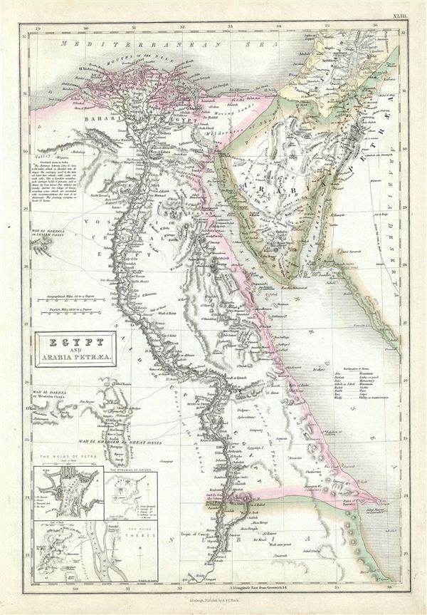
Egypt and Arabia Petraea.
sold
- Digital Map Information
- Suitable for large format printing
- DPI: 300
- File Size: 5.9 MB
- File Type: ZIP / TIFF
- ICC color profile embedded
- Delivered instantly via download link
This is a fine example of Adam and Charles Black's 1851 map of egypt and the Sinai. It covers modern day egypt as well as parts of adjacent, Palestine, Israel, Sudan, and Jordan. Three insets in the lower left quadrant detail 'The ... (more details)

Eastern Islands Birmah &c.
sold
- Digital Map Information
- Suitable for large format printing
- DPI: 300
- File Size: 7.6 MB
- File Type: ZIP / TIFF
- ICC color profile embedded
- Delivered instantly via download link
This is a fine example of Adam and Charles Black's 1851 map of the east Indies, Southeast Asia, and the Philippines. Includes modern day nations of Singapore, Myanmar (Burma), Laos, Vietnam, Cambodia, Thailand, Malaysia, Indonesia, ... (more details)
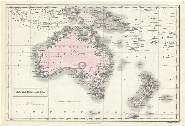
Australia.
sold
- Digital Map Information
- Suitable for large format printing
- Full resolution TIFF file
- ICC color profile embedded
- Delivered instantly via download link
This is a fine example of Adam and Charles Black's 1851 map of Australia and New Zealand. The map covers from the east Indies to the Auckland Islands and the Chatam Islands of New Zealand. It includes New Holland or Australia, New ... (more details)