
Mostly likely the finest commercially published Civil War Era map of the Mississippi River.
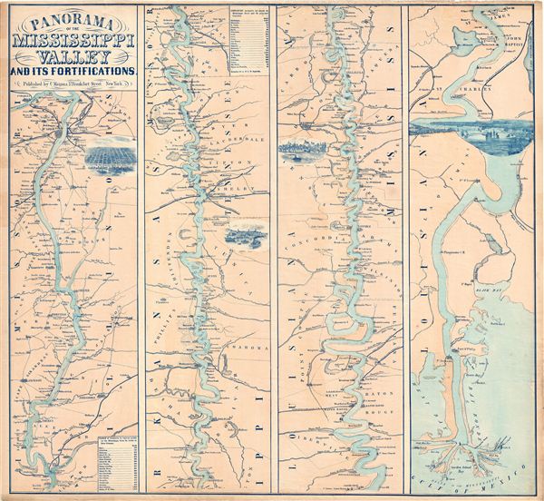
Panorama Of The Mississippi Valley And Its Fortifications.
sold
- Digital Map Information
- Suitable for large format printing
- File Size: 19.45 MB
- File Type: ZIP / TIFF
- ICC color profile embedded
- Delivered instantly via download link
An exceptionally scarce 1863 Charles Magnus Civil War era broadside map of the Mississippi River valley from St. Louis to the Delta of the Mississippi. This map, or as it is called 'panorama,' is presented in strip format divided into four distinct sections. each ... (more details)
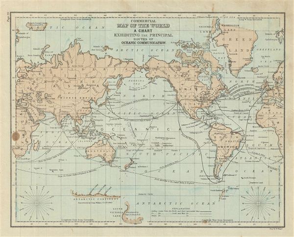
Commercial Map of the World A Chart Exhibiting the Principal Routes of Oceanic Communication.
sold
- Digital Map Information
- Suitable for large format printing
- File Size: 3.67 MB
- File Type: ZIP / TIFF
- ICC color profile embedded
- Delivered instantly via download link
This is an example of David M. Warren's 1879 map of the World with a chart showing the principal routes of oceanic communication. Centered on the Bering Strait, it covers the entire world. Although countries and major cities are labeled, political distinctions ... (more details)
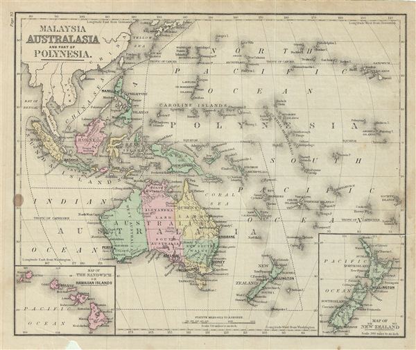
Malaysia Australia and Part of Polynesia.
sold
- Digital Map Information
- Suitable for large format printing
- File Size: 4.19 MB
- File Type: ZIP / TIFF
- ICC color profile embedded
- Delivered instantly via download link
This is an example of David M. Warren's 1879 map of Australia and Polynesia. It covers Australia, Polynesia, Melanesia and Malaysia. An inset in the lower left quadrant depicts the Sandwich or Hawaiian Islands. Another inset in the lower right quadrant ... (more details)
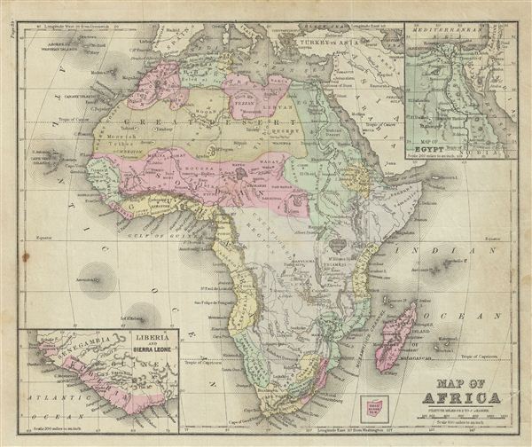
Map of Africa.
sold
- Digital Map Information
- Suitable for large format printing
- File Size: 4.44 MB
- File Type: ZIP / TIFF
- ICC color profile embedded
- Delivered instantly via download link
This is an example of David M. Warren's 1879 map of Africa. It covers the entire continent from the Mediterranean Sea to the Cape of Good Hope, including the island of Madagascar. Part of adjacent Arabia and Turkey are also featured. An inset map in ... (more details)

Map of Asia.
sold
- Digital Map Information
- Suitable for large format printing
- File Size: 4.91 MB
- File Type: ZIP / TIFF
- ICC color profile embedded
- Delivered instantly via download link
This is an example of David M. Warren's 1879 map of Asia. It covers from the Arabian Peninsula and Turkey eastward as far as Kamchatka and Japan. It includes the empires of Hindoostan (India), China (includes Tibet), Turkistan, Persia (Iran), ... (more details)

Commercial Map of the United States showing the Principal Connecting Lines of Railroad.
sold
- Digital Map Information
- Suitable for large format printing
- File Size: 4.75 MB
- File Type: ZIP / TIFF
- ICC color profile embedded
- Delivered instantly via download link
This is an example of David M. Warren's 1879 map of the United States showing its principal connecting railroad lines. It covers the most inhabited parts of the United States from Texas, Kansas, Nebraska and Dakota eastward to the Atlantic. ... (more details)
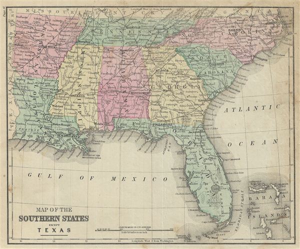
Map of the Southern States except Texas.
sold
- Digital Map Information
- Suitable for large format printing
- File Size: 4.67 MB
- File Type: ZIP / TIFF
- ICC color profile embedded
- Delivered instantly via download link
This is an example of David M. Warren's 1879 map of the Southern states of the United States. It covers Arkansas, Louisiana, Mississippi, Tennessee, North Carolina, South Carolina, Georgia, Alabama and Florida, including the Bahamas. The ... (more details)
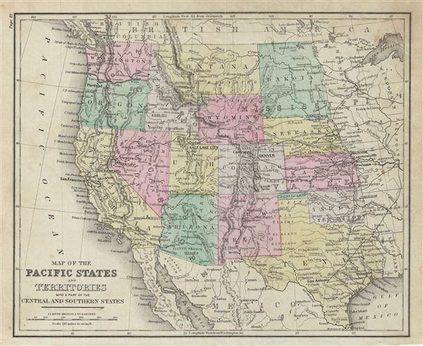
Map of the Pacific States and Territories with a part of the Central and Southern States.
sold
- Digital Map Information
- Suitable for large format printing
- File Size: 4.28 MB
- File Type: ZIP / TIFF
- ICC color profile embedded
- Delivered instantly via download link
This is an example of David M. Warren's 1879 map of the Pacific, central and southern states of the United States. The map covers the states of Washington, Montana, Dakota, Nebraska, Wyoming, Oregon, Indiana, California, Nevada, Arizona, ... (more details)
1879 Warren Map of the Mid Atlantic States: NY, NJ, Pennsylvania, Virginia, W Virginia, Maryland, De

Map of the Middle Atlantic States.
sold
- Digital Map Information
- Suitable for large format printing
- File Size: 4.57 MB
- File Type: ZIP / TIFF
- ICC color profile embedded
- Delivered instantly via download link
This is an example of David M. Warren's 1879 map of the Mid-Atlantic States. It covers New York, Pennsylvania, New Jersey, Delaware, Maryland, Virginia and West Virginia. Parts of neighboring Ohio, Kentucky and North Carolina are also ... (more details)
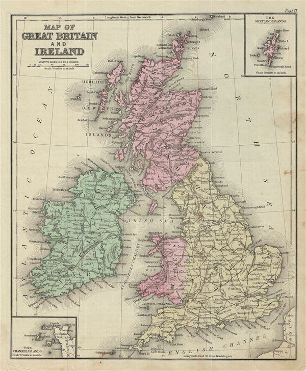
Map of Great Britain and Ireland.
sold
- Digital Map Information
- Suitable for large format printing
- File Size: 4.87 MB
- File Type: ZIP / TIFF
- ICC color profile embedded
- Delivered instantly via download link
This is an example of David M. Warren's 1879 map of Great Britain and Ireland. It covers the British Isles from the Orkney Islands to Scilly Islands and includes the Hebrides Islands and Ireland. An inset in the top right quadrant ... (more details)
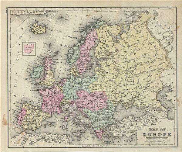
Map of Europe.
sold
- Digital Map Information
- Suitable for large format printing
- File Size: 4.85 MB
- File Type: ZIP / TIFF
- ICC color profile embedded
- Delivered instantly via download link
This is an example of David M. Warren's 1879 map of europe. The map covers the continent in its entirety from the Atlantic to the Caspian Sea and from the Arctic Ocean to the Mediterranean Sea. It also details Iceland and parts of ... (more details)
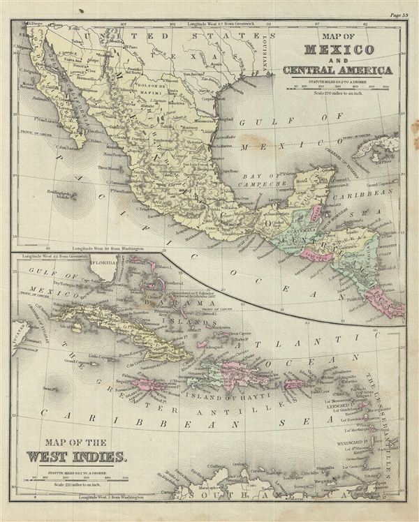
Map of Mexico and Central America. Map of the West Indies.
sold
- Digital Map Information
- Suitable for large format printing
- File Size: 4.76 MB
- File Type: ZIP / TIFF
- ICC color profile embedded
- Delivered instantly via download link
This is an example of David M. Warren's 1879 map of Mexico, Central America and the West Indies. Divided into two parts, the upper map covers Mexico and Central America from Mexico to Costa Rica. The lower map details West Indies ... (more details)
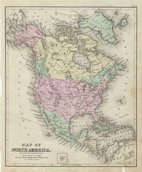
Map of North America.
sold
- Digital Map Information
- Suitable for large format printing
- File Size: 4.4 MB
- File Type: ZIP / TIFF
- ICC color profile embedded
- Delivered instantly via download link
This is an example of David M. Warren's 1879 map of North America. Centered on the United States, it covers from the Arctic Ocean to Panama, including Greenland, Iceland and parts of South American and the West Indies. ... (more details)

Map of Nine of the Central States.
sold
- Digital Map Information
- Suitable for large format printing
- File Size: 4.48 MB
- File Type: ZIP / TIFF
- ICC color profile embedded
- Delivered instantly via download link
This is an example of David M. Warren's 1879 map of the nine central states of the United States. It covers Minnesota, Wisconsin, Michigan, Ohio, Kentucky, Indiana, Illinois, Iowa and Missouri. It also includes parts ... (more details)

Map of the British Provinces of North America.
sold
- Digital Map Information
- Suitable for large format printing
- File Size: 4.12 MB
- File Type: ZIP / TIFF
- ICC color profile embedded
- Delivered instantly via download link
This is an example of David M. Warren's 1879 map of Canada or the British Provinces of North America. It covers from the Clear Water Lake in Ontario to New Jersey in the United States and from the eastern end of Lake ... (more details)
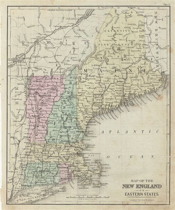
Map of the New England or Eastern States.
sold
- Digital Map Information
- Suitable for large format printing
- File Size: 4.69 MB
- File Type: ZIP / TIFF
- ICC color profile embedded
- Delivered instantly via download link
This is an example of David M. Warren's 1879 map of New england or the eastern States. It covers Maine, New Hampshire, Vermont, Massachusetts, Connecticut and Rhode Island. Parts of neighboring New York, Long ... (more details)

Map of Central Europe.
sold
- Digital Map Information
- Suitable for large format printing
- File Size: 4.71 MB
- File Type: ZIP / TIFF
- ICC color profile embedded
- Delivered instantly via download link
This is an example of David M. Warren's 1879 map of Central europe. It covers from Denmark to the Mediterranean Sea and includes the modern nations of Germany, Switzerland, Italy, Austria, european Turkey and ... (more details)

Carte de la Palestine pour l'intelligence de son histoire. Depuis les temps les plus reculés jusqu'au retour de la captivite de Babylene en 536 avant J.C. Carte de la Palestine pour l'intelligence de son histoire. Depuis le retour de la captivite jusqu'au 5eme Siecle de l'ere Vulgaire.
sold
- Digital Map Information
- Suitable for large format printing
- DPI: 300
- File Size: 9.32 MB
- File Type: ZIP / TIFF
- ICC color profile embedded
- Delivered instantly via download link
This is a beautiful example of Alexandre Delamarche's 1850 map of Israel, Palestine or Holy Land. Map is divided into two parts. The map on the left details Israel (Palestine) detailing the Babylonian exile ... (more details)

Carte de l'Égypte et de la Palestine jusqu'au temps de Moise Limites du Royaume de David et de Salomon.
sold
- Digital Map Information
- Suitable for large format printing
- DPI: 300
- File Size: 7.55 MB
- File Type: ZIP / TIFF
- ICC color profile embedded
- Delivered instantly via download link
This is a beautiful example of Alexandre Delamarche's 1850 map of egypt and Israel, Palestine or Holy Land from the time of the Biblical Moses to the reigns of David and Solomon. It covers from egypt to ... (more details)
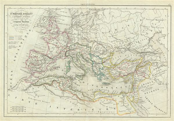
Carte de l'Empire Romain depuis l'Avenement d'Auguste jusqu'au traite de paix entre l'Empereur Diocletien et le Roi Sassanide Narses.
sold
- Digital Map Information
- Suitable for large format printing
- Full resolution TIFF file
- ICC color profile embedded
- Delivered instantly via download link
This is a beautiful example of Alexandre Delamarche's 1845 map of europe under the Roman empire from the time of Augustus Caesar to the signing of the peace treaty between emperor Diocletian and the ... (more details)