

The North East Part of Italy, Comprising the Estates of Venice, The Dutchies of Milan, Mantua, Modena & Parma; with Part of the Estates of Genoa, From the best Authorities.
sold
- Digital Map Information
- Suitable for large format printing
- DPI: 300
- File Size: 3.37 MB
- File Type: ZIP / TIFF
- ICC color profile embedded
- Delivered instantly via download link
An exquisitely detailed first edition 1794 map of northeastern Italy and the Venetian States by Robert Wilkinson. Wilkinson's map covers from the Duchy of Milan to the Gulf of Venice and from Tyrol to the Gulf of Genoa, inclusive of Venice, Milan, Parma, Genoa, ... (more details)

Italy, with the Islands of Sicily, Sardinia, & Corsica, Drawn from the Best Authorities.
sold
- Digital Map Information
- Suitable for large format printing
- DPI: 300
- File Size: 2.91 MB
- File Type: ZIP / TIFF
- ICC color profile embedded
- Delivered instantly via download link
An exquisitely detailed first edition 1794 map of Italy by Robert Wilkinson. Covers the entire peninsula of Italy as well as Piedmont, the Venetian States, the Dalmatian Coast, and the islands of Sardinia, Corsica, and Sicily. Color coding defines individual ... (more details)
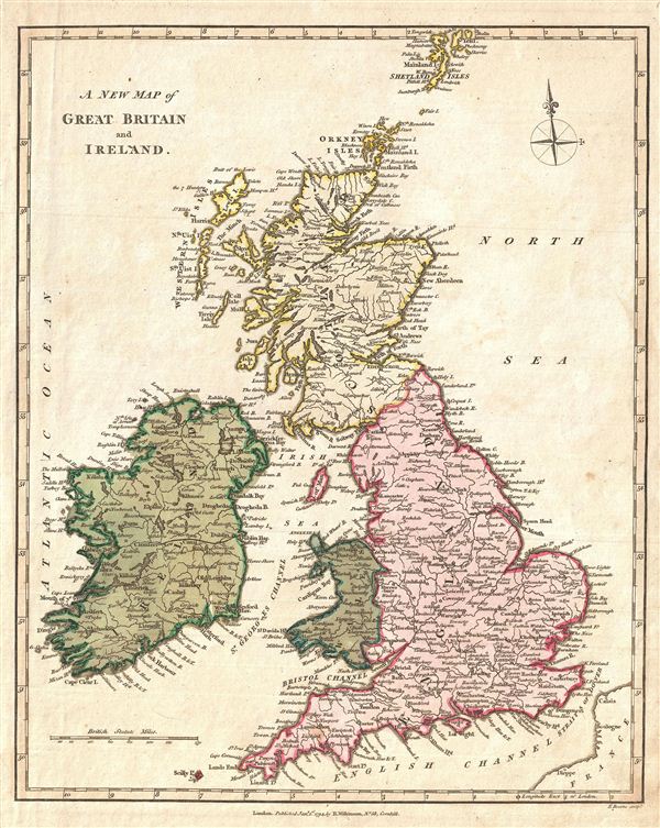
A New Map of Great Britain and Ireland.
sold
- Digital Map Information
- Suitable for large format printing
- DPI: 300
- File Size: 3.1 MB
- File Type: ZIP / TIFF
- ICC color profile embedded
- Delivered instantly via download link
An exquisitely detailed first edition 1794 map of the British Isles by Robert Wilkinson. Wilkinson's map covers all of england, Scotland, and Ireland, inclusive of the Shetland Isles. Color coding divides the map according to region, with england, Ireland, ... (more details)

A New and Acurate Map of England and Wales, from the latest Surveys.
sold
- Digital Map Information
- Suitable for large format printing
- DPI: 300
- File Size: 4.08 MB
- File Type: ZIP / TIFF
- ICC color profile embedded
- Delivered instantly via download link
A finely detailed first edition 1794 map of england and Wales by Robert Wilkinson. Wilkinson's map covers england in full Scotland south to the english Channel and from St. George's Channel to the mouth of the Thames River. Color coding divides the region ... (more details)

A New and Accurate Map of Scotland from the latest Surveys.
sold
- Digital Map Information
- Suitable for large format printing
- DPI: 300
- File Size: 3.72 MB
- File Type: ZIP / TIFF
- ICC color profile embedded
- Delivered instantly via download link
A finely detailed first edition 1794 map of Scotland by Robert Wilkinson. Wilkinson's map covers Scotland in full from the Cheviot Hills to the Orkney Island and from the Outer Hebrides (Western Islands) to Aberdeenshire. Color coding divides the region ... (more details)

A New Map of Ireland from the best Authorities.
sold
- Digital Map Information
- Suitable for large format printing
- DPI: 300
- File Size: 2.07 MB
- File Type: ZIP / TIFF
- ICC color profile embedded
- Delivered instantly via download link
A fine first edition 1794 map of Ireland by Robert Wilkinson. Wilkinson's map depicts Ireland in full with color coding dividing the island into its four ancient provinces: Ulster, Connaught, Leinster, and Munster. These in turn are subdivided into 32 ... (more details)
The only known example of Grierson's 1732 piracy of Herman Moll's Codfish Map of North America.
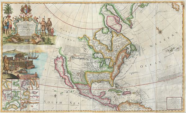
To His Grace Hugh, Lord Archbishop of Armagh, Primate and Metropolitan of all Ireland and One of the Lords Justices of the said Kingdom this map of North America According to the Newest and most Exact Observations is most humbly Dedicated by your Graces most humble Serv: Geo: Grierson.
sold
- Digital Map Information
- Suitable for large format printing
- Full resolution TIFF file
- ICC color profile embedded
- Delivered instantly via download link
An antique map discovery of the utmost rarity. Ostensibly, this is a fine example of Hermann MollÂ's important and highly desirable 1720 Codfish Map, entitled 'To the Right Honourable John Lord Sommers...' Upon closer inspection however, an entirely ... (more details)

Plan of Aldgate Ward with its Divisions into Precints and Parishes from a New Survey. Plan of Lime Street Ward Divided into Parishes from a new Survey. Plan of Queen Hith and Vintry Wards Divided into Parishe, from a New Survey.
sold
- Digital Map Information
- Suitable for large format printing
- DPI: 300
- File Size: 5.32 MB
- File Type: ZIP / TIFF
- ICC color profile embedded
- Delivered instantly via download link
An uncommon and appealing c. 1780 ward plan of parts of London, England, by Alexander Hogg. Essentially three maps in one, this chart covers, from top down Aldgate Ward, Lime Street Ward, and Queen Hith and Vintry Wards. The Aldgate Map is centered ... (more details)

Edgwater, Pleasant Valley, Ridgefield, Fairview.
sold
- Digital Map Information
- Suitable for large format printing
- File Size: 11.1 MB
- File Type: ZIP / TIFF
- ICC color profile embedded
- Delivered instantly via download link
Maps of Edgewater merging into Pleasant Valley, and Ridgefield merging into Fairview, showing roads, hachured relief, property boundaries and owners' names. Published as plates 156-157 in Walker & Pease' exquisite 'topographical, illustrated, ... (more details)
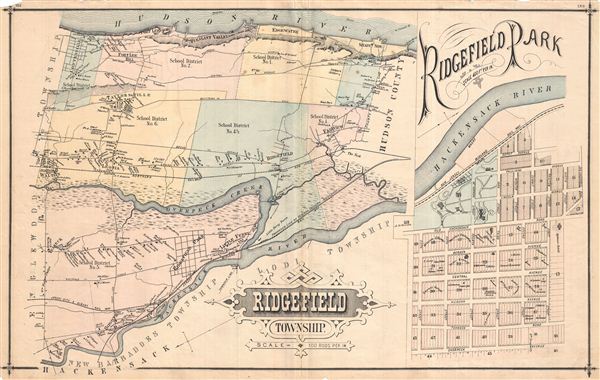
Ridgefield, Township.
sold
- Digital Map Information
- Suitable for large format printing
- File Size: 11.95 MB
- File Type: ZIP / TIFF
- ICC color profile embedded
- Delivered instantly via download link
Exquisitely detailed 1876 map of Ridgefield Township, New Jersey, showing roads and property owners' names. With an inset of Ridgefield Park, showing numbered lots. Notable is the early depiction of school district boundaries in a state that ... (more details)
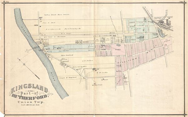
Kingsland and part of Rutherford, Union Township.
sold
- Digital Map Information
- Suitable for large format printing
- File Size: 9.14 MB
- File Type: ZIP / TIFF
- ICC color profile embedded
- Delivered instantly via download link
Detailed 1876 map of Kingsland and part of Rutherford in Union Township, New Jersey. Shows roads, property boundaries and owners' names. Published as plates 148-149 in Walker & Pease' exquisite 'topographical, illustrated, historical, ... (more details)
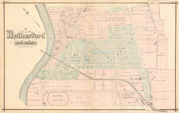
Rutherford, Union Township.
sold
- Digital Map Information
- Suitable for large format printing
- File Size: 9.91 MB
- File Type: ZIP / TIFF
- ICC color profile embedded
- Delivered instantly via download link
Very detailed 1876 map of the southern portion of Rutherford in Union Township, New Jersey. Shows roads, property boundaries and owners' names. Published as plates 144-145 in Walker & Pease' exquisite 'topographical, illustrated, ... (more details)
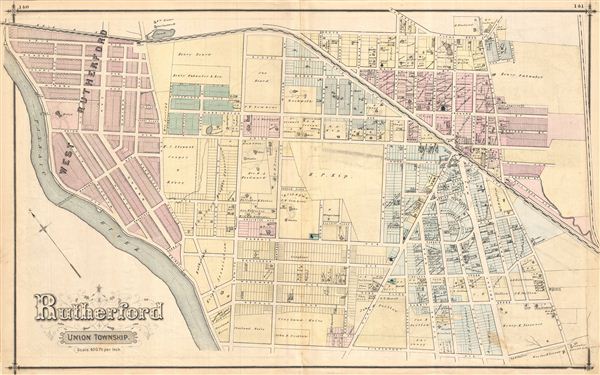
Rutherford, Union Township.
sold
- Digital Map Information
- Suitable for large format printing
- File Size: 12.59 MB
- File Type: ZIP / TIFF
- ICC color profile embedded
- Delivered instantly via download link
Highly detailed 1876 map of the northern portion of Rutherford in Union Township, New Jersey. Shows roads and property boundaries and owners' names. Published as plates 140-141 in Walker & Pease' exquisite 'topographical, ... (more details)
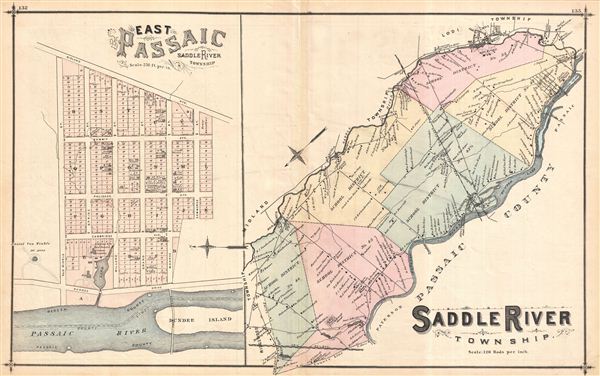
Saddle River Township.
sold
- Digital Map Information
- Suitable for large format printing
- File Size: 10.98 MB
- File Type: ZIP / TIFF
- ICC color profile embedded
- Delivered instantly via download link
Exquisitely detailed 1876 map of Saddle River Township, New Jersey, showing roads and property owners' names. With an inset of East Passaic showing numbered property lots. Notable is the early depiction of school district ... (more details)
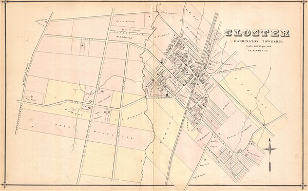
Closter, Harrington Township.
sold
- Digital Map Information
- Suitable for large format printing
- File Size: 8.65 MB
- File Type: ZIP / TIFF
- ICC color profile embedded
- Delivered instantly via download link
Thoroughly detailed 1876 map of Closter, Harrington Township, New Jersey. Shows roads and property boundaries and owners' names. Published as plates 100-101 in Walker & Pease' exquisite 'topographical, illustrated, ... (more details)
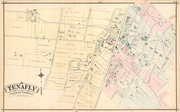
Tenafly, Palisade Township.
sold
- Digital Map Information
- Suitable for large format printing
- File Size: 8.77 MB
- File Type: ZIP / TIFF
- ICC color profile embedded
- Delivered instantly via download link
Extremely detailed 1876 map of Tenafly, Palisade Township, New Jersey, showing roads and property owners' names. Published as plates 84-85 in Walker & Pease' exquisite 'topographical, illustrated, historical, ... (more details)

Palisade Township.
sold
- Digital Map Information
- Suitable for large format printing
- File Size: 10.15 MB
- File Type: ZIP / TIFF
- ICC color profile embedded
- Delivered instantly via download link
Highly detailed 1876 map of Palisade Township, New Jersey, showing roads and property owners' names. Notable too is the early depiction of school district boundaries in a state that today publicizes the high ... (more details)
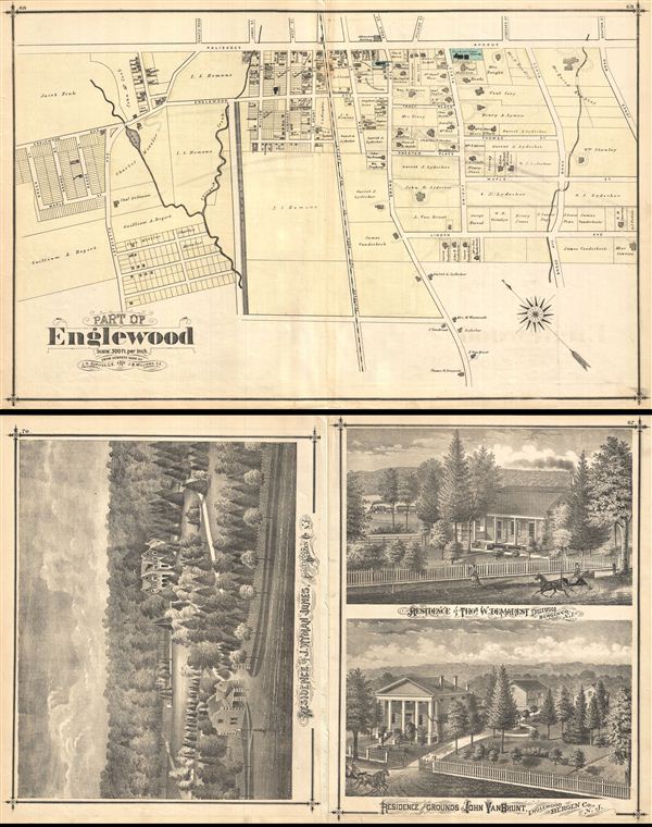
Part of Englewood.
sold
- Digital Map Information
- Suitable for large format printing
- File Size: 33.7 MB
- File Type: ZIP / TIFF
- ICC color profile embedded
- Delivered instantly via download link
Very detailed 1876 map of southwestern Englewood, New Jersey (part 2 of 2, showing roads and property owners' names, and building footprints. Published as plates 68-69 in Walker & Pease' exquisite ... (more details)
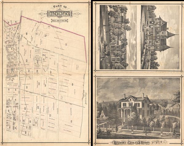
Part of Hackensack.
sold
- Digital Map Information
- Suitable for large format printing
- File Size: 32.54 MB
- File Type: ZIP / TIFF
- ICC color profile embedded
- Delivered instantly via download link
Very detailed map of part of Hackensack (2 of 2), New Jersey, showing property boundaries, owners' names and individual building footprints. Published as plates 48-49 in Walker & Pease's exquisite ... (more details)
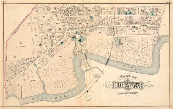
Part of Hackensack.
sold
- Digital Map Information
- Suitable for large format printing
- File Size: 12.61 MB
- File Type: ZIP / TIFF
- ICC color profile embedded
- Delivered instantly via download link
Very detailed map of part of Hackensack (1 of 2), New Jersey, showing property boundaries, owners' names and individual building footprints. Published as plates 44-45 in Walker & Pease's exquisite ... (more details)