

Venezuela, New Grenada & Equador.
sold
- Digital Map Information
- Suitable for large format printing
- DPI: 300
- File Size: 7.72 MB
- File Type: ZIP / TIFF
- ICC color profile embedded
- Delivered instantly via download link
A fine example of Thomas Cowperthwait and S. A. Mitchell's 1854 map of Venezuela, Colombia (New Grenada) and Ecuador. The whole is engraved and colored in Mitchell's distinctive style with green border work and vivid pastels. Political and topographical features ... (more details)

A New Map of the State of Illinois.
sold
- Digital Map Information
- Suitable for large format printing
- DPI: 300
- File Size: 10.19 MB
- File Type: ZIP / TIFF
- ICC color profile embedded
- Delivered instantly via download link
A fine example of Thomas Cowperthwait and S. A. Mitchell's 1854 map of Illinois. The whole is engraved and colored in Mitchell's distinctive style with green border work and vivid pastels. Political and topographical features are noted and color coded with ... (more details)

A New Map of the State of Iowa.
sold
- Digital Map Information
- Suitable for large format printing
- DPI: 300
- File Size: 9.5 MB
- File Type: ZIP / TIFF
- ICC color profile embedded
- Delivered instantly via download link
A fine example of Thomas Cowperthwait and S. A. Mitchell's 1854 map of Iowa. The whole is engraved and colored in Mitchell's distinctive style with green border work and vivid pastels. Political and topographical features are noted and color coded with ... (more details)
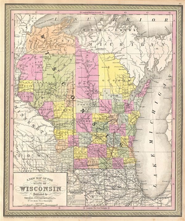
A New Map of the State of Wisconsin.
sold
- Digital Map Information
- Suitable for large format printing
- DPI: 300
- File Size: 10.52 MB
- File Type: ZIP / TIFF
- ICC color profile embedded
- Delivered instantly via download link
A fine example of Thomas Cowperthwait and S. A. Mitchell's 1854 map of Wisconsin. The whole is engraved and colored in Mitchell's distinctive style with green border work and vivid pastels. Political and topographical features are noted and color coded ... (more details)
Early mapping of Australia with incomplete northern shoreline.
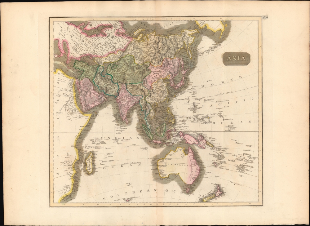
Asia.
sold
- Digital Map Information
- Suitable for large format printing
- DPI: 300
- File Size: 13.57 MB
- File Type: ZIP / TIFF
- ICC color profile embedded
- Delivered instantly via download link
This fascinating hand colored 1814 map depicts Asia and Australia. The whole is beautifully engraved in the minimalist English style pioneered in the early part of the 19th century. Thomson maps are known for their stunning color, awe inspiring size, ... (more details)

West India Islands.
sold
- Digital Map Information
- Suitable for large format printing
- DPI: 300
- File Size: 15.11 MB
- File Type: ZIP / TIFF
- ICC color profile embedded
- Delivered instantly via download link
This exquisitely hand-colored 1814 map depicts three Caribbean Islands: St. Christopher, St. Lucia, and Nevis. The whole is beautifully engraved in the minimalist English style pioneered in the early part of the 19th century. Thomson maps are known ... (more details)

North Africa. South Africa.
sold
- Digital Map Information
- Suitable for large format printing
- DPI: 300
- File Size: 16.17 MB
- File Type: ZIP / TIFF
- ICC color profile embedded
- Delivered instantly via download link
This unusual hand-colored 1815 map by John Thomson is essentially two maps in one: North Africa and South Africa. Thomson's decision to focus on these two parts of Africa may seem unusual until one realizes that these were in fact the only ... (more details)

Attica. Turkish Dominions in Europe.
sold
- Digital Map Information
- Suitable for large format printing
- DPI: 300
- File Size: 19.29 MB
- File Type: ZIP / TIFF
- ICC color profile embedded
- Delivered instantly via download link
This is hand colored 1814 map of Greece and Attica. Beautifully engraved in the minimalist English style pioneered in the early part of the 19th century, this chart is essentially two maps in one, the right hand map details Greece and the ... (more details)

Spain and Portugal.
sold
- Digital Map Information
- Suitable for large format printing
- DPI: 300
- File Size: 18.44 MB
- File Type: ZIP / TIFF
- ICC color profile embedded
- Delivered instantly via download link
This fascinating hand colored 1815 map of Spain and Portugal is beautifully engraved in the minimalist English style pioneered in the early part of the 19th century. Thomson's map includes both countries in full, with Spain being divided ... (more details)

Atlantic Islands.
sold
- Digital Map Information
- Suitable for large format printing
- DPI: 300
- File Size: 14.79 MB
- File Type: ZIP / TIFF
- ICC color profile embedded
- Delivered instantly via download link
This lovely hand colored 1814 map depicts the Atlantic islands of Cape Verde, the Canary Islands, Madeira, and the Azores, with insets the ports of Fayal and Lancarota (Lanzarote). Though visited mostly for touristic purposes today, in the ... (more details)

Scotland.
sold
- Digital Map Information
- Suitable for large format printing
- DPI: 300
- File Size: 21.1 MB
- File Type: ZIP / TIFF
- ICC color profile embedded
- Delivered instantly via download link
This beautifully hand colored 1815 map depicts Scotland at an interesting moment in its history. The United Kingdom and its allies had just defeated the Napoleon's French Empire, but the war had been so costly that the United Kingdom began ... (more details)

British Isles.
sold
- Digital Map Information
- Suitable for large format printing
- DPI: 300
- File Size: 18.88 MB
- File Type: ZIP / TIFF
- ICC color profile embedded
- Delivered instantly via download link
This lovely hand-colored 1815 map of the British Isles is beautifully engraved in the minimalist English style pioneered in the early part of the 19th century. This map was issued just as United Kingdom and its allies had just defeated ... (more details)

Scandinavia or Sweden, Denmark & Norway
sold
- Digital Map Information
- Suitable for large format printing
- DPI: 300
- File Size: 14.6 MB
- File Type: ZIP / TIFF
- ICC color profile embedded
- Delivered instantly via download link
This fascinating hand colored 1814 map depicts Sweden, Denmark, and Norway. Modern day Finland, though included, was then part of the Kingdom of Sweden. In Norway, the Lofoten Maelstrom, inspiration for Edgar Allen Poe's classic, the ... (more details)
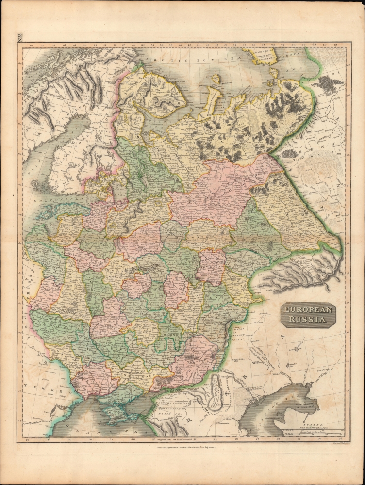
European Russia.
sold
- Digital Map Information
- Suitable for large format printing
- DPI: 300
- File Size: 19.28 MB
- File Type: ZIP / TIFF
- ICC color profile embedded
- Delivered instantly via download link
This impressive 1815 map of the European part of Russia is beautifully engraved in the minimalist English style pioneered in the early part of the 19th century. In 1815 Tsarist Russia emerged from the Napoleonic Wars economically ... (more details)
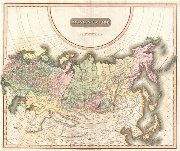
Russian Empire.
sold
- Digital Map Information
- Suitable for large format printing
- DPI: 300
- File Size: 17.69 MB
- File Type: ZIP / TIFF
- ICC color profile embedded
- Delivered instantly via download link
This large 1814 atlas map depicts the Russian Empire in its entirety, both in Europe and in Asia as well as adjacent parts of Tartary, Chinese Tartary, Japan, Korea, and the Gobi. In 1815 Tsarist Russia emerged from the Napoleonic ... (more details)
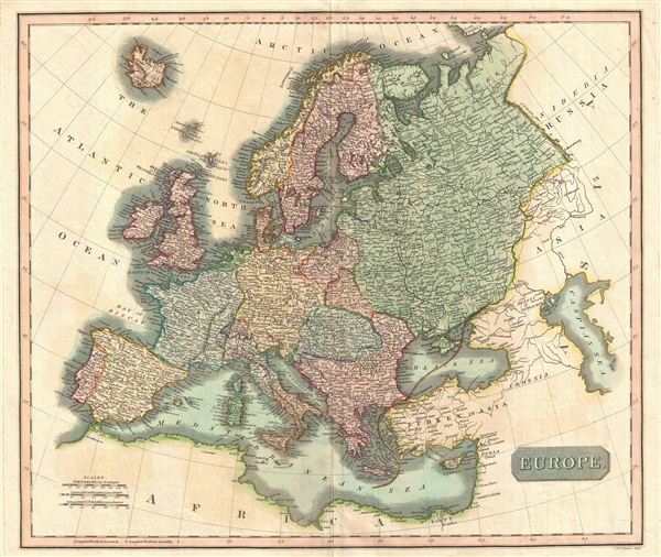
Europe.
sold
- Digital Map Information
- Suitable for large format printing
- DPI: 300
- File Size: 14.61 MB
- File Type: ZIP / TIFF
- ICC color profile embedded
- Delivered instantly via download link
This fascinating hand colored 1814 map depicts Europe one year before Napoleon's final defeat at Battle of Waterloo in 1815. This map illustrates French dominion over Belgium and parts of Northern Italy, a unified Germanic League, ... (more details)
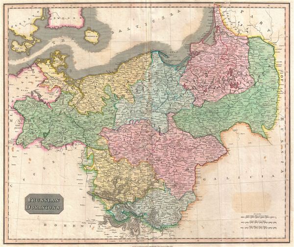
Prussian Dominions.
sold
- Digital Map Information
- Suitable for large format printing
- DPI: 300
- File Size: 16.57 MB
- File Type: ZIP / TIFF
- ICC color profile embedded
- Delivered instantly via download link
This fascinating hand colored 1815 map by Edinburgh cartographer John Thomson depicts Prussia (central and northern Europe). In 1815 Prussia emerged from the Napoleonic Wars and the Congress of Vienna as the dominant Germanic ... (more details)

The Netherlands.
sold
- Digital Map Information
- Suitable for large format printing
- DPI: 300
- File Size: 11.42 MB
- File Type: ZIP / TIFF
- ICC color profile embedded
- Delivered instantly via download link
This beautifully hand colored 1814 Thomson map shows modern day Belgium, here called the Netherlands divided into thirteen departments. The labeled the Netherlands or 'Low Countries' for their elevation, this map focuses on ... (more details)
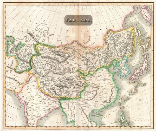
Tartary.
sold
- Digital Map Information
- Suitable for large format printing
- DPI: 300
- File Size: 21.6 MB
- File Type: ZIP / TIFF
- ICC color profile embedded
- Delivered instantly via download link
This fascinating hand colored 1814 map of central and east Asia, covering southern Tartary, Tibet (Thibet), Mongolia, and generally the whole of Central Asia. The area is named after the 'Tartars,' the Turkic and Mongol ... (more details)
One of the finest maps of Arabia to appear in the 19th century.
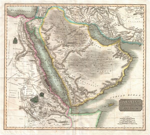
Arabia, Egypt, Abyssinia, Red Sea & c.
sold
- Digital Map Information
- Suitable for large format printing
- DPI: 300
- File Size: 15.19 MB
- File Type: ZIP / TIFF
- ICC color profile embedded
- Delivered instantly via download link
This is an exceptionally fine example of John Thomson's 1817 map of Arabia, Egypt, and Abyssinia. Centered on the Arabian Peninsula, Thomson's map covers from the eastern Mediterranean to the Horn of Africa, and from ... (more details)