
CartoCuriosity - Strahlenberg, A Mapmaker's Misfortune
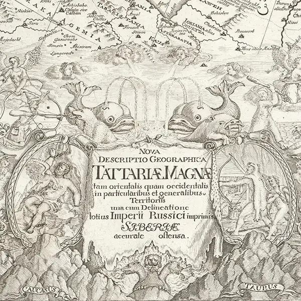
CartoCuriosity - Strahlenberg, A Mapmaker's Misfortune
A Swedish Prisoner of War, against all odds, revolutionizes the mapping of Siberia.
In this episode of CartoCuriosity, James Roy of Geographicus Rare Antique Maps uncovers the extraordinary story of Philipp Johann von Strahlenberg (1676 - 1747), the Swedish soldier, prisoner of war, ethnographer, and pioneering cartographer whose groundbreaking maps transformed European understanding of Siberia, Central Asia, Great Tartary, and the Russian Empire. Captured at the Battle of Poltava (1709) and exiled to Tobolsk during the Great Northern War (1700 - 1721), Strahlenberg devoted his captivity to documenting the geography, languages, cultures, and histories of Russia's remote eastern territories - only to see his manuscripts lost in a fire, confiscated by a powerful governor, stolen, and published without attribution. It is a compelling tale of antique maps, geographic discovery, intellectual theft, and remarkable perseverance, revealing how one mapmaker's misfortunes shaped the eighteenth-century cartography of northern Asia.
Featuring James Roy of Geographicus Rare Antique Maps
Produced by Cory Choy, Tom Fama, and Christian Cuciniello
Music by Luke Allen and El Buru. Sound by Silver Sound
2026-09-01
A Closer Look at the Maps
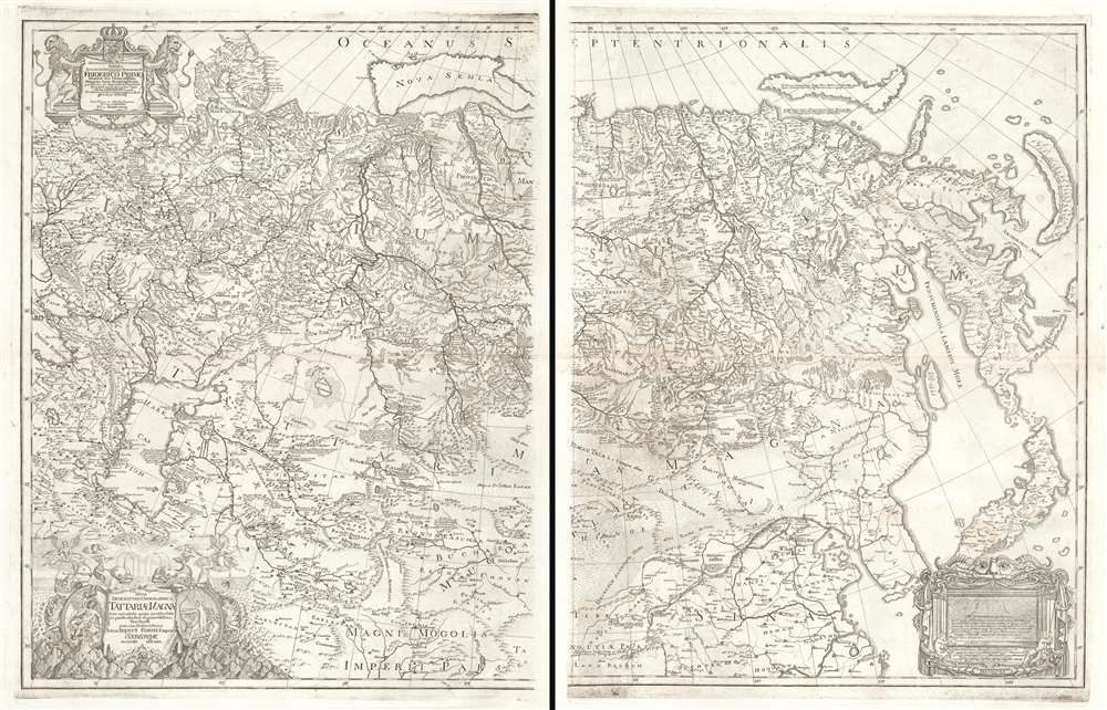
The most important map of the Northeast Passage and the pre-Bering cartography of the Northeast Asian Arctic.
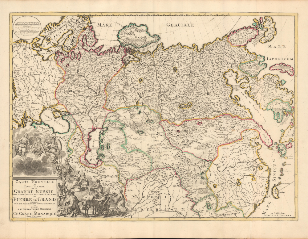
Strahlenberg’s stolen 1715 map of Asiatic Russia and the Tatar Empire.
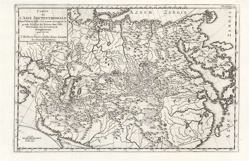
The Tatar Empire mapped from Tatar sources.
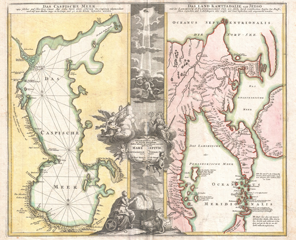
The only surviving glimpse of Strahlenberg’s second lost map.
A mapmaker robbed by history
In this episode of CartoCuriosity, James Roy of Geographicus Rare Antique Maps explores the remarkable and often frustrating life of Philipp Johann von Strahlenberg, a Swedish soldier, prisoner of war, ethnographer, and cartographer whose pioneering maps helped define European knowledge of Siberia and the Russian Empire—yet were repeatedly lost, confiscated, stolen, and published without his consent.
A Soldier in a Losing War
Philipp Johann von Strahlenberg was born in 1677 in Pomerania, in what is now northern Germany. A member of the lower nobility, he entered military service under the Swedish crown.
He soon found himself caught in the Great Northern War (1700–1721), a sweeping conflict that pitted Sweden against a coalition including Russia, Denmark–Norway, and Poland–Lithuania.
After a series of early Swedish successes, the war turned decisively at the Battle of Poltava in 1709. The Swedish army was defeated, Strahlenberg was taken prisoner, and Russia emerged under Peter the Great as a major European power.
Exile in Siberia
As an officer, nobleman, and trained engineer, Strahlenberg received comparatively favorable treatment. He was eventually sent to Tobolsk, the administrative center of Russian Siberia.
There, he enjoyed a surprising degree of freedom, largely because escape across the immense Siberian wilderness was almost inconceivable.
In Siberia, geography itself served as the prison walls.
During his captivity, Strahlenberg began systematically studying the region’s geography. He also developed a deep interest in the histories, languages, customs, and migrations of the Tatar, Kazakh, and other Indigenous peoples of northern and central Asia.
Mapping the Unknown
European knowledge of Russia’s eastern territories remained fragmentary. Siberia and Central Asia were vast, difficult to traverse, and poorly represented on contemporary maps.
Strahlenberg undertook two major scholarly projects:
- Creating a new map of the eastern Russian Empire
- Compiling a genealogical and historical account of the Tatar peoples
His research introduced European readers to place names, territorial relationships, linguistic evidence, and ethnographic information that had rarely, if ever, appeared in Western cartography.
Disaster Strikes
Around 1715, a major fire swept through Tobolsk, a city constructed largely of wood. Attempting to save his research, Strahlenberg threw a chest containing his maps and manuscripts from a window.
By the time he escaped the burning building, the chest had disappeared.
Years of work were gone.
Undeterred, Strahlenberg began again.
Interference and Confiscation
While reconstructing his lost map, Strahlenberg encountered another formidable obstacle. Prince Matvei Gagarin, the powerful governor of Siberia, confiscated his materials.
Gagarin’s motives remain uncertain. He may have wanted to control sensitive geographic information, appropriate Strahlenberg’s research, or conceal his own increasingly questionable activities in Siberia.
Once again, Strahlenberg was forced to recreate his work.
A Stolen Publication
The Great Northern War ended in 1721, and Strahlenberg returned to Europe the following year. He resumed his efforts to publish his research, only to discover that his lost work had apparently preceded him.
In 1726, an anonymous publication appeared in Leiden presenting a genealogical history of the Tatars accompanied by maps derived from Strahlenberg’s research.
The maps were his—but the publication was not.
The first printed versions of Strahlenberg’s work were unauthorized copies published without his name.
A Bitter Irony
Among the most striking appropriations was a map issued by the Amsterdam publishers Covens and Mortier following the death of Peter the Great.
The map celebrated the geographic extent of the Russian Empire, yet depended upon research undertaken by a Swedish officer who had spent more than a decade as a prisoner of that same empire.
Strahlenberg’s captivity had given him access to the lands he mapped, but it also deprived him of control over the resulting work.
A Late Success
In 1730, Strahlenberg finally published his own authorized map of Russia, Siberia, and Great Tartary. More refined than the unauthorized versions, it represented the culmination of two decades of observation, reconstruction, and persistence.
By then, however:
- Unauthorized editions of his work had already circulated widely
- Other cartographers had incorporated and expanded upon his discoveries
- More precise scientific surveys of the Russian Empire were beginning to appear
Strahlenberg had finally secured control of his map, but the historical moment in which it might have transformed his reputation had largely passed.
The Legacy of Philipp Johann von Strahlenberg
Strahlenberg was neither the finest draftsman nor the most sophisticated mathematician of his generation. His importance instead rests on his powers of observation, intellectual curiosity, and unusual engagement with the peoples and geography of northern Asia.
His maps introduced significant new geographic and ethnographic knowledge to Europe, documenting territories that remained poorly understood in the West. They also stand among the earliest important European maps of Siberia to draw substantially upon regional and Tatar sources.
Yet his career remains inseparable from misfortune: a manuscript lost in a fire, reconstructed materials confiscated by a governor, and stolen research published before he could issue it under his own name.
Strahlenberg did not miss his moment because he lacked insight, but because circumstances repeatedly denied him control of his own work.
Why Strahlenberg Matters
Strahlenberg’s story reveals that the history of cartography is not simply a history of discovery. It is also a history of war, captivity, access, authorship, appropriation, and the uncertain survival of knowledge.
His maps endured even when his ownership of them did not. In that contradiction lies both the tragedy of his career and the measure of his achievement.
Featuring James Roy, Geographicus Rare Antique Maps.
Produced by Cory Choy and Christian Cucinello.
Music by L. Budu and Luke Allen. Sound by Silver Sound.