
CartoCuriosity - Would-Be Conquistador, Real-World Con-man
CartoCuriosity - Would-Be Conquistador, Real-World Con-man
Tale of exploration, ambition, lost cities of gold, and treachery in the American Southwest.
Diego Dionisio de Peñalosa - count, conquistador, would-be king, and confidence man - is one of history’s great forgotten maverick adventurers. Born in Peru in the shadow of Pizarro’s conquest of the Inca Empire, Peñalosa imagined himself a latter-day Cortés, destined to carve out a new empire in the uncharted north. Through charm, cunning, and deception, he rose through the Spanish colonial bureaucracy to become provincial governor of New Mexico. There, he conceived an audacious plan: to discover and conquer Quivira and Gran Teguayo, mythical kingdoms of gold and silver hidden in the mountains of North America. Peñalosa’s life was a blend of ambition and illusion - a tale of imperial dreams, deception, and the thin line between conquest and con.
Kevin J. Brown, Cory Choy, Tom Fama, Christian Cuciniello
2025-03-20
A Closer Look at the Maps
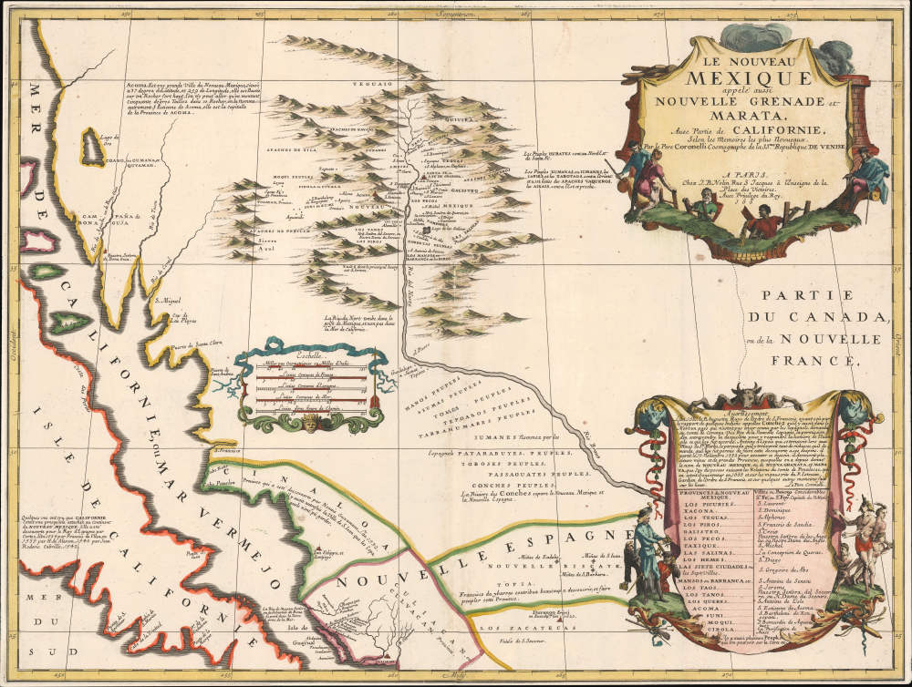
Le Nouveau Mexique appelé aussi Nouvelle Grenade et Marata Avec Partie de Californie, Selon les Memoires les plus Nouveaux.
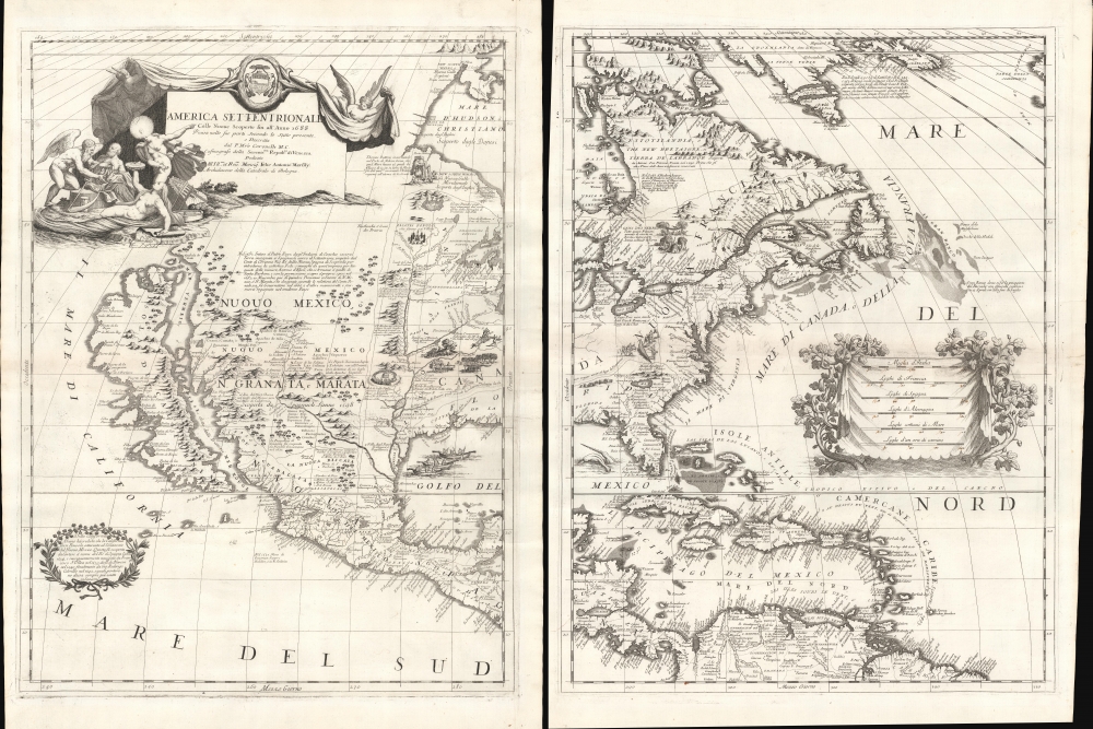
America Settentrionale Colle Cuoue Scoperte fin all' Anno 1688.
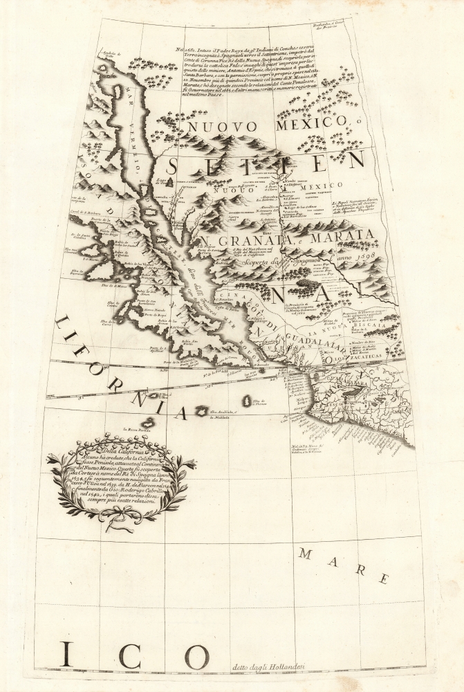
Earliest Acquirable Accurate Map of the Southwest?
Podcast Summary:
Imagined geographies, kingdoms of gold, and the political ambitions behind early maps of the American Southwest
Early maps of the New World often blended fact, myth, ambition, and educated guesswork.
In this episode of CartoCuriosity, Kevin Brown of Geographicus Rare Antique Maps explores the strange and consequential story of Don Diego de Peñalosa, a disgraced Spanish colonial official whose ambitions helped shape French ideas about the American Southwest.
A Man of Ambition
Don Diego de Peñalosa was a Peruvian Creole, politically well connected and clearly capable. After rising to a position of authority in Peru, he ran afoul of the viceroy’s son and was exiled.
He fled north, survived a shipwreck off Mexico, and soon rebuilt his career. By the 1660s, he had become governor of New Mexico, then a remote Spanish frontier province encompassing parts of what are now New Mexico, Texas, Arizona, and lands north of the Rio Grande.
Peñalosa saw himself in grand terms—as a modern Cortés, destined to conquer unknown lands and uncover wealthy indigenous kingdoms.
Teguayo and Quivira
While in New Mexico, Peñalosa studied earlier Spanish accounts, including the Benavides Memorial, written by Fray Alonso de Benavides, head of the missions in New Mexico decades earlier.
Benavides described two mysterious places: Teguayo and Quivira. Quivira, already associated with Coronado’s expedition, had long been imagined as a wealthy indigenous kingdom somewhere in the interior of North America.
To Peñalosa, these legendary places were not merely curiosities—they were opportunities.
Exile and Reinvention
Peñalosa eventually clashed with the Spanish Inquisition and was exiled from New Mexico. His conflict may have involved political rivalries with priests, disputes over mission policy, or accusations that he was insufficiently zealous in converting indigenous peoples.
Rather than disappear, he reinvented himself as a geopolitical advisor. He traveled first to England, where he proposed an invasion of New Mexico. He claimed the region was weakly defended, rich in silver, and close to legendary kingdoms of gold.
England declined.
Peñalosa and La Salle
Peñalosa then went to France, where he presented similar ideas to the court of Louis XIV. At the same time, René-Robert Cavelier, Sieur de La Salle, was also in Paris, advocating for a French colony near the mouth of the Mississippi.
The two men met, dined, and exchanged ideas.
La Salle proposed a colony on the Gulf Coast near the Mississippi. Peñalosa proposed one farther west, closer to the Rio Grande and Spanish New Mexico.
Louis XIV rejected Peñalosa’s plan but approved La Salle’s. La Salle’s later expedition famously missed the Mississippi and landed in Texas— not far from the region Peñalosa had advocated.
Peñalosa’s story forces us to reconsider the political geography behind La Salle’s Gulf Coast ambitions.
Coronelli, Nolin, and the Peñalosa Geography
Peñalosa also produced a manuscript map in French, intended for presentation to the king. His geographic ideas soon entered European cartography through the work of major mapmakers.
One of the most important was Vincenzo Coronelli, the great Venetian cartographer famous for producing enormous globes for Louis XIV.
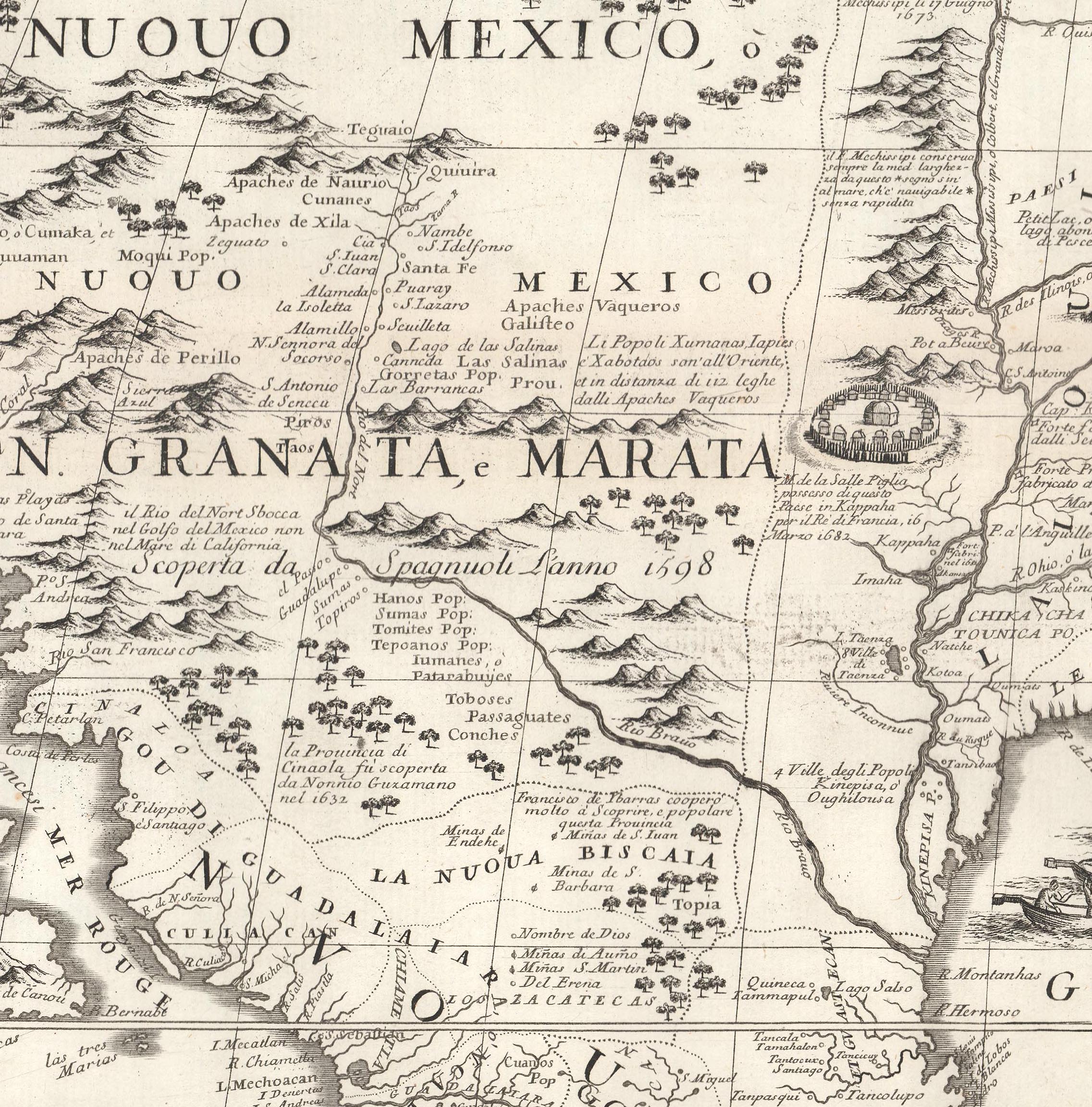
Coronelli’s royal connections gave him access to privileged geographic information, including French Jesuit records from the New World. Working with the French cartographer Jean-Baptiste Nolin, he incorporated Peñalosa’s geography into maps of New Mexico.
These maps identified:
- The silver mines of Santa Barbara in northern Mexico
- Teguayo, north of Santa Fe
- Quivira, also placed in the interior Southwest
Cartography as Propaganda
Coronelli’s 1688 map of North America, as well as his related globe gores, helped circulate Peñalosa’s vision of the Southwest.
These maps were cartographically important because they improved European mapping of New Mexico. But they were also politically charged.
They presented the region as desirable, vulnerable, and strategically valuable— a geography that could support French expansion into territory long claimed by Spain.
Peñalosa’s geography was not simply descriptive. It was persuasive.
A Forgotten Figure with Lasting Influence
Peñalosa remains a relatively obscure figure, but his influence reached farther than his reputation suggests. Through Coronelli and Nolin, his ambitions became embedded in the printed geography of North America.
His story reveals how maps could serve as instruments of persuasion— blending rumor, political ambition, strategic intelligence, and myth into a form that looked authoritative.
In the case of Peñalosa, cartography became a tool not only for describing the world, but for imagining—and perhaps encouraging—its conquest.
Featuring Kevin J. Brown, Geographicus Rare Antique Maps.
Produced by Cory Choy, Tom Fama, and Christian Cucinello.
Music by L. Budu and Luke Allen. Sound by Silver Sound.