Digital Image: 1867 Keeler Map of the Western United States (Minerals and Reservations)
WesternUnitedStates-keeler-1867-2_d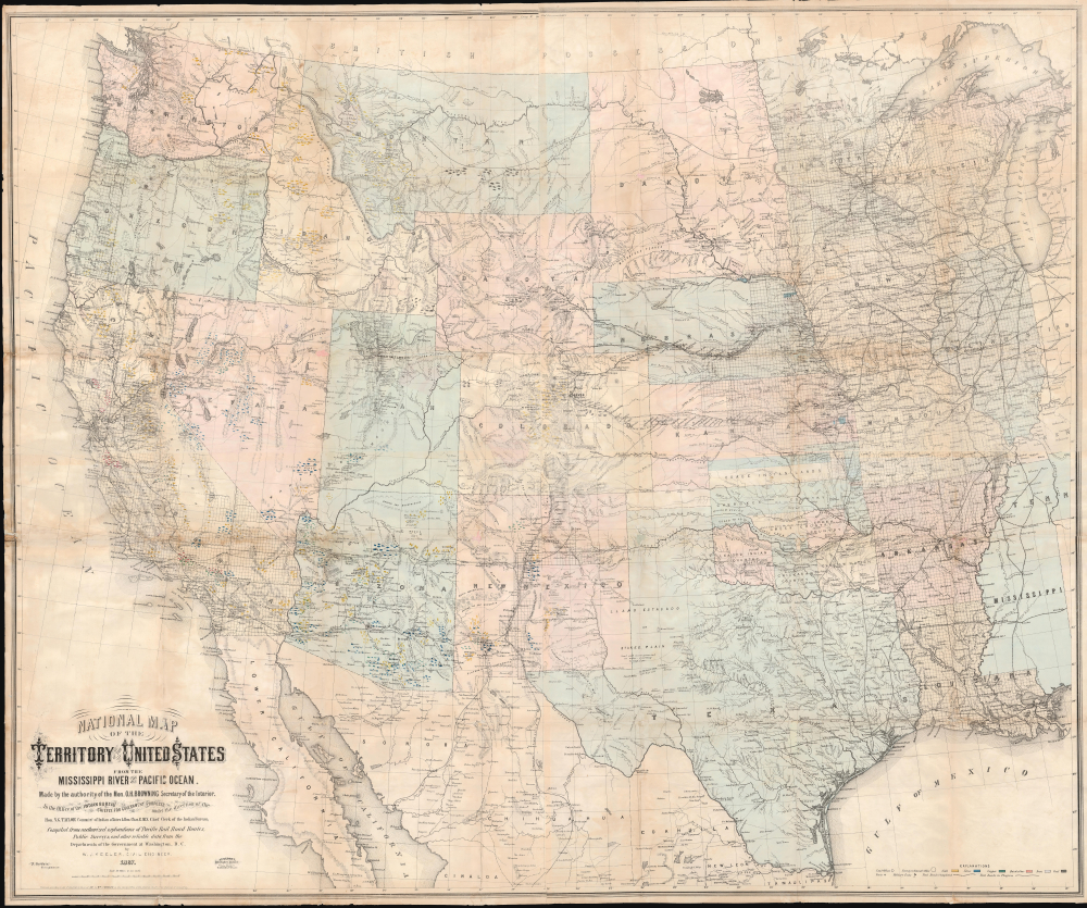


Title
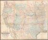
National Map of the Territory of the United States From The Mississippi River To The Pacific Ocean.
1867 (dated) 47.5 x 57.5 in (120.65 x 146.05 cm) 1 : 2280960
1867 (dated) 47.5 x 57.5 in (120.65 x 146.05 cm) 1 : 2280960
Description
FOR THE ORIGINAL ANTIQUE MAP, WITH HISTORICAL ANALYSIS, CLICK HERE.
Digital Map Information
Geographicus maintains an archive of high-resolution rare map scans. We scan our maps at 300 DPI or higher, with newer images being 600 DPI, (either TIFF or JPEG, depending on when the scan was done) which is most cases in suitable for enlargement and printing.
Delivery
Once you purchase our digital scan service, you will receive a download link via email - usually within seconds. Digital orders are delivered as ZIP files, an industry standard file compression protocol that any computer should be able to unpack. Some of our files are very large, and can take some time to download. Most files are saved into your computer's 'Downloads' folder. All delivery is electronic. No physical product is shipped.
Credit and Scope of Use
You can use your digial image any way you want! Our digital images are unrestricted by copyright and can be used, modified, and published freely. The textual description that accompanies the original antique map is not included in the sale of digital images and remains protected by copyright. That said, we put significant care and effort into scanning and editing these maps, and we’d appreciate a credit when possible. Should you wish to credit us, please use the following credit line:
Courtesy of Geographicus Rare Antique Maps (https://www.geographicus.com).
How Large Can I Print?
In general, at 300 DPI, you should at least be able to double the size of the actual image, more so with our 600 DPI images. So, if the original was 10 x 12 inches, you can print at 20 x 24 inches, without quality loss. If your display requirements can accommodate some loss in image quality, you can make it even larger. That being said, no quality of scan will allow you to blow up at 10 x 12 inch map to wall size without significant quality loss. For more information, it is best consult a printer or reprographics specialist.
Refunds
If the high resolution image you ordered is unavailable, we will fully refund your purchase. Otherwise, digital images scans are a service, not a tangible product, and cannot be returned or refunded once the download link is used.
Cartographer S
William J. Keeler (fl. c. 1856 - 1868) was an American civil engineer active during the second half of the 19th century. He is an elusive figure, and little is known of his birth and death dates, places, or early education. He appears in 1856, already working as a civil Engineer in Buffalo with the Erie Canal. In 1862 he received a civilian appointment, and possibly a honorary military rank, to work as an engineer at the Washington Naval Yard. He may also have worked at the Naval Yard in New York (Brooklyn). He was decommissioned in 1864 or 1865, after which he traveled west where he is recorded as an engineer with the Leavenworth, Lawrence and for Gibson Railroad Company. In 1865 he is also mentioned as working with the Union Pacific. In 1866 he was the chief engineer of the Kansas and Nesho Valley Railroad. He appears to have been employed with the department of the Interior Indian Bureau in by 1866 and/or 1867. He released his National Map of The Territory of The United States from the Mississippi River to the Pacific Ocean, one of the most important maps of the American west to appear in the 19th century, 1867. Although based upon government and railroad surveys, the map was a private publication and went through several subsequent editions, reissues, reformatting, and republications. Following the publication of the 2nd edition in 1868, Keeler seems to disappear from all record. More by this mapmaker...
Nicholas Du Bois (January 25, 1823 - August 8, 1879) was an engineer and draughtsman in the Washington D.C. General Land Office. Du Bois was born in Great Bend, Pennsylvania. Little is known of his early education, but in the 1850 census, he appears as an 'engineer'. By 1862, he was a clerk at the General Land Office. Subsequent reports from 1864 name him a draughtsman. He drafted William Keeler's seminal 1867 National Map of the Territory of the United States from the Mississippi River to the Pacific Ocean. By 1873, he was listed as an 'Assistant Surveyor'. Du Bois died in Washington, D.C. in 1879. Learn More...
Joseph Francis Gedney (November 4, 1828 - October 5, 1903) was a French-English-American engraver, printer, and lithographer. Gedney was born in Le Havre, Seine-Maritime, France, to a distinguished British family of Lincolnshire. He emigrated to the United States as a child, arriving at age 2 in 1831, in the wake of his mother's untimely 1830 death. It is unclear where he studied engraving, but he established himself on Maryland Avenue in Washington, D.C. in 1854, opening an engraving establishment. During the American Civil War (1861 - 1865), he served in the Union Army under John Aaron Rawlins (1831 - 1869). He completed both private and government contracts, including engraving and printing William Keeler's seminal 1867 National Map of the Territory of the United States from the Mississippi River to the Pacific Ocean. Gedney went on to acquire several important government printing contracts, which he retained until his 1903 death. Learn More...