
1832 Dong / Li Huge Wall Map of China under the Qing

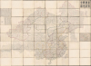
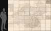
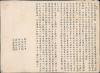
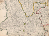
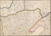
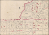
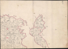
皇朝壹統輿地全圖 / [Complete Map of the Unified Territory of the Empire].
Largest and Most Detailed Early-19th Century Map of China.
Largest and Most Detailed Early-19th Century Map of China.
This is a massive (98 x 134 in) 64-sheet 1832 wall map of Qing China, prepared by Dong Fangli and Li Zhaoluo. Building on administrative maps of the early-mid Qing, it represented the most detailed and accurate mapping of China and surrounding territories under Qing suzerainty produced in the early 19th century.A Closer Look
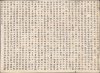
This superlative map covers the entirety of the Qing realm, including 'China Proper' (the territories administered by the predecessor Ming Dynasty), the homeland of the Manchu rulers of the dynasty in Manchuria, and the lands of Qing vassals and clients in Mongolia, Central Asia (Xinjiang), Tibet, and even Ladakh, today administered by India as part of Jammu and Kashmir. Provincial boundaries are traced for distinction, though less so in the west, reflecting the indirect Qing rule and evolving administration in these areas. Indeed, even Gansu Province is not labeled in large characters or has its borders traced in the same way as other Chinese provinces, reflecting its position as more of a frontier than the sedentary core of China. On the opposite end of the Qing realm, Taiwan, which had been conquered by the Qing in the late 17th century, exhibits some interesting features, such as Tamsui (Danshui 淡水) being significantly south and west of its actual location, suggesting a tenuous grasp on the island's geography.The map is overlaid by a grid that resembles the traditional grid system employed on earlier Chinese maps (計里畫方, see, for example, our YuJiTu-unknown-1137). However, as explained by Li Zhaoluo's textual preface, while the traditional system is maintained to divide the realm into consistent blocks of 200 square li, horizontal lines are meant to represent latitude while dotted lines running vertically (or, more accurately, diagonally) represent longitude, with a prime meridian running through Beijing (here as Shuntian 順天). This 'dual grid' system was an innovation in Chinese cartography and remained in use into the 20th century. A legend of sorts in the textual preface explains symbols used for cities or towns that acted as administrative centers at different levels. Aside from cities, the map is particularly detailed on waterways, a special focus of Dong Fangli, who was working on an illustrated Commentary on the Water Classic (水經注圖) at the time of his death, a year after completing the manuscript map on which this printed map is based.
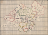
The level of detail and information is remarkable, beginning with the key sheet (the third image above) and moving to the individual sheets. For instance, the northwestern quadrant of the area mapped corresponds to Xinjiang (新疆), meaning 'new frontier,' or Xiyu Xinjiang (西域新疆), 'new frontier of the western regions,' which were general terms for the area under Qing military control since 1757 rather than a fixed administrative region like a province. Indeed, the term Xinjiang does not appear here (except for a handwritten note on the key sheet, 'Sinnkiang'), but rather is covered by a combination of names, with its eastern portion being part of the Kobdo region (科布多), established by the Qing after the suppression of the Dzungars in 1757 to oversee the Dörbet tribe, one of the larger sub-groups of the Dzungars, some of whom submitted to the Qing in the course of the fighting. Most of Xinjiang is referred to as Ili (伊犁), subdivided into sections: Tarbagatai (塔爾巴哈台), Ili Proper (伊犁之伊犁), and Ili south of the Tianshan Mountains (天山南路, often known informally as 'southern Xinjiang' Nanjiang 南疆), which is itself divided into two sections. The previous, French owner of this map (see 'Provenance' below) has written 'Jongaria' (Dzungaria) over a large portion of Ili and Tarbagatai, as well as 'Little Bokhara' over a western portion of the province, perhaps a reference to the Dungan Revolt (1862 - 1877) and the emirate established there by Yakub Beg (c. 1820 - 1877). The key map numbers eight cities in the southern part of Ili (that is, Xinjiang), referring to eight historic oasis cities surrounding the Tarim Basin (bacheng 八城), a variation on common Uyghur names, Altishahr (ئالتە شەھەر), meaning 'six cities' and Yettishar (يەتتەشەھەر), 'seven cities.'
As the case of Xinjiang demonstrates, the map is extremely useful for understanding the evolving Qing understanding of suzerainty, sovereignty, and territory in the early 19th century. The vast Mongol lands are divided into large sections of the familiar Inner and Outer Mongolia (roughly corresponding to today's Inner Mongolia Autonomous Region of the People's Republic of China and the Republic of Mongolia, respectively), with several large, important khanates, tribes, and banners named, including the Tüsheet (土謝圖), Sain Noyon (三音諾顏), and Zasagt (扎薩克圖), all of which played an important role in the early phase of the long-running Qing war against the Dzungars. The map also includes a large territory to the north of Outer Mongolia called here Uriankhai (烏梁海), the northernmost portion of which corresponds to today's Republic of Tuva within the Russian Federation, much closer to Lake Baikal and frontier outposts of the Russian Empire like Krasnoyarsk and Irkutsk than to Beijing or Manchuria.
Similarly, the northeastern portion of the map includes the large swath of forested lands claimed as the Manchu homeland, before the Russian Empire cleaved off large portions of it in the course of the 19th and early 20th century. Thus, here Qing territory includes not only the lands of today's 'three eastern provinces' (東三省) of Liaoning, Jilin, and Heilongjiang, as well as the northernmost part of Inner Mongolia (here as Qiqihar 齊齊哈爾), but also large portions of today's Amur Oblast, Khabarovsk Krai, Primorsky Krai, and the entirety of Sakhalin Island in the Russian Far East.
Notably, though it is clearly differentiated from Qing territory, the Korean Peninsula is also mapped here in a similar fashion as the rest of the map, underscoring Qing suzerainty over Joseon. The Korean Court officially accepted a subservient role within the Qing hegemony of mainland East Asia, but many Joseon elites pined for the deposed Ming Dynasty rather than what they regarded as upstart barbarians from the north and even saw themselves as the true repository of genuine Chinese Confucian culture while China itself had been corrupted.
Another important frontier feature of the map is its treatment of Tibet and adjacent lands. The Qing presence in Lhasa typically consisted of a handful of officials, the highest being the Amban ('High Commissioner'), and a small garrison of troops. But wars against the Dzungars and the Nepalese (Gurkhas 廓爾喀) led to temporary but large increases in the Qing military presence in Tibet. To this day, the Chinese border with India and other nearby countries is disputed, but the border conceived here reflects the Qing claims after the conclusion of wars against their frontier foes, which also included Burma and Tây Sơn rebels in northern Vietnam. Most noticeably, this map includes the disputed region of Aksai Chin as well as the entirety of Ladakh, which was nominally under the supervision of the Qing Amban in Lhasa and served as an important 'listening post' for information on lands south (Hindustan). However, just after this map's publication, a Sikh general invaded Ladakh and placed it under the suzerainty of the Sikh Empire in 1834. The Qing Amban in Lhasa was appealed to but opted not to send troops to intervene, thus Ladakh became part of Jammu and Kashmir, though it easily could have ended up as part of claimed Chinese territory in the 20th century.
Provenance
Handwritten notes, mostly in French, appear throughout, evidently added by an owner who likely acquired the map in the late 19th or early 20th century. The greatest number of these appear in Yunnan Province and along the border with Tonkin, noting waterways, distances between major cities and towns, and areas of special importance to the French, such as the 'grand centre commercial' of Mengzi (蒙自), which effectively operated as a treaty port near the border of Tonkin (a French colony from 1883) and Yunnan. Nearby is a pencil annotation recording the location of the 'chemin de fer Sinn-ngann,' which must refer to the Kunming-Haiphong Railway, constructed between 1904 - 1910. Other notes refer to the Mekong Expedition of 1866 - 1868, which reached Yunnan, led by Ernest Doudart de Lagrée (1823 - 1868) and, after his death, by Francis Garnier (1839 - 1873), who was later killed near Hanoi fighting the mostly Chinese Black Flag Army. Outside of Yunnan, the handwritten annotations give more information or clarification on geography, discuss subsequent territorial changes (such as the Russian seizure of the Manchurian territories mentioned above), or transliterate toponyms / give alternative Western names. Taking all this into consideration, we can assume that this map was printed in 1832 and then came into the possession of a Frenchman in China around the turn of the 20th century. This individual was unusually well-informed about far-flung regions of China, places most foreigners would never visit or even have interest in, leading us to assume that the annotations were made by a French diplomat or military officer stationed in China or Tonkin.Publication History and Census
This map was originally prepared by Dong Fangli (董方立), a mathematician and geographer who drew on earlier large-format administrative maps of the Qing Dynasty, particularly the 1719 Kangxi huangyu quanlan tu (康熙皇輿全覽圖, Complete Map of the Empire of the Kangxi Era) and 1775 Qianlong neifu yutu (乾隆内府輿圖, Complete Map of the Empire of the Qianlong Era), which had very limited circulation outside of the imperial court. Dong augmented these earlier maps with information from historical records and local gazetteers, including more recent surveys of the distant areas of the Qing realm in Central Asia (Xinjiang) and Tibet, updated areas where administrative changes had taken place or waterways had changed course, and attempted to integrate his own (somewhat imperfect) understanding of latitude and longitude. Dong completed this updated map of the Qing realm in 1822, a year before his death at the young age of 32. A decade later, the scholar Li Zhaoluo (李兆洛) prepared the map as a woodcut, standardizing the size of its sheets in the process, allowing for a wider distribution among the public, or at least among literati elites like himself and Dong.The present map is this original 1832 (Daoguang 12) woodcut, distinguished from later printings in 1842 and 1865, which are smaller in scale (generally in sheets of roughly 8 x 11 inches versus roughly 12.5 x 16.5 inches here) though still quite large (70 x 92.25 in.). The latter printings also differ in appearance, tracing longitude lines in red. Another reduced print was also issued by the publishing house Hongwen Ge (宏文閣) in Shanghai in 1902. These different printings are not always clearly distinguished in catalog records in the OCLC. The original 1832 printing of the map is only held at the Library of Congress, the New York Public Library, the Bibliothèque nationale de France, the National Museum of Japanese History, and the Hong Kong University of Science and Technology (other examples cataloged in the OCLC at the Pitts Theological Library at Emory University, Yale University, and the Royal Danish Library are the latter, smaller printing, which is also held by the National Diet Library and the Nichibunken - International Research Center for Japanese Studies). In brief, this is a rare opportunity to acquire the greatest Chinese map of the Qing Empire from the first half of the 19th century.
Cartographers
Dong Fangli (董方立; 1791 - 1823) was a mathematician, geographer, and scholarly expert on the Chinese calendrical system in the middle of the Qing Dynasty. He was born in Yanghu, now Changzhou, in Jiangsu, roughly half-way between Shanghai and Nanjing. His birth name was Zengchen (曾臣), and during his early life he was known as Youcheng (祐诚), but is best known by Fangli, his courtesy name. In 1817, his older brother Dong Jicheng (董基诚) attained the exalted jinshi rank in the imperial exams and moved to Beijing, bringing his younger brother with him. Dong Fangli passed the provincial imperial exams (becoming a juren) in 1818, and became known in Beijing as an expert on mathematics and calendrical calculations. Most of Dong's works were in these fields, which prepared him well as a geographer who sought to synthesize Chinese astronomical observations with knowledge of latitude and longitude partially incorporated from Western cartography. In terms of cartography, Dong is best known for compiling the 'Complete Map of the Unified Territory of the Empire' (皇朝壹統輿地全圖) in 1822, a synthesis of earlier Qing administrative maps, updated and informed by a wide range of sources, which was the most detailed and accurate map of the dynasty's territory (including Mongolia, Tibet, and Xinjiang) produced in the early-mid 19th century. Before his death, Dong was working on producing and illustrated Commentary on the Water Classic (水經注圖) but never completed the work and the manuscript was lost after his death. After his death, his older brother Dong Jicheng (董基诚), also a member of the literati who had attained jinshi rank, published his other incomplete works as Dong Fangli Yishu (Posthumous Works of Dong Fangli, 董方立遺書). Further Details...
Li Zhaoluo (李兆洛; 1769 - 1841), courtesy name Shenqi (申耆), was a scholar and educator in the mid-Qing Dynasty. Born in Yanghu (now Changzhou), Jiangsu, he passed the provincial-level imperial exams and took the jinshi rank in 1805. Seen as an especially promising young scholar, he was chosen to be a 'Gentleman of Virtue' (shujishi, 庶吉士) at the Hanlin Academy, a position which carried significant prestige as such shujishi were advisors to the emperor and provided him consultation relating to classical texts, though the position had become less influential in the Qing era than had been the case in the Ming. After this scholarly service to the emperor, in which he spent much of his time compiling classical texts, Li was assigned to government service as a magistrate in Fengtai County, Anhui Province not so far from his native Yanghu (but, as standard in Qing assignments, far enough to preclude any nepotism for family members and associates). Li prioritized education while in Fengtai, opening free schools and setting up an academy for higher education. He left government service when his father died, entering the expected period of mourning according to filial piety precepts. Afterwards, he went on to lecture for twenty years at the Jiyang Academy (暨阳书院) in Jiyang (now Jiangyin), Suzhou. Li was considered an expert in many fields, amassing a personal library of more than 50,000 volumes, so large that it had to be dispersed across several locations. Much of his work dealt with historical geography, dealing with the history of placenames and evolution of administrative divisions, including his twenty-volume Modern Commentary on the Rhymed Compendium of Historical Geographical Treatises (歷代地理志韻編今釋). In cartographic terms, he edited a map published in 1832, originally completed a decade earlier by Dong Fangli (董方立), titled 'Complete Map of the Unified Territory of the Empire' (皇朝壹統輿地全圖), which was a landmark Chinese map of the early-mid 19th century. The Draft History of Qing (清史稿) colorfully describes him as 'short in stature and large in belly, with a leopard-like head and piercing eyes, appearing unapproachable at first glance. Yet, he was easy to get along with and never spoke harshly or showed a rude expression. He generously provided financial assistance to his old friends and acquaintances in need.' Further Details...
Condition
Very good. Sheets backed on Chinese silk. Most sheets feature manuscript updates in Chinese. Some French annotations. Cased in period French box.
References
Library of Congress G7820 1832 .D5. NYPL Map Div. 20-246 [atlas cases]. Bibliothèque nationale de France, département Cartes et plans, GE A-357 (RES). HKUST G7820 1832 .D5er. National Museum of Japanese History H-110-2-79. Mosca, M., From Frontier Policy to Foreign Policy: The Question of India and the Transformation of Geopolitics in Qing China (Stanford University Press) 2013. Cheng, Y., 'Nonscientific' Traditional Maps of China: A Study of Traditional Chinese Mapmaking (Springer / Social Sciences Academic Press) 2022, p. 186.