
1840 Depot de la Marine Chart of Northern Arabian Sea, Persian Gulf

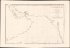

Carte des côtes d'Arabie, et de Perse, comprenant depuis l'Ile Socotra jusqu'à Bombay.
Challenging British Hegemony in the Indian Ocean.
- Digital Map Information
- Suitable for large format printing
- File Size: 39.57 MB
- File Type: ZIP / TIFF
- ICC color profile embedded
- Delivered instantly via download link
Challenging British Hegemony in the Indian Ocean.
This is a rare, large-format 1840 nautical chart of the Arabian Sea and Persian Gulf prepared by the French Dépôt Général de la Marine. At the time it was produced, France was trying to match Britian's growing dominance of the Indian Ocean, presenting itself to indigenous rulers as an alternative trading partner.A Closer Look
This chart covers, as the title indicates, the coasts of the Arabian Peninsula to Persia and beyond to India, from the Gulf of Aden beginning just east of Aden itself to Mangalore (Mangaluru), not far from the French trading enclave of Mahé (Mayyazhi). Islands, islets, and shoals are indicated throughout, including the relatively large islands of Socotra, Masirah, Bahrain, Bubiyan, Qeshm, and Bombay (Mumbai). The very tip of the Horn of Africa appears along the bottom border near Socotra. Some inland waterways are traced, and landward features such as cities (Basra, Hyderabad), forts, and mountains are noted. Soundings and hazards are recorded all along these coasts, especially in the Persian Gulf and along the coast of India. A table of conversions from brasses to meters is provided below the title.Historical Context
This chart was produced at a time when France was desperate to regain some of its prestige and naval power lost in the early 19th century and challenge Britain's growing hegemony over the Indian Ocean. Like the British, France sought to gain a series of outposts along the coasts of the Indian Ocean, and in fact had already started to do so before most of them were seized by Britain in the course of the French Revolution (1789 - 1799) and Napoleonic Wars (1803 - 1815). Réunion was occupied but returned to France after the Napoleonic Wars, and around the time this map was produced, France gained some outposts around Madagascar, providing some basis for a future chain of trading posts and coaling stations, though these never nearly rivalled Britain's dominance of the Indian Ocean.The immediate context for the production of this chart was Britain's seizure of Aden in 1839. This move threatened to cut the French out of the lucrative Indian Ocean trade and prompted a frantic but initially futile search for suitable locations for French outposts on the Red Sea. Further east, the British East India Company already had a significant presence in the Persian Gulf, with outposts at Basra and Bushehr (Bushire here). Their main interest was in assuring the safe passage of their ships and counteracting piracy, which had diminished greatly after the suppression of the Al Qasimi in 1819. Here, too, France responded quickly with diplomatic missions, led by Comte de Sercey (1839 - 1840) and the Comte de Sartiges (1844), which were warmly received by leading Persian ministers fearful of being subordinated by Britain or Russia. In effect, France tried to offer a third option to Persia and other local rulers caught up in the 'Great Game' competition between Russia and Britain. A draft trade treaty was prepared but not yet ratified when the July Monarchy fell in 1848, thwarting the ongoing negotiations.
Publication History and Census
This chart was prepared in 1840 by Pierre Daussy, engraved by Chassant, and letter-engraved by Jacques-Marie Hacq, for the Dépôt général de la Marine. It is only noted in institutional collections at the Archives nationale d'outre-mer and the Swedish Royal Naval Academy. Scarce to the market.Cartographers
Pierre Daussy (October 8, 1792 - September 5, 1860) was a French astronomer and hydrographic engineer with the Bureau des Longitudes and later the Dépôt des Cartes et Plans de la Marine, which he led as Director in the years prior to his death. Daussy was born in Paris, the son of hydrographer Magloire Thomas Daussy (1758 - 1826). He followed in his father's footsteps, studying at the École des Ingénieurs Hydrographes before undertaking hydrographic work in the North Sea under the command of Charles-François Beautemps-Beaupré. He graduated to the rank of engineer in 1819 and chief engineer in 1829. In 1833, he began work with the Bureau des Longitudes correcting the French Table des Positions Géographiques des Principaux Lieux du Globe to conform with the most recent measurements made possible by new hydrographic instruments and methodologies. He was elected Director of the Dépôt des Cartes et Plans de la Marine in 1855. He also served as the President of the Société de Géographie de Paris in his later years and published several works on hydrography and navigation, particularly relating to the coasts of the Ottoman Empire and Persia. Further Details...
Dépôt des Cartes et Plans de la Marine (fl. 1720 - present), often called the Dépôt Général de la Marine, was a French hydrographic mapping organization founded in 1720 under Charles-Hercule of Albert de Luynes (1674 - 1734). Much like the U.S. Coast Survey, the British Admiralty, and the Spanish Deposito Hydrografico, the Dépôt was initiated as a storehouse and distribution center of existing nautical and marine charts. Eventually the Dépôt initiated its own mapping activities in an attempt to improve and expand upon existing material. Some of the more prominent cartographers and hydrographers associated with the of Dépôt Générale des Cartes were, Philippe Buache, Jacques-Nicholas Bellin, Giovanni Rizzi-Zannoni, Rigobert Bonne, and Jean Nicolas Buache. Further Details...
Chassant (fl. c. 1830 - 1860) was a French line and chart engraver active in Paris in the middle part of the 19th century. Chassant was active with the French Dépôt de Marine from the 1830s into the 1860s. He was a master engraver and, some have argued, his dramatic hachuring work to illustrate topography suggests he may have been wasted on nautical charts. Most of his engraving was completed in partnerships with Jacques-Marie Hacq (September 22, 1785 – 18??). Chassant did not sign any of his engravings with a first name or other identifier, so it is difficult to track him down. He may be Alphonse Antoine Louis Chassant (August 1, 1808 - September 7, 1907), who in later life was an art historian and librarian of the city of Évreux. He wrote several books, including works on engraving. We cannot alas verify the connection and it may be pure guesswork. Further Details...
Jacques-Marie Hacq (September 22, 1785 – 18??) was a French letter and line engraver, and historian, active in Paris during the middle part of the 19th century. Hacq was born in Paris and trained under J. P. Besançon, who he succeeded at the Dépôt de la Guerre in 1830. He engraved for the Dépôt de la Guerre as early as 1830 and for the Dépôt des Cartes et Plans de la Marine from, at least, 1840 to 1852. In addition to his work for the French Government, he also completed maps and engravings for Lesage, Lapie, Dufour, Duperrez, Gouvion St. Cyr, and Dumont d'Urville. His historical works include a history of the Napoleonic Wars and a history of Paris under the reign of Louis XIII. During most of his career in Paris he lived at 58 Rue de la Harpe. Further Details...
Condition
Very good. Closed margin tears professionally repaired on verso.
References
OCLC 556390082. Kungliga örlogsmannasällskapet Atlas 12 kort 0903. Archives nationale d'outre-mer, FR ANOM 25DFC160A. Alai, Special maps of Persia, E.294.