
1535 Lorenz Fries / Martin Waldseemüller / Claudius Ptolemy Geographis

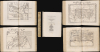
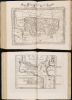
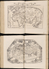
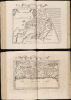
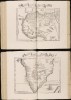
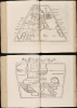
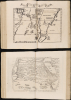
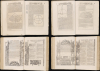
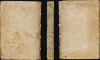
Claudii Ptrolemaei Alexandrini Geographicae Enarrationis Libri Octo Ex Bilibaldi Pirckeymheri tralatione...
Spreading the Age of Discovery.
Spreading the Age of Discovery.
This is Lorenz Fries' expanded version of Ptolemy's Geography: an attractive, complete example of the 1535 issue edited by Michael Villanovus (Servetus). It is a key document of the Discovery Era, containing an array of the earliest disseminated maps of Africa, the Indies and the New World; one of its trio of world maps is the earliest acquirable map to name 'America.' This 1535 Servetus edition is scarce. Many were burned when the editor was condemned for heresy in 1553: only one example of this edition is listed in an institutional collection.A Closer Look
Following the salutations of the editor and the translator, the book's first 150 pages consist of Willibald Pirckheimer's Latin translation of Ptolemy's text, completely re-set and annotated in improvement upon the 1525 edition (about the quality of which Pirckheimer had complained stridently to the printer, Grüninger). Pirckheimer's opinion on the new edition is unavailable (he died five years earlier), but its organization and typography are markedly clearer than in earlier editions.The text is followed by the 26 Ptolemaic tabulae (10 of Europe, 4 of Africa, and 12 of Asia). These present their respective regions based on Ptolemy's data and are thus 16th-century maps based on 2nd-century information; in most respects, they closely copy the corresponding maps of Martin Waldseemüller. Two of these incorporate imagery and descriptive text drawn from contemporaneous sources: the 8th map of Europe (Sarmatia in Europe, the region comprising Russia, Ukraine, Poland and Hungary) and the 9th map of Asia (Gedrosia, the region between Persia and the Indus River). The 26 Ptolemaic maps are followed by Fries' iteration of the oikoumene, the part of the world known to be inhabited in Ptolemy's era. While Waldseemüller's Ptolemy included such a map, this one is not a copy: the 1513 map employed Ptolemy's first, trapezoidal, projection; Fries employed Ptolemy's more curvilinear second projection, and the decorative frame of clouds and windheads differs from the earlier map.
The 23 following maps are the complement of tabulae modernae: maps representing the world as understood by Europeans in the 16th century. These include some of the earliest printed maps of regions that Ptolemy's era had not yet encountered: One of the first acquirable maps to present the New World as described by Columbus and Vespucci; one of the first printed maps of Scandinavia; maps of Africa and the Far East that would have been the earliest glimpses of these regions for Fries' readership. The map section concludes with two modern depictions of the world: one based on the map appearing in Waldseemüller's Ptolemy, and the other a work of Fries' own composition. This latter is notable as the earliest widely available printed map to use the placename 'America.'
A Fresh Presentation to a Broad Audience
Fries' Ptolemy has its roots in the 1513 edition of Martin Waldseemüller, which was hailed by Nordenskiold as 'the first modern atlas of the world' on the strength of its collection of tabulae modernae; Streeter considered the Waldseemüller to be 'the most important of all the Ptolemy editions.' What is not generally recognized is that Fries' edition was not a simple copy of Waldseemüller. From the first edition of 1522, the two maps of the Far East were new compositions. The second of the two modern world maps was entirely new, and the depiction of the Ptolemaic world used a different projection than Waldseemüller's 1513 map. Beyond these, Fries incorporated descriptive images and text throughout the book to make Ptolemy relevant beyond its usefulness as a classical work. These appear on the maps representing the regions most novel to and remote from the book's European audience - Eastern Europe, Africa, Asia, and the New World. The text was also updated: starting with its second edition in 1525, the work was based on the entirely new Latin translation by humanist and lawyer Willibald Pirckheimer.The presentation of Fries' Ptolemy - both in terms of the quality of its printing and with its updated and decorative content - suggests that the object was to bring Waldseemüller's scholarship to a broader audience.
A Synthesis of Waldseemüller's Broader Work
While there is no evidence that Fries knew him personally, Fries was instrumental in producing editions of almost every part of Waldseemüller's oeuvre; this familiarity directly impacted his choices in producing the maps in this work, which incorporated elements from all but one of Waldseemüller's maps. Fries worked with Peter Apian to produce the world map for the latter's 1520 Cosmography; that map (a reduction of Waldseemüller's 1507 world map) was the earliest after 1507 to name America. By 1513, Waldseemüller had decided that the name was not appropriate to apply to the New World, and the name does not appear in his Ptolemy. Fries' decision to use the name on his own world map is likely influenced by his interaction with Apian on the 1520 map.Fries had also worked long on a new edition of Waldseemüller's second large-scale world map, the 1516 Carta Marina. This was published by Grüninger in 1525, but was dated 1522, and was likely a work in progress during or even before the execution of his 1522 Ptolemy. Fries' close familiarity with Waldseemüller's 1516 map is evident from his use of imagery and descriptive text from the Carta Marina within the relevant maps of the 1522 Ptolemy. For example, the cheery cannibal scenes appearing on the Terra Nova and India Orientalis maps, the depiction of suttee on the modern map of India, and all of the imagery on the two modern Africa maps can be traced to images found on the Carta Marina; likewise, the descriptive text accompanying these images is all taken from Waldseemüller's 1516 map.
On the other hand, Fries' book contains two maps of the Far East (the map of the East Indies, and the map of China and Japan) that do not derive from the 1513 Ptolemy, but are instead adapted from Waldseemüller's 1507 world map. The only element of Waldseemüller's cartographic output not evident in Fries' work here is his 1511 Carta Itineraria Europae, a south-oriented wall map of Europe which survives in only one example, and which would produce no derivatives until adopted as a model by Sebastian Münster's 1536 Tabula Europe.
The Longevity of Ptolemy
European exploration in the late 15th and early 16th centuries expanded the known world far beyond Claudius Ptolemy's 2nd-century geographical knowledge. And yet, mapmakers continued to publish editions of Ptolemy - often simultaneously with modern maps reflecting these discoveries. There were two reasons for this. First, Ptolemy's geography was among the few available references to ancient locations, shedding light on Humanistic attempts to recover and understand ancient literature. Second, Ptolemy's methodology remained essential and authoritative. By employing his great innovation - laying out a grid and assigning coordinates to real-world locations - one could produce a mathematical representation of the world, clearly showing the distances between known features. Every geographer of the Age of Discovery embraced Ptolemy's methodologies to absorb discoveries. Before developing new work, any geographer needed to understand the Ptolemaic foundations of the discipline. Consequently, editions of Ptolemy continued to be printed well into the 18th century. Manuscript and print editions of Ptolemy were produced during the 15th and 16th centuries, with the maps included (with varying levels of sophistication and success). While Waldseemüller's 1513 edition is widely considered the most important, Fries' editions were instrumental in bringing the work to a broader audience.Publication History and Census
Laurent Fries' first edition was printed in 1522 in Strasbourg by Johannes Grüninger (1455 - 1533). Grüninger also published a second edition in 1525, edited by Willibald Pirckheimer and featuring a newly translated text by him. After the death of both Fries and Grüninger, the blocks and text had passed to the publishing firm of Melchior Trechsel in Lyon. The firm's editor Michael Villanovus (Servetus) produced the present edition in 1535. A further Trechsel edition would be produced in 1541, in Vienne-in-the-Dauphane. We see the book, in various editions, well represented in OCLC. We see thirty one of these corresponding to this 1535 edition. The separate maps appear on the market with some regularity, with the 1535 edition appearing less frequently.Cartographers
Lorenz Fries (c. 1490 – 1531) was a German cartographer, cosmographer, astrologer, and physician based in Strasbourg. Little is known of Fries' early life. He may have studied in Padua, Piacenza, Montpellier, and Vienna, but strong evidence of this is unfortunately lacking. The first recorded work of Fries was a 1513 Nuremberg broadside (announcing and describing the birth of a 'wonderous and terrifying monster' (Karrow). Fries settled in Strasbourg in March 1519, where he developed a long-standing relationship with the publisher Johann Grüninger. His time in Strasbourg makes it possible that he encountered and knew the St. Die scholars, but beyond the documented connection to the publisher, there is no concrete evidence that he knew them. Most importantly, while there is abundant and clear evidence that Fries was an intellectual successor of Martin Waldseemüller, having worked extensively with his cartographic legacy, there is no similar evidence to prove that the two worked together or even knew one another. On the other hand, from roughly 1520 to 1525, Fries did work closely with Grüninger as the geographic editor of various maps and atlases based upon Waldseemüller's work. He collaborated with Peter Apian in the production of their 1520 reissue of Waldseemüller's world map of 1507. Around this time, Fries also began working on Grüninger's reissue of Waldseemüller's 1513 edition of Ptolemy's Geographie Opus Novissima. That edition included three new maps by Fries based upon the Waldseemüller world map of 1507 – two of these, his maps of East Asia and Southeast Asia, are quite significant as the first specific maps of these regions issued by a European0 publisher. In 1525, Fries and Grüninger produced a new edition of Waldseemüller's Carta Marina, a project which plausibly could have predated Fries' Ptolemy, as many of the text notations included in Fries's 1522 work were paraphrased and sometimes quoted directly from Waldseemüller's 1516 map. 1525, Fries decided to leave Strasbourg and surrendered his citizenship, relocating to Trier. In 1528, he moved to Basel. Afterward, he relocated to Metz, where he most likely died. In addition to his cartographic work, Fries published tracts on medicine, religion, and astrology. Further Details...
Martin Waldseemüller (September 11, 1470 - March 16, 1520) was a German cartographer, astronomer, and mathematician credited with creating, along with Matthias Ringmann, the first map to use the placename America. He was born in Wolfenweiler, near Freiburg im Breisgau. Waldseemüller studied at the University of Freiburg and, on April 25, 1507, became a member of the Gymnasium Vosagese at Saint-Dié. Martin Waldseemüller was a major proponent of theoretical or additive cartography. Unlike contemporary Portuguese and Spanish cartographers, who left maps blank where knowledge was lacking, Waldseemüller and his peers speculated based upon geographical theories to fill unknown parts of the map. He is best known for his Universalis Cosmographia a massive 12-part wall map of the world considered the first map to contain the name America, today dubbed as 'America's Birth Certificate'. This map also had significance on other levels, as it combined two previously unassociated geographical styles: Ptolemaic Cartography, based on an ancient Greek model, and the emergent 'carta marina', a type of map commonly used by European mariners in the late 15th and 16th centuries. It also extended the traditional Ptolemaic model westward to include the newly discovered continent of America, which Waldseemüller named after the person he considered most influential in its discovery, Amerigo Vespucci. When Waldseemüller died in 1520, he was a canon of the collegiate Church of Saint-Dié. In contemporary references his name is often Latinized as Martinus Ilacomylus, Ilacomilus, or Hylacomylus. Further Details...
Claudius Ptolemy (83 - 161 AD) is considered to be the father of cartography. A native of Alexandria living at the height of the Roman Empire, Ptolemy was renowned as a student of Astronomy and Geography. His work as an astronomer, as published in his Almagest, held considerable influence over western thought until Isaac Newton. His cartographic influence remains to this day. Ptolemy was the first to introduce projection techniques and to publish an atlas, the Geographiae. Ptolemy based his geographical and historical information on the "Geographiae" of Strabo, the cartographic materials assembled by Marinus of Tyre, and contemporary accounts provided by the many traders and navigators passing through Alexandria. Ptolemy's Geographiae was a groundbreaking achievement far in advance of any known pre-existent cartography, not for any accuracy in its data, but in his method. His projection of a conic portion of the globe on a grid, and his meticulous tabulation of the known cities and geographical features of his world, allowed scholars for the first time to produce a mathematical model of the world's surface. In this, Ptolemy's work provided the foundation for all mapmaking to follow. His errors in the estimation of the size of the globe (more than twenty percent too small) resulted in Columbus's fateful expedition to India in 1492.
Ptolemy's text was lost to Western Europe in the middle ages, but survived in the Arab world and was passed along to the Greek world. Although the original text almost certainly did not include maps, the instructions contained in the text of Ptolemy's Geographiae allowed the execution of such maps. When vellum and paper books became available, manuscript examples of Ptolemy began to include maps. The earliest known manuscript Geographias survive from the fourteenth century; of Ptolemies that have come down to us today are based upon the manuscript editions produced in the mid 15th century by Donnus Nicolaus Germanus, who provided the basis for all but one of the printed fifteenth century editions of the work.
Further Details...
Michael Servetus (1509/11 - October 27, 1553), also known as Miguel Servet, Michel de Villeneuve, and Michael Villanovanus or Villanovus, was a Spanish physician, theologian, humanist, and geographical editor whose career united Renaissance scholarship with the religious controversies of the Reformation. He studied law at Toulouse before pursuing theological questions that brought him into conflict with both Catholic and Protestant authorities; his De Trinitatis Erroribus (1531) and Dialogorum de Trinitate (1532) challenged orthodox Trinitarian doctrine, prompting him to adopt the name Michel de Villeneuve and establish himself in France. Working with the Trechsel printing firm in Lyon, he edited the 1535 and 1541 editions of Ptolemy’s Geographia, the works through which his name is most familiar to map collectors. His geographical contribution was principally editorial: he revised the Latin text, supplied explanatory material, and compiled descriptions of countries and their inhabitants, drawing extensively on earlier authorities. These editions place him within the Renaissance effort to reconcile classical geographical learning with contemporary knowledge, although modern scholarship cautions against treating all his descriptive material as original. Peter Hughes, Michael Servetus's Britain. Servetus subsequently studied medicine in Paris, assisting the anatomist Johann Günther von Andernach, and eventually settled in Vienne as physician to Archbishop Pierre Palmier. His theological interests continued alongside his medical practice, culminating in Christianismi Restitutio (1553), which contained the first published European description of pulmonary circulation—the passage of blood from the right side of the heart through the lungs to the left. Publication exposed his concealed identity and led to his arrest by Catholic authorities in Vienne; after escaping imprisonment, he traveled to Geneva, where he was arrested again and prosecuted for heresy, with John Calvin playing a leading role in the proceedings. Condemned by Geneva’s council for his religious teachings, including his rejection of orthodox Trinitarian doctrine and infant baptism, Servetus was burned at the stake on October 27, 1553. His execution provoked an enduring controversy over religious persecution and helped make him a central figure in the history of freedom of conscience. Further Details...
Source
Fries, L., Claudii Ptolemaei Alexandrini Geographicae enarrationis libri octo, (Lyon : Trechsel) 1535
Condition
Excellent. Folio Worn vellum on boards; inscribed spine. 16.75 x 11.5 inches. 149 pp, 50 map plates, 79 pp. (a-m6, n4, A-E6, F8.) Several maps with marginal mends not impacting printed image, overall excellent.
References
OCLC 29085916. Rumsey 10891 (1525). Shirley, Rodney W., The Mapping of the World: Early Printed World Maps 1472-1700, #47, 48, 49. Burden, P., The Mapping of North America, 4. Tibbets, G. R., Arabia in Early Maps, map 16, p. 41. Gole, S., Early Maps of India, 3. Suarez, T., Early Mapping of Southeast Asia, pp. 109-114, fig 41. l Ankary, Khaled The Arabian Peninsula in Old European Maps, pp 127-129. A. E. Nordenskjöld, The Early History of Cartography, p. 101.63.