
Waldseemüller, Martin
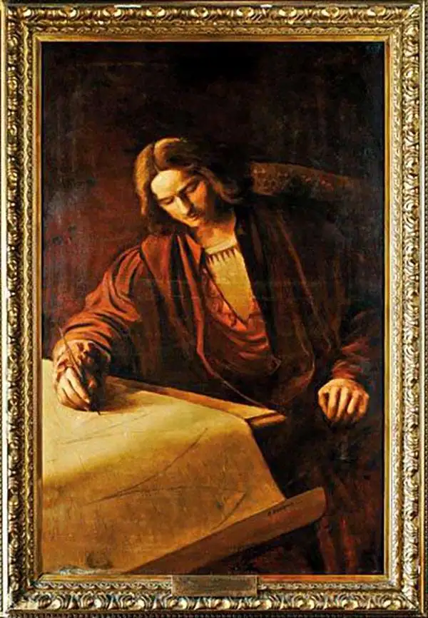
Martin Waldseemüller (September 11, 1470 - March 16, 1520) was a German cartographer, astronomer, and mathematician credited with creating, along with Matthias Ringmann, the first map to use the placename America. He was born in Wolfenweiler, near Freiburg im Breisgau. Waldseemüller studied at the University of Freiburg and, on April 25, 1507, became a member of the Gymnasium Vosagese at Saint-Dié. Martin Waldseemüller was a major proponent of theoretical or additive cartography. Unlike contemporary Portuguese and Spanish cartographers, who left maps blank where knowledge was lacking, Waldseemüller and his peers speculated based upon geographical theories to fill unknown parts of the map. He is best known for his Universalis Cosmographia a massive 12-part wall map of the world considered the first map to contain the name America, today dubbed as 'America's Birth Certificate'. This map also had significance on other levels, as it combined two previously unassociated geographical styles: Ptolemaic Cartography, based on an ancient Greek model, and the emergent 'carta marina', a type of map commonly used by European mariners in the late 15th and 16th centuries. It also extended the traditional Ptolemaic model westward to include the newly discovered continent of America, which Waldseemüller named after the person he considered most influential in its discovery, Amerigo Vespucci. When Waldseemüller died in 1520, he was a canon of the collegiate Church of Saint-Dié. In contemporary references his name is often Latinized as Martinus Ilacomylus, Ilacomilus, or Hylacomylus.
One of the Earliest Printed Maps of India.
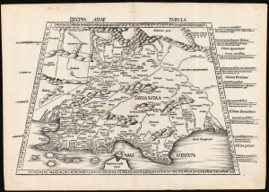
Decima Asie Tabula.
$8,500.00
Acquire
- Digital Map Information
- Suitable for large format printing
- File Size: 22.27 MB
- File Type: ZIP / TIFF
- ICC color profile embedded
- Delivered instantly via download link
This is Martin Waldseemüller's 1513 edition of the Ptolemaic map of India, one of the earliest acquirable maps of the area and an essential step in the subcontinent's cartographic evolution. Waldseemüller and Ringmann issued it for their 1513 Geographie Opus Novissima, the most comprehensively edited and amended edition of Claudius Ptolemy's 2nd-century geography. Moreover, this map was the largest format edition of Ptolemy's map to have been produced to date. (more details)
Reconciling ancient geography with new discoveries.
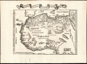
Tabu. Nova Partis Aphri.
$1,900.00
Acquire
- Digital Map Information
- Suitable for large format printing
- Full resolution TIFF file
- ICC color profile embedded
- Delivered instantly via download link
This is Laurent Fries' 1535 edition of the earliest acquirable modern mapping of Africa north of the Equator. This is one of the earliest printed maps to incorporate contemporary Portuguese discoveries while preserving classical Ptolemaic geography. (more details)
One of the Earliest Modern Maps of Africa.
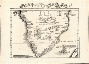
Tabu. Nova Partis Aphri.
$2,000.00
Acquire
- Digital Map Information
- Suitable for large format printing
- Full resolution TIFF file
- ICC color profile embedded
- Delivered instantly via download link
This is Laurent Fries' 1535 edition of the earliest acquirable modern mapping of South Africa, among the first to reveal the discoveries of the Portuguese explorers Dias and De Gama. This map represents an effort to reconcile two contrasting depictions of southern Africa by Martin Waldseemüller: the 1513 Tabula Moderna Secunde Porcionis Aphrice, and the 1516 Carta Marina. In the past, it has been erroneously described as a more decorative version of the former, but closer study reveals it as cartographically distinct and independently significant. (more details)
One of the Earliest Modern Maps Ceylon / Sri Lanka.
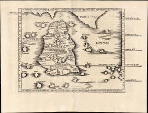
[Tabula XII. Asiae.]
$750.00
Acquire
- Digital Map Information
- Suitable for large format printing
- Full resolution TIFF file
- ICC color profile embedded
- Delivered instantly via download link
This is Laurent Fries' 1525 edition of Martin Waldseemüller's Ptolemaic map of Sri Lanka. This island - here named Taprobana - represented, for Ptolemy, the limit of European geographic knowledge in the east. The smallest area to have appeared in Ptolemaic canon, later geographers wrestled with the identity of the island depicted. Many correctly identified the island as Sri Lanka, though Munster, Mercator, and others speculated that the better candidate was Sumatra. (more details)
One of the Earliest maps to name America.
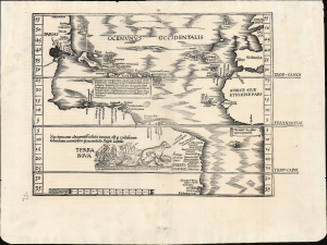
[Tabula terrae novae]
$13,500.00
Acquire
- Digital Map Information
- Suitable for large format printing
- Full resolution TIFF file
- ICC color profile embedded
- Delivered instantly via download link
A cartographic landmark, this is Lorenz Fries' edition of the first separate, printed map of America. First printed in 1522, it succeeds and synthesizes Martin Waldseemüller's 1513 Tabula Terre Nove and his 1516 Carta Marina. No improved, acquirable map of this part of the world appeared until Münster's 1540 map of the Americas. (more details)
Spreading the Age of Discovery.
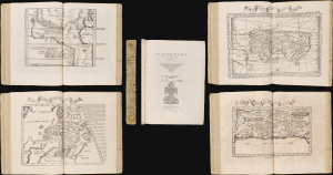
Claudii Ptrolemaei Alexandrini Geographicae Enarrationis Libri Octo Ex Bilibaldi Pirckeymheri tralatione...
$55,000.00
Acquire
This is Lorenz Fries' expanded version of Ptolemy's Geography: an attractive, complete example of the 1535 issue edited by Michael Villanovus (Servetus). It is a key document of the Discovery Era, containing an array of the earliest disseminated maps of Africa, the Indies and the New World; one of its trio of world maps is the earliest acquirable map to name 'America.' This 1535 Servetus edition is scarce. Many were burned when the editor was condemned for heresy in 1553: only one example of this edition is listed in an institutional collection. (more details)
Earliest acquirable map of Europe based on contemporaneous knowledge.
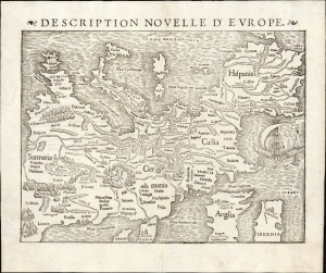
Description Nouvelle D'Europe.
$2,750.00
Acquire
- Digital Map Information
- Suitable for large format printing
- Full resolution TIFF file
- ICC color profile embedded
- Delivered instantly via download link
This is a 1556 edition of Sebastian Münster's 1540, southern-oriented map of Europe: the first acquirable map of Europe based on contemporary geographical information and the earliest acquirable derivative of Martin Waldseemüller's unobtainable 1511 map of Europe. Münster's Geographia and Cosmographia provided for many years the literate European's only glimpses of the world, and these two works contained a number of maps with previously unseen, contemporaneous knowledge of the areas they depicted. For Münster's readership, this map was almost certainly the first depiction of their home continent, not based on the 2nd-century work of Claudius Ptolemy. (more details)
Most beautifully executed woodcut map of Europe.
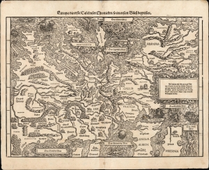
Europa / die erste Tafel diser Chronicken / so im ersten Buech begrissen.
$4,000.00
Acquire
- Digital Map Information
- Suitable for large format printing
- File Size: 14.99 MB
- File Type: ZIP / TIFF
- ICC color profile embedded
- Delivered instantly via download link
This is a bold, attractive 1606 edition of Johann Stumpf's 1548 south-oriented map of Europe. It is the only map derived from Sebastian Münster's Europe and is thus the last derivative of Martin Waldseemüller's unobtainable 1511 map of Europe. While Münster's map went to many editions and is readily acquirable, Stumpf's work was produced in smaller numbers and is a rarer work: larger, more beautifully executed, and more desirable. (more details)