
1636 / 1680 Jansson/ Pitt Map of Livonia (Latvia and Estonia)

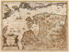
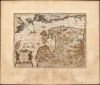
Nova Totius Livoniae accurata Descriptio. Apud Janssonio Waesbergios et Mosem Pitt.
Estonia and Latvia as the Swedish Frontier
- Digital Map Information
- Suitable for large format printing
- Full resolution TIFF file
- ICC color profile embedded
- Delivered instantly via download link
Estonia and Latvia as the Swedish Frontier
A beautifully engraved map of Livonia and the Duchy of Estonia - encompassing much of modern Latvia and Estonia - originally published in Jan Jansson's Atlas and revised for inclusion in Moses Pitt's rare 1680 English Atlas. Derived from Anders Bure's seminal map of the Swedish Empire, it depicts the region during Swedish rule following Sweden's victories over the Polish-Lithuanian Commonwealth. Sweden retained Estonia and Livonia until its defeat by Russia in the Great Northern War (1700 - 1721).A Closer Look
The map focuses on the region surrounding the eastern Baltic and the Gulf of Finland, including most of modern-day Latvia and Estonia. Tallinn, Estonia's capital, is labeled with its historical name, Revel. Latvia's capital, Riga, and Narva (now the easternmost point in the European Union) are named, along with many smaller cities and towns. Across the Gulf of Finland, Helsinki is marked and named Helsingfors.Aside from Livonia and the Duchy of Courland, surrounding lands of Sweden (including Stockholm at top-left), Poland-Lithuania, and Tsarist Russia (Moscoviae Pars) are indicated.
The map is beautifully engraved, exhibiting superb calligraphy and decorated with four sailing ships and a sea monster. A note in the Gulf of Finland indicates a reef reputed to have magnetic properties, causing mariners' compass needles to fluctuate.
State-of-the-Art Cartography
When Jansson took over production of the Mercator/Hondius atlas, he thoroughly updated the maps. A map of Livonia was present in the atlas as early as 1595, but it had remained substantially unchanged for 40 years. In the intervening period, the Swedish geographer Anders Bure had published his 1626 wall map of Scandinavia, which immediately became the dominant mapping of the northern parts of Europe; his work was characterized by its advances in accuracy and reliance on firsthand astronomical measurements. Bure undertook the project at the behest of King Gustavus Adolphus, during the course of the Polish-Swedish War (1600 - 1629); by the time Bure was at work, Sweden had successfully invaded Livonia; according to the 1622 Truce of Mitawa, the Polish-Lithuanian Commonwealth ceded Livonia north of the Daugava, including Riga. Thus, Bure's mapping of the Swedish Empire included the first detailed mapping of the newly occupied Estonia and Livonia, representing both a prize of war and a likely future theater of war.Bure's firsthand experience in the region extended at least as far back as 1619, when he was active in establishing the new borders with Russia based on the Peace of Stolbova. He also acquired a very personal stake in Livonia: as a reward for his cartographic achievements, Gustavus Adolphus awarded him a feudal estate in Randen (now Rannu in Estonia, east of Lake Võrtsjärv, 'Wort' on the map).
Publication History and Census
This map was first issued in Jansson's 1636 German text Appendix, replacing the 1595 map that had previously appeared in the Mercator/Hondius/Janssonius atlas. Jansson's heir, Johannes Waesberger, continued to publish the atlas under Jansson's imprint. In 1680, Waesberger collaborated with Moses Pitt to release the work in England; in addition to receiving Pitt's imprint, this 1680 state of the map can be identified by its inclusion of latitude and longitude lines and the plate number XIX in the upper left corner. Jansson issues of this map are well represented in institutional collections, but the 1680 Waesberger/Pitt impressions are scarce, with only seven separate examples cataloged in OCLC.Cartographers
Jan Jansson or Johannes Janssonius (1588 - 1664) was born in Arnhem, Holland. He was the son of a printer and bookseller and in 1612 married into the cartographically prominent Hondius family. Following his marriage, he moved to Amsterdam, where he worked as a book publisher. It was not until 1616 that Jansson produced his first maps, most of which were heavily influenced by Blaeu. In the mid-1630s, Jansson partnered with his brother-in-law, Henricus Hondius, to produce his important work, the eleven-volume Atlas Major. About this time, Jansson's name also begins to appear on Hondius reissues of notable Mercator/Hondius atlases. Jansson's last major work was his issue of the 1646 full edition of Jansson's English Country Maps. Following Jansson's death in 1664, the company was taken over by Jansson's brother-in-law Johannes Waesberger. Waesberger adopted the name of Jansonius and published a new Atlas Contractus in two volumes with Jansson's other son-in-law, Elizée Weyerstraet, with the imprint 'Joannis Janssonii Haeredes' in 1666. These maps also refer to the firm of Janssonius-Waesbergius. The name of Moses Pitt, an English map publisher, was added to the Janssonius-Waesbergius imprint for maps printed in England for use in Pitt's English Atlas. Further Details...
Anders Bure (August 14, 1571 - February 4, 1646) was a Swedish mathematician and cartographer. He is considered the father of Swedish cartography. He was the son of the parish priest Engelbertus Laurentii and Elisabeth Andersdotter Burea, descendant of the long-established Bureätten family. His immediate family included diplomats and government officials. His education is obscure, though he is mentioned as an office clerk in 1602. His duties in the following years involved recording royal genealogical and historical works, involving him in the highest echelons of Swedish society. He also participated in diplomatic assignments, including missions to both Russia and Finland. His cartographic contributions improved the mapping both of the northern parts of Sweden, and the kingdom as a whole. His six-sheet 1626 Orbis Arctoi represented the first real improvement to the mapping of the northern parts of Europe since the Olaus Magnus map of the previous century: this map would provide the basis for virtually every European map of Scandinavia to follow in the 17th century. In addition to these achievements, he was the first person recorded to use the decimal system in Sweden. Further Details...
Moses Pitt (c. 1631 - 1697) was one of the largest British book publishers, printers, and booksellers of the second half of the 17th century. A very ambitious man whose plans eventually led to bankruptcy, Pitt was a small bookseller and publisher before he embarked on some enormous, very expensive ventures. The largest was the English Atlas, which he intended to contain 900 pages of text and 600 plates in eleven volumes, in partnership with Jan Jansson's heir Johannes Waesberger. The first volume was published in 1680, but rising costs meant that only four volumes were completed. Pitt's ambitions did not stop there, as he began a huge property speculation scheme in Westminster and took over the printing office of Oxford University. By 1685, however, he was forced to sell off much of his stock at auction, which marked the end of his print publishing. His final bankruptcy and arrest for debt happened in 1689, and he spent the following eight years in prison, only to be released shortly before his death. In 1691, Pitt published The Cry of the Oppressed: Being a True and Tragical Account of the Unparallel'd Sufferings of Multitudes of Poor Imprison'd Debtors In Most of the Gaols in England, an appeal on behalf of people imprisoned for debt. Further Details...
Source
Pitt. M./ Waesberger, Johannes The English Atlas, (Oxford: Printed at the Theater, for Moses Pitt) 1595.
Condition
Very good. Some areas of oxidation reinforced, with some cracking; minimal loss. Original color with an attractive patina.
References
OCLC 699805427.