
1891 Bien Elephant Folio Atlas of New York City and Environs

Atlas of the Metropolitan District and Adjacent Country.
Dawn of Modern New York City.
Dawn of Modern New York City.
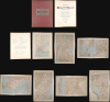
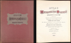
This is a stunning elephant folio chromolithograph atlas of New York City and environs by Julius Bien and C. C. Vermeule, dated 1891. It captures New York City and its surrounding area during a period of frenetic growth and modernization, which, in the following years, led to the consolidation of the five boroughs and the adoption of cutting-edge technology to facilitate the movement of people and goods through the metropolis.A Closer Look
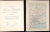
The atlas includes thirteen striking color maps, many double-page, of today's New York City and other nearby parts of its metropolitan area, including New Jersey and Westchester County. The maps, which drew on surveys by the U. S. Coast and Geodetic Survey and the Geological Survey of New Jersey, indicate topography (elevation - both on land and sea - and terrain) in addition to the street grid and other urban architecture like railroads, piers, and bridges. The double-page maps measure 34 x 22.75 in., which, combined with the striking chromolithographic color, allows for remarkable detail and sharpness. The page listing the plates also includes a key to the color shading and symbols used. In order, the plates in the atlas are:- I. Index Map
- II. City and County of New York [Manhattan and much of the Bronx]
- III. Brooklyn, New York Bay, Jersey City, Hoboken, Bayonne and Newark Bay
- IV. The Narrows to Jamaica Bay, Coney Island north to Brooklyn
- V. Richmond County (Staten Island)
- VI. Newark, Elizabeth, the Oranges and Vicinity
- VII. Newark to Paterson, east
- VIII. Long Island Sound, Westchester north to Mt. Vernon, Queens south to Jamaica
- IX. Westchester County: Yonkers to Dobbs Ferry, east to State Line
- X. Westchester County: Irvington, Tarrytown to Sing Sing, east to State Line
- XI. Westchester County: Scarborough to Putnam County Line, east
- XII. Westchester County: Vicinity of Croton Lake
- XIII. Westchester County: Bedford to State Line
Historical Context
These maps capture the City of New York, then just Manhattan and Queens, when it came to resemble the metropolis of today, with skyscrapers, bridges, and a strict geometric street plan that covers nearly the entire island of Manhattan and beyond. The areas around the city also came to resemble their modern forms at this time, with Brooklyn becoming a metropolis in its own right and the hitherto rural parts of Queens, Staten Island, Westchester County, and New Jersey increasingly being drawn by the gravitational pull of the growing city at the core of the metropolitan area.Among the most notable features of these maps are the railroads, ferries, and other infrastructure that struggled to meet the demand of the area's booming population. It is no surprise that the following years saw the completion of additional bridges across the East River (the Williamsburg, Manhattan, and Queensboro Bridges) as well as railroad tunnels under both the East and Hudson River. Interestingly, on Plate II, a railroad tunnel is ghosted beneath the Hudson River south of its ultimate location, reflecting the decades-long, on-and-off efforts to complete such a project, which posed a daunting engineering challenge.
Chromolithography
Chromolithography, sometimes called oleography, is a color lithographic technique developed in the mid-19th century. The process uses multiple lithographic stones, one for each color, to yield a rich composite effect. Generally, a chromolithograph begins with a black basecoat upon which subsequent colors are layered. Some chromolithographs used 30 or more separate lithographic stones to achieve the desired effect. Chromolithograph color can be blended for even more dramatic results. The process became extremely popular in the late 19th and early 20th centuries when it emerged as the dominant method of color printing. The vivid color chromolithography made it exceptionally effective for advertising and propaganda.Publication History and Census
This atlas was prepared and published by Julius Bien and C. C. Vermeule in 1891. The title page includes the signature of a previous owner - which appears to be P. H. or R. H. Ohm - but we have been unable to locate any information about this individual. The atlas appears in multiple OCLC listings, but many of these are microfilm or digital reproductions. We only locate physical examples at the New York Public Library, New York University, the State University of New York at Binghamton, the Archives of Michigan, the Wisconsin Historical Society, the Huntington Library, and the David Rumsey Historical Map Collection.Cartographers
Julius (Julien) Bien (September 27, 1826 - December 21, 1909) was a German-Jewish lithographer and engraver based in New York City. Bien was born in Naumburg, Germany. He was educated at the Academy of Fine Arts, Cassell and at Städel's Institute, Frankfurt-am-Main. Following the suppression of the anti-autocratic German Revolutions of 1848, Bien, who participated in the pan-German movement, found himself out of favor in his home country and joined the mass German immigration to the United States. Bien can be found in New York as early as 1849. He established the New York Lithographing, Engraving & Printing Company in New York that focused on the emergent chromo-lithograph process - a method of printing color using lithographic plates. His work drew the attention of the U.S. Government Printing Office which contracted him to produce countless government maps and surveys, including the Pacific Railroad Surveys, the census, numerous coast surveys, and various maps relating to the American Civil War. Bien also issued several atlases both privately and in conjunction with a relation, Joseph Bien. At the height of his career Bien was elected president of the American Lithographers Association. After his death in 1909, Bien's firm was taken over by his son who promptly ran it into insolvency. The firm was sold to Sheldon Franklin, who, as part of the deal, retained the right to publish under the Julius Bien imprint. In addition to his work as a printer, Bien was active in the New York German Jewish community. He was director of the New York Hebrew Technical Institute, the New York Hebrew Orphan Asylum, and president of the B'nai B'rith Order. Further Details...
Cornelius Clarkson Vermeule (September 5, 1858 - February 1, 1950) was a civil engineer and surveyor active in the New York City area in the late 19th and early 20th centuries. He was born in Raritan Landing, New Jersey and attended Rutgers University before joining the U.S. Geological Survey. Vermeule was also placed in charge of the New Jersey Geological Survey, eventually completing the first topographical survey of New Jersey, and as a result remained an authority of New Jersey's geology, hydrology, and topography for the rest of his career, including serving as a consulting engineer for the state of New Jersey. In 1888, Vermeule opened an office in New York City and thereafter served as a consulting engineer for more than 100 municipalities as well as private clients and some foreign governments, including in Cuba both before and after independence from Spain. He was particularly expert at understanding natural water flows and designing municipal water supply systems. Late in his career, Vermeule was tasked with overseeing the dismantling of the Morris Canal in New Jersey, first opened in 1831, a task which was carried on and completed by his son, Cornelius Clarkson Vermeule II (1895 - 1943). The elder Vermeule was also an avid local historian and an active member of the New Jersey Historical Society. Further Details...
The Office of the Coast Survey (1807 - present) founded in 1807 by President Thomas Jefferson and Secretary of Commerce Albert Gallatin, is the oldest scientific organization in the U.S. Federal Government. Jefferson created the "Survey of the Coast," as it was then called, in response to a need for accurate navigational charts of the new nation's coasts and harbors. The spirit of the Coast Survey was defined by its first two superintendents. The first superintendent of the Coast Survey was Swiss immigrant and West Point mathematics professor Ferdinand Hassler. Under the direction of Hassler, from 1816 to 1843, the ideological and scientific foundations for the Coast Survey were established. These included using the most advanced techniques and most sophisticated equipment, as well as an unstinting attention to detail. Hassler devised a labor-intensive triangulation system whereby the entire coast was divided into a series of enormous triangles. These were, in turn, subdivided into smaller triangulation units, which were then individually surveyed. Employing this exacting technique on such a massive scale had never been attempted before. Consequently, Hassler and the Coast Survey under his leadership developed a reputation for uncompromising dedication to accuracy and excellence. Unfortunately, despite being a masterful surveyor, Hassler was abrasive and politically unpopular, losing congressional funding for the Coast Survey twice. Nonetheless, Hassler led the Coast Survey until his death in 1843, when Alexander Dallas Bache, a great-grandson of Benjamin Franklin, took the helm. Bache was fully dedicated to the principles established by Hassler, but proved more politically astute and successfully lobbied Congress to fund the endeavor generously. Under the leadership of A. D. Bache, the Coast Survey completed its most important work. Moreover, during his long tenure with the Coast Survey, from 1843 to 1865, Bache was a steadfast advocate of American science and navigation and, in fact, founded the American Academy of Sciences. Bache was succeeded by Benjamin Pierce, who ran the Survey from 1867 to 1874. Pierce was, in turn, succeeded by Carlile Pollock Patterson, who was Superintendent from 1874 to 1881. In 1878, under Patterson's superintendence, the U.S. Coast Survey was reorganized as the U.S. Coast and Geodetic Survey (USCGS) to accommodate both topographic and nautical surveys. Today, the Coast Survey is part of the National Oceanic and Atmospheric Administration (NOAA) as the National Geodetic Survey. Further Details...
Condition
Very good. Repaired centerfold split, Plate III. Atlas measures 23.25 x 18.25 in. Double page map plates measure 34 x 22.75 in.
References
OCLC 228677495.