
1562 Girolamo Ruscelli's First Latin Edition of Ptolemy

This item has been sold.
Geographis Cl. Ptolemaei Alexandrini...
Latin Edition of an Influential Geography
Latin Edition of an Influential Geography
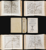
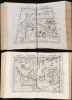
This is a superb example of Girolamo Ruscelli's Geographia Cl. Ptolemaei Alexandrini, the 1562 edition of his expanded Ptolemy, featuring the new Latin re-translation of the work by Giuseppe Moleto, amending Willibald Pirckheimer's translation of Ptolemy's text. Ruscelli's Geographia was a tour de force and, in this Latin edition, it reached its broadest audience, marking this as the most important edition of Ruscelli's Ptolemy. With its complement of maps beautifully engraved by Giulio Sanuto (particularly the Zeno map of the North Atlantic), the work had a long-standing influence on European geographical thought. The maps here are all in their first state and are thus most desirable.A Beautiful Example
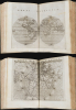
The present book - beautifully rebound, with the original vellum covers is unusually wide-margined throughout and remarkably clean and free of mends. All the maps are bold, sharp examples in their first states. These include the classical maps derived from the 2nd-century Roman ur-geographer Claudius Ptolemy and Ruscelli's tabulae moderni, that is, maps showing modern topography and expanding coverage beyond the limits of classical geographical knowledge. The cartographic content of the book updates and improves upon Giacomo Gastaldi's 1548 Ptolemy. Ruscelli's maps here are twice the size of those appearing in Gastaldi's Ptolemy and beautifully engraved by Giulio Sanuto, whose unsung work makes them quiet masterpieces of clarity and legibility.Ruscelli's work contained maps not derived from Gastaldi. Perhaps surprisingly, the 1548 did not include any version of Ptolemy's map of the known world, or the oikoumene. Ruscelli corrects this with his Ptolemaei Typus, employing the more complicated (and thus less common) second Ptolemaic projection, easily distinguished by its curvilinear longitude lines. (Unnacountably, this beautiful map was replaced in 1574 with a more conventional one utilizing Ptolemy's first, trapezoidal projection.) The modern world map supplied by Ruscelli is an even more important departure, replacing Gastaldi's oblong composition with the first double-hemisphere world map to appear in a printed geography.
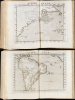
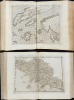
Gastaldi's 'modern' map of the British Isles (based on Waldseemüller's 1513 map, and admitted by Gastaldi scholar Douglas Sims as 'the poorest modern map' in Gastaldi's book) has been wisely replaced with a map based on the 1546 map of George Lily, thus presenting to a broad audience the first contemporaneous mapping of the British Isles by an Englishman. Closer to home, Ruscelli's map of Tuscany corresponds to none of the maps appearing in the 1548 book, but is rather reduced from either Matteo Pagano's 1550 Chorographia Tusciae or the 1559 Vavassore, derived from the same source. Ruscelli's map of Brazil likewise does not originate with Gastaldi but instead from Giovanni Battista Ramusio and manuscript works of the Dieppe school.
The most momentous of Ruscelli's new inclusions was his Septentrionalium Partium Nova Tabula, based on Nicolo Zeno the Younger's 1558 Carta da navegar: this was the map that introduced the phantom islands of Frisland, Icaria, Drogeo, and Estotiland to the cartographic world, arguably setting back geographical knowledge of the North Atlantic a century or more. Without Ruscelli's involvement, Zeno's map would most likely never have been disseminated beyond Venice; instead, its inclusion in his Geographia ensured it reached a broad audience. In particular, it reached the eyes of Gerard Mercator, who enshrined Zeno's fraudulent geography into cartographic canon.
Modernized Ptolemy
European exploration in the late 15th and early 16th centuries resulted in a massive expansion of the known world, far superseding Claudius Ptolemy's 2nd-century geographical knowledge. And yet, mapmakers continued to publish editions of Ptolemy - as here, in company with modern maps reflecting the new discoveries. There were two reasons for this. First, Ptolemy's geography was among the only obtainable references to the locations of antiquity, shedding light on Humanistic attempts to recover and understand ancient literature. Second, Ptolemy's methodology remained essential and authoritative. By employing his great innovation - laying out a grid and assigning coordinates to real-world locations - one could produce a mathematical representation of the world, clearly showing the distances between known features. Every geographer of the Age of Discovery embraced Ptolemy's methodologies to absorb new discoveries. Any geographer needed to understand the Ptolemaic foundations of their discipline before undertaking any new work. Consequently, editions of Ptolemy would continue to be printed well into the 18th century. Manuscript and print editions of Ptolemy were produced during the 15th and 16th centuries.Giacomo Gastaldi's edition of 1548 was significant in its own right. It was the first small-format Ptolemy, but more importantly, it was the first Ptolemy to be published in a vernacular, in this case Italian. It was only produced in one edition, though, so by 1561 either Ruscelli or his publisher Valgrisi determined that the market was ripe for a new approach to the work.
Publication History and Census
Ruscelli's edition of Ptolemy was first compiled for the publisher Valgrisi in the Italian edition of 1561, its maps engraved by Giulio Sanuto. The present Latin edition was printed in 1562. Further editions in both languages, distinguishable typographically, were printed in 1564 by the publisher Ziletti. All four of these editions exhibit the maps in their first states, with the plates running off the top edge of the sheets; some examples of the Latin edition of 1564 exhibit platemarks on the top as well. Ziletti produced a 1574 Italian edition with all the maps in their second states; the publisher Sessa released 1598 and 1599 editions with the plates much altered. The present Latin edition is well represented in institutional collections, but it is scarce on the market, and any of the editions are increasingly difficult to find in such attractive examples.Cartographers
Girolamo Ruscelli (1500 - 1566) was an Italian polymath, humanist, editor, and cartographer active in Venice during the early 16th century. His work as a polygraph - a writer on many subjects, producing, editing, and copying content for the new printing industry - required erudition in a broad array of fields. Born in Viterbo, Ruscelli lived in Aquileia, Padua, Rome, and Naples before relocating to Venice, where he spent much of his life. Cartographically, Ruscelli is best known for his important revision of Ptolemy's Geographia, which he published in 1561, with further editions as late as 1599. Ruscelli's work represented a marked improvement on Gastaldi's 1548 Ptolemy, presenting both the ancient and modern maps in larger, more clearly-engraved examples. His edition also included maps not present in Gastaldi's Ptolemy, including the first double-hemisphere world map to appear in a Geography, the earliest mapping of the British Isles from an English source, and the notorious and influential Zeno map of the North Atlantic. Ruscelli is also listed as the editor of such important works as Boccaccio's Decameron, Petrarch's verse, Ariosto's Orlando Furioso, and various other works. In addition to his well-known cartographic work, many scholars associate Ruscelli with Alexius Pedemontanus, author of the popular De' Secreti del R. D. Alessio Piemontese. This well-known work, or "Book of Secrets," was a compilation of scientific and quasi-scientific medical recipes, household advice, and technical commentary on a range of topics that included metallurgy, alchemy, dyeing, and perfume making. Ruscelli, as Alexius, founded an "Academy of Secrets," a group of noblemen and humanists dedicated to unearthing "forbidden" scientific knowledge. This was the first known experimental scientific society and was later imitated by a number of other groups throughout Europe, including the Accademia dei Secreti of Naples. Further Details...
Claudius Ptolemy (83 - 161 AD) is considered to be the father of cartography. A native of Alexandria living at the height of the Roman Empire, Ptolemy was renowned as a student of Astronomy and Geography. His work as an astronomer, as published in his Almagest, held considerable influence over western thought until Isaac Newton. His cartographic influence remains to this day. Ptolemy was the first to introduce projection techniques and to publish an atlas, the Geographiae. Ptolemy based his geographical and historical information on the "Geographiae" of Strabo, the cartographic materials assembled by Marinus of Tyre, and contemporary accounts provided by the many traders and navigators passing through Alexandria. Ptolemy's Geographiae was a groundbreaking achievement far in advance of any known pre-existent cartography, not for any accuracy in its data, but in his method. His projection of a conic portion of the globe on a grid, and his meticulous tabulation of the known cities and geographical features of his world, allowed scholars for the first time to produce a mathematical model of the world's surface. In this, Ptolemy's work provided the foundation for all mapmaking to follow. His errors in the estimation of the size of the globe (more than twenty percent too small) resulted in Columbus's fateful expedition to India in 1492.
Ptolemy's text was lost to Western Europe in the middle ages, but survived in the Arab world and was passed along to the Greek world. Although the original text almost certainly did not include maps, the instructions contained in the text of Ptolemy's Geographiae allowed the execution of such maps. When vellum and paper books became available, manuscript examples of Ptolemy began to include maps. The earliest known manuscript Geographias survive from the fourteenth century; of Ptolemies that have come down to us today are based upon the manuscript editions produced in the mid 15th century by Donnus Nicolaus Germanus, who provided the basis for all but one of the printed fifteenth century editions of the work.
Further Details...
Giacomo Gastaldi (c. 1500 - October, 1566) was an Italian astronomer, cartographer, and engineer active in the second half of the 16th century. Gastaldi (sometimes referred to as Jacopo or Iacobo) began his career as an engineer, serving the Venetian Republic in that capacity until the fourth decade of the sixteenth century. During this time he traveled extensively, building a large library relating to voyages and exploration. From about 1544 he turned his attention to mapmaking, working extensively with Gextantiovanni Battista Ramusio, Nicolo Bascarini, and Giovanbattista Pedrezano, as well as taking private commissions for, among others, Venice's Council of Ten. He is credited with the fresco maps of Asia and Africa still extant in the map room of the Doge's Palace. Gastaldi was also one of the first cartographers to embrace copper plate over woodblock engraving, marking an important development in the history of cartography. His 1548 edition of Ptolemy's Geographia was the first to be printed in a vernacular; it was the first to be printed in copperplate. As with his Swiss/German contemporary Münster, Gastaldi's work contained many maps depicting newly discovered regions for the first time, including the first map to focus on the East Coast of North America, and the first modern map of the Indian Peninsula. His works provided the source for the vast majority of the Venetian and Roman map publishers of the 1560s and 70s, and would continue to provide an outsize influence on the early maps of Ortelius, De Jode, and Mercator. Further Details...
Condition
Fine overall. 1 vol in quarto (9 x 7 inches) 8 unnumbered pages, 112, 286 pages, 66 unnumbered pages, 128 unnumbered leaves of plates woodcut illustrations and 64 engraved maps. New front and end papers. Rebound with original vellum binding. All edges red.
References
OCLC 56370335 Not in Rumsey: see the 1561 Italian edition 11311.000