
1980 Hunting Geology and Geophysics Arabic Geological Map of Qatar

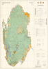
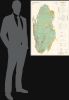
Qatar Geological Map / خريطة قطر الجيولوجية.
Maturation of Qatar's Oil and Gas Industries.
Maturation of Qatar's Oil and Gas Industries.
This is an extremely rare 1980 large-format bilingual geological map of Qatar, produced by Hunting Geology and Geophysics for the Qatari government. Issued nearly a decade after independence, the map played an important role in the country's continued development of its oil and gas industries, the wealth from which was successfully leveraged to support wider social and economic development.A Closer Look
The map covers the Qatari Peninsula, its nearby islands (including the Hawar Islands, belonging to Bahrain), and reclaimed coastal land, using color-shading to indicate a variety of sands, gravels, clay, and stone, as explained in the bilingual legends present at right, which also indicate geological era. Roads, carriageways (highways), tracks, settlements, oil wells, pipelines, waterways (including wadis), and other features, including some maritime features (sand banks, reefs), are recorded, as explained in a legend at right. The level of detail is so extraordinary that even power lines and fences are noted. Additional information is also explained at right, such as the local grid employed and a reliability diagram based on the surveys that form the basis of the map's data.Qatar's Oil Industry Takes Off
The early history of Qatar's oil industry began in the 1920s and 1930s, when the small, sparsely populated British protectorate first attracted the interest of international oil companies exploring the Persian Gulf. In 1932, the Anglo-Persian Oil Company obtained the first oil concession in Qatar through a subsidiary, the Iraq Petroleum Company. Initial exploration efforts included geological surveys and test drilling, reflecting British hopes that Qatar might yield oil reserves comparable to those already found in neighboring Bahrain and Saudi Arabia. The first promising discovery came in 1939 at the Dukhan field on Qatar's western coast. However, development was delayed by the outbreak of the Second World War, which diverted resources and prevented large-scale extraction.Oil production in Qatar truly began after the war. In 1947 - 1948, the Dukhan field was finally brought into production, with the first export shipment departing in December 1949. Revenues from oil began to replace traditional industries like pearling, fishing, and small-scale trade. Through the 1950s, the Qatar Petroleum Company (then an operating arm of the concession-holding consortium) expanded infrastructure at Dukhan and the growing port of Umm Said (Mesaieed), which became the center of refining and export operations.
The influx of oil revenue initiated an era of modernization. Beginning in the 1950s, the ruling al-Thani family used oil income to fund public works, schools, healthcare, and roads, gradually transforming Qatar from a relatively poor Gulf sheikhdom into a state with rapidly improving infrastructure and services.
This map was when Qatar's oil industry entered a period of rapid growth. The discovery and development of new offshore reserves were especially significant during this period, including the Bul Hanine field, located southeast of the Qatari peninsula. Discovered in 1970 and brought into production in 1972, Bul Hanine became a key contributor to Qatar's output during the 1970s, reflecting the country's shift toward offshore exploration that would later define much of its energy sector. Qatar also steadily increased its role in managing the sector, especially after independence. In the early 1970s, the government negotiated increased participation in concessionary operations, aligning with a broader regional trend across the Gulf and the wider Arab world. In 1974, Qatar achieved a majority state share in the Qatar Petroleum Company's operations, reflecting the global momentum of resource nationalization. Oil exports from fields such as Bul Hanine strengthened the young state's financial position, enabling even further investments in education, housing, infrastructure, and early industrialization projects, driven by the leadership of Emir Khalifa bin Hamad (r. 1972 - 1995). This era also set the stage for the eventual development of Qatar's massive natural gas resources (especially the North Field, the largest natural gas field in the world), which would propel the country into a new phase of energy leadership, even as geopolitical incidents (the 1973 Oil Embargo, the Iranian Revolution and Iran-Iraq War) caused turmoil in the oil and gas industries.
Publication History and Census
This map was compiled and drawn by the firm Hunting Geology and Geophysics in the late 1970s, based on their own surveys and those of Seltrust Engineering Limited (which prepared an equally rare explanatory booklet for the map, OCLC ), and was published in 1980. In a sense, the map can be seen as a successor to a 1970 geological map of Qatar (previously sold by us, QatarGeological-jaidah-1970), which Hunting had a role in developing, with the same title and dimensions as the present map, similar involvement of the Qatari government (in this case the Industrial Development Technical Centre, مركز الفني للتنمية الصناعية), and equivalent types of data reflected. However, the present map is based on later surveys and benefits from a decade of additional technological advances, making it a rather unique work rather than a second edition. In any event, the present map is very scarce, noted only among the holdings of the Library of Congress and with no known market history.Cartographer
Hunting Geology and Geophysics Ltd. (1952 - 1987) was a British surveying firm that specialized in cutting-edge methods of mapping, especially aeromagnetic surveys, and focused on discovering potential reserves of natural resources, especially fossil fuels. It was part of the larger Hunting Group, originally founded in 1874 as a shipping company by Charles Hunting, and later moving into aircraft, surveying, and petroleum. Companies within the Hunting group frequently merged with each other and with outside acquisitions, leading to frequent name changes; in this case, Hunting Aerosurveys (founded 1944) merged with Hunting Geophysics (founded 1952) to form Hunting Surveys in 1960. In 1965, a public company was formed called Hunting Associated Industries Ltd., which included Hunting Surveys (Holdings) Ltd. but not a new entity, Hunting Geology and Geophysics Ltd., which remained part of the privately-owned Hunting Group. In 1987, Hunting Geology and Geophysics Ltd. was closed down in a consolidation process that saw the public company (now Hunting PLC) buy out the Hunting Group, though the Hunting family retains a significant share of the company's stock and one of its members remains Chairman of the Board. Hunting Geophysics, and later Hunting Geology and Geophysics Ltd., made pioneering surveys of Great Britain itself, along with several countries in Central Africa (seeking uranium and other minerals), the Philippines, Ethiopia, and especially countries in the Middle East, where the company conducted critically important surveys that helped to develop the lucrative oil industries of the United Arab Emirates, Qatar, and Kuwait, among others. Further Details...
Condition
Very good.
References
OCLC 35277935.