
Albert Richard (sold)
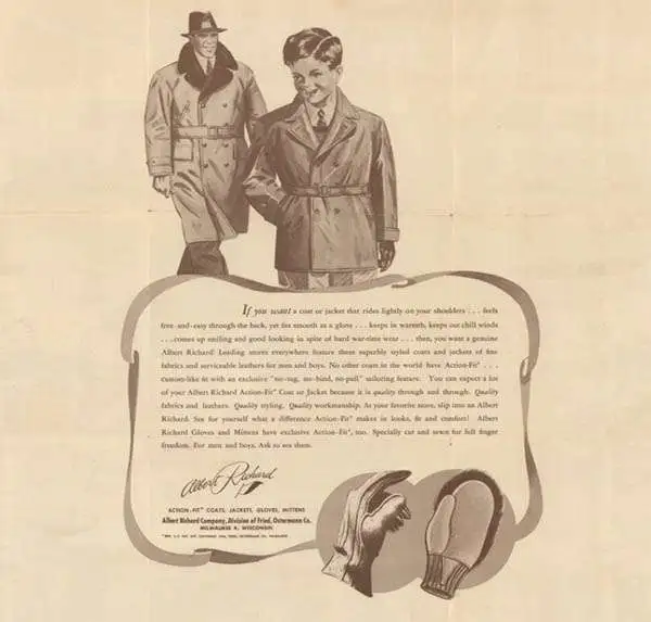
Albert Richard Company (c. late 1920s - c. 1955) began as a division of the Fried-Ostermann Company of Milwaukee, Wisconsin. Fried-Ostermann was a glove manufacturer, and in the late 1920s, decided to diversify their production and opened a division to produce outerwear, which they called Albert Richard. Albert Richard produced leather jackets, mackinaws, overcoats, and sportswear and would soon become more profitable than the glove-making part of the company. Before World War II, Albert Richard advertising focused on health and sports, and received endorsements from college football players. From about 1938 to 1950, Albert Richard partnered with F. E. Cheeseman to published a series of poster size college football maps, which bore advertisements for the company’s jackets on the verso. After the outbreak of World War II, Albert Richard began manufacturing flight jackets for the military under the name of their parent company Fried-Ostermann. Leather jackets, overcoats, and similar products were heavily advertised by Albert Richard during the war. They also gave their jackets model names like ‘Spitfire’ and ‘Meteor’. During the war Albert Richard also gave away wall-sized posters depicting various American military aircraft. Fried-Ostermann sold Albert Richard to the Drybak Corporation of Binghampton, New York in 1952. Daybook began manufacturing Albert Richard clothing in 1953 at a factory in New Jersey, with plans to move production to New York by 1954. However, in 1955, Drybak bought the Martin Mfg. Co. of Martin, Tenessee, closed their operations in Binghampton and moved to the plant in Tennessee, where labor prices were lower.
American college football.
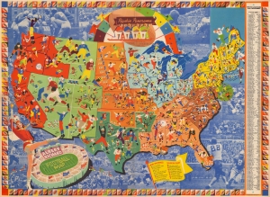
Albert Richard Football Map: Pigskin Panorama News.
sold
- Digital Map Information
- Suitable for large format printing
- Full resolution TIFF file
- ICC color profile embedded
- Delivered instantly via download link
This is a 1939 F. E. Cheeseman pictorial map of U.S. college football. The map is part of a series that appeared as football was increasingly becoming a national pastime. It an era before television, most followed their teams through radio and newspapers. The 'Pigskin Panorama' was a way for sport fans to connect not only with the colors and mascots of their favorite teams, but also to visualize the increasingly complex network of regional and national leagues. The series was updated annually from roughly 1939 to 1950. (more details)
Gorgeous map celebrating college football - an American past time.
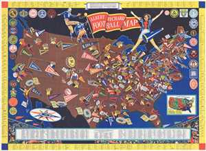
Albert Richard Football Map.
sold
- Digital Map Information
- Suitable for large format printing
- File Size: 17.12 MB
- File Type: ZIP / TIFF
- ICC color profile embedded
- Delivered instantly via download link
This is a 1940 F. E. Cheeseman and Albert Richard football map of the United States. The map depicts the continental United States from the Pacific Ocean to the Atlantic Ocean and from Canada to Mexico. Pennants from universities and colleges from coast to coast ... (more details)
Highlights over 200 college football teams, including LSU, Oregon, UCLA, Texas, and Wisconsin.
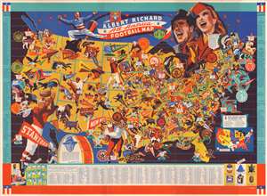
Albert Richard All-America Football Map.
sold
- Digital Map Information
- Suitable for large format printing
- File Size: 43.31 MB
- File Type: ZIP / TIFF
- ICC color profile embedded
- Delivered instantly via download link
This is a 1941 Albert Richard pictorial map of the United States highlighting the many American's passion for college football. The map depicts the continental United States from the Pacific Ocean to the Atlantic Ocean and from Canada to Mexico with thick teal lines creating the borders between the states. The map's focus, however, is on the tradition and fanfare associated with college football, a uniquely American past time. 239 different schools are referenced in some manner and correspond with an index along the bottom border which provides the school's location by city and state, nickname, and win-loss-tie record for 1940. Some schools are marked only by their names, while others are highlighted by pennants, seals, or caricatures of their mascot. The latter include LSU, Kentucky, Auburn, Duke (with the Blue Devil pointing its pitchfork at UNC's pennant), Wisconsin, Wyoming, UCLA, Oregon State, Oregon, and the University of Washington. Conference winners are highlighted by large blue stars bearing the college or university's name and conference affiliation, while All-Americans are recognized with red stars bearing their name, position, and college or university. Bowl games are also included, marked by small stadiums and the score of the 1940 game. Conference winners dating back to 1896 are listed along both borders. Small infographics on either side of the index along the bottom border include illustrations of official signals on the left side and rivalry trophies on the right. (more details)
Pigskin Panorama.
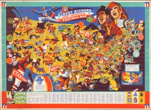
Albert Richard All-America Football Map.
sold
- Digital Map Information
- Suitable for large format printing
- Full resolution TIFF file
- ICC color profile embedded
- Delivered instantly via download link
This is a 1941 Albert Richard pictorial map of the United States highlighting college football. The map is part of a series that appeared as football was increasingly becoming a national pastime. It an era before television, most followed their teams through radio and newspapers. The 'Pigskin Panorama' was a way for sport fans to connect not only with the colors and mascots of their favorite teams, but also to visualize the increasingly complex network of regional and national leagues. The series was updated annually from roughly 1939 to 1950. (more details)
Celebration of American WWII Aviation.
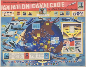
Aviation Cavalcade. Wings Over the World…Yesterday, Today and Tomorrow.
sold
- Digital Map Information
- Suitable for large format printing
- Full resolution TIFF file
- ICC color profile embedded
- Delivered instantly via download link
This is a 1944 World War II era F. E. Cheeseman and Albert Richard pictorial propaganda map celebrating U.S. military aviation. (more details)
Wonderful pictorial map celebrating the beginning of the 1946 college football season.
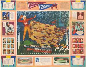
Albert Richard Sportswear Grid Revue.
sold
- Digital Map Information
- Suitable for large format printing
- File Size: 26.95 MB
- File Type: ZIP / TIFF
- ICC color profile embedded
- Delivered instantly via download link
This is a scarce 1946 F.E. Cheeseman pictorial map of United States college football teams - possibly the rarest of the series. The map depicts the continental United States from the Pacific Coast to the Atlantic Seaboard and from the Canadian border to the Mexican border and the Gulf of Mexico. Pennants, stuck into the map of the United States as if it were a cork board, mark the location of a plethora of American college football teams, with many of the most successful teams present. Smaller white banners with green text mark the conference winners which include Army, Indiana, Oklahoma, Texas, Denver, Colorado College, U.S.C., Alabama, and Duke. The map is situated 'above' a football field, with a quarterback to the left and three cheerleaders in the bottom right corner. The teams in the National Professional Football League and the All-America Professional Football Conference are recognized below the map. The whole is framed by numerous different graphics and tables providing information about the history of college football and about the previous season. For example, a portrait of the 1945 Heisman Trophy Winner Army fullback Felix (Doc) Blanchard, is included on the left just above nine portraits of 'great all-time coaches'. Portraits of famous all-time players are on the right, below an illustration of the first inter-collegiate game of football played between Princeton and Rutgers in 1869. Sketches of the All-Star game between the Los Angeles Rams and the College All-Stars and of Harvard Stadium, the first football stadium built in America, are situated along the bottom. (more details)