
Allen, William Houghton (sold)

William Houghton Allen (April 14, 1788 - January 1855) was a bookseller and publisher in London, England. He was born in New Sleaford, Lincolnshire, England. Nothing is known of his early education, but he was admitted to the London Company of Stationers as a bookseller in 1817. Shortly afterwards, in 1818, he partnered with others to form 'Black, Kingsbury, Parbury and Allen'. This would evolve into Kingsbury, Parbury, and Allen (William Houghton Allen, Thomas Kingsbury, Charles Parbury) in 1822, and again into Parbury, Allen, and Co. in 1827. In 1835, he struck out on his or, partnering with his sons James Pearce Allen(1818 - 1878) and William Ferneley Allen (1816 - 1877) as 'W. H. Allen and Company'. As 'W. H. Allen, the firm established close ties with the British East India Company, who had offices nearby, also on Leadenhall Street. The firm later moved to 12 Waterloo Place. After Allen's death, the firm went through numerous acquisitions and mergers with the name 'W.H. Allen' persevering until 1991, when it was subsumed into Virgin Publishing.
The Theatre of the Anglo-Afghan Wars.
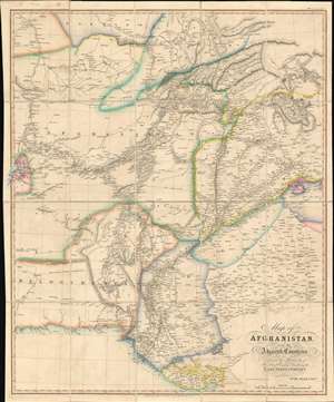
Map of Afghanistan and the Adjacent Countries Published by the Authority of the Hon.ble Court of Directors of the East India Company.
sold
- Digital Map Information
- Suitable for large format printing
- Full resolution TIFF file
- ICC color profile embedded
- Delivered instantly via download link
This is an 1842 Allen map of Afghanistan and its surrounds, showing the theatre of the First Anglo-Afghan War: the first major conflict of ‘The Great Game’ for British control of India. It was printed just four months after the disastrous Retreat from Kabul. Not only are the passes between Kabul and Peshawar shown in detail but the infamous 'Khyber Pass' is labeled clearly. (surpassing other contemporaneous maps of the area ) that it seems clear that the map reflects the best British understanding of Afghanistan’s geography at the time of the conflict. (more details)
The China Trade in the Wake of the Opium War.
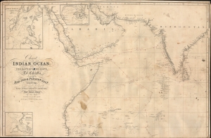
Chart of the Indian Ocean from the Cape of Good Hope to Calcutta, including the Red Sea and the Persian Gulf.
sold
- Digital Map Information
- Suitable for large format printing
- File Size: 1059.71 MB
- File Type: ZIP / TIFF
- ICC color profile embedded
- Delivered instantly via download link
This is John Walker's 1845 blueback nautical map of the Indian Ocean, featuring extensive annotations relating to a 1847 - 1849 voyage of the barque Anne Maclean. It is notable for reflecting British hydrographers' and geographers' better understanding of the coastlines of the Indian Ocean, particularly along the Arabian Peninsula and the Persian Gulf, and for demonstrating Britain's growing hegemony over the Indian Ocean as part of its global trading networks. (more details)
The steam age.
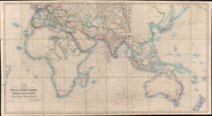
Map Showing the Steam Communication and Overland Routes between England, India, China and Australia.
sold
- Digital Map Information
- Suitable for large format printing
- Full resolution TIFF file
- ICC color profile embedded
- Delivered instantly via download link
A striking 1853 large-scale map by W. H. Allen detailing both overland and steamship routes between England, India, Australia, and East Asia. It illustrates the height of the steamship trade between far-flung British colonies in the decades before the construction of the Suez Canal. The present example features numerous manuscript updates, some in pencil, tracing additional steamship lines run by Oriental-Lloyds-Shanghai and Eastern Atlantic. In addition, further highlighting in red illustrates telegraph lines. (more details)