
American Photo-Lithographic Company (sold)
American Photo-Lithographic Company (1866 - c. 1884) was a Brooklyn, New York based lithography house active in the late 19th century. By the 1870s they had relocated to Fulton Street, in Manhattan. Early on, the firm was best known for its use of the Osborne Process, an economical photo-mechanical technique for making lithographic plates invented by Irish-Australian John Walter Osborne (1828 - 1902). Osborne may have been the owner or one of the co-founders of the American Photo-Lithographic Company, as he certainly had moved to New York City by this time to market his technique. He is known to have worked for the American Photo-Lithographic Company in both New York and Washington D.C - but the relationship remains unclear. Later the embraced other more advanced printing techniques. By 1877, the firm opened an annex office in Boston under Clement Drew, which it retained until 1879. We have identified no work by the American Photo-Lithographic Company postdating 1884. The firm should not be confused with the American Lithographic Company, which was founded by 1892.
One of the earliest maps to show Riverside Park.
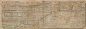
Map of the City of New York, North of 55th Street, Showing on the 'West Side', the Streets, Roads, Avenues and Public Places, established, widened and retained, and the New Pier and Bulk Head Lines and c., as Laid out by the Commsnrs. of Central park. Also showing on the East Side, The Extenson of Madison and Lexington Avenues, The Location fo the Harbor Commissioners, Bulk-Head and Pier Lines, together with the Sizes of the Blocks, Widths of Streets and Avenues, The Elevations of Established Grade, Dimensions and Distances complete.
sold
- Digital Map Information
- Suitable for large format printing
- File Size: 126.62 MB
- File Type: ZIP / TIFF
- ICC color profile embedded
- Delivered instantly via download link
An extremely rare privately published map of New York City's Manhattan above 55th street drawn by Hamilton Ewen and published in 1869 by Hamilton E. Towle. Although a commercial rather than official venture, the map offers impressive size and detail, noting information relating to the enormous project of street grading and leveling then occurring on what is today the Upper West Side. It also notes prospective improvements on the docks, references real estate transactions, proposed rail lines, and notes street widths. Towle clearly recognized the commercial value in such a map to real estate developers and speculators. (more details)