
Barker, William

William Barker (June 29, 1770 - April 19, 1805) was an engraver active in Philadelphia un the late 18th and early 19th centuries. Barker was born in Philadelphia, the son of Elihu Barker (17?? - 1792). Both father and son worked for the firm of Mathew Carey (1760 - 1839) and engraved maps for Carey's American Atlas, considered the first general atlas published in America. He appears in Philadelphia directories for 1795 - 1796 and 1800 - 1809. His business may have been carried on by a son of the same name, but it is unclear.
First Map of the first state to be published in the United States.
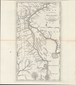
Delaware, from the best authorities.
$500.00
Acquire
- Digital Map Information
- Suitable for large format printing
- DPI: 600
- File Size: 24.55 MB
- File Type: ZIP / TIFF
- ICC color profile embedded
- Delivered instantly via download link
An example of Matthew Carey and William Barker's 1795 map of Delaware, which appeared in Carey's American Edition of Guthrie's Geography Improved, the first atlas published in the United States of America. It provides a fascinating snapshot of America's first state in the years following independence. (more details)
The last days of Ottoman Europe.
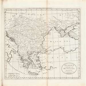
Turkey in Europe and Hungary; from the best authorities.
$400.00
Acquire
- Digital Map Information
- Suitable for large format printing
- DPI: 600
- File Size: 29.37 MB
- File Type: ZIP / TIFF
- ICC color profile embedded
- Delivered instantly via download link
This is Matthew Carey and William Barker's c. 1795 map of Ottoman Europe, Hungary, and nearby territories in southeastern Europe, made for Carey's General Atlas. It depicts the region as it was just prior to a major rearrangement that would see Ottoman rule over the European portion of its empire collapse. (more details)
Earliest Atlas Map of Maryland Published in the American Republic.
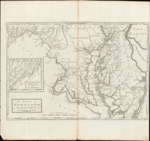
The State of Maryland, from the Best Authorities.
$600.00
Acquire
- Digital Map Information
- Suitable for large format printing
- Full resolution TIFF file
- ICC color profile embedded
- Delivered instantly via download link
An important map of Maryland from the early days of the American Republic, this 1795 work was drawn by Samuel Lewis and engraved by William Barker for inclusion in Matthew Carey's Carey's American Edition of Guthrie's Geography Improved, the first atlas published in the United States. (more details)
A map of the West Indies from the first atlas published in the United States.
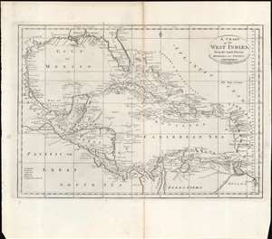
A Chart of the West Indies From the Latest Marine Charts and Surveys.
$250.00
Acquire
- Digital Map Information
- Suitable for large format printing
- Full resolution TIFF file
- ICC color profile embedded
- Delivered instantly via download link
This is a c. 1796 map of the West Indies from Carey's General Atlas, the first atlas published in the new American Republic. (more details)
An early American map of the Russian Empire.
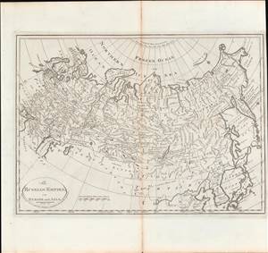
Russian Empire, in Europe and Asia.
$350.00
Acquire
- Digital Map Information
- Suitable for large format printing
- DPI: 600
- File Size: 9.01 MB
- File Type: ZIP / TIFF
- ICC color profile embedded
- Delivered instantly via download link
This is a rare c. 1811 map of the Russian Empire from Carey's General Atlas, the first atlas published in the new American Republic. It shows the Russian Empire after two and a half centuries of territorial expansion beginning with Ivan IV (the 'Terrible') through Catherine the Great. (more details)