
Bowles III, Samuel (sold)

Samuel Bowles III (February 9, 1826 – January 16, 1878) was an American journalist born in Springfield, Massachusetts. Bowles is best known as the editor of The Republican, which he inherited form his father of the same name and ran until his deal in 1878. Bowles was a hands-on editor and his hard work contributed to the success of his paper. By 1840 The Republican was the largest circulated daily in New England and Bowles had become a highly respected figure in journalism. He was also well known for his frequently travels. In 1865 he made the transcontinental journey to the Pacific, publishing the story in a well-read memoire, Across the Continent. He subsequently crossed the continent again in 1869. He also traveled extensively in Europe in the early 1870s. Bowles died in Springfield, Massachusetts. He was succeeded by ten children, one of whom, Samuel Bowles IV, inherited The Republican.
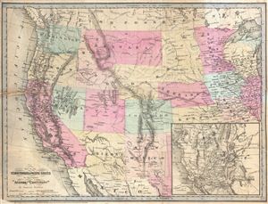
Map of the Territories & Pacific States to Accompany 'Across the Continent' by Samuel Bowles.
sold
- Digital Map Information
- Suitable for large format printing
- File Size: 8.6 MB
- File Type: ZIP / TIFF
- ICC color profile embedded
- Delivered instantly via download link
A highly appealing 1865 map of the western parts of the United States drawn to illustrate Samuel Bowles' Across the Continent . The map covers from the Pacific Ocean to Illinois and the Great Lakes. It is notable for its detailed inclusion of important ... (more details)
Bowles map of the western United States.
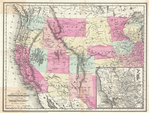
Map of the Territories and Pacific States to Accompany 'Across the Continent'.
sold
- Digital Map Information
- Suitable for large format printing
- File Size: 8.31 MB
- File Type: ZIP / TIFF
- ICC color profile embedded
- Delivered instantly via download link
A highly appealing 1865 map of the western parts of the United States drawn to illustrate Samuel Bowles' Across the Continent . The map covers from the Pacific Ocean to Illinois and the Great Lakes. It is notable for its detailed inclusion of important ... (more details)