
Brooklyn Eagle (sold) (1841 - 1955)

Brooklyn Eagle (1841 – 1955; 1960 – 1963) was a daily newspaper published in Brooklyn that at one point was the afternoon paper with the largest circulation in the U.S. Its editors included Walt Whitman and the paper was closely connected with the Democratic Party in New York. It closed during a long strike in 1955 and was briefly revived in the early 1960s before folding again. A much smaller-scale newspaper reviving the name Brooklyn Eagle has been in publication since 1996.
AKA: 1841 - 1955
City within a city.
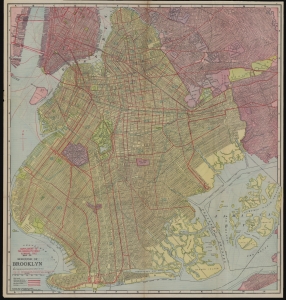
Supplement to the Brooklyn Eagle Almanac 1912, Map of Borough of Brooklyn / Map of Borough of Richmond.
sold
- Digital Map Information
- Suitable for large format printing
- Full resolution TIFF file
- ICC color profile embedded
- Delivered instantly via download link
A colorful, richly detailed 1912 two-sided indexed map of the Brooklyn and Richmond (Staten Island) produced by the William Map and Guide Co. and published in the Supplement to the Brooklyn Eagle Almanac. It depicts Brooklyn fully-formed, reaching roughly its current street grid and extent of development. (more details)
A city within a city.
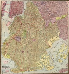
Supplement to the Brooklyn Eagle Almanac 1913, Map of Borough of Brooklyn / Map of Borough of Richmond.
sold
- Digital Map Information
- Suitable for large format printing
- Full resolution TIFF file
- ICC color profile embedded
- Delivered instantly via download link
A colorful, richly detailed 1913 two-sided indexed map of the Brooklyn and Richmond (Staten Island) produced by the William Map and Guide Co. and published in the Supplement to the Brooklyn Eagle Almanac. It depicts Brooklyn fully-formed, reaching roughly its current street grid and extent of development. (more details)
Speculative cartography and urban development in Queens.
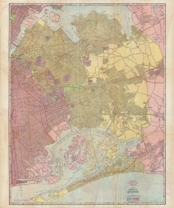
Map of Borough of Queens / Map of Nassau and Suffolk Counties / Map of Boroughs of Manhattan and Bronx.
sold
- Digital Map Information
- Suitable for large format printing
- Full resolution TIFF file
- ICC color profile embedded
- Delivered instantly via download link
A rare, highly-detailed, and curious 1913 map of the Borough of Queens, with maps of Manhattan, the Bronx, and Long Island on the verso. The map reveals Queens during its most explosive period of growth - as such, it is highly speculative, despite a misleading level of seemingly precise detail based upon prospective (but often unrealized) development schemes. (more details)