
Browning, Ross C. (sold)

Ross Charles Browning (September 8, 1822 - March 26, 1899) was an American publisher and editor. Browning was born in Barre, Vermont in 1822. He studied at the Liberal Institute of Lebanon, New Hampshire. Afterward graduating he move to Sussex County, New Jersey, where he taught school. Seeking a better future in the bustling railroad industry, he took a position with the Erie Railroad at Piermont-on-the-Hudson. Relocating to Richmond, Virginia, he entered the publishing business in 1859, when he partnered with Alvin Jewett Johnson (1827 - 1884) to introduce Johnson's New Illustrated (Steel Plate) Family Atlas under the imprint of 'Johnson and Browning'. Perhaps seeing war on the horizon, Johnson and Browning spit their firm, with Johnson moving to New York and Browning running the southern arm of the firm out of Richmond. Richmond editions of the atlas are extremely rare, and contain several different maps from the New York editions. We are aware of Richmond editions in 1860 and 1861. At this time, Browning, being an ardent Union man, snuck through the lines to settle in New York. Back in Richmond, Johnson and Browning's printer Charles H. Wynne (1822 - 1870) transitioned his presses for the Confederacy, printing currency and war bonds. It is unclear how Johnson and Browning divided the firm when Johnson moved to New York, be subsequent editions of the atlas appear under 'Johnson and Ward', suggesting a sale of shares. What is known is that he left the publishing business altogether in 1863 during the New York Draft Riots (Jul 11, 1863 – Jul 16, 1863) to volunteer as a vigilante, a profession he continued throughout the war. After the war, Browning settled in Llewellyn Park, New Jersey, where he started a new business manufacturing and selling clothes wringers. He remained in this business until selling out to a conglomerate in 1892. He died in Jacksonville, Florida from pneumonia.
First edition of an iconic Vermont map.
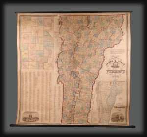
This is the extremely scarce 1859 first edition of H. F. Walling's spectacular wall map of Vermont, jointly published with 'Johnson and Browning'. It was the largest-scale and most accurate map of Vermont when it was issued, subsequently as the cartographic basis for two decades of Vermont maps. (more details)
First maps to name Arizona?
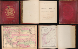
This is the 1860 Richmond-imprint first edition of Johnson's New Illustrated (Steel Plate) Family Atlas. While Johnson's atlases are not, in general, rare, the 1860 Richmond first edition is a genuine rarity. It is one of the only atlases published in the soon-to-be Confederacy prior to the American Civil War (1861 - 1865). It also includes the first two maps to name Arizona, predating the existence of the Arizona Territory by 5 years. In 20 years in the rare map trade, this is the first time we have seen a Richmond-imprint first edition of this atlas. (more details)