
Chace Jr., Jacob (sold)

Jacob Chace Jr. (January 27, 1819 - February 18, 1903) was an American surveyor, civil engineer, educator, and map publisher. Born in North Hoosick, New York, Chace became one of the most prolific creators and publishers of county maps of the northeastern United States in the mid-19th century. He was involved in the production of large-format county maps, published mostly between 1854 and 1860. Many of these counties were in Maine, but he also produced maps of Vermont, New Hampshire, and New York. There is some ambiguity in historical accounts of his date of death. Many references state that he died in 1864 while Ambrose F. Church was working for him to create a map of Nova Scotia. However, references to a Jacob Chace surveying towns for maps of Virginia and North Carolina appear in newspaper columns in the 1870s and 1880s. Chace's name is sometimes misspelled on maps and references as 'Chase'. Our own research confirms that Chase died in Omaha, Nebraska, on February 18, 1903.
Maine's Capital County.
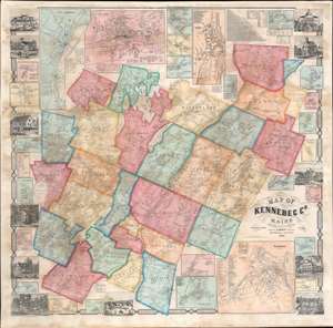
Map of Kennebec County, Maine.
sold
- Digital Map Information
- Suitable for large format printing
- File Size: 182.93 MB
- File Type: ZIP / TIFF
- ICC color profile embedded
- Delivered instantly via download link
A striking 1856 Jacob Chace Jr. wall map of Kennebec County, Maine, home to Augusta, the state capital. Chase was Maine's pre-eminent map publisher in the mid to late 19th century. Cities, towns, and villages throughout are named, including Augusta, situated just below center. The map's exceptional detail extends to individual homesteads (identified by the owner's name). The county's many lakes, ponds, and rivers are also illustrated and labeled. Inset maps provide further detail of important cities, towns, and villages, including Augusta, Hallowell, Waterville, Gardiner, and Winthrop Village. Views of the state capital building in Augusta, the courthouse in Augusta, a daguerrian gallery in Waterville, Litchfield Academy, and several private residences decorate the border. A table of distances and small tables providing agricultural, religious, and population data are included alongside text boxes bearing the names of local businesses. (more details)
Mill towns on the Merrimack River.
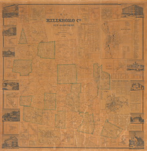
Map of Hillsboro Co. New Hampshire From Actual Surveys.
sold
- Digital Map Information
- Suitable for large format printing
- File Size: 277.61 MB
- File Type: ZIP / TIFF
- ICC color profile embedded
- Delivered instantly via download link
An uncommon 1858 Jacob Chace Jr. wall map of Hillsborough County (Hillsboro), New Hampshire, including large insets of Manchester and Nashua. The map captures the area, particularly the Merrimack River corridor, at the height of its prosperity as the center of textile production. (more details)