
Conley, Walter Haddon (sold)

Walter Haddon Conley (December 3, 1893 - November 3, 1936) was a Chicago based architect active in the middle of the 20th century. Conley was born in Spring Valley, Fillmore, Minnesota. He studied architecture at Beloit College where he was a member of the Alpha Zeta Chapter of the Sigma Chi fraternity. He graduated in 1917. In 1933, Conley completed his only cartographic project. In partnership with Otto Emil Stelzer (1901 - 1984), he drafted and issued a historical map of Chicago as it was in 1833. According to period reports, the map was the product of 2 years of research and caused a popular sensation when published and displayed at the Marshall Field Galleries. When Conley died, at just 42, he was working with the Federal Housing Administration. Conley married Lola Catherine Callaghan on June 18, 1919, in Olmsted, Minnesota, with whom he had a son.
A rare Chicago Sunday Tribune edition of Conley and Stelzer's iconic map of Chicago.
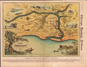
A Map of Chicago Incorporated as a Town August 5, 1833.
sold
- Digital Map Information
- Suitable for large format printing
- File Size: 23.06 MB
- File Type: ZIP / TIFF
- ICC color profile embedded
- Delivered instantly via download link
This is a beautiful 1933 pictorial map of Chicago issued by Walter Conley and Otto Emil Stelzer to commemorate the centennial of the founding of Chicago in 1833 for the 1933 Century of Progress Exhibition / World's Fair. Oriented with north to the right, it depicts Chicago at the time of its incorporation in 1833, when it was just a small settlement. The Chicago River is identified as it empties into Lake Michigan. The Town of Chicago is noted to have a population of 350. Throughout, the map notes trails, roads, swamps, and forests. (more details)