
Eldridge, George

George Eldridge (November 27, 1821 - August 23, 1900) and his son George Washington Eldridge (1845 - 1914) were American makers of nautical charts and Pilot Books active in the late 19th century. George Eldridge was a Cape Cod fisherman known locally as an excellent ship's pilot. While recuperating from an injury in 1851, Eldridge drew his first nautical chart. The chart proved popular, and its success led Eldridge to pursue a career in hydrography - the science of mapping the sea with a special focus on navigation. Eldridge produced numerous subsequent maps and is credited with issuing some of the earliest accurate nautical charts of the American Atlantic coast. In time George Eldridge passed his thriving business on to his son, George Washington Eldridge, who continued to produce beautiful and practical maritime charts until 1924.Though most of Eldridge's charts were loosely based on U.S. Coast Survey work, they proved popular with navigators. The Eldridges possessed a talent, shared by both father and son, for distilling the often convoluted Coast Survey maps into practical nautical charts for the working mariner. From 1875, in addition to large format independently issued nautical charts, Eldridge also issued annual editions of Eldridge's Tide and Pilot Book and The Book of Harbor Charts. The Eldridge offices were located at 103 State St. Boston, Massachusetts. After the deaths of George and George Washington Eldridge, the firm passed into the hands of the latter's widow Sydna, and son-in-law, Wilfrid O. Wight. Wight's son and subsequent generations have continued to publish the Eldridge Tide and Pilot Book down to the present.
First edition of Eldridge's Chesapeake Bay, the largest 19th century commercial chart of the Chesapeake.
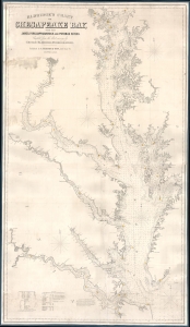
Eldridge's Chart of Chesapeake Bay, with the James, York, Rappahannock and Potomac Rivers.
$1,800.00
Acquire
- Digital Map Information
- Suitable for large format printing
- Full resolution TIFF file
- ICC color profile embedded
- Delivered instantly via download link
A rare first edition 1868 Eldridge / Thaxter nautical chart or maritime map of the Chesapeake Bay. This expansive chart covers the Chesapeake from its mouth at Cape Henry to Baltimore. It extends westward to include the James, York, Rappahannock, and Potomac River estuaries. In a brilliant aesthetic flourish, Washington D.C. appears centered directly below the title area, with the President's House, the Capitol, and the Smithsonian Institution labeled. Includes original hand color highlighting of lighthouses. (more details)
A visually impressive nautical chart.
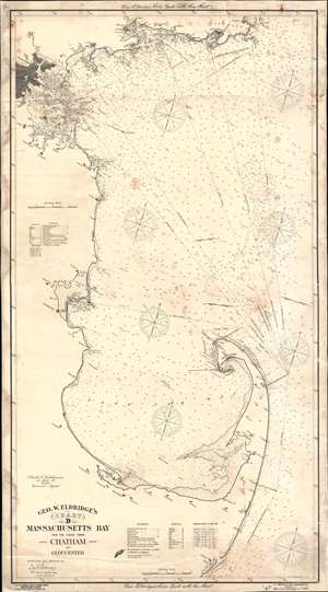
Geo. W. Eldridge's Chart D. Massachusetts Bay and the Coast from Chatham to Gloucester.
$1,400.00
Acquire
- Digital Map Information
- Suitable for large format printing
- File Size: 57.89 MB
- File Type: ZIP / TIFF
- ICC color profile embedded
- Delivered instantly via download link
This is a 1904 George Eldridge blueback nautical chart or maritime map of Massachusetts Bay. Coverage extends from Cape Ann south to Chatham and from Boston east to the Atlantic Ocean. Boston, Charlestown, East Boston, South Boston, Dorchester, and Roxbury appear in the upper right and are shaded gray for emphasis. The many flats and islands in the President Roads are illustrated with excellent navigational detail. Coastal lights are marked in red manuscript ink. Countless depth soundings are noted throughout. Coastal cities and towns, including Salem, Marblehead, Gloucester, Plymouth, Barnstable, Yarmouth, and Provincetown, are labeled. Notes in the top and bottom margin state that one ought to 'use Eldridge's Tide Book with the Chart'. (more details)
Iconic chart of Nantucket and Martha's Vineyard.
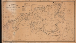
Geo. W. Eldridge's Chart C Vineyard Sound Lt. Ship to Chatham.
$2,500.00
Acquire
- Digital Map Information
- Suitable for large format printing
- File Size: 62.48 MB
- File Type: ZIP / TIFF
- ICC color profile embedded
- Delivered instantly via download link
This is George W. Eldridge's 1910 nautical map of Vineyard Sound, including Martha's Vineyard and Nantucket Island. (more details)
Find Your Way through Massachusetts Bay.
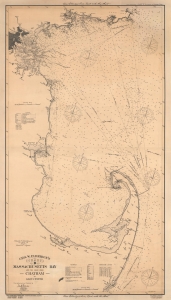
Geo. W. Eldridge's Chart D. Massachusetts Bay and the Coast from Chatham to Gloucester.
$1,500.00
Acquire
- Digital Map Information
- Suitable for large format printing
- File Size: 175.64 MB
- File Type: ZIP / TIFF
- ICC color profile embedded
- Delivered instantly via download link
A very large 1919 George Eldridge blueback nautical chart or maritime map of Massachusetts Bay. It provides a wealth of navigational information across the entire span of the bay from Cape Ann, past Boston, and on both coasts of Cape Cod. (more details)