
Schièble, Georges Erhard
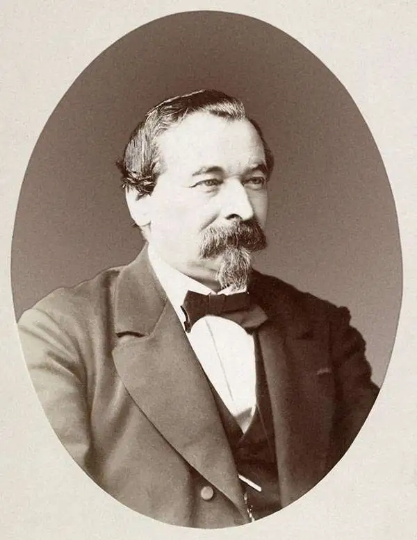
Georges Erhard Schièble (1823 – November 23, 1880) was a German printer active in Paris during the middle to late 19th century. Erhard was born in Forchheim, Baden-Württemberg, and relocated to Paris in his 16th year, where he apprenticed under his cousin, an engraver and mapmaker. In 1852, after 6 years with the Royal Printing Office, he started his own business. Around this time, he also became a naturalized French citizen. From his offices on Rue Bonaparte, he produced several important maps, and a detailed topography of Gaul for Napoleon III's History of Julius Caesar. In 1865 he took on larger offices expanding his operations to include a lithographic press. He was among the first to introduce printed color maps and pioneered photo-reduction, including the process known as Erhard reproduction. After Erhard's death in 1880, the firm was taken over by his sons and run under the imprint of 'Erhard Frères' until 1911.
One of the earliest western maps of Shanghai.
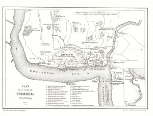
Plan de la Ville de Changhai et de ses Faubourgs.
$850.00
Acquire
- Digital Map Information
- Suitable for large format printing
- File Size: 2.25 MB
- File Type: ZIP / TIFF
- ICC color profile embedded
- Delivered instantly via download link
This 1858 map of Shanghai by W. S. Milne and Erhard illustrates the early days of the Treaty Port Era (1842 - 1943). Cartographically, it is one of the earliest Western representations of Shanghai, based on the L. M. Becker map of 1853, itself drawn and published in the 1857 first English edition of Milne's Life In China. This example is the 1858 French edition. Although printed in 1858, the cartography dates to the late 1840s or early 1850s, when Milne visited Shanghai, thus revealing the early stages of Concession development. (more details)
First printed example of a Babinet / Mollweide Projection.
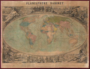
Planisphère Babinet Physique et Politique.
$3,500.00
Acquire
- Digital Map Information
- Suitable for large format printing
- File Size: 150.01 MB
- File Type: ZIP / TIFF
- ICC color profile embedded
- Delivered instantly via download link
A stunning c. 1860 wall-sized map of the world on a Mollweide or Babinet Projection surrounded by elaborate allegorical imagery. Our research suggests this is one of the earliest, if not the earliest, published examples of a Mollweide Projection. (more details)
Decoding the Dead Sea.
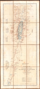
Réduction des cartes du cours inférieur du Jourdain, de la mer Morte, du wady Arabah et du wady El Jeib.
$1,200.00
Acquire
- Digital Map Information
- Suitable for large format printing
- File Size: 13.15 MB
- File Type: ZIP / TIFF
- ICC color profile embedded
- Delivered instantly via download link
A scarce 1866 separate-issue folding map of the Dead Sea and the Jordan Rift Valley by Louis Vignes. It was the product of the Duc de Luynes's 1864 expedition to the Dead Sea, noted for its scientific discoveries, as well as the early photographs of the region taken by Vignes. (more details)
Earliest Official Map of the Suez Canal.
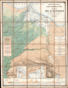
Compagnie Universelle du Canal Maritime de Suez Carte de l'Isthme.
$5,000.00
Acquire
- Digital Map Information
- Suitable for large format printing
- Full resolution TIFF file
- ICC color profile embedded
- Delivered instantly via download link
This is a 1866 large-format chromolithographic folding map issued by the Compagnie universelle du canal maritime de Suez, under the direction of its chief engineer, François-Philippe Voisin. Published in 1866, three years before the canal's completion, this rare first edition of the official canal map is among the most visually compelling and technically detailed maps ever made of the project. During World War I (1914 - 1918), the Imperial German Army deemed it so accurate and useful that it issued a faithful pirated edition for commanders planning an assault on the canal. (more details)
International competition to reach the North Pole.
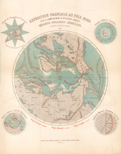
Expédition Française au Pôle Nord sou le Commandement de Mr. Gustave Lambert. Régions Polaires Boréales.
$750.00
Acquire
- Digital Map Information
- Suitable for large format printing
- File Size: 7.71 MB
- File Type: ZIP / TIFF
- ICC color profile embedded
- Delivered instantly via download link
This is an 1867 Victor-Auguste Malte-Brun and Georges Erhard Schièble map of the North Pole highlighting three proposed polar expeditions. The map captures the peak of the global competition to reach the North Pole. Reaching the Pole was considered a matter of national pride, with both government-funded and private expeditions making the attempt. This map captures rival proposals by French, English, and German explorers. (more details)
Greatest Map of Mont Blanc Ever Made.
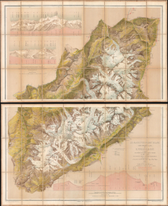
Le Massif du Mont Blanc.
$5,500.00
Acquire
- Digital Map Information
- Suitable for large format printing
- Full resolution TIFF file
- ICC color profile embedded
- Delivered instantly via download link
This is Eugène Emmanuel Viollet-le-Duc's stunning chromolithographic 1876 map of Mont Blanc, produced after years of studying the massif's geography and geology. It is considered the greatest map of Mont Blanc ever produced, reflecting Viollet-le-Duc's artistic skills and unique experience as France's premier restorationist of historic sites. The map's production also coincided with territorial disputes between France and Italy (still unresolved) following the 'return' of Mont Blanc to France in 1860. (more details)
Forgotten Portuguese explorers of Africa's interior.
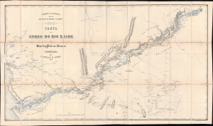
Carta do curso do rio Zaire de Stanley-Pool au Oceano.
$1,900.00
Acquire
- Digital Map Information
- Suitable for large format printing
- Full resolution TIFF file
- ICC color profile embedded
- Delivered instantly via download link
This is a remarkable 1883 map of the Congo River and adjoining regions produced by the Portuguese Comissão de Cartografia das Colónias. It highlights knowledge gained from the forgotten but important 1877 - 1879 Capelo-Ivens Expedition, a Portuguese effort to map and claim the lands along the river in the early days of the Scramble for Africa. (more details)
Portugal's dream of a transcontinental African colony.
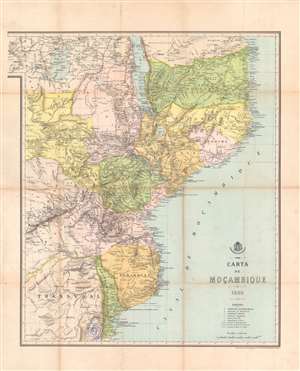
Carta de Moçambique.
$800.00
Acquire
- Digital Map Information
- Suitable for large format printing
- Full resolution TIFF file
- ICC color profile embedded
- Delivered instantly via download link
This is an 1889 map of Mozambique (Portuguese East Africa) made by the Comissão de Cartographia and printed in Paris by Georges Erhard. It was produced at the height of a Portuguese-British competition in central and eastern Africa, part of the 'Scramble for Africa' among European powers. The map reflects territorial claims extending far past areas of Portugal's actual control, a failed attempt to claim sovereign based on the doctrine of 'effective occupation' laid out at the Berlin Conference of 1884 - 1885. (more details)