
Finé, Oronce (sold)
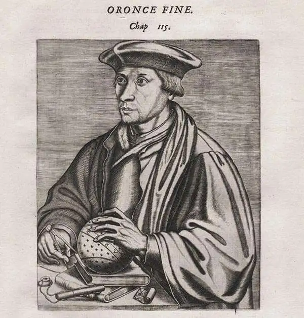
Oronce Finé (December 20, 1494 - August 8, 1555), also known as Orontius Finnaeus, was a French astronomer, astrologer, mathematician, and cartographer active in Paris in the first half of the 16th century. Finé was born in Briançon, the son and grandson of prominent physicians. He was educated in Paris at the Collège de Navarre, where in1522 he was awarded a medical degree. As a young man he became involved with judicial astrology, a pseudoscience that involved predicting future events based upon complex mathematical calculations derived from careful observations of planetary and stellar bodies. This practice was declared heretical by the catholic church and led to Finé's temporary arrest and imprisonment in 1524. Nonetheless by 1531 he was appointed to the chair of mathematics at the Collège Royal (the present Collège de France), founded by King Francis I. This was a position he would retain throughout his life. Finé became one of the most prolific authors of mathematical books of his age. He worked in a wide range of mathematical fields, including practical geometry, arithmetic, optics, gnomonics, astronomy, and instrumentalism. In cartography, Finé is known for several maps, including a revolutionary 1525 map of France. Significantly, he introduced the cordiform (heart-shaped) projection model in an attempt to address the curvature of the Earth on a two-dimensional plane. Finé issued two cordiform world maps, a single heart-shaped map representing the known world, and a double cordiform projection detailing expanding from the north and south polar regions. His work was both revolutionary and widely copied in the subsequent century. Finé died in Paris at 60. The lunar crater Orontius and Finaeus Cove in Antarctica are named after him. In 2014, a square named after Oronce Fine was inaugurated in Paris.
One of the Finest and Most Detailed Woodcut World Maps.
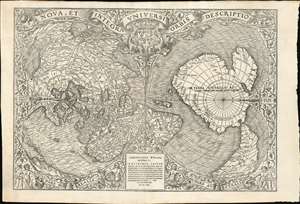
Nova, et Integra Universi Orbis Descriptio.
sold
- Digital Map Information
- Suitable for large format printing
- Full resolution TIFF file
- ICC color profile embedded
- Delivered instantly via download link
This the rare and influential 1531 Oronce Fine map of the world, portrayed using a double cordiform polar projection. This intricate woodcut map was both influential and - especially compared to other printed maps of its era - remarkably reflective of state-of-the-art cartographic detail. Rodney Shirley proclaimed it 'a rendering considerably in advance of any others printed earlier.' Many areas of significant interest are addressed in detail for the first time. The peninsular shape of Florida is clearly presented for the first time, and both Pineda and Cortez' mapping of the Gulf of Mexico are recorded here. This is the first printed map to refer to Magellan's voyage, naming a 'Mare Magellanicum' west of South America. The map breaks from Martin Waldseemüller's convention of presenting North America as separate from Asia: Fine's map incontrovertibly presents Labrador, Florida and the Gulf Coast as part of the Asian mainland; South America itself is depicted as taking the place of the Ptolemaic Great Promontory, or 'Dragon's Tail' that appeared on earlier maps like the 1507 Waldseemüller and the 1490 Martellus. Although including (but not naming) Magellan's strait, the map fails to account for the size of the ocean that circumnavigator revealed (despite naming that ocean - Mare Magellanicum.) (more details)
Earliest Acquirable Derivative of the First Map of France made in France.
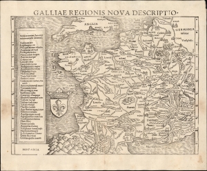
Galliae Regionis Nova Descriptio.
sold
- Digital Map Information
- Suitable for large format printing
- Full resolution TIFF file
- ICC color profile embedded
- Delivered instantly via download link
This elegant 1550 woodcut map by Sebastian Münster is one of the earliest acquirable true modern maps of France, being based on the unacquirable 1525 Oronce Finé Nova Totius Galliae descriptio, the first map of France produced in France based on contemporaneous observations. Münster's work is the earliest acquirable derivative of that groundbreaking map. (more details)