
Finn, William John (sold)

William John Finn (February 18, 1867 - June 6, 1919) as an Irish-American newspaper man active in Boston during the late 19th and early 20th centuries. Finn was born in Boston and spent most of his life working as a salesman for the Union News Co., specifically on the steamboat circuit of the Nantasket Line out of Rowes Wharf. In this position he supervised production of several chromolithograph views for sale at steamship terminals.
From Boston to Cape Cod.
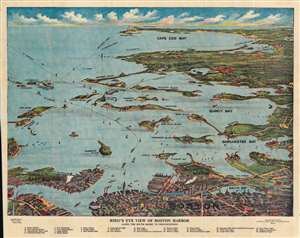
Bird's Eye View of Boston Harbor along the South Shore to Provincetown.
sold
- Digital Map Information
- Suitable for large format printing
- File Size: 54.87 MB
- File Type: ZIP / TIFF
- ICC color profile embedded
- Delivered instantly via download link
This is a 1914 William J. Finn chromolithograph bird's eye view of Boston Harbor from Boston to Provincetown. This view was drawn and published for sale to steamship passengers at the Union News stands at the Rowes Wharf steamship terminal, which serviced the Nantasket Line. All of Cape Cod Bay, Quincy Bay, and Dorchester Bay are depicted, including the communities of Boston, East Boston, South Boston, Dorchester, Quincy, and Hough's Neck, Mingham, Nantasket, Duxbury, Cohasset, and Scituate. Numerous islands in Boston Harbor are illustrated and labeled, including Moon Island, Spectacle Island, Thomson's Island, and Governor's Island. Ferry and steamboat lines are also labeled. Twenty-five locations throughout the region are numerically labeled and correspond with an index situated along the bottom border. Four additional locations are labeled alphabetically, which are also included in said index. (more details)
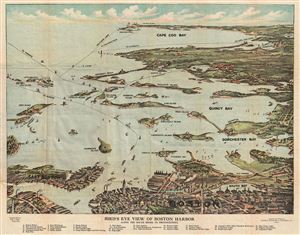
Bird's Eye View of Boston Harbor along the South Shore to Provincetown.
sold
- Digital Map Information
- Suitable for large format printing
- DPI: 300
- File Size: 13.6 MB
- File Type: ZIP / TIFF
- ICC color profile embedded
- Delivered instantly via download link
A remarkable 1917 color lithograph map and view of Boston Harbor from Boston to Provincetown. Includes all of Cape Cod Bay, Quincy Bay and Dorchester Bay with the communities of Boston, east Boston, South Boston, Dorchester, Quincy, Hough's Neck, Mingham, ... (more details)
A detailed view of Boston Harbor.
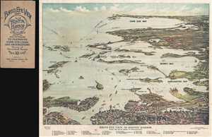
Bird's Eye View of Boston Harbor along the South Shore to Provincetown.
sold
- Digital Map Information
- Suitable for large format printing
- File Size: 9.09 MB
- File Type: ZIP / TIFF
- ICC color profile embedded
- Delivered instantly via download link
This is a 1917 William J. Finn color lithograph bird's eye view of Boston Harbor from Boston to Provincetown. All of Cape Cod Bay, Quincy Bay, and Dorchester Bay are depicted, along with the communities of Boston, East Boston, South Boston, Dorchester, ... (more details)
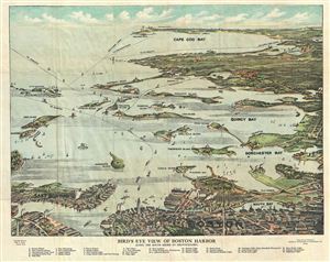
Bird's Eye View of Boston Harbor along the South Shore to Provincetown.
sold
- Digital Map Information
- Suitable for large format printing
- Full resolution TIFF file
- ICC color profile embedded
- Delivered instantly via download link
A remarkable 1918 color lithograph map and view of Boston Harbor from Boston to Provincetown. Includes all of Cape Cod Bay, Quincy Bay and Dorchester Bay with the communities of Boston, East Boston, South Boston, Dorchester, Quincy, Hough's Neck, ... (more details)