
Gardner, William R. (sold)

William R. Gardner (fl. c. 1810 - c. 1850) was and English engraver active in London during the first half of the 19th century. His offices were at 867 Strand Street, London. Gardner worked with many of the most prominent London publishers of his day including Charles Smith and William Darton. His most significant contribution to the world of cartography is his 1823 publication, along with publisher William Darton, of the first composite comparative mountains and rivers chart.
The earliest chart to depict the heights of mountains and the lengths of rivers together in one illustration' - Rumsey
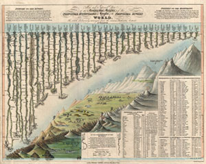
New and Improved View of the Comparative Heights, of the Principal Mountains and Lengths of the Principal Rivers in the World.
sold
- Digital Map Information
- Suitable for large format printing
- DPI: 300
- File Size: 6.4 MB
- File Type: ZIP / TIFF
- ICC color profile embedded
- Delivered instantly via download link
A groundbreaking convention establishing map of extreme scarcity, this is William Darton and W. R. Gardner's 1823 comparative mountains and rivers of the world chart. According to Rumsey this is the first known example of a comparative chart to depict both ... (more details)
The earliest chart to depict the heights of mountains and the lengths of rivers together in one illustration' - Rumsey
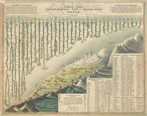
New and Improved View of the Comparative Heights, of the Principal Mountains and Lengths of the Principal Rivers in the World.
sold
- Digital Map Information
- Suitable for large format printing
- DPI: 300
- File Size: 5.78 MB
- File Type: ZIP / TIFF
- ICC color profile embedded
- Delivered instantly via download link
A groundbreaking convention establishing map of extreme scarcity, this is William Darton and W. R. Gardner's 1823 comparative mountains and rivers of the world chart. According to Rumsey this is the first known example of a comparative chart to depict both ... (more details)
Among the earliest composite mountains and rivers charts.
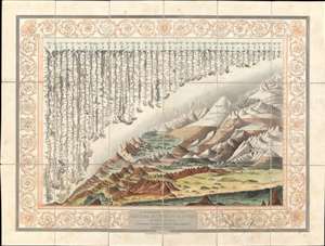
A Combined View of the Principal Mountains and Rivers in the World; accompained by a table shewing their relative Heights and Lengths.
sold
- Digital Map Information
- Suitable for large format printing
- DPI: 600
- File Size: 110.56 MB
- File Type: ZIP / TIFF
- ICC color profile embedded
- Delivered instantly via download link
A groundbreaking convention establishing map of extreme scarcity, this is Charles Smith and W. R. Gardner's 1824 comparative mountains and rivers of the world chart. It is the second known iteration of a comparative chart to depict both mountains and rivers in the same plate, preceded only by the Gardner/Darton chart of 1823 – thus defining a cartographic style that would flourish throughout the remainder of the 19th century. (more details)