
Geological Survey of Japan (sold) (全國地質測量)

Geological Survey of Japan (全國地質測量; 1878 - present) was originally an office within the Japanese government's Ministry of Home Affairs (内務省) and later other government ministries before becoming an independent organization (地質調査総合センター) in 2001. It its early years, it played an important role developing Japan's energy resources during the crash course of modernization during the Meiji era. It focused in particular on resource-rich Hokkaido (then known as Ezo, a term referring to Japan's entire northern frontier) and was closely affiliated with the Hokkaidō Development Commission (開拓使, Kaitakushi).
AKA: 全國地質測量
The resources behind Japan's militarization.
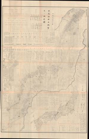
日本油田之地質及ヒ地形圖 / Geological and Topographical Maps of the Oil Lands of Japan.
sold
- Digital Map Information
- Suitable for large format printing
- File Size: 110.36 MB
- File Type: ZIP / TIFF
- ICC color profile embedded
- Delivered instantly via download link
This is an important 1882 bilingual map of Japan highlighting oil regions. It was issued in a unique 19th century Japanese-American collaboration spurred by the Meiji agenda to modernize, expand access to fossil fuels, and drive industrialization. It was prepared by the American geologist Benjamin Smith Lyman and a team of Japanese colleagues. The size of the map, its lack of publication information, and the high-level of technical underscore its purpose as internal government and industrial document. (more details)
Rebuilding the Kanto - a groundbreaking survey.
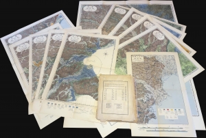
東京及横濱地質調查報告附圖 / [Attached Maps of the Report of the Tokyo-Yokohama Geological Survey].
sold
This is a rare complete set of sixteen maps issued in 1929 by the Geological Survey of Japan for the Bureau of Reconstruction, the Japanese government body tasked with rebuilding Tokyo and Yokohama in the wake of the Great Kanto Earthquake. The maps represent a landmark study of the geology of the Kanto region following one of the greatest natural disasters in recorded history. (more details)