
Hardcastle, Edmund La Fayette (sold)
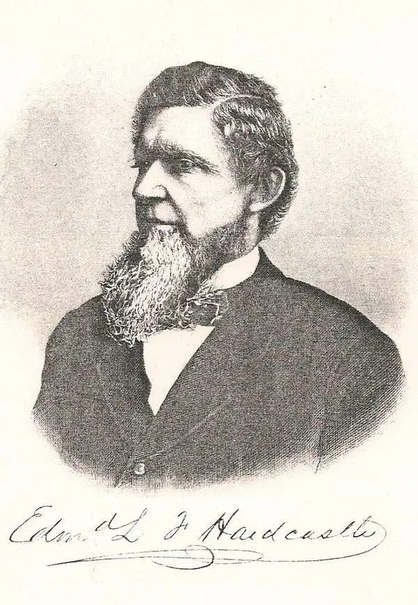
Edmund La Fayette Hardcastle (October 18, 1824 - August 11, 1899) was an American military officer, politician, and businessman. Born in Denton, Maryland, Hardcastle attended the Unites States Military Academy at West Point from 1842 - 1846, after which he was commissioned a Brevet Second Lieutenant in the Army Corps of Topographical Engineers. He was immediately assigned to the United States Coast Survey, but was soon transferred to participate in the Mexican American War. Hardcastle saw action I the Siege of Vera Cruz, the Battle of Cerro Gordo, the Skirmish of Amazoque, the capture of San Antonio, the Battle of Churubusco, the Battle of Molino del Rey, the Battle of Chapultepec, and the assault and capture of Mexico City. He was twice promoted for meritorious conduct on the battlefield, once after the battles of Contreras and Churubusco, Gand again following the Battle of Molino del Rey, attaining the rank of Brevet Captain. After the war, he held the position fo Assistant in the Topographical Bureau at Washington, D.C., and also was a member of the Mexican Boundary Survey from February 1849 until June 1852. Hardcastle finally received his formal commission as a Second Lieutenant in the Topographical Engineers on September 26, 1849. He then served as the Engineer Secretary of the Light-house Board at Washington, D.C. from October 1852 until April 30, 1856 when he resigned his commission. Hardcastle returned home to Maryland, where he began farming in Talbot County. He served on several boards and as president of the Maryland and Delaware Railroad Company in 1868. He also served as a member of the House of Delegates of the Maryland Legislature from 1870 until 1878. Edmund Hardcastle passed away at Towson, Maryland on August 11, 1899.
Illustrates the capture of Mexico City by the U.S. Army and Marines during the Mexican-American War.
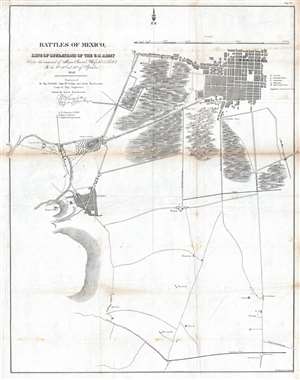
Battles of Mexico, Line of Operations of the U.S. Army under the command of Major General Winfield Scott, on the 8th, 12th and 13th of September, 1847.
sold
- Digital Map Information
- Suitable for large format printing
- DPI: 300
- File Size: 9.71 MB
- File Type: ZIP / TIFF
- ICC color profile embedded
- Delivered instantly via download link
This is an 1847 Edmund Hardcastle map of the engagements that make up the Battle of Mexico City during the Mexican-American War. The map depicts the region from the Casa de Mata near the Molino del Rey to several sites of Mexican gun batteries to the east of the San Antonio Gate and from Mexico City itself to Churubusco. Led by General Winfield Scott, American forces executed an amphibious landing and captured the port of Veracruz. The army then marched across Mexico, winning victories at the Battle of Cerro Gordo and the Battle of Churubusco, which was located only five miles outside Mexico City. Numerous artillery batteries, both American and Mexican, are identified alphabetically and correspond to information provided in the key. The citadel, national palace, cathedral, and Alameda (Alameda Central) are also identified. (more details)
Illustrates the movements of General William J. Worth's division on August 20, 1847, during the Battle of Churubusco near the end of the Mexican-American War.
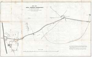
Map of Genl. Worth's Operations on the 20th of August, 1847.
sold
- Digital Map Information
- Suitable for large format printing
- DPI: 300
- File Size: 7.22 MB
- File Type: ZIP / TIFF
- ICC color profile embedded
- Delivered instantly via download link
This is an 1847 Edmund Hardcastle map of the actions of General William Jenkins Worth's division during the Battle of Churubusco which took place near the end of the Mexican-American War. Oriented towards the east, the map depicts the battlefield from the bridge ... (more details)
Illustrates the area southwest of Mexico City which is now the upscale neighborhood of Jardines del Pedregal.
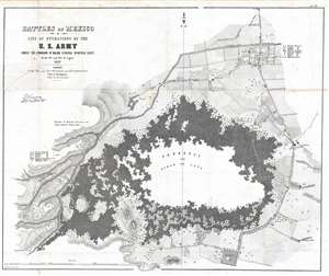
Battles of Mexico, Line of Operations of the U.S. Army under the command of Major General Winfield Scott, on the 19th and 20th of August 1847.
sold
- Digital Map Information
- Suitable for large format printing
- DPI: 300
- File Size: 16.18 MB
- File Type: ZIP / TIFF
- ICC color profile embedded
- Delivered instantly via download link
This is an 1847 Edmund Hardcastle map of the Battle of Churubusco during the Mexican-American War. The map depicts a region southwest of Mexico City surrounding the lava fields of the Pedregal de San Àngel, today the fashionable upscale residential neighborhood of Jardines del Pedgregal. Several buildings and communities are illustrated around the Pedregal, including San Augustin, San Angel, San Antonio La Isla (San Antonio), and Churubusco. Individual buildings are depicted along many of the roads, though most are not labeled. (more details)
Provides geographical context for the recently concluded Mexican-American War after the American capture of Mexico City.
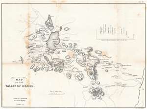
Map of the Valley of Mexico.
sold
- Digital Map Information
- Suitable for large format printing
- DPI: 600
- File Size: 10.47 MB
- File Type: ZIP / TIFF
- ICC color profile embedded
- Delivered instantly via download link
Created just after the Mexican American War, this is an 1847 Edmund Hardcastle map of the Valley of Mexico, a highlands plateau in central Mexico containing present-day Mexico City and the eastern half of the State of Mexico. The map depicts the region from Toluca to Cuatlacingo and from Xaltocan to Popocatepetl. Meant to illustrate a portion of the theater of war, Mexico City is situated on the left side near Lake Texcoco (Laguna de Tezcuco), and settlements, roads, lakes, and mountains throughout the region are illustrated. The American army, und General Winfield Scott, landed a Veracruz on the Mexican coast of the Gulf of Mexico and marched west, and eventually assaulted and captured Mexico City. A profile of their march is situated in the upper right quadrant. (more details)