
Hase, Johann Matthias (sold)

Johann Matthias Hase (January 14, 1684 - September 24, 1742) was a German cartographer, historical geographer, mathematician, and astronomer. Born in Augsburg, Hase was the son of a mathematics teacher, thus exhibited skill at mathematics early in life. He began attending the University of Helmstedt in 1701, where he studied mathematics under Rudolf Christian Wagner and then moved to the University of Leipzig to pursue a master's degree. He received his master's in 1707 and promptly returned to Augsburg to work as a teacher. However, he soon returned to Leipzig to serve as court master for two Augsburg patricians. There he became increasingly involved with geography, astronomy, and cartography as adjunct to the philosophical faculty. Hase was recommended for the position of chair of higher mathematics at the University of Wittenberg by his former professor, Christian Wolff, in 1715, but he was rejected. Five years later in 1720, however, he was named Professor of Mathematics at the University of Wittenberg. It is unclear exactly when Hase began working with the Homann Heirs firm, but he Hase compiled numerous maps under that imprint. He was also a prolific writer, publishing several treatises on universal history.
An early example of d'Anville's influential map of China.
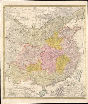
Regni Sinae Vel Sinae Propriae Mappa et Descriptio Geographica.
sold
- Digital Map Information
- Suitable for large format printing
- Full resolution TIFF file
- ICC color profile embedded
- Delivered instantly via download link
This is a rare and early example of d'Anville's famous map of China, printed in c. 1738 by Johann Hase of the Homann Heirs publishing house. It shows the geography and provinces of 'China proper,' as well as surrounding regions, as it stood in the early 18th century. (more details)
Includes an unusual depiction of Novaya Zemla along the northern coast of Russia.
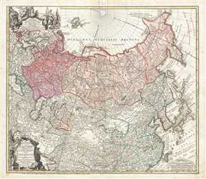
Imperii Russici et Tatariae Universal.
sold
- Digital Map Information
- Suitable for large format printing
- DPI: 300
- File Size: 15.46 MB
- File Type: ZIP / TIFF
- ICC color profile embedded
- Delivered instantly via download link
This is a 1739 Johann Matthias Hase and Homann Heirs map of Russia and Asia. The map depicts the region from Denmark, Norway, and the Black Sea to Japan and the Pacific Ocean and from the Arctic Ocean to India. Two intriguing cartographic missteps are illustrated ... (more details)