
Higgins, Howe (sold)

Howe Dwaine or Duane Higgins (February 26, 1894 - May 31, 1974) was an American artist, craftsman, and customs officer. Born at Town Hill, Bar Harbor, Maine, Higgins joined the Customs Service in 1918 and spent his first year in Presque Isle, Maine. he Became Deputy Collector of Customs in Southwest Harbor, Maine the following year. Eventually he was appointed Inspector of Customs and his wife Athol was ade Deputy Collector. During Prohibition, Higgins vowed to crack down on rum running, which was big business in that part of Maine. He would spend hours staking out places where he believed rum runners to land, many times the entire night. Higgins's position on rum running proved to be generally unpopular, because many respected people in the Mount Desert Island community were involved and they spent their money locally, giving the local populace a boost during the Great Depression. Higgins married his wife Athol M. Kane on December 22, 1917 in Bath, Maine.
Mount Desert Island published during the Great Depression.
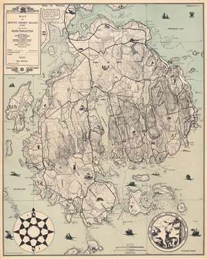
Map of Mount Desert Island Maine Showing Acadia National Park.
sold
- Digital Map Information
- Suitable for large format printing
- File Size: 34.88 MB
- File Type: ZIP / TIFF
- ICC color profile embedded
- Delivered instantly via download link
This is a 1934 Howe D. Higgins map of Mount Desert Island, Maine. Depicting the island in its entirety, Higgins employed two U.S. Coast and Geodetic Survey charts to create the base map and then added the delightful vignettes and a different typeface. Thick black lines trace the island's road network, while dashed lines highlight its famed carriage roads. Depth soundings appear along the coasts, particularly in the coves and harbors. (more details)
A rare map of Mount Desert Island published during the Great Depression.
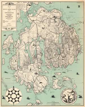
Map of Mount Desert Island Maine Showing Acadia National Park.
sold
- Digital Map Information
- Suitable for large format printing
- File Size: 40.24 MB
- File Type: ZIP / TIFF
- ICC color profile embedded
- Delivered instantly via download link
This is a 1934 Howe D. Higgins map of Mount Desert Island, Maine. Depicting the island in its entirety, Higgins employed two U.S. Coast and Geodetic Survey charts to create the base map and then added the delightful vignettes and a different typeface. Thick black lines trace the island's road network, while dashed lines highlight its famed carriage roads. Depth soundings appear along the coasts, particularly in the coves and harbors. (more details)