
Hinman and Dutton (sold)

Hinman and Dutton (fl. c. 1836 - 1838), possibly Samuel Dutton and William Hinton, were map engravers based in Philadelphia, Pennsylvania in the first half of the 19th century. The firm engraved for several publishers, including Samuel Augusts Mitchell's Sr. in 1837. The firm was based upon 7 Commerce Street in Philadelphia.
Uncommon flag chart showing the flag for the Republic of Texas.
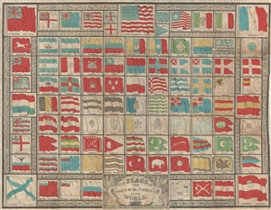
The Flags of the Principal Nations in the World.
sold
- Digital Map Information
- Suitable for large format printing
- DPI: 300
- File Size: 9.33 MB
- File Type: ZIP / TIFF
- ICC color profile embedded
- Delivered instantly via download link
A beautiful 1837 flag chart issued by R. L. Barnes including the martime ensign of the Republic of Texas. The chart features a total of 98 flags associated with countries in Asia, Africa, America, and Europe. In some cases, both merchant and naval ensigns are included. The chart also includes the ensigns of merchant companies, including the British East India Company and the Russian-American Company. (more details)
Uncommon flag chart showing the flag for the Republic of Texas.
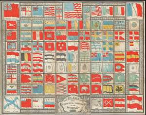
The Flags of the Principal Nations in the World.
sold
- Digital Map Information
- Suitable for large format printing
- DPI: 600
- File Size: 33.52 MB
- File Type: ZIP / TIFF
- ICC color profile embedded
- Delivered instantly via download link
A beautiful 1837 flag chart issued by Hinman and Dutton, and Samuel Augustus Mitchell Sr. including the maritime ensign of the Republic of Texas. The chart features a total of 98 flags associated with countries in Asia, Africa, America, and Europe. In some cases, both merchant and naval ensigns are included. The chart also includes the ensigns of merchant companies, including the British East India Company and the Russian-American Company. (more details)
World with Republic of Texas.
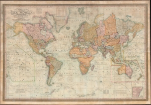
Map of the World, on Mercator's Projection Exhibiting the Researches of the Principal Modern Travelers and Navigators.
sold
- Digital Map Information
- Suitable for large format printing
- File Size: 189.78 MB
- File Type: ZIP / TIFF
- ICC color profile embedded
- Delivered instantly via download link
This is an impressive large-scale 1838 wall map of the world issued by S. A. Mitchell. The map includes ephemeral geographical content, including the Republic of Texas, U.S. claims to British Columbia, an early state of exploration in central Africa, and ongoing speculation regarding the Northwest Passage. (more details)