
Holmes, William Henry (sold)
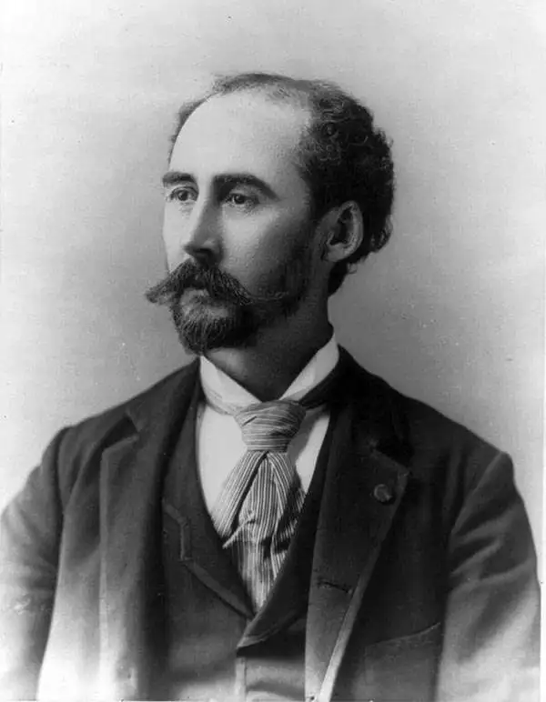
William Henry Holmes (December 1, 1846 - April 20, 1933) was an American geologist, cartographer, artist, explorer, archaeologist, scientific illustrator, anthropologist, museum curator, and mountain climber. Born on a farm near Cadiz, Ohio, and, in 1870, graduated from the McNeely Normal School in Hopedale, Ohio. Holmes briefly taught painting, drawing, geology, and natural history at the school before moving to Washington, D.C. to study art under Theodore Kaufmann in 1871. Holmes's talent for art soon garnered the attention of scientists at the Smithsonian Institution, who employed him to draw and sketch fossil shells and the shells of live mollusks. Holmes replaced Thomas Moran as the artist/topographer of the government survey of Ferdinand Vandeveer Hayden in 1872 and made his first expedition west to Yellowstone National Park. He earned a national reputation as a scientific illustrator during the 1870s and helped Hayden produce the Geological and Geographical Atlas of Colorado, And Portions of Adjacent Territory, published in 1877 and 1881. The Hayden Survey was absorbed by the U.S. Geological Survey in 1879, which allowed Holmes to leave for Munich, Germany, to further his art education under Frank Duveneck. While in Germany, he also studied 'museum making' at Dresden's Anthropology Museum under Adolphe B. Meyer. Holmes 'returned' to the U.S. Geological Survey upon his return to the United States and worked as a geologist and illustrator. In 1889 Holmes left the Geological Survey to join the Smithsonian Institution's Bureau of American Ethnology as an archaeologist. Then he worked as the curator of anthropology at the Field Columbian Museum in Chicago, Illinois from 1894 through 1897. In 1897 Holmes returned to Washington, D.C. to serve as the U.S. National Museum's head curator of anthropology. He served as chief of the Bureau of American Ethnology from 1902 through 1905 and then became the chairman of the U.S. National Museum's Division of Anthropology in 1910. He became the director of the National Gallery of Art (now the Smithsonian American Art Museum) in 1920. He retired from his position as Director of the National Gallery of Art in 1932 and moved to Royal Oak, Michigan, to live with his son.
Yellowstone's geology.
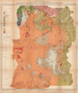
Preliminary Geological Map of the Yellowstone National Park.
sold
- Digital Map Information
- Suitable for large format printing
- File Size: 150.13 MB
- File Type: ZIP / TIFF
- ICC color profile embedded
- Delivered instantly via download link
This is an 1878 Ferdinand V. Hayden geological map of Yellowstone National Park. Published only six years after the park's creation, this map represents one of the great American 19th century survey expeditions. Hayden's work was instrumental in inspiring Congress to create Yellowstone National Park, and the park system as an institution, in 1872. (more details)
Early illustrations of the American West.
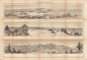
Panoramic views : Glacial lake and moraines on New Fork of Green River - Wind River Mountains ; the glaciers of Fremont's Peak, Wind River Mountains, Wyoming ; the Teton Range from upper Grosventre Butte looking west, with the valley of Snake River in the foreground.
sold
- Digital Map Information
- Suitable for large format printing
- File Size: 57.99 MB
- File Type: ZIP / TIFF
- ICC color profile embedded
- Delivered instantly via download link
A stunning set of views drawn by William Henry Holmes, produced in 1878 by Ferdinand Vandeveer Hayden and the U.S. Geological and Geographical Survey of the Territories (USGGST), the forerunner to the U.S. Geological Survey. They display panoramas of portions of the Wind River and Teton Ranges in Wyoming. (more details)