
Jacotin, Pierre (sold)
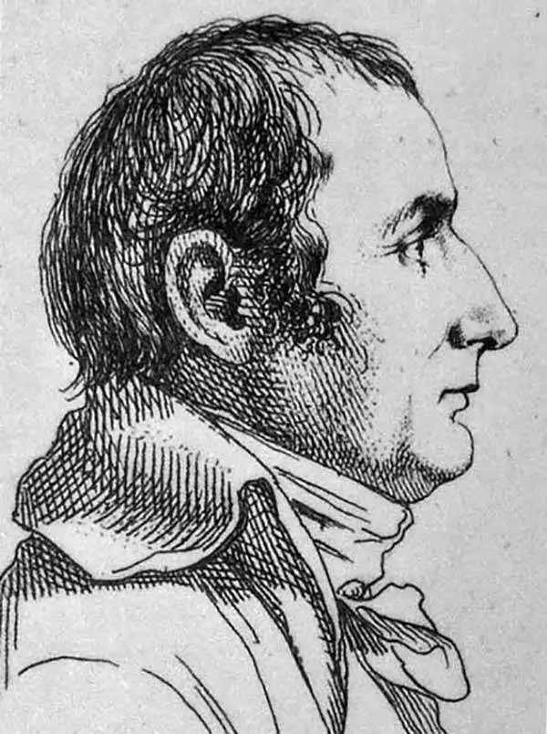
Pierre Jacotin (April 11, 1765 - 1827) was a French geographer and military cartographer active in Egypt and France during the late 18th and early 19th centuries. Jacotin was born in Champigny-lès-Langres (Haute-Marne). He assisted his uncle. Dominique Testervuide in completing the first large scale land plan of Corsica in 1770. Both Jacotin and his Uncle were assigned to the Armée d'Orient for Napoleon's 1798 invasion of the Middle East and Egypt. His uncle, Dominique Testevuide (1735 - 1798), was assassinated during the October 21, 1798 Cairo Revolt. Afterwards, in 1799, Jacotin was named director of all the surveyors and geographers working in the Nile Valley. After his return from Egypt, Jacotin was assigned to the Dépôt de la Guerre and worked on preparing the manuscript maps of the Egypt Expedition for publication in a grand folio atlas volume connected to the Description de l'Égypte. In 1808 Napoleon formally made the geographic records of the Egypt Campaign, the finest maps of Egypt yet compiled, state secrets and put them under censure. It was not until 1817, after the Bourbon Restoration, that the maps were finally published as volume 23 of the Imperial Edition of Description de l'Égypte.
Best 19th century map of the Nile Valley near Aswan.
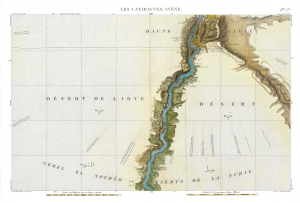
Flle. 1ere. Cataractes Syene Aswan (Carte topographique de l'Egypte et de plusieurs parties des pays limitrophes...)
sold
- Digital Map Information
- Suitable for large format printing
- Full resolution TIFF file
- ICC color profile embedded
- Delivered instantly via download link
This is a stunning 1817 map of the Nile Valley at Aswan, Egypt, one of the great achievements of Napoleonic scientific cartography and the first sheet of the monumental survey prepared for the Description de l'Égypte. Based upon fieldwork undertaken during Napoleon's Egyptian Campaign (1798 - 1801), it records in extraordinary detail the Nile cataracts, the Temple of Philae, ancient ruins, villages, roads, and battle sites. Beyond its significance as one of the earliest scientific surveys of Upper Egypt, the map preserves a landscape that has largely ceased to exist: much of the territory mapped south of Aswan, including the ancient cataracts and countless archaeological sites, disappeared beneath the waters of Lake Nasser following the construction of the Aswan High Dam. (more details)
World's richest archeological landscape.
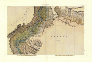
Flle. 5. Thebes. Carte topographique de l'Egypte et de plusieurs parties des pays limitrophes...)
sold
- Digital Map Information
- Suitable for large format printing
- Full resolution TIFF file
- ICC color profile embedded
- Delivered instantly via download link
An exceptionally detailed 1817 map of the Nile Valley at Luxor, ancient Thebes, documenting one of the richest archaeological landscapes in Egypt at the dawn of modern Egyptology. Centered on Luxor and the great monuments of Thebes, the map embraces both banks of the Nile, identifying ancient ruins, villages, roads, cultivated lands, and desert approaches with remarkable precision. It was compiled from surveys undertaken during Napoleon Bonaparte's Egyptian Campaign (1798 - 1801), when French military engineers and the celebrated Savants conducted the first systematic scientific survey of Egypt. Published as Sheet 5 of the monumental Description de l'Égypte, this map represents both a landmark of scientific cartography and an extraordinary record of the Theban landscape before nearly two centuries of excavation, development, and archaeological transformation. (more details)