
Jeppe, Friedrich Heidrich (sold)
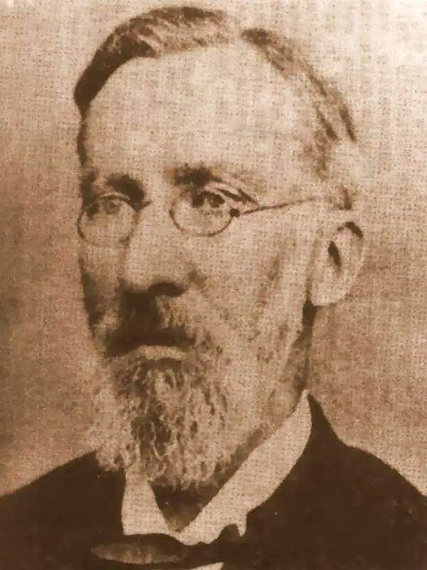
Friedrich Heinrich Jeppe (July 25, 1834 - July 17, 1898) was a German publisher, spy, and mapmaker active in South Africa during the second half of the 19th century. Jeppe was born in Rostock, Germany and relocated to South Africa with his two brothers in 1861. Although initial merchants, F. H. Jeppe took a position as postmaster in Potchefstrom, and later, became Postmaster-General of the Transvaal Republic, a position he maintained until 1875 - when he lost his appointment to political maneuvering. Jeppe published numerous important large-format maps of the Transvaal and South Africa from about 1867 onwards. He also published the Transvaal Almanac and Directory from about 1877 onwards. Also in that year, 1877, he was commissioned as Government Translator and Controller of Statistics in the office of the Colonial Secretary. Eventually he obtained the position of Chief Draughtsman in the Department of the Surveyor-General. There is considerable evidence to suggest that Jeppe was a British agent that actively channelled cartographic information to British authorities until the time of his death. Jeppe became ill with liver disease early in 1898 and died in Pretoria on July 17 of 1898 (interred at the Old Cemetery, Pretoria.) On the eve of his death, he was still actively working on his most ambitious map, and his final missive to friend and government official Johann Rissik, requested assistance to his son, Carlos Friedrich Wilhelm (Charles) Jeppe (1870 - 1900), in publishing the completed map. The massive 6-sheet map was finally published in 1899 - just in time for the Second Boer War (1899 - 1902). Although published posthumously, Jeppe's 1899 Map of the Transvaal or S.A. Republic. The maps was used by both sides during the war and proved one of the finest and most important maps of South Africa ever published.
German interest in the Transvaal?
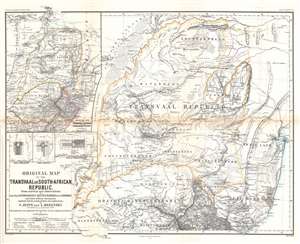
Original Map of the Transvaal or South-African Republic.
sold
- Digital Map Information
- Suitable for large format printing
- File Size: 26.44 MB
- File Type: ZIP / TIFF
- ICC color profile embedded
- Delivered instantly via download link
This is an 1868 Frederick Jeppe and Augustus Petermann map of the Transvaal, South Africa. Composed in English but published by a German publishing house (likely to capitalize on a British audience), the map details the emerging Transvaal Republic and surrounding region. The Transvaal Republic is outlined in orange and the 'limit of the tsetse fly' is emphasized by light green. The treks of eight explorers active 1844 until 1867 are traced and highlighted. Cities, towns, and villages are labeled, including Pretoria and Potchefstroom. A large inset in the upper left situates the Transvaal Republic within the greater region and labels numerous surrounding polities, including the Oranje River Freestate. Smaller inset maps detail Rustenburg, Pretoria, and Potchefstroom. (more details)
A spy's map of the Transvaal from the Second Boer War.
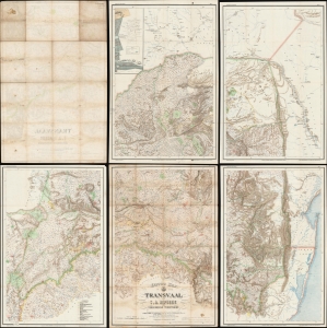
Jeppe's Map of the TRANSVAAL S. A. Republic and Surrounding Territories.
sold
- Digital Map Information
- Suitable for large format printing
- Full resolution TIFF file
- ICC color profile embedded
- Delivered instantly via download link
This is a rare 1899 Friedrich Heinrich Jeppe map of the South African Republic or Republic of the Transvaal issued shortly before the outbreak of the Second Boer War (1899 - 1902) with interesting provenance to Capt. E. W. Margesson, a British field officer. The map consists of 5 of the 6 sheets of the original map - unfortunately the northeast sheet, containing insets of Johannesburg and Pretoria, has been lost, but the overall rarity of the map balances this out. (more details)